2024 Caribbean Cruise

Panama City – a pleasant surprise

Metropolitan Cathedral Basilica of Santa Maria the Ancient

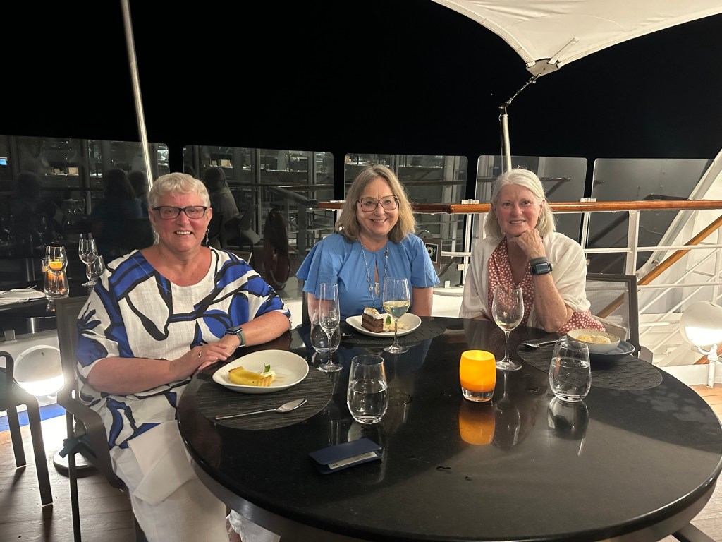
Well, I thought I was done. But on our way to the hotel from the ship today a tour of the three main areas of Panama City was offered, so I took it, of course. We had a great guide, Eduardo. So I thought I’d do a brief summary and provide some pics.

I had no idea what to expect from Panama City and it’s a lovely city from what I’ve seen. One definitely worth revisiting…. Only problem is that my bucket list keeps getting longer because there are so many places that I want to go back to and spend more time!

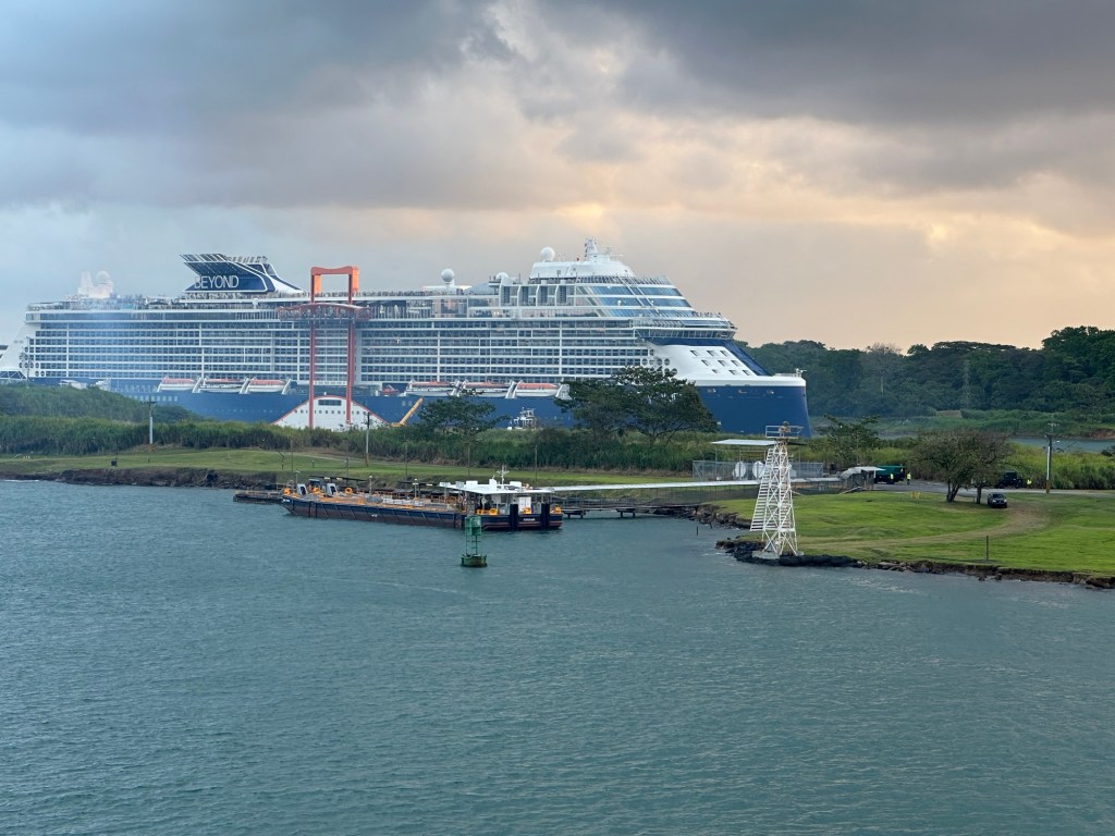
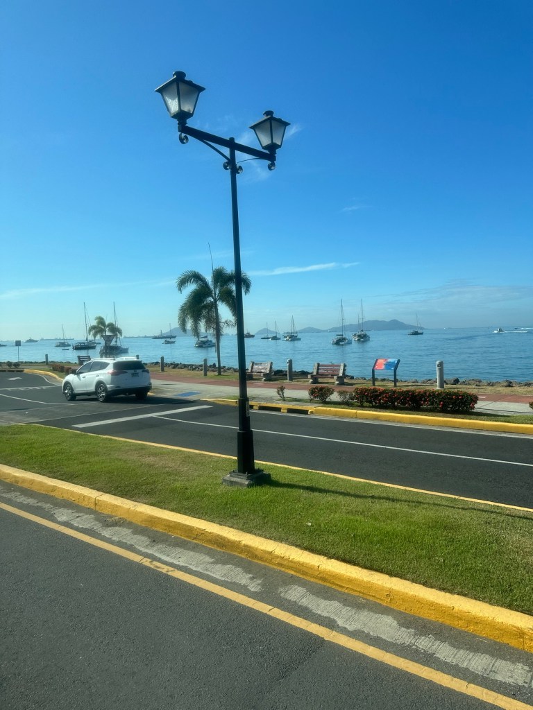
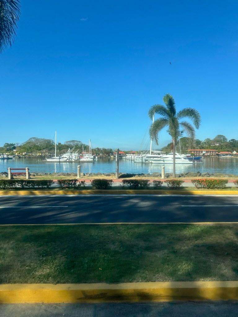
We started our tour with a drive along the Pacific and the “Canal Zone” for a bit and it was a lovely drive – lots of pathways, Bike paths, and vegetation. Lots of traffic circles. The Canal Zone is a zone 5 miles on either side of the canal that the US was given for their use by the Panamanian government when they took over construction of the canal. The US used it for military facilities and housing for their workers. It is now given back to Panama government and some parts of it provide recreation facilities for the city.

The Pacific

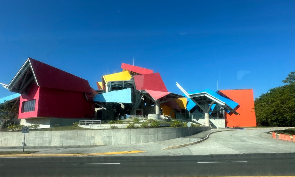
A brightly coloured building we passed when we were still on board Star Pride coming out of the Panama Canal and into the Pacific yesterday, and which we saw during our drive along the Amador Causeway is the Biomuseo. It is a museum dedicated to biodiversity and it was designed by internationally renowned and Canadian-born architect, Frank Gehry.

Frank Gehry designed Biomuseo

As we drove, our guide filled us on some statistics regarding Panama and the city. Of the 4 million people in Panama, 2 million of them live in Panama City. Spanish is the official language of the country but most also speak English as children have been taught English in school for many years. Most Panamanians are Catholic, given its Spanish roots.

According to our guide, there is a good relationship between Panama and the US due to the support given to Panama by the Americans. He said that Panamanians don’t however have a burning desire to join the immigration race to the United States as they have a comfortable life in Panama. Workers are paid a minimum wage of US$650 a month paid twice monthly and our guide felt that anyone that wanted to get ahead could do so in Panama. University is free, they pay $1.25 a pay (or a month – sorry he was talking fast!), for education and $9.00 a pay (or a month) for healthcare. Rent in the high end areas is $ 2000 – 5000 a month, but that’s at the top end. Rent is reasonable in many other areas of the city. They pay 7% tax on all goods, and 10% on Alcohol and cigarettes.

Panamanians are required to vote in elections held every 5 years, and the President cannot run for consecutive terms. There are 7 aboriginal tribes, the Kunas who we learned about in the San Blas islands is the largest.

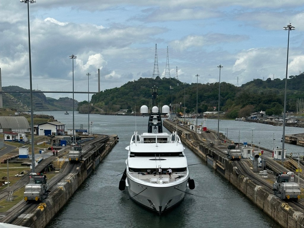
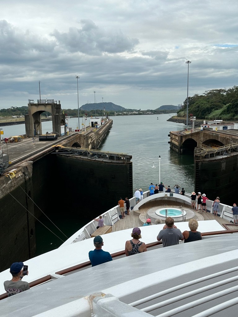
Our guide pointed out that the canal is the hub of the shipping of vehicles throughout the world and as a result the cost of cars and gas are very reasonable in Panama.

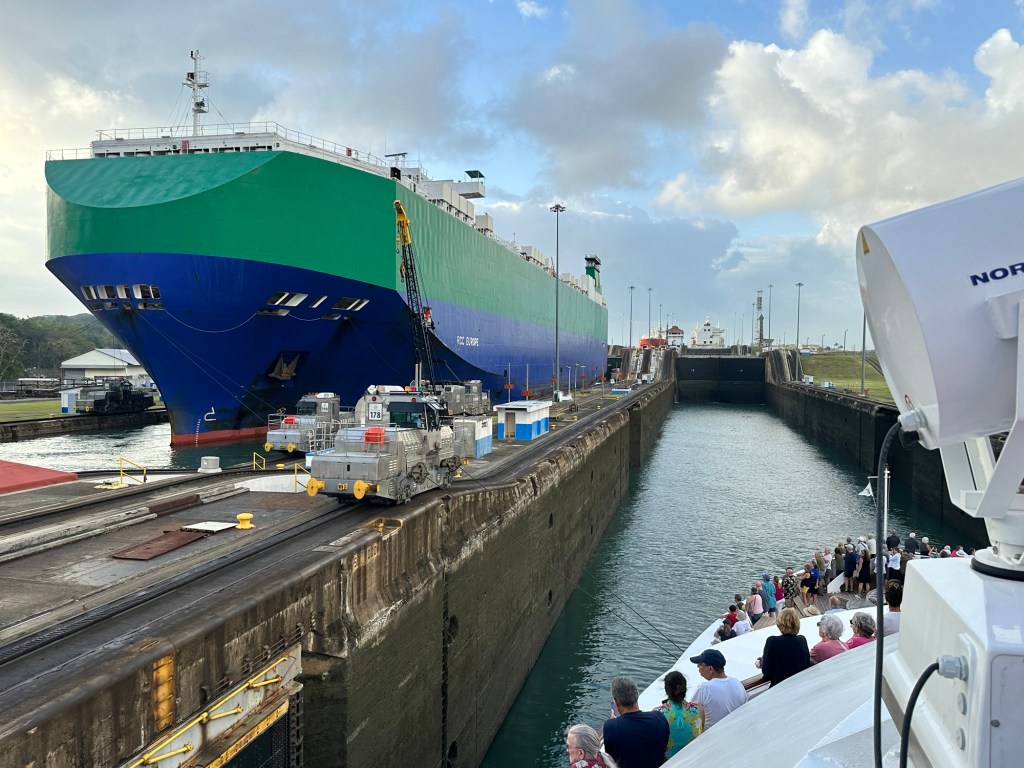
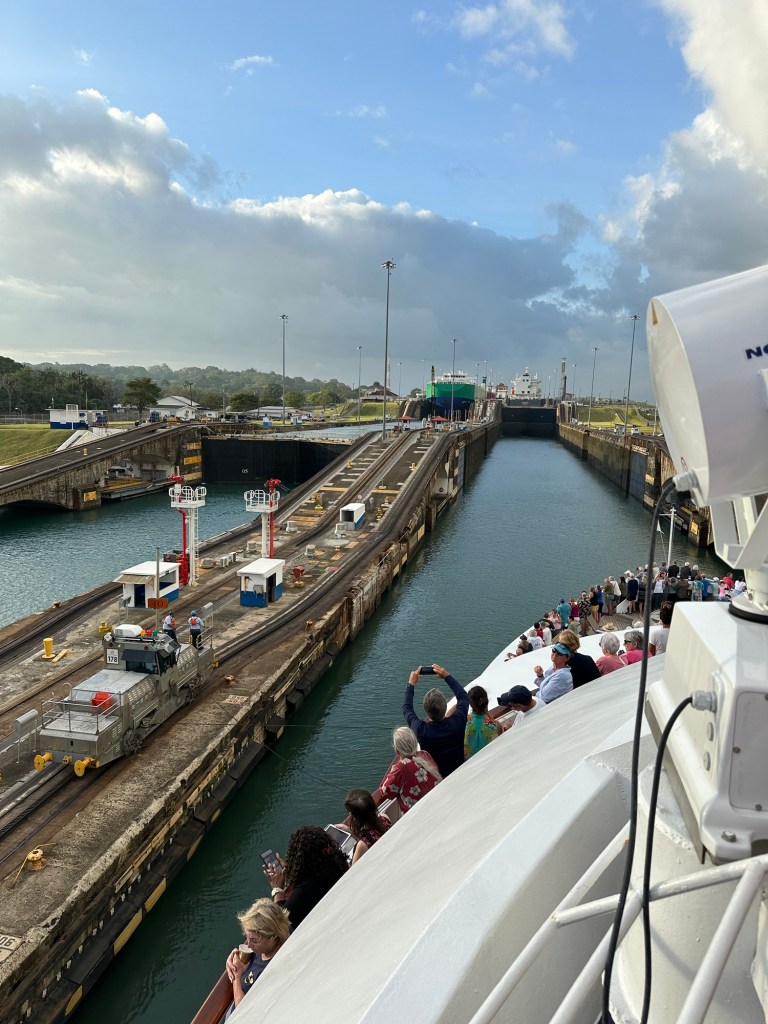
Spain started colonization of the area in 1503, and Panama remained a colony of Spain until 1821. At that time Panama joined Colombia and other formerly Spanish countries in a republic called Gran Colombia in its independence from Spain. Gran Colombia dissolved in 1831. Panama became a republic in 1903 with support from the US. A failed attempt at building a canal was started by France and the project was taken over by the US and completed between 1904 – 1914. (At the start of WWI) In 1955 the US also built a railway line that ran along side the canal across the isthmus. The US continued to exclusively administer the canal until 1977 when the Torrijos-Carter Treaty to completely transfer the canal to Panama effective Dec 31, 1999.

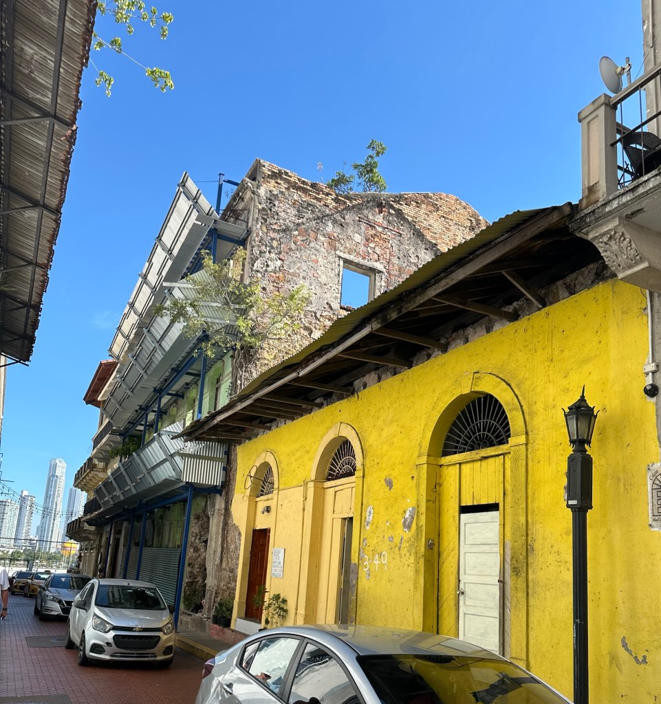
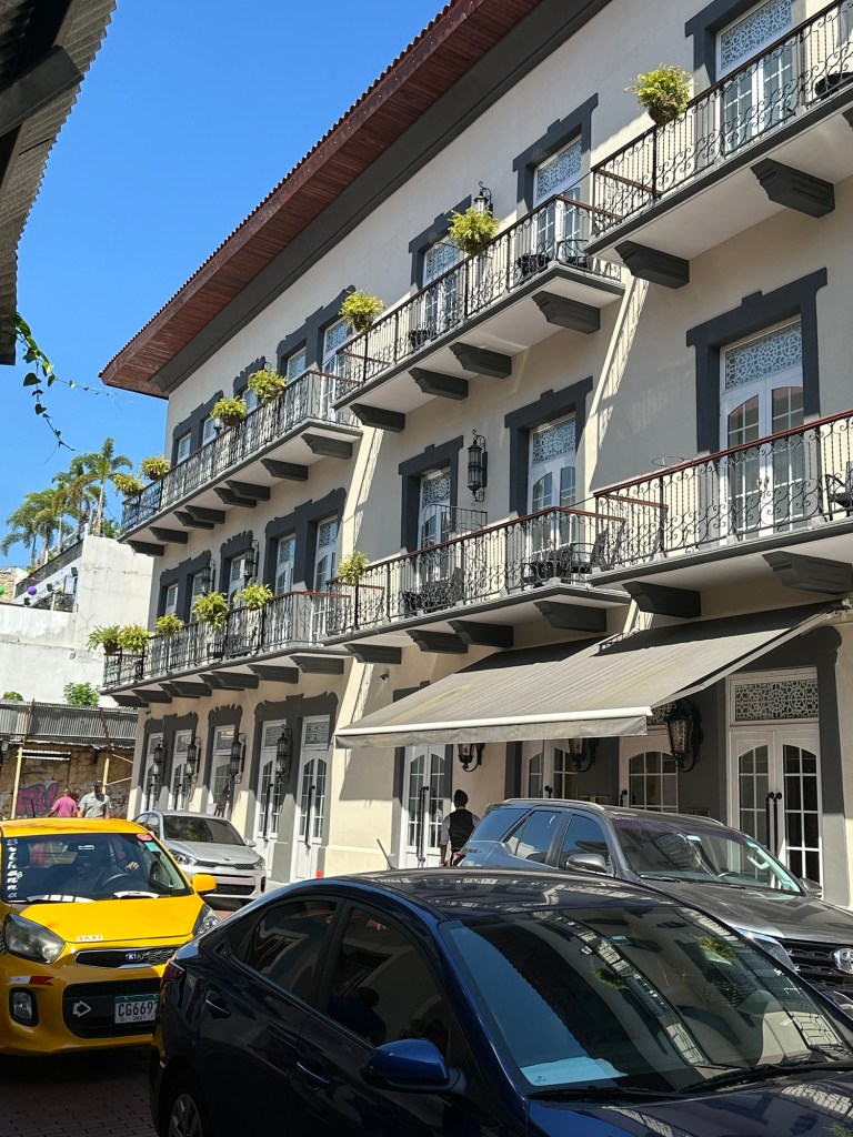
After a quick drive through the modern part of Panama City, our first stop was the old quarter or Casco Viejo (also called Casco Antiguo), the city’s historic area. It was built on a peninsula isolated by the sea and a defensive system of walls in 1673 following the destruction of the original location of Panama Viejo in 1671. More on Panama Viejo later. Casco Viejo was designated a World Heritage Site in 1997.

4 story French design building

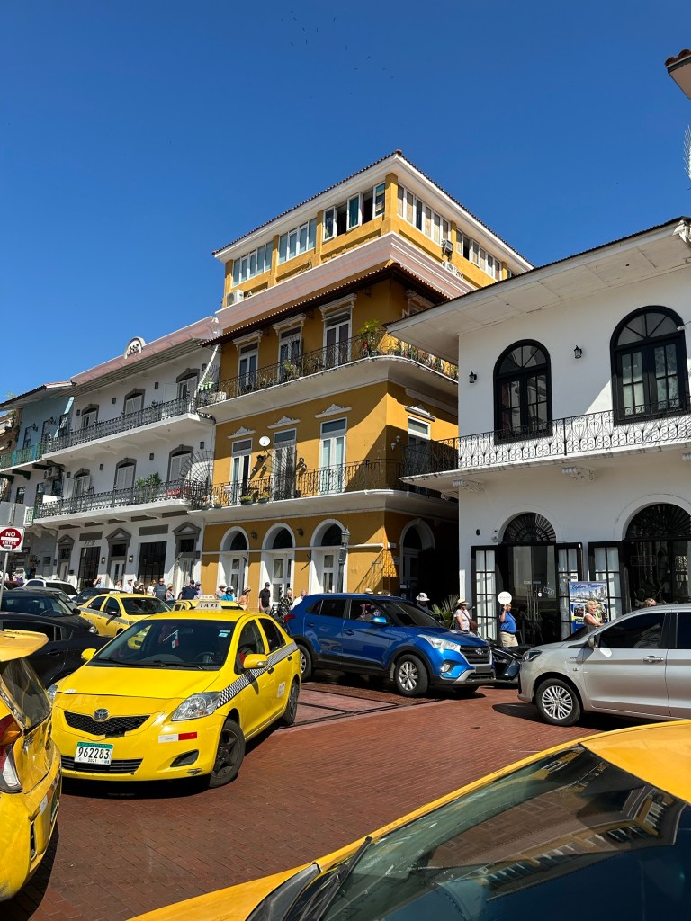
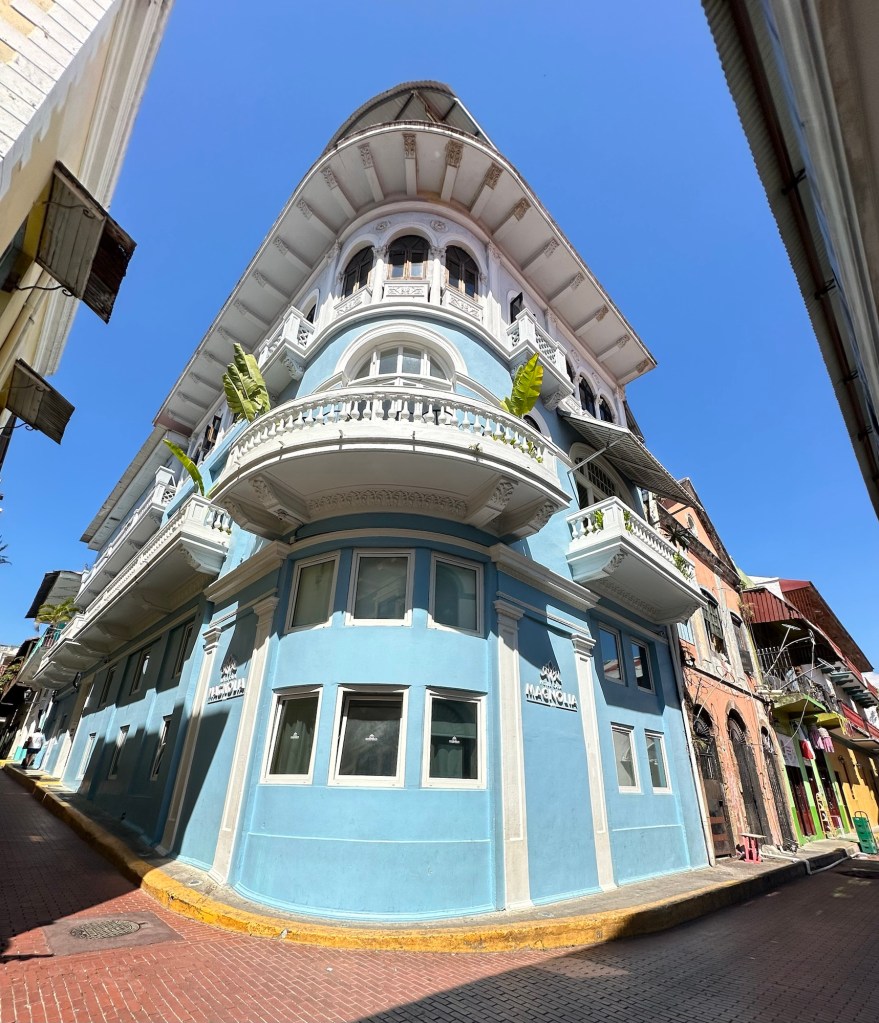
As with most historical areas, we had to walk in this area as the streets were narrow and traffic horrendous. It is a beautiful area where the building styles from its roots, French, Spanish and American have been maintained, even in the newer buildings and many of the older ones have been upgraded on the inside. There are some that are just literally facades, and others that are waiting for someone to bring them back to life. Even those buildings must be properly secured to they don’t deteriorate further or create a hazard. Of course there are several churches and one cathedral in this area, some of which have been rebuilt and some that are just ruins.

The building beside the yellow one is simply a facade, with metal sheeting to ensure there will be no material falling on pedestrians or cars.

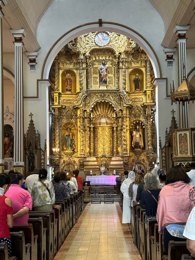
We saw inside one of the churches, Iglesia San Jose (Saint Joseph Church) to see their beautiful gold altar which was saved from pillaging in another area of the country when the parishioners covered the altar in mud to hide it’s gold leaf.

The area is home to museums, restaurants, boutique hotels, tourist goods stores, and nightclubs. One hotel, the Hyatt Hotel la Compania, was renovated over 7 years, from a whole block of buildings and is tribute to the three styles in the area with French, Spanish and American wings.

The French wing of the Hyatt Hotel la Comania

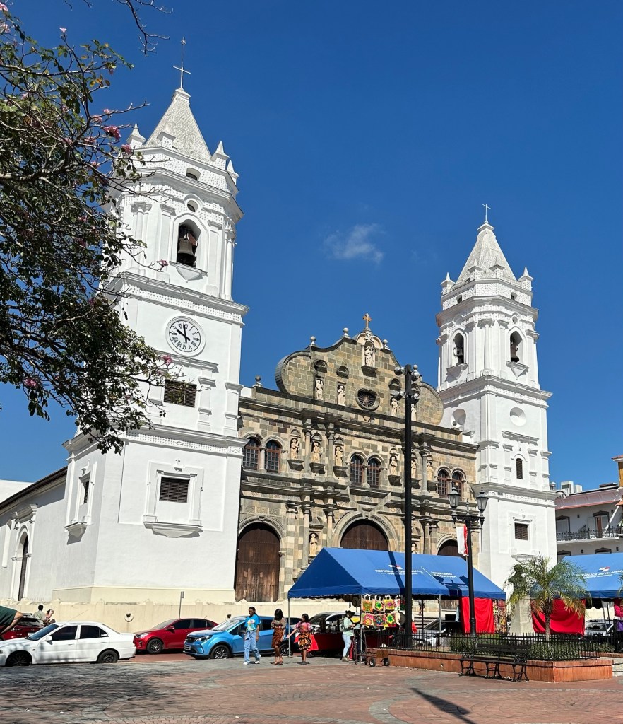
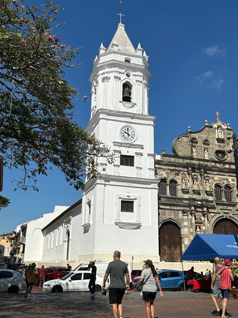
We came to Independence Square where the beautiful Metropolitan Cathedral Basilica of Santa Maria the Ancient stands. It was the largest Cathedral in Latin American when it was built in 1673. There are sea shells built into the roof of the Cathedral which reflected the moon light acting as a lighthouse for sailors. There are 7 steps on the way up to the cathedral each representing a sin, so that you are sin free arriving at the cathedral. We weren’t able to go inside today as there was a special event happening.

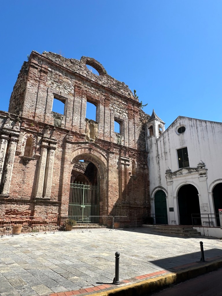
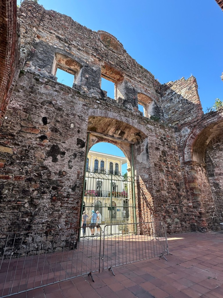
We wandered some more and saw the ruins of the Church of Santa Domingo built in the 1700s. It is said that the square archway in this church was the reason that it was decided to build the canal in Panama instead of some of the other Central American countries that were being considered. The fact that the arch was still standing all these years later, indicated that there was no seismic activity in the area that would affect the canal.

Church of Santa Domingo
One of the cute boutique hotels in this area

We were glad to get back on the air conditioned bus after our long walk thru this area, and glad that our guide had chosen for us to get there early in the tour when it was maybe a bit cooler. It’s very hot and humid here, being only 11 degrees or so from the equator. Next stop, Panama Viejo Museum and Ruins.

One of the ruins at Panama Viejo

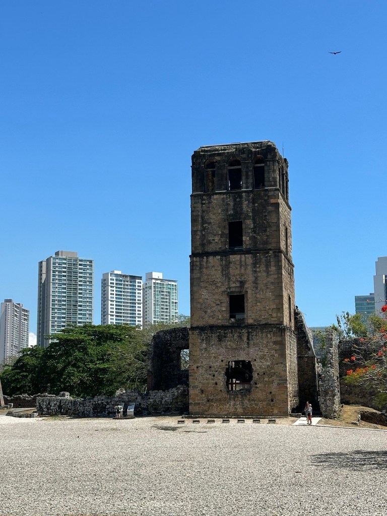
Panama Viejo is the area that was the main settlement of aboriginals, mainly fishers and farmers, in the area going back 1500 years. Unfortunately this site was attacked by a British Privateer (or pirate depending on your definitions), Henry Morgan, in 1671. Panama City was not prepared to fend off the attackers, and was poorly led by Donna Juan Perez de Guzman and the battle was short and bloody. The attackers spent a month on the site ransacking and torturing the villagers attempting to find any hidden treasures. When they left, more than half the villagers were dead, injured, sick or missing. From my reading, Captain Henry Morgan was not an explorer looking to claim riches and land for Britain, but instead was out for himself. In any case, you may recognize his name as a British-made rum “Captain Morgan” was named after him.

I have to admit that my attention span had reached its limits by this point and I was glad that we were heading to our hotel for tonight in the Financial District.

Fun Facts:

⁃ Panama’s motto is “Pro Mundi Beneficio,” which means “For the Benefit of the World.”

⁃ The tallest building in Central America, now the JW Marriott in Panama City, used to be called Trump Tower.

⁃ There are no roads between Panama and its neighbour to the south, Colombia because the jungle in that area is so thick and impenetrable.

⁃ Panama exports pineapples, bananas, coffee, and rum.

⁃ A type of coffee called Giesha, grown primarily in Panama, has been named the most expensive coffee in the world. In 2021 a pound of Geisha coffee sold for more than $2500 a pound.

⁃ There is a Smithsonian Institute Nature Centre located at the Pacific Entrance to the Panama Canal in Panama City

⁃ The National Sport of Panama is baseball. An American influence.

⁃ The name Balboa is everywhere in Panama because of the Spanish explorer, Vasco Nunez de Balboa. He was the first European to lead an expedition to reach the Pacific from the Atlantic across the isthmus.

This is just the tip of the iceberg of history of this region and it’s been great dipping my toe into it. (Two figures of speech in one sentence!) I will caution again that I may have messed up in either noting or understanding some of the facts presented in this and other posts, but I try to corroborate stories told to me or the info I dig up but it’s not always possible.

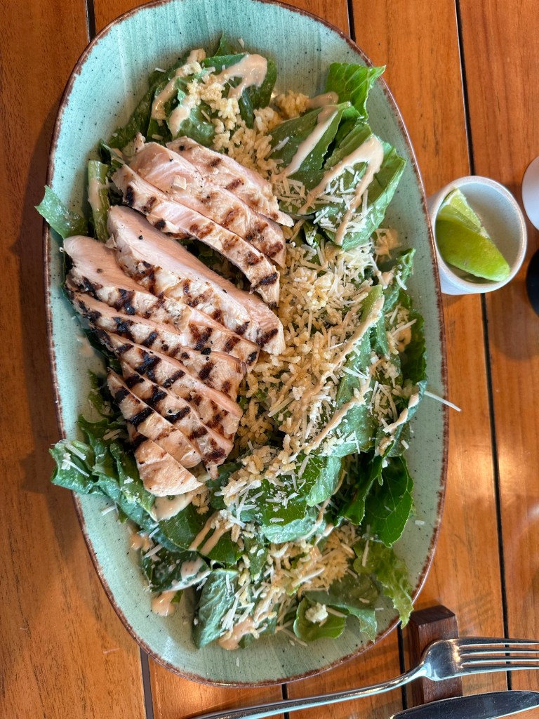
Tonight I ate dinner in the lovely hotel restaurant, having run out of adventurous spirit. And I decided there was no time like the present to get back into healthy eating after 2 weeks on a cruise ship.

Ok, off to bed, as I have an early flight home to Ottawa tomorrow. Hopefully it will be uneventful.

2024 Caribbean Cruise

“Order of the Ditch”

Atlantic Bridge at dawn

Many fellow passengers have been waiting for today and took this specific itinerary to get to experience today. It’s the day we transit the Panama Canal from the Atlantic side to the Pacific. We end the day in Panama City after traversing the 3 lock stations, cuts and lakes. I have to admit that I wasn’t all that excited about it but I recognize that it’s definitely an incredible feat of engineering and ingenuity and I understand its significance to world wide trade. Going through the locks was really interesting, and I was up at 6:30 am to see what was probably the first sun rise of my vacation along with dozens of others on board. I was pleasantly surprised by the views from the ship as we passed through Gatun Lake.

Gatun Lake

There is a plethora of information on the canal, its engineering, its history etc, and I can’t face beginning to distill it into an interesting post. So I’ll provide a bit of information I have gleaned from the on ship guide, and some other info sources, but it’s not at all intensive. Can you tell I’m coming to the end of my journey and I’m a tad weary?

Some Milestones in the Panama Canal History:

1914 – August 15 – The Panama Canal is officially opened

1962- October 12 – the first public crossing, the Bridge of the Americas, is opened for public use on the Pacific side of the canal

1999 – December 31 – Panama takes over the administration and operation of the Canal

2016– June 26 – the expanded canal is officially opened.

2019 – August 2 – Inauguration of the third Bridge of the Atlantic

So yesterday afternoon we beat it out of Bocas del Toro late due to some passengers not getting back on the ship on time. I’m sure the Captain was not pleased as we had to be in moorage at the entrance to the canal by 2 am to secure our reserved spot for today. Windstar pays a premium to be able to book specific dates for their crossings.

The original Panamax locks on the right and the NewPanamax Locks on the left.

We started moving this morning, with a Panamanian pilot on board at about 5 am, and we joined a line of ships moving toward the narrower “Panamax” locks. Just as the sun was rising we went under the high span of the Atlantic Bridge, completed in 2019 that joins the two sides of the isthmus for vehicular traffic.

Large passenger ship in the Neopanamax Locks

There is now a new channel of the canal (finished in 2016), to allow for the super large ships, and the huge passenger ship in line behind us veered off to the port and entered the “Neopanamax Locks” as it was too large to get through the smaller channel. The new channel allows for more and larger traffic, by increasing the width and depth of the locks. The larger ships are 1 1/2 times the size of the previous ships and their capacity is twice as much.

Car Carrier with only 2 ft on either side to spare.

We did not enter the first set of locks until almost 8 am. There were three locks to get us up to the highest point, of Gatun Lake, 85 feet above the ocean. There was a car carrier going through the lock in the other direction which was 106 feet wide. The lock is only 110 feet wide so there was only 2 feet clearance on each side. Tight squeeze!

I’ve “locked through” on numerous occasions on the Rideau system between Ottawa and Kingston and have seen the Sault Ste Marie locks for the lake freighters going through from Lake Huron to Lake Superior so I’m familiar with the operation. Of course, this is a bit larger scale! Something I hadn’t seen before were the small mechanical “mules” that run along the sides of the canal with lines on the ships to make sure they stay centred in the lock. For small ships 2 mules are used but for the larger ones they used 8.

The “mule” on the left attaching the lines to the port side. There was another on the starboard side and then two more on the stern.
This little guy slipped into the lock behind us.
Oh look! A lighthouse! I have no idea why it is needed in the middle of the locks? There are lights all along the sides.

As you have no doubt read, there was a severe water drought in Panama last winter and the number of ships allowed through the locks is dramatically reduced. I think they said from 42 to 22. Many of the large container ships are forced to go around the southern tip of South America as the explorers once did. One of the changes they have made to deal with the water shortage is to re-route water between the two channels while emptying one and filling the other so that less water needs to be used from Gatun Lake.

Miraflores Locks visitor centre.

We locked through the second lock, Pedro Miguel Lock, at approximately 2:00 pm. There was just one small step in this lock to take us down to the level of Miraflores Lake. And then the last step, the Miraflores Locks was two steps of 27 ft each to take us down to the level of the Pacific Ocean. After just 54 miles but an all day adventure we had transited from the Atlantic to the Pacific and earned a pin adding us to the “Order of the Ditch”.

The gates opening to let us through to the Pacific!
Order of the Ditch!

Today, we sadly received Panamanian customs forms, luggage tags and instructions for disembarkation tomorrow morning. The two weeks have flown by and it’s been a fabulous adventure. While I am on this adventure by myself, I have met some wonderful people along the way. I first met Clair from Denver/Wisconsin last year on another Caribbean cruise, and we got on so well that we planned to be on the same cruise at the same time this year. And as it turns out, a friend from Calgary who I haven’t seen for probably 10 years, Karen, unknown to me had booked this very same cruise. So it’s been great to re-connect and spend time with both of them as well as Adrienne last week. We did our own thing sometimes and did things together at others. Always lots to talk about and laughs over our dinners. Tonight the three of us celebrated our last supper at the outdoor Candles Restaurant instead of the main dining room, and it was a lovely evening.

Don’t know if I’ll have time to post tomorrow as I will be disembarking and staying over night one in Panama City before my flight home on Sunday. I hope you have enjoyed this journey. Until next time……..

Sunset over the Pacific Ocean
2024 Caribbean Cruise

Bocas del Toro, Panama

We’re arriving into Boco Town, Boco del Toro in the rain.

Well, our luck ran out. Some days we’ve had passing showers, which come and go, but this morning it is completely socked in with rain as you can tell from my breakfast view.

So snorkelling didn’t happen for me. I was meant to go this morning, and the excursion did go ahead because it’s booked rain or shine. But I figured no point in going when I’d see very little without at least a little more light and likely be uncomfortable on the 30 minute boat ride out and back. I did venture into the town to take a look around because really, when will I be back in Bocas del Toro? I’ve described the experience below.

The tender dock at Bocas Town.

But let me tell you a little about Bocas del Toro. It is a province in the northeast of the mainland of Panama as well an archipelago of 8 islands on the Caribbean side of Panama, almost at the Costa Rican border, near Limon. It is one of the main tourist destinations in Panama, receiving 150,000 tourists per year. However, only smaller cruise ships are able to get into this small port with narrow channels. Many fly in to the “International Airport” of which the island is very proud. It flies a little puddle jumper between here and Costa Rica so it’s designated as International.

The Captain had to slowly pick his way along the channel, with lots of twists and turns to avoid the sand bars and reefs between the islands. We were anchored near the capital of the islands, Bocas Town, on Colon Island where approximately 8000 live.

In this region, you can find the UNESCO World Heritage Site, LaAmistad National Park, which is a marine park off the coast of the mainland named in 1983. Another National Marine Park, Bastimentos is off the coast of Bastimentos Island. Because of its diversity, this area has been called the “Galapagos of the Caribbean”. It provides protection for forests, mangroves, monkeys, sloths, caiman and other reptiles. There is also a nesting site for sea turtles.

Bocas del Toro has been named a “Hope Spot” by the organization called Mission Blue for its work on protecting and restoring the coral reef. According to the organization, “Hope Spots are about recognizing, empowering and supporting individuals and communities around the world in their efforts to protect the ocean”. There are 140 identified at this point.

The Smithsonian Tropical Research institute has a facility in the archipelago because of Bocas del Toro’s diversity of coral and marine life.

Historically, we’re back to talking about good old, Chris Columbus who visited this area on his final voyage in 1502. He took on provisions and made repairs to his ship in the area. Pirates also used the islands as a hideout and so buried treasures stories fly about. The aboriginal people called “Carabaro” were mostly wiped out from diseases the Europeans brought with them.

The next part of the history of this area is different than the other islands Columbus discovered, in that many immigrants from other islands, mainly Jamaica, made Bocas Town on Isla Colon home and built it up to be a thriving business area, marketing cocoa and bananas by the beginning of the 20th century. Unfortunately a banana plague in 1920 put an end to the area’s prosperity. But the park survives as does tourism. And the banana industry has come back, and they now ship about 3/4 of a million tons of bananas per year. Chiquita International is one of the main companies operating in this area. Other crops are now exported, such as cacao, coconuts, and plantains. And of course, tourism is a larger economic driver as ecotourism increases in popularity.

A private home on the water in Bocas Town

Bocas Town, the capital of Bocas del Toro Province and where we are anchored, is at the southern Tip of Isla Colon. It is home to roughly 15,000 people, and there is a strong Afro-Caribbean culture. There are brightly coloured bars and restaurants along the waterfront, many of them on stilts, although I couldn’t get a picture of them as the windows were all closed on the tender due to the rain. Seafood is big here, as are ceviche and plantain chips.

Tip Toe, through the puddles.

Unfortunately the roads in the central part of the town are under construction, and with all the rain today, there were huge mud puddles to navigate around. We went on an adventure anyway, and walked around this interesting little town for an hour or so, in the light rain. There is a sense of the pace slowing down on the island, with lots of spots to grab a coffee or brew and chill. It had a “hippie” or “backpacker” feel, with hostels and reasonable small hotels. There are also some ecolodges and luxury accommodations throughout the islands, so something for everyone. It was really interesting and I’m glad I opted to get on to the island.

I think this may have been here a while.
Not getting too much business today.
Near our tender dock
An herb store.
The tender dock owners private deck overlooking the harbour
One of dozens of restaurants along the waterfront, without many customers today
A resort on one of the islands on our way out of the archipelago

We have left the islands with the Captain once again gingerly making his way out to open water, at least an hour behind schedule because of the late return of some passengers who had wandered into town. We are making our way to our anchorage near the entrance of the Panama Canal which we will be entering at approximately 7 am tomorrow. Many on board have come on this cruise with that as a highlight. So hopefully the weather lifts for tomorrow so we can have good viewing weather. Sadly, only 2 sleeps left on board.