Uncategorized

San Blas Islands (Guna Yala), Panama here we come!

First of all, I wanted to correct something I said in yesterday’s blog. We did not travel all across the north of Panama to get here this morning. I was confused with the names and days of the week for our Panama Stops. The location that is almost at the Costa Rican border is tomorrow’s stop in Bocas del Toro. This San Blas Islands archipelago is approximately in the middle of the isthmus of Panama.

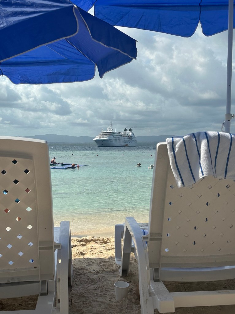
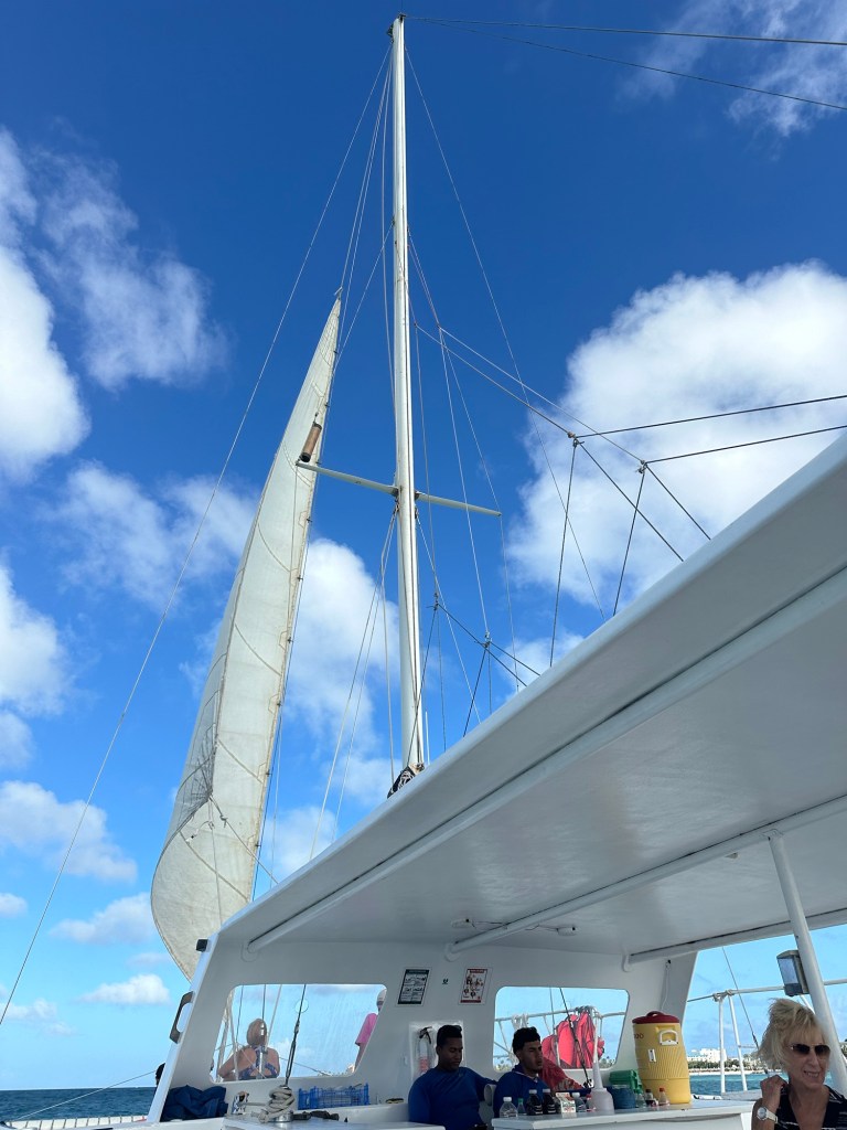
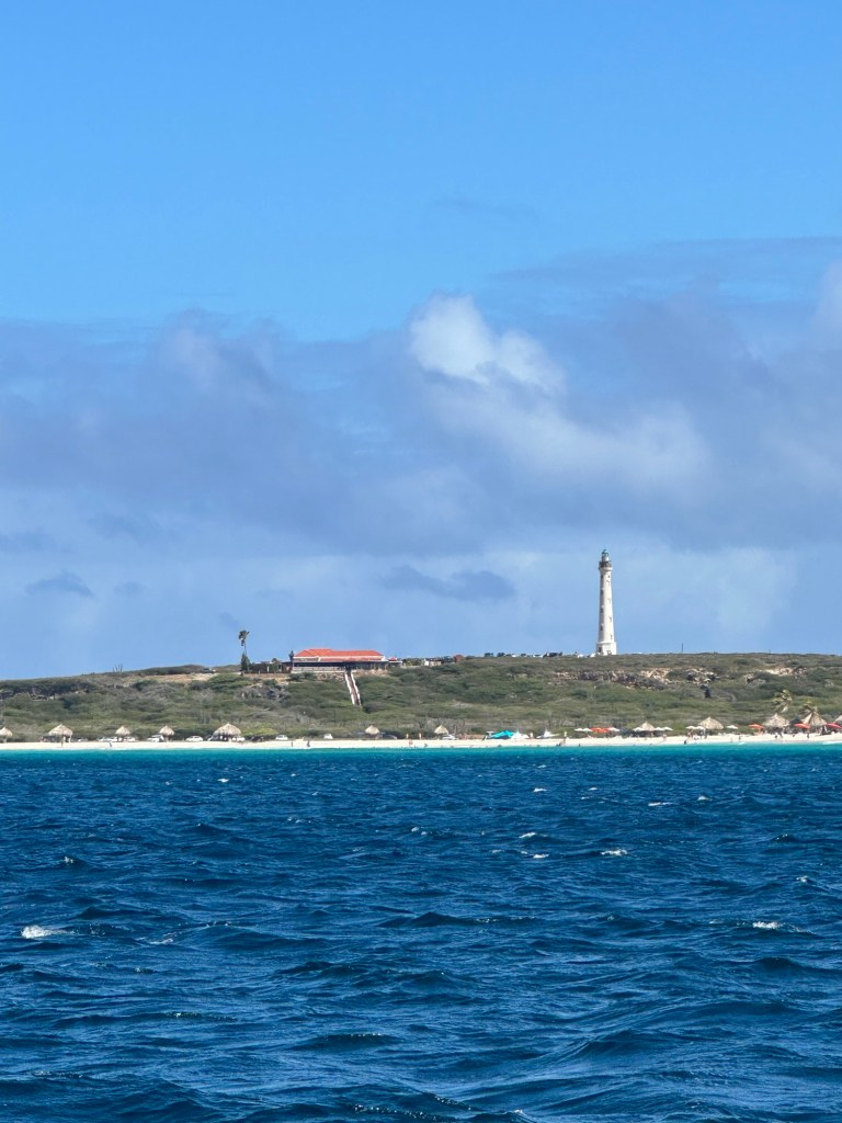
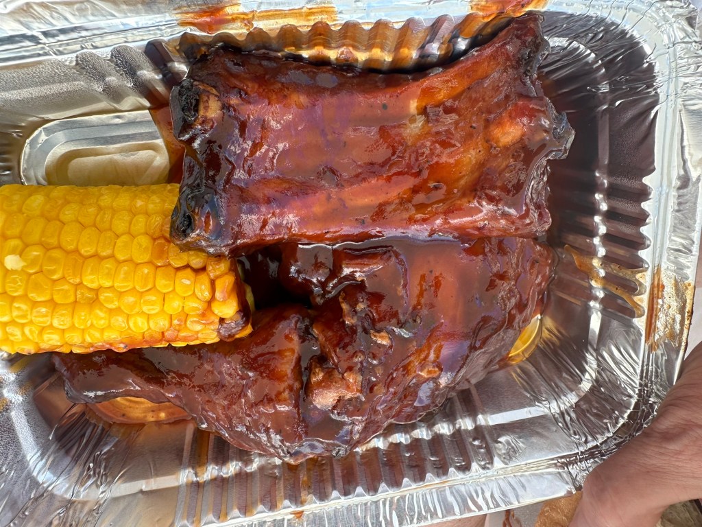
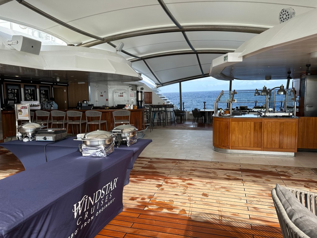
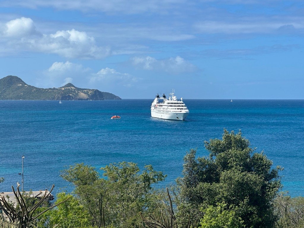
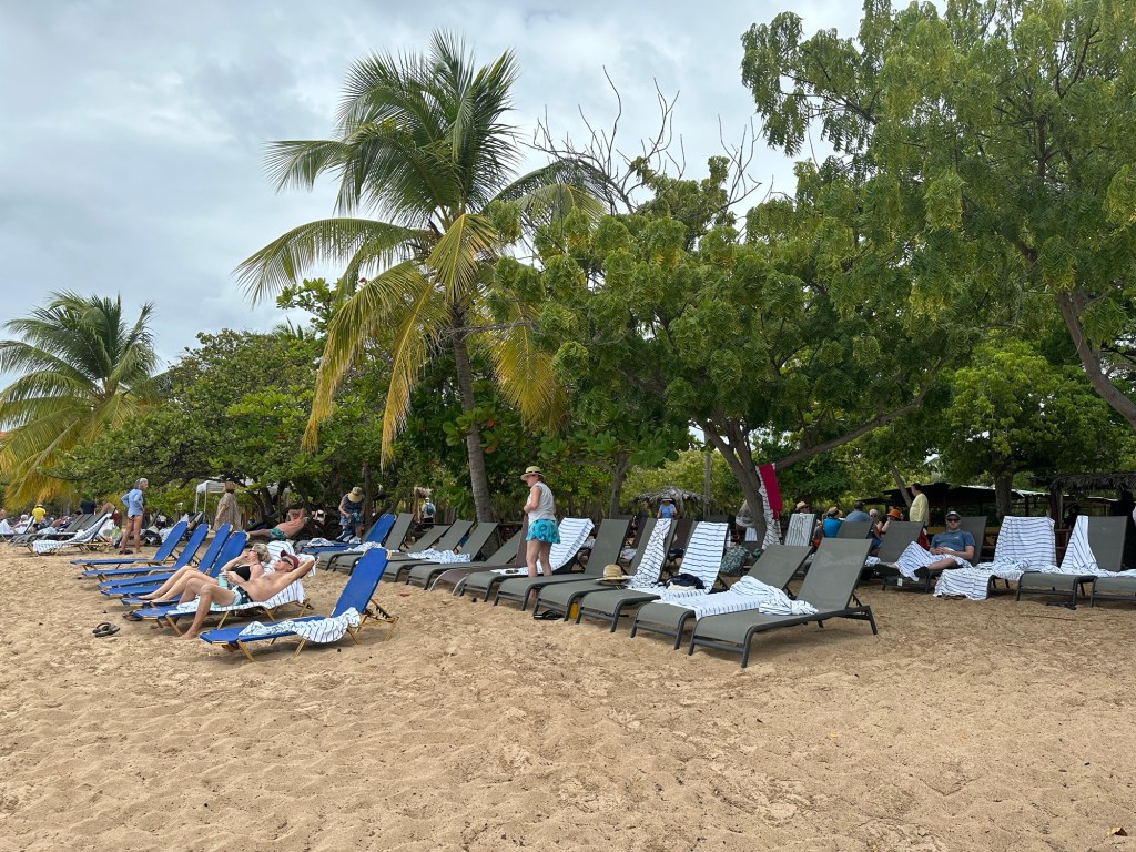
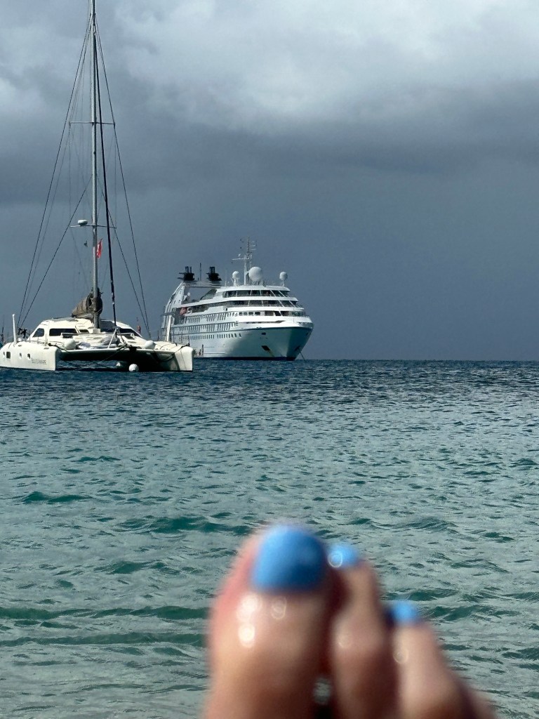
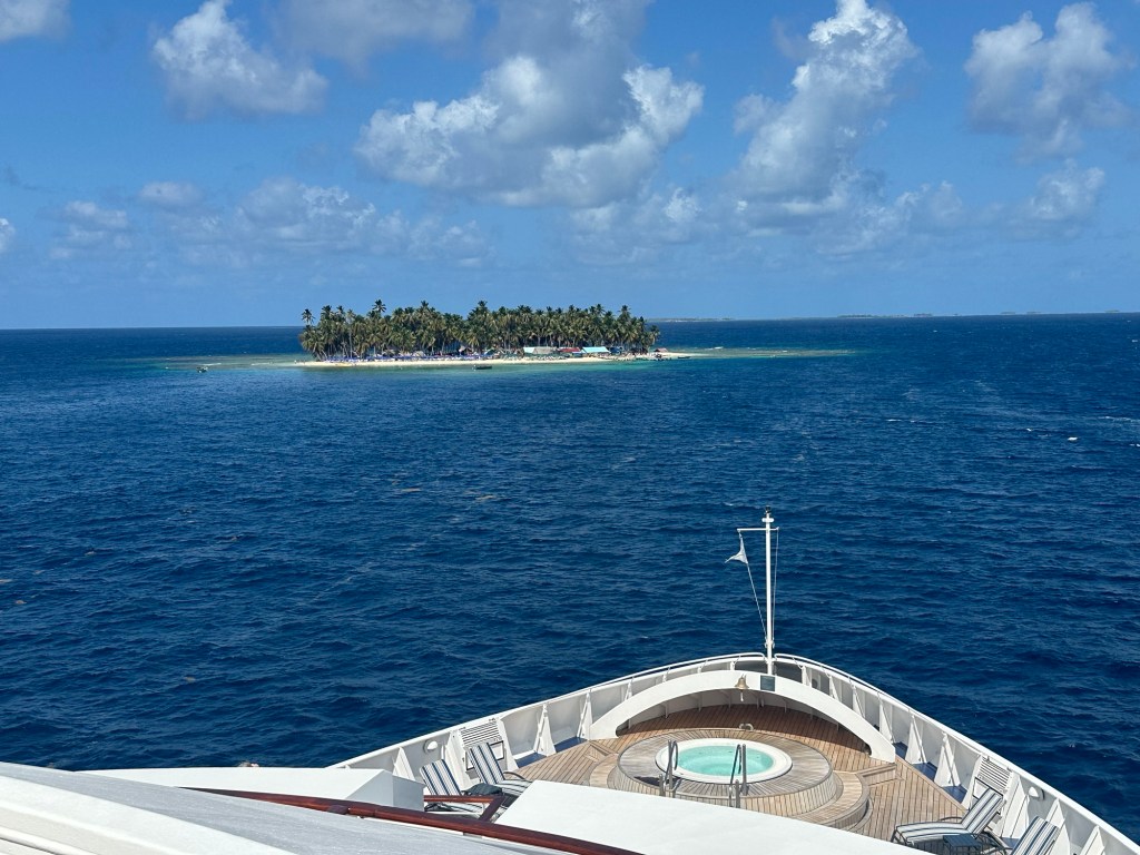
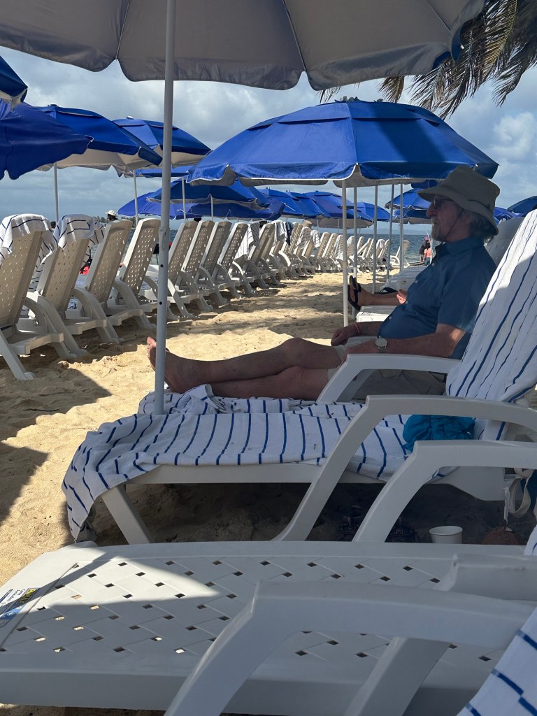
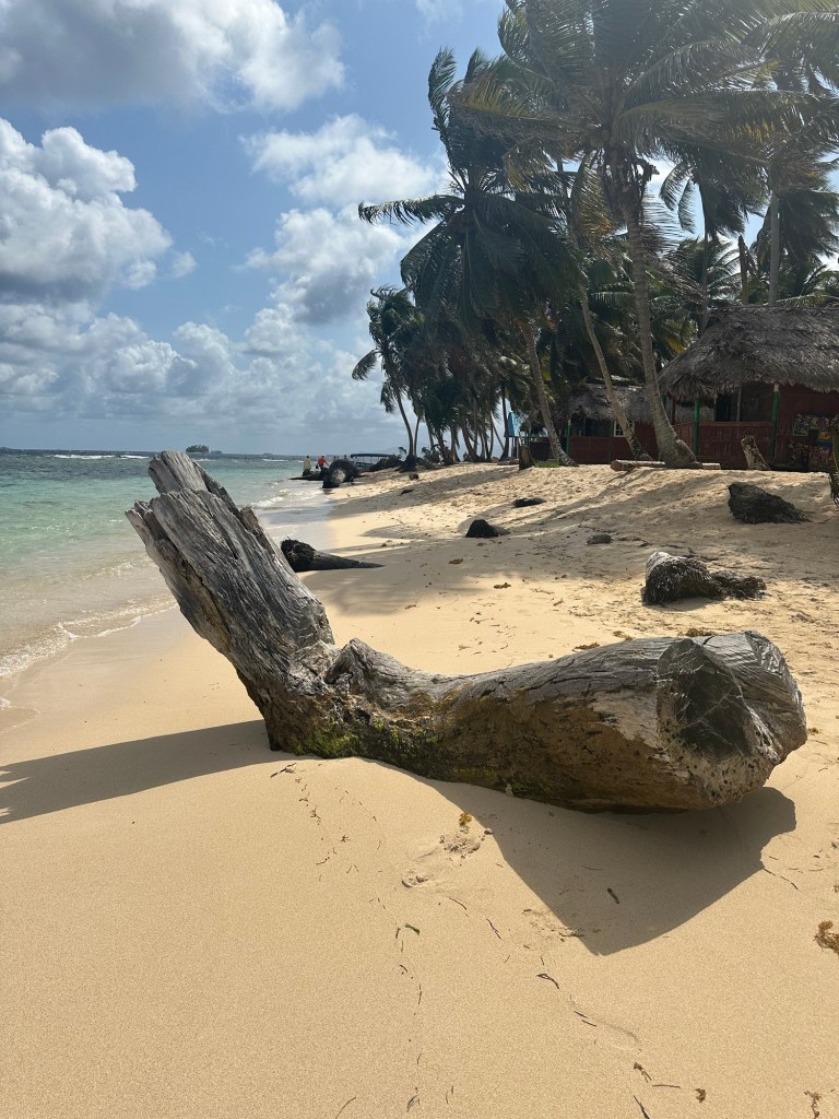
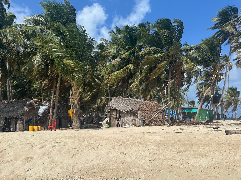
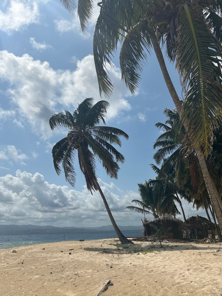
Beach Party! Today is our first stop in Panama, and we’re beach partying on Isla Aroma, one of the San Blas Islands. Isla Aroma is a tiny island with little else than white sand beaches lined with palm trees and cocoanut palms (we’ve been warned not to move the lounge chairs as they have been strategically placed to avoid having cocoanuts fall on our heads!). There washrooms and not a lot of other amenities but Windstar provides that. Full bar, lunch barbeque, lounge chairs, water toys, etc. We were able to just focus on relaxation today, while WindStar looks after us in grand style.

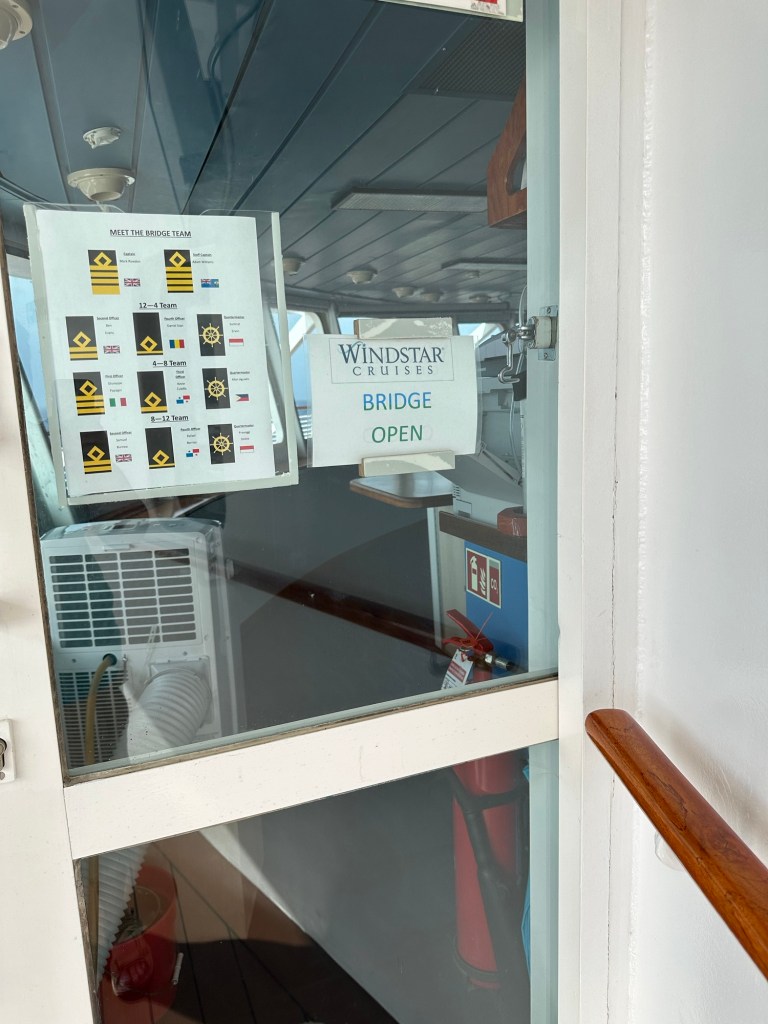
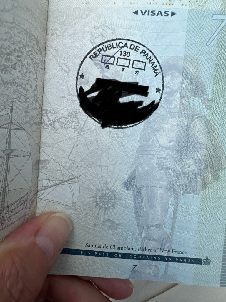
However, this morning before our beach outing, we had to go through Panamanian customs and immigration here on the ship. They came on board and meet with every crew member and every passenger before we can be cleared to disembark. On all the other islands, the ship provides the passport information and we’re cleared without presenting ourselves. I guess that means that when we land in Panama City we won’t have to go through customs there. I, by happenstance, was the first passenger through immigration and I finally got the first stamp in my new passport despite having been in a dozen countries or so since I got it.

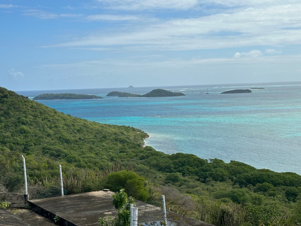
San Blas Islands is part of The Holandes Cays, 9 miles off the north coast of the mainland and is an archipelago of approximately 365 islands and cays, of which only 49 are inhabited. Many of them are just a sand bar with a couple of cocoanut trees.

In the 1800s the aboriginal Kuna/Guna (I’ve seen it spelled both ways) people were driven off the Isthmus of Panama by the Spanish and they settled in the islands of San Blas. They traded with pirates and explorers and they flourished. When Panama became independent from the Spain in 1903, the Kuna did not want to join Panama and in 1925 they became an independent state within Panama. They maintained control over their own culture and governance and even wrote their own constitution which was approved by the Panamanian government in 1945.

Tourists were allowed into the state in the 1940s, but the Kuna maintain control and manage all tourism facilities. They steward the land, maintaining the natural beauty of the islands. The Kuna people are the only ones that are allowed to own islands and conduct business here. The islands are off the beaten path, have interesting nature, and interesting culture, which makes them attractive vacation spots. There are approximately 300,000 of Kunas living in the islands and on a strip of land on the mainland.

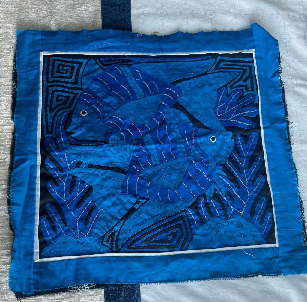
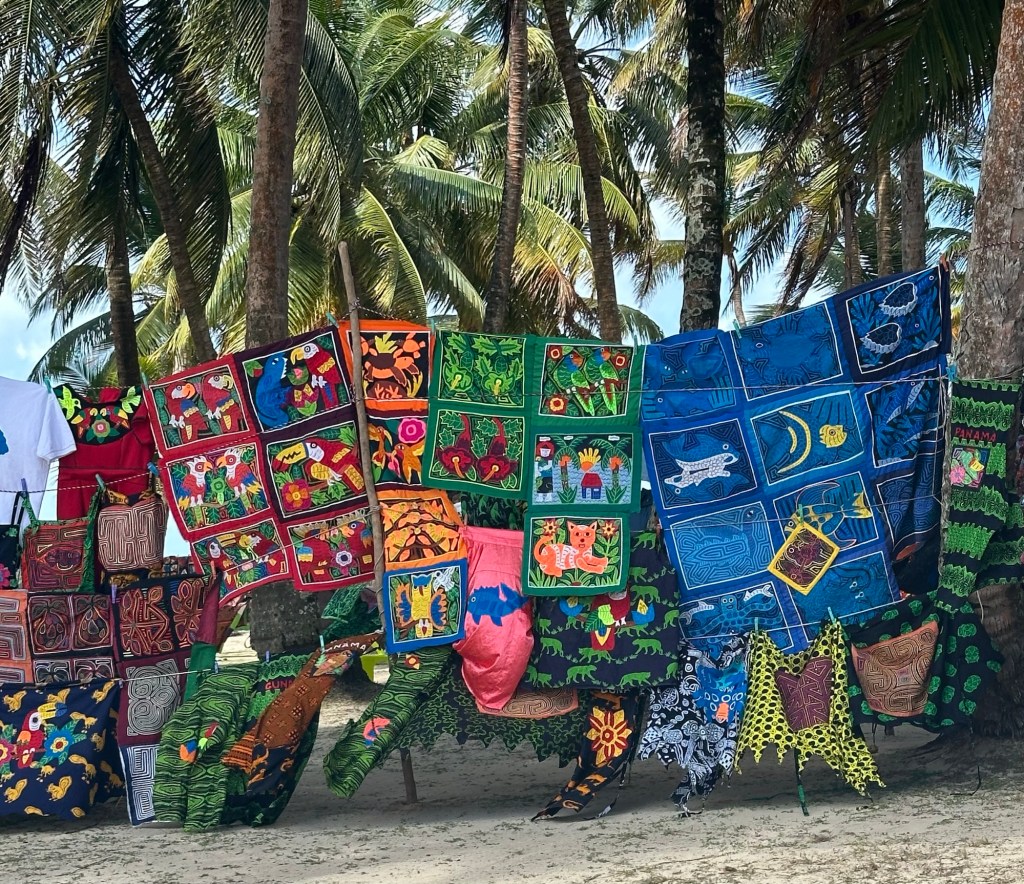
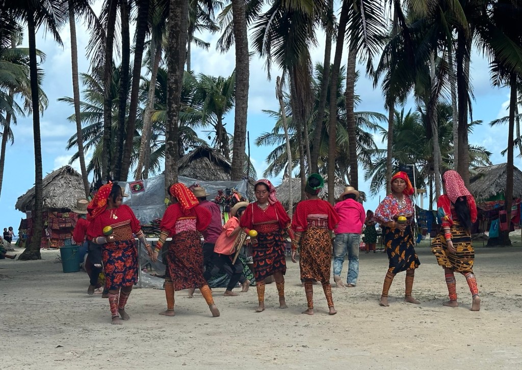
Historically, the Kuna didn’t wear much in the way of clothing, but decorated their bodies with designs. When the Europeans arrived and encouraged the Guna to wear clothing, they made their clothing (specifically a blouse) with a multi-layer textile that they called molas, and they copied the designs they’d previously worn on their skin on the molas. Their clothing includes a patterned wrapped skirt, a red and yellow headscarf, arm and leg beads, a gold nose ring and earrings in addition to the mola blouse. Some of the women also had tattoos on the bridge of their nose. They now sell their designs on pillow covers and small pieces of fabric, but not the blouse itself because they don’t want foreigners wearing their national costume.

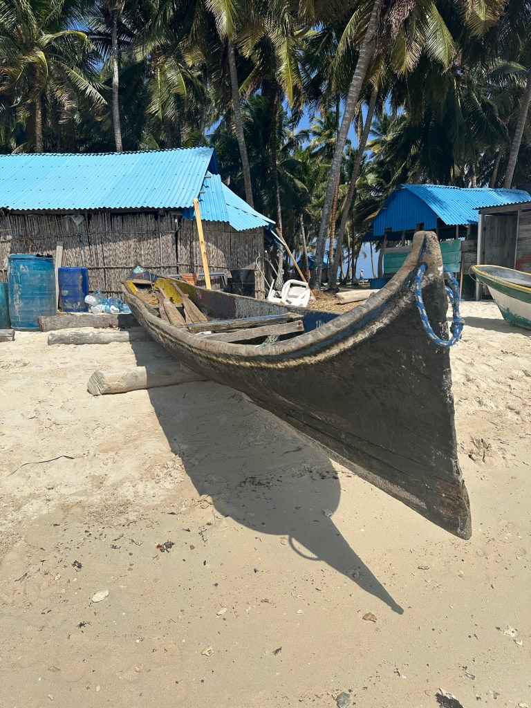
Many Kuna are hunters and fishermen. On some of the islands, children can attend school. Spanish is spoken by most of the men, however some of the women maintain their old traditions.

Fun Facts:

⁃ At one point, Microsoft Windows used a picture of one of the San Blas islands as one of their standard wallpaper choices. It was a small island with only two palm trees on it.

⁃ One of the islands, Chichimei, is owned by the Kuna community, and they rotate families on a quarterly basis to allow different families to benefit financially for servicing the tourists.

⁃ You can dock on the empty islands but not the ones which are inhabited.

⁃ Because the Kuna’s own all tourist services, there are no chain hotels on the islands.

⁃ You can’t make reservations at some lodges on the islands, but people just show up and hope there is rooom.

⁃ Most accommodation is primitive, thatched huts, without heated water, or camping or renting hammocks!

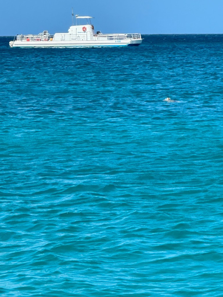
⁃ Snorkelling is allowed in the islands but not scuba diving, which may help to preserve the coral reefs.

⁃ There is a fine for harvesting cocoanuts by foreigners, and no outsiders are allowed to fish or hunt.

⁃ There are various companies offering tours in the San Blas islands where a catamaran or sailboat will island hop for multi night stays.

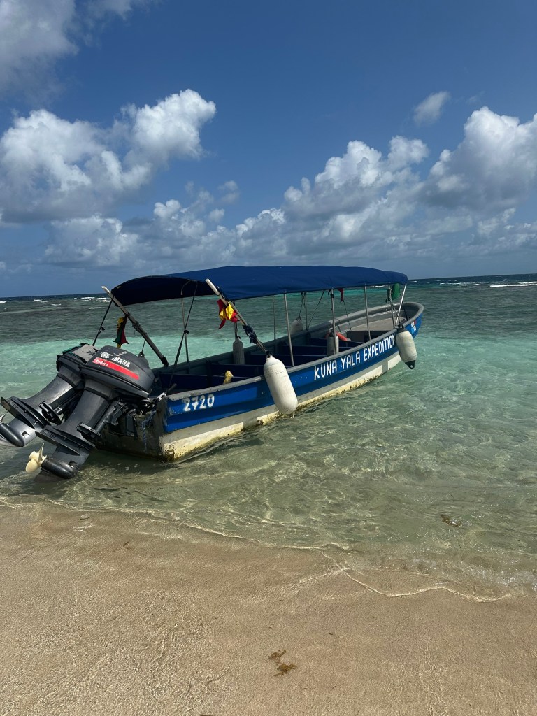
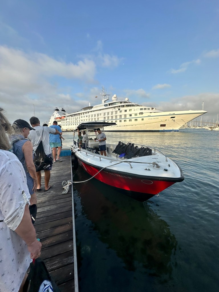
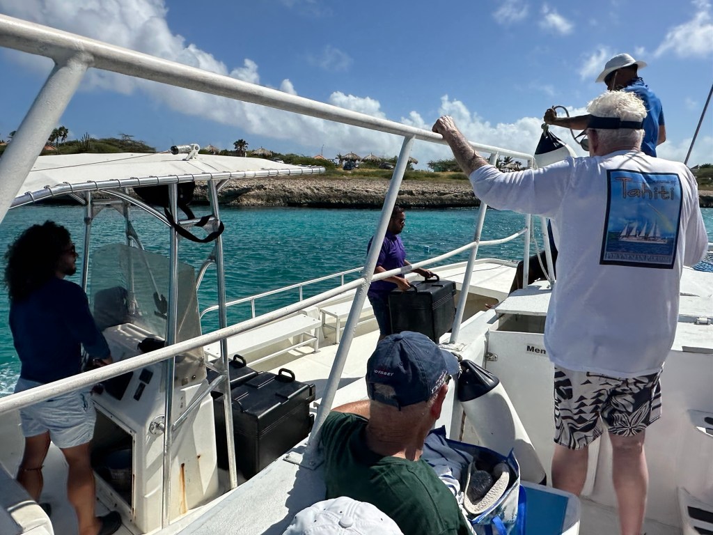
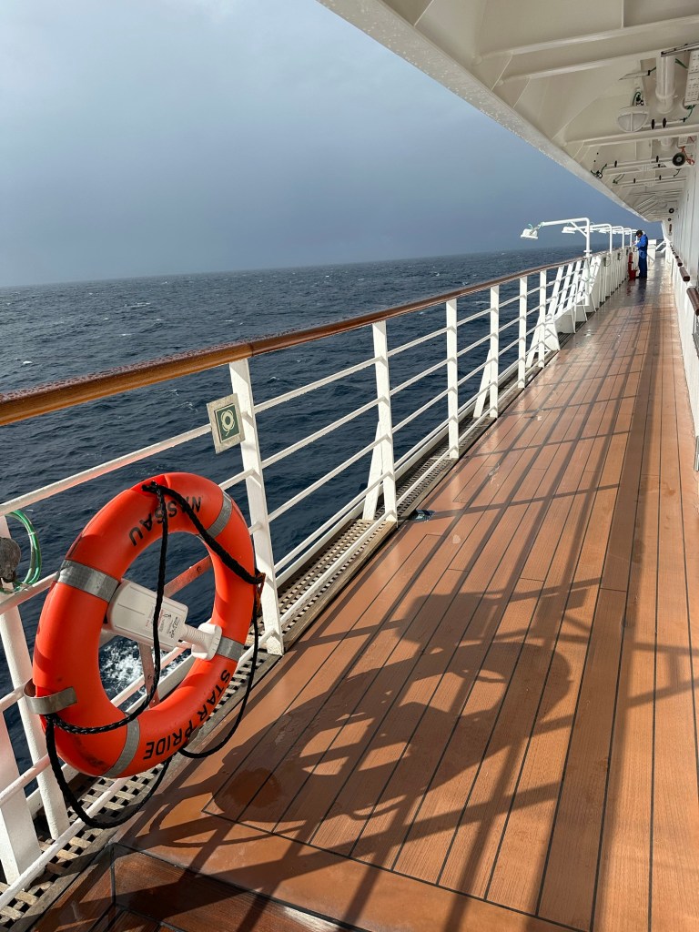
The weather totally cooperated today and although it was rough on the tender between the ship and the island, it was calm just off the beach where went swimming. Walking around the island took all of 10 minutes or so. It looks like the huts that are there are for rent. No one lives on the island full time.

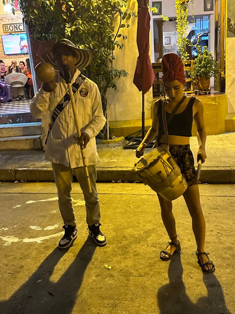
The Kuna women were on the island selling their beautiful, bright fabrics and I might have succumbed to call to purchase 4 of them. Supporting the local economy. And there was a group of them that danced and played instruments for us in the bright traditional costumes.

I had a lovely lunch, a swim and then headed back to the ship to get cleaned up. I managed to not get so much sand in my shoes and bathing suit this week. Tonight we will dine at one of the specialty restaurants and I’m really looking forward to it.

2024 Caribbean Cruise

Cartagena, Colombia Day 2

Fort Jose

Today, I was torn between seeing more of Cartagena and another opportunity to snorkel and I chose the later. None of the other organized tours were appealing, (apiary tour and coffee tour) and it was up to 33 and 90% humidity today again and I just couldn’t convince myself to give up being in the water.

We had an early start, which I did grumble about to the Destination Manager, but it was kind of nice to be out early and back early to relax the rest of the day.

Our speed boat picked us up at a small dock right beside the pier where the Star Pride is docked and in no time we were on our way, double time, out of the harbour ready for adventure. The views of Cartagena as we were leaving the harbour were spectacular. In my mind’s eye when thinking about Cartagena, the historic part of the city was all that I saw. So when I woke up and looked out my window on the first morning I was surprised to see the modern city that I could see from my cabin window. And as I’ve seen more, I’m more surprised by how many modern high rises there are around Cartagena Bay.

Our dock location
Leaving the harbour in Cartagena Bay
On the other side of the bay

Back to today’s adventure, the dive master on this trip was the best we’ve had along the way. He explained things really well, was helpful to those that needed it with their equipment, ran a tight ship and we all had a great time as a result.

On our 30 minute trip to our snorkel site, the he spoke about some of the history and about the forts, on which building started in 1646, and completed in 1759 that protected the harbour. The narrow entrance between the two forts was the only access to the harbour for military ships or pirates since the other channels were too shallow. The forts were built at different heights relative to the water so that the cannon fire would penetrate the ships at various heights and the crossfire was deadly to the incoming foe. The fort on the starboard side, was burned to the ground and was rebuilt more substantially the second go around.

We carried on to Baru Island just offshore, and around the far side of it to a bay in the Bernardo Corals National Natural Park. It took quite some time for everyone to get geared up and into the water, but once in we were guided into more shallow water along the reef to see what we could see. There were many types of coral that I hadn’t seen before as well as some great species of some familiar ones, such as Brain Coral which seem to be quite hardy. And there were lots of little fish, and some larger ones to see in the valleys of the coral and around the larger pieces. We were in the water for 30 minutes or so, and then a few carried on to see more while some had had enough and climbed back on board. Guess which group I was in?

The captain then moved the boat into a very calm bay and served up plantain chips, bananas, and sandwiches. Some people hopped back into the warm sea and had a swim in the very buoyant salt water. When everyone had had enough of the water, we headed back into port.

We had an early departure from Cartagena today as we’re headed all the across the Panamanian Isthmus (205 nautical miles) to a remote island group (San Blas Islands) for our beach day tomorrow. Yay beach day! The Norwegian Cruise Line ship that came in to port as we were headed out snorkelling this morning left just before our pilot came aboard to assist us out of the harbour. On our way out we came close enough to a statue in the harbour, the Virgin Mary and Child, to get this not too clear picture. It’s a relatively calm day today, so should be clear sailing.

The Norwegian Cruise Line ship leaving from the main cruise ship terminal further out of the harbour
Virgin Mary and Child Statue at the entrance to the harbour
2024 Caribbean Cruise

I keep hearing about Cartagena, Columbia

And finally I’m experiencing Cartagena myself. It’s been on my bucket list for ages and now I’ll be raving too. It has an amazing feel of vitality and history. Clearly one day is only enough time to get a sense of the place and to wet the appetite to come back and spend more time.

We arrived here early this morning and I didn’t go snorkelling! (Although I will tomorrow). I did a guided tour of the Old Town and Gethsemani this morning and an evening walking tour of the Gethsemani neighbourhood to see it as it awakens.

Cartagena is a port city and UNESCO World Heritage Site and the walled Old Town has such amazing brightly coloured, colonial architecture, churches, monasteries, plazas, and the street art is a level above anything I’ve seen. It’s often cited as one of the most beautiful cities in the world, and from those that I’ve seen I’d have to agree.

Archeologists have found evidence that people have lived in this area, from around 4000 BC. But Cartagena was founded in 1533 on the site of a Carib Indian settlement. It was rebuilt in 1552 after a fire destroyed many of it’s buildings. It quickly became a main port for the Spanish on the Caribbean coast. It suffered many attacks from pirates, including Sir Francis Drake in 1586, who demanded a random not to destroy the whole city. These attacks precipitated the building of a series of forts and a seven mile wall around the city and 22 bastions, which successfully defended the city from severe attacks. In one attack, 25,000 English soldiers and their fleet of 186 ships was fended off by commander Blas de Lezo, and 2500 poorly trained troops. Don Blas is considered the saviour of Cartagena and there is a statue of him outside San Felipe Fortress. Don Blas, it was said, was only half a man, having lost one eye, one arm and one leg, however it is also said he had 33 children by 25 different women!

Cartagena was one of the first cities in the Spanish empire to proclaim independence from Spain which it did in 1810. Spanish forces retaliated in 1815 and took the city after a four month siege during which 6000 inhabitants died of starvation and disease. But in 1821, Simon Bolivar’s troops defeated the Spaniards after freeing Bogata in 1819.

Fun Facts:

⁃ Colombia is one of 17 megadiverse countries of the world.

⁃ Although there are claims that Cuba was the originator of the Mojito, Colombia’s aboriginals are thought to be the origin. They came up with a mixture of rum, lime juice,mint, and sugar which is believed to be an antidote for dysentery.

⁃ Famous Colombians include Actress Sofia Vergara, Garacia Marquez, (Nobel Prize winner in literature) and singer/songwriter Shakira.

⁃ Coffee is the national symbol of Colombia. Colombia is a primary supplier of Arabica coffee beans to the world and it’s important to the economy. Also, it’s not unusual to see kids drinking coffee in Colombia.

⁃ It’s required by law for radio and tv stations to play the national anthem daily, at 6 am and 6 pm.

⁃ It’s believed that 70-90% of the world’s emerald market is from Colombia and that they are of the best quality. In fact one of the excursions offered is to an emerald facility.

⁃ Colombians like to put cheese in their hot chocolate. The saltiness of the cheese supposedly brings out the other flavours within the chocolate. They use a special cheese that is like a halloumi or mozzarella.

⁃ The condor is the national bird of Colombia

⁃ All men must serve in the military for 2 years when they turn 18 unless there is a medical reason, they are an only child, or if they are married. Our guide said many get married early in Colombia.

To start our day, we were transported along the harbour surrounded by modern high rises, to the Getsemani neighbourhood for the start of our tour. This area is where the poorer of the people of Cartagena lived in early days, and it had become run down and once was the scene of a prolific drug trade. But in the last 10 years the area has been reclaimed and some of the old buildings of this neighbourhood are being turned into cute boutique hotels, and the main floors are retail shops, restaurants and bars. It’s now considered one of the “hippest” neighbourhoods.

We criss crossed some of the most colourful streets and the street art is unbelievable. We got an early start to try and avoid some of the heat but failed. It was 33 and 90% humidity by the time we were done and I was literally soaked all the way through my clothes by the time we got back. An early start was great for moving around and taking pictures, with not too much traffic. Some of the shops were starting to open and we were told that the neighbourhood really gets going by about 8 pm and the dancing in the streets lasts til 2 – 3 in the morning.

From Getsemani, we walked along the top of the wall to see some of the strategic placement of the fortifications and then jumped on the bus to head to where the more wealthy people lived in the Old Town. The difference was very apparent with the homes being larger, with more embellishment such as balconies on the second stories, etc. Such colour, and charm. It was getting busier and the traffic in the narrow streets was crazy. But we tromped around to see many of the special buildings and get a sense of the history of the place. Our guide gave us a lot of history of the place and the buildings. I can’t begin to retell it, and would bore you to death if I did. Hopefully the pictures give you a sense of this special place.

One of the things that is always interesting when travelling are the doorways of the local architecture. And here it is even more interesting because there is meaning to the doors of the homes. Door knockers are very prominent and they even tell a story of what the role in the city the inhabitants played. Lion door knockers meant that this place was home to some in the military. A Reptile meant that they were politicians. A fish meant that these people were businesspeople and a hand meant that this family were close to the church, and the government. Also on most doors there were what our guide called nipples, small knobs of metal. If there were a lot of nipples, it indicated this family was wealthy and if only a few or none, not so much. We headed back to the ship, thankful for the air conditioning in the bus.

Then after lunch, the second shower of the day and a nap, we headed out at 4:30 pm to re-visit Getsemani, in the evening as it was starting to come alive. We were to experience a “full body neighbourhood” as our guide called it. He meant that the environment, music, food and drink would make our whole body come alive.

It was a much more pleasant temperature than earlier in the day, and there was a bit of a breeze. As we walked along streets we had seen this morning, I could not believe the transformation. Chairs and tables suddenly appeared on the side of the streets. Doors that were closed in the morning opened to reveal boutique hotels and charming restaurants and already busy bars. The coming darkness meant lights were coming on to give the streetscape a completely different vibe. Families strolled along the streets or stopped for dinner. Young people gathered to enjoy each other’s company and the food and drink. There was music spilling from every doorway and window. People’s living rooms were open to the street now that it was a little cooler. It was a very comfortable, charming, exciting and vibrant feeling as we walked through the neighbourhood.

We had three specific stops to experience some of the common items that Carteganians eat and drink. First stop was at a coffee shop where they explained the process for roasting and brewing the Arabica beans that Colombia is famous for. I had a couple of sips of their product and it tasted great to me, but I don’t generally drink coffee.

Next we wondered over to another street and sampled an egg arepa. It’s typical street food, with a dough made from corn maze, and stuffed with different fillings and deep fried. It was delicious! Next stop was into the back room of a bar to wash the arepa down with a local beer. I don’t generally drink beer but I have to say that it tasted magnificent after our long and hot walk.

We saw demonstrations of various types of music and dance both in the bar and by street performers.

And then it was back to the ship for the deck barbecue and then the third shower of the day and off to bed. After 17,042 steps, and 9.8 km, I have to think I’ll sleep well tonight.

There are many stories and much history that our guide imparted today, and I’ve only given you a sampling. This is definitely one city I’d highly recommend and it goes back on my bucket list to come and visit for a longer time again.

2024 Caribbean Cruise

Aruba

Our excursion catamaran

We docked early this morning in Oranjestad, the capital of the island of Aruba. For this morning, I chose a snorkel excursion. What else, right? This one was on a very wide catamaran that had shade in many of the areas and so it was a lovely ride. We headed north along the western coast, under sail, checking out the various resorts that line the wonderful white sand beaches of Aruba with barely a break for about 10 km or 45 minutes. One beach of note that our captain pointed out is the widest beach in Aruba, Eagle Beach. It is often rated as one of the best beaches in the world. In fact it was rated second in the top 10 for 2023 by Tripadvisor. It is also home to the nesting grounds of Leatherback Turtles.

Forgot to add this to the blog that I earlier published, but I saw a lighthouse today!

A lighthouse!
There they are again.

While I’m here I’m going to mention what I learned about turtle activity in Aruba today. First of all, there are 4 types of turtles living in the waters around the island, the largest of which is the Leatherback. The other three species are the Loggerhead, the Green and the Hawksbill. We saw about a dozen Green turtles cavorting in the warm sea while bobbing around today.

Our catamaran captain gave us some info on the Leatherbacks, in Aruba in particular, and I’ve research some of the more general info. The nesting season runs from March through September and hatching takes place from May to November. The turtles return to the beach where they hatched to nest as adults. Once they leave their birth beach and head into the seas of the world, they use the earth’s magnetic field to guide their navigation.

If you use your imagination you can see the green turtle in this picture.

Leatherbacks of Aruba lay about 115 eggs in a clutch and the female will nest 6-8 times a season. It’s estimated that only 1 in 1000 hatchlings survives to maturity. In Aruba there is a Foundation Tortugaruba that overseas and helps during the hatching of the turtles by building wooden barricades to route the hatchlings into the ocean. Our guide said that the hatchlings can’t be touched and even our footsteps on the beach can disrupt their nesting, because the feel of the sand from that particular beach imprints on their stomachs as they make their way to the beach so they know where to return.

Picture thanks to Turtugaruba

So, our first snorkel stop was in Catalina Bay, where there was a reef in about 6 – 10 feet of water. It wasn’t rough but there were swells so we had to be careful not to get in too shallow. The reef itself wasn’t in good shape, (pretty bleached) but there were quite a few fish to see. Many schools of small yellow fish were quite remarkable.

Getting ready to go down the stairs. I jumped.

After we’d satisfied our curiosity, we unmoored and went just 5 minutes to our second snorkel site that was a German freighter, the Antilla, that was sunk at the beginning of the the Second World War in 60 feet of water. The Antilla had picked up a cargo load in Galveston, Texas and was starting its return trip to Germany when it got a coded message that they were to stay out of main shipping lanes, and a second message saying they should head toward a neutral port and change the appearance of their ship. They tried to get to Curacao, but the harbour there was already full of German freighters, and so they came on to Aruba and anchored just off shore in Malmok Bay. They were told that they were not to be surrendered if they came into armed conflict. On May 10th, Germany invaded the Netherlands, so the Dutch Government ordered the seizure of all German ships. They were found by the Dutch navy, and surrounded. While the Dutch waited for daylight, the captain of the Antilla prepared to scuttle the ship themselves. He was successful and within a couple of hours, the Antilla was on the bottom of the bay. The crew were imprisoned on Bonaire for the duration of the war.

I didn’t snorkel at the second site as it was a little rough and I’m just not that interested in snorkelling to see ship wrecks. I did that in the Red Sea in Aqaba, Jordan and it was interesting, but would much rather see fish, turtles and coral.

Local swimming hole.

After the few people that went in the second time were finished, we moved on to a lovely bay, near the shore and anchored. It was across from what appeared to be a public swimming area as there were many families climbing through the rocks to reach the cooling water. We wondered what we were waiting for, and it turns out it was for Uber Eats Aruba style. Another boat came along and delivered three big insulated bins full of our individually packaged BBQ lunches. We had ribs, chicken, roll, beans and something else that I wasn’t familiar with. And of course, the ubiquitous rum punch was served to those that wanted it.

Our lunch arriving, Uber Eats Aruba style.
Part of our lunch.

Then it was a lovely, relaxing sail back to our dock, in perfect conditions. It was one of my favourite excursions so far.

Fun Facts:

⁃ There are 26 casinos on Aruba and the bonus is the Aruban government doesn’t tax your winnings!

⁃ Aruba sits outside the hurricane belt so is rarely touched by them.

⁃ I bet you would guess that the national sport obsession on Aruba is cricket based on my previous island visits. Well you’d be wrong. Baseball seems to be the obsession in Aruba, and many Island kids are active in both Little League and the PONY League, and Arubans become major players in the US.

⁃ The current population of Aruba is approximately 112,000 made up of over 90 nationalities and ethnic groups. Among them are sizable European, East Indian, Filipino, and Chinese communities, whose native traditions and cultures are all celebrated on the island.

⁃ I didn’t get a chance to check it out myself, but apparently the unique crushed coral and shell composition of Aruba’s fine, powdery white beaches keeps the sand comfortably cool, even in the heat of the day. So you can get your 10,000 steps on the beach any time of the day.

⁃ We are even closer to Venezuela on Aruba than we were on Curacao. On a clear day you can see it, since it’s only nice miles away.

But I bet you’re wondering about Aruba’s history!

If you read my blog on the history of Bonaire, you can almost just exchange the names with a few small changes. Arawaks here first. Spanish claimed in 1499 but didn’t find gold so not interested, Netherlands wanted it as a naval base for claimed if in 1636. Joined Netherland Antilles in 1954. Broke away from Netherlands Antilles in 1986 and became autonomous and independent territory of the Netherlands.

The capital of Oranjestad Aruba’s main harbour and is a blend of old and new.

From the ship I can see many signs of prominent and luxury retailers on the buildings nearby. There is a tram connecting the cruise ship terminal with downtown, to get passengers more quickly to being separated from some of their cash. It also has stops at monuments and museums along the way. There is no end of restaurants and thriving night life.

Fort Zoutman was built by the Dutch in 1796 and Aruba’s oldest building was built to protect the city from pirates. It was originally called Bay of Horses, because horses were bred and raised here and exported to Curacao. Its current name is after the first Kind Willem van Oranje-Nassau, the first heir to the Dutch House of Orange.

A refinery for crude oil from Venezuela was built in the 1920s which provided jobs and helped to establish a middle class. The economy thrived. In 1959 the first multi-story hotel was built and workers from the oil refinery moved to jobs in tourism when the plant was mechanized and workers were laid off

Unlike many of the Caribbean islands we’ve visited, Aruba’s climate is arid, less than 15 inches of rain a year, and the vegetation is primarily cacti, and aloe plants. There are lots of iguanas and lizards and not much else from the animal kingdom.

Aruba has been present in the fight to slow down climate change, with ambitious targets to reduce their foot print. They experience pollution from the oil refinery, and the desalination plant. They have started using windmills, with a farm on the South Island, and are considering more use of solar, and a waste-to-energy plant. They banned plastic shopping bags, plastic straws, single use plastic cups, and foam plates in the lat 2010s. And they banned sunscreens containing oxybenzone in 2018 as it causes changes in the coral, causing them to not be able to recover from bleaching.

We will miss Adrienne at dinner tonight, and hope she had worry free travel home. Tomorrow will be a day at sea, and so I may take the day off from blogging, although I will likely do some research on our upcoming stops.

2024 Caribbean Cruise

Curaçao – the “Useless Island”

We’re not visiting the ABC Islands in alphabetical order but rather geographic order, (east to west) having stopped at Bonaire yesterday, stopping at Curaçao today, and then on to Aruba tomorrow. We docked in the capital city of Curaçao, Willemstad, with its colourful architecture today. Such an interesting city.

Curaçao is part of the South American continental shelf 37 km off its north coast. Curacao consists of two islands, the main island with its 170,000 inhabitants, and a second smaller, uninhabited island of Klein Curacao.

Its first inhabitants were the Arawak people and it was first visited by the Spanish in 1499 who established settlements and they were joined by the Dutch who established it as a major centre of trade. The Spanish abandoned interest in Curacao when no gold was discovered. (They called it “Useless Island” in Spanish). Curaçao is also the home of the oldest continuously inhabited Jewish community in the western Hemisphere who emigrated from Spain and Portugal in the 1500s.

The Mikve Israel-Emanuel Synagogue – the oldest surviving synagogue in the Americas.

Willemstad is the site of a fabulous natural deep harbour which is protected by a reef with a channel through it into the bay. The Dutch were looking for a source of salt which brought them to Curaçao and during the late 1600s they grew the Dutch West India Company. It also unfortunately become a major centre for the Atlantic Slave Trade in 1660s. Slaves were shipped from their home countries to Curacao and on to work on plantations and salt mines throughout the Caribbean. Slavery was abolished in Curacao in 1863.

The Dutch did have some tussles with the British but it has remained in Dutch hands since 1816. Curacao became one of the “dependencies” of the Netherlands Antilles in 1954 and were granted autonomy. However the Netherlands Antilles dissolved in 2010 (rumour is they didn’t get along too well among themselves) and Curacao and Sint Maarten became countries within the Kingdom of the Netherlands like Aruba had in 1986.

The Dutch monarch is head of state, represented by a governor and a representative of Curacao also resides in the Netherlands and is integrated into the governing structure. A elected Prime Minister presides over a Council of Ministers, who determine policy and they have a unicameral parliament which is elected by proportional representation for no more than five years. Much like other territory structures, Curacao has control over internal affairs, but the Netherlands is responsible for defense, foreign relations, and other international affairs. They share a Court of First Instance with Aruba, Sint Maarten, Bonaire, Sint Eustatius and Saba but the Supreme Court of the Netherlands is the final court of appeal.

The deep harbour can handle large tankers and Curacao refines petroleum from Venezuela, which can then easily be shipped through the nearby Panama Canal.

Fun Facts:

⁃ the island of Curacao is currently home to eight forts which have withstood the test of time.

⁃ There are approximately 40 beaches on Curacao, but some are privately owned by resorts.

⁃ Curacao has many dive sites and is known to be one of the best dive destinations in the Caribbean.

⁃ There are two national parks: Shete Boka National Park (an important nesting site for turtles) and Christoffel National Park. Both parks are located on the northern end of the island.

⁃ Papiamento is the official language, a blend of Spanish, Portuguese and Dutch, but Dutch and English are often used.

⁃ One word of Papiamento that you might hear often is the word “dushi” which can mean “sweet,” “nice,” or “good” when referring to a pretty place, a tasty dish, or a congenial person.

⁃ Iguana is served in stews in Curacao. (Tastes like chicken).

⁃ Curacao liqueur is made from the peels of Iaraha oranges, (a type of Seville oranges) brought to Curacao from Spain in the 1500s.

⁃ Curacao uses desalinated sea water for its drinking water.

⁃ As of 1997, the historic district of Willemstad was added to the UNESCO World Heritage list.

⁃ Curacao’s buildings are apparently bright colours because, according to a law enacted in 1817 by the then Dutch Governor of Curacao, Aruba and Bonaire, Albert Kikkert, houses could not be painted white because the sun’s glare caused headaches and blindness.

My choice of excursion didn’t take me far from the ship today. It was a walking tour of Willemstad. It’s hard to choose an excursion when you have only one day in a port, because there were some others that look interesting too. One took you on a tour of the whole island, others that toured the underground caves, etc. But the historical downtown is pretty special.

We started by going to a neighbourhood called Otrabanda, just a 3 minute walk from the ship. Otrabanda is from the local Papiamento language and means “on the other side” because the city was established with a fort on the other side of the river and when more homes were needed, they started building “on the other side”. It is a UNESCO designated historic neighbourhood full of Dutch Colonial designed buildings. A neighbourhood within Otrabanda, the Kira Hulanda Village, has been redeveloped by a wealthy Dutch businessman taking the run down historic buildings and making them into shops, restaurants, beauty services, a hotel all interspersed with courtyards decorated with beautiful statues and wall murals. It’s really beautifully done.

The Curacao flag, with the base representing the Crown of the Netherlands.

Joining the two sides of the city is uniquely designed Queen Emma Pedestrian Bridge built in 1888. Because it is a shipping channel between the two sides, the bridge needs to let ships through. Instead of building one that raises up to do that, this one was designed to sit on 16 floating pontoons, and it has two engines that swing the bridge sideways across the channel to let ships through. If it’s just a small boat, they only open it a small amount, but if needed it can swing completely open in 5 minutes. However, our guide told us some of the freighters take up to 30 minutes to go through the area. In this case, there is a ferry service that jumps into action to take passengers across only while the bridge is open.

The Queen Emma Pedestrian Bridge
The 16 floating pontoons under the bridge.

We walked across the bridge to the district of Punda, the historic centre of the city, starting in Fort Amsterdam, a UNESCO site. It was built by the Dutch in 1635 as part of their first settlement. and houses the Governor’s office, Council of the Ministers and Government offices. The most recent governor, appointed by the King of the Netherlands, created history by being the first woman in the 300 years of Dutch governors and she refused to live in the Governor’s home and is instead living in her own home. There is a British canon ball still stuck in the wall of the Protestant Church directly across from the governor’s house which couldn’t be removed when they restored the walls of the church and it’s been left as a bit of a message that the British couldn’t take over the Dutch fort.

Governor’s office and historical residence
See the black dot on the column second from the left beside the half circle window? It’s a canon ball stuck in the building.

The architecture of the building in Willemstad has been called Dutch Colonial or Caribbean Baroque. Most people speak at least 2 languages (Papiamento, Dutch) and many speak 4 (Spanish, English). Then we walked past a floating vegetable market where boats from Venezuela have been bringing fresh produce to the side of the canal where the farmers sell their produce for a hundred years They sleep and live on their boats until their produce is gone and they head back to Venezuela to restock.

Venezuelan vegetable market
The veggie vendors ships, with the Star Pride in the background.

And then we were on through the oldest areas of the city, where the facades of the buildings have been preserved and the main level is used for retail. These historic buildings are protected and can’t be modified to the standards that many people would like in order to live in them so they remain empty.

We stopped for a cool drink in the shade before the short walk back to the ship. We lucked out with the weather this morning, and it was blue skies. We’re relaxing this afternoon and it’s the last night before some of my fellow travellers will be leaving the ship in Aruba and more will be joining.

It was fun to watch the departure from Willemstad tonight, and see the pilots and tugs manoeuvring us out of the narrow channel and the Queen Emma Bridge in action.

Mother Nature provided us with a beautiful sun set as we sailed away from Willemstad.

Four of us enjoyed the steak and chop restaurant this evening. Once again too much food! But oh, so good. Three of us are carrying on for another week, but sadly one is on her way home to Denver tomorrow. It’s been a delight to spend time with her this week (thanks for being my snorkelling buddy) and I hope we will have a chance to meet up some other time. Bon Voyage, Adrienne.

2024 Caribbean Cruise

Bonaire – and now for something different

Last night (after I’d sent my blog for the day) it was the much lauded Crew Talent show on the Star Pride. I have seen a couple of them before and they were fun. It is pretty amazing the talent on board. There are many countries represented among the crew and they are proud to show their culture to the passengers. Last night was a guitar/singer from the Philippines, a group from Indonesia doing some choreographed drumming, a singer from the housekeeping crew (mine actually) singing Lady Gaga’s part of Shadow, a fabulous singer from the Bar server team who did justice to The Prayer, and the ever popular grand finale, the synchronized swimming team. A group of about 8 of the housekeeping staff put up a barrier about thigh high to represent the water, and then they do various formations behind it like synchronized swimmers. Hard to explain, but it was hilarious. And the neat thing is that the crew seem to really enjoy doing it. Now on to Bonaire.

The Prayer by Anna. Fabulous talent.

Bonaire started out the same way most of the Caribbean islands, with the native Arawaks, and discovered by the Spanish in 1499. The Spanish depopulated the island by sending the Arawaks to work in mines throughout their empire. Then the Dutch took power in 1634 and saw the potential from the flat topography for harvesting salt. It was very labour intensive and so slaves were put to work in horrific conditions in the salt fields until the abolition of slavery when the salt flats were closed. They lay dormant until World War II when mechanization allowed them to be productive.

In 1954 the country of the Netherlands Antilles came into being and Bonaire was part of it along with Curaçao, Saba, and Sint Eustatius, with the capital in Curaçao. However, the Netherlands Antilles was dissolved in 2010 and Bonaire and other islands, not including Curaçao, now have a “special territory” relationship with the Netherlands.

The islands we’ve visited so far have been quite hilly and lush vegetation with villages dotting the mountain sides, and in flats areas along the shore, however the south of Bonaire is relatively flat with mangroves in places and salt flats in the south. The north is more rugged and hilly, and protected by the Washington-Slagbaai National Park.

Tourism has grown on Bonaire revolving around the bounty of the sea in the form of well preserved coral reefs growing on the leeward side of the island, very close to shore. There are 50+ dive sites available just off shore around the island so it makes for extraordinary access. In fact, just walking along the sea wall this morning we could see beautiful fish in blues, and purples. The island is quite arid with little rainfall because of its location, and the lack of rainfall makes the waters exceptionally clear of silt. The reefs have been protected by establishing an underwater national park that surrounds the island in recent years, although enforcement is always an issue.

Although there has been no industry to have a negative impact on the environment, in recent years concerns have been raised about the health of the reefs, and the growing number of tourists visiting the island. Too much of a good thing. Although many tourists come to stay on the island, ship passenger traffic has increased exponentially.

In 2022 the government implemented a “one ship a day” policy to limit the number of daily visitors and increase both the quality of life of islanders and the tourist experience. Only one of the big cruise ships is allowed into port each day, with the exception of those carrying under 600 passengers which can dock along with the one larger vessel. This is the first full season of this policy so it will be interesting to see how that works out for them.

Bonaire is home to 10,000 Caribbean Flamingos, and it is Bonaire’s national bird. It is one of only four major breeding sites for the Caribbean Flamingo. Three thousand pairs have historically landed in Bonaire in December and some in June to mate, laying just one egg each. In recent years, biologists have noticed that the hatchlings are undernourished and not doing well. Drought, large amounts of Sargassum weed piling up on the shores and stronger winds are all potential causes that are being investigated.

Fun Facts:

⁃ Bonaire is a part of the so-called ABC (Aruba, Bonaire, Curacao) islands close together and near the north coast of Venezuela. They are protected from most hurricanes and have only been hit by the eye of a hurricane on average every 29 years.

⁃ “Divers Paradise” is on the license plates of vehicles in Bonaire.

⁃ Bonaire’s airport is called Flamingo Airport.

⁃ Rincon is Bonaire’s only other town, founded by the Spanish in 1527. It was strategically placed by the Spanish in a valley with lookout points surrounding it so that pirates and other country’s ships couldn’t see it when passing by Bonaire.

⁃ Bonaire has an extensive wet and dry cave system where thousands of bats from nine species call home. They are active at dusk and after dark, hunting for insects, nectar, fish, pollen and fruit.

⁃ Bonaire is south of the hurricane belt, but right in the path of the trade winds, and its almost constant breezes from the east push off rain making it a true island desert.

⁃ Drinking water for the approximate 20,000 inhabitants of Bonaire is produced from desalinated seawater via reversed osmosis and additional treatment steps

⁃ Salt produced on Bonaire by the American company Cargill, can be seen piled in huge pyramids on the southeastern part of the island. The salt is produced by moving sea water through a series of condenser ponds with the water evaporating by the wind and sun. Then when the salinity reaches 25 – 30 percent it’s moved to crystallizer ponds and when more water evaporates and it reaches 37% the salt starts to crystallize and precipitate out of the brine. A microorganism which flourishes in high salinity causes pigments which give the ponds the pink-red colour.

One of the main streets of Kralendijk

Having said how arid it is in Bonaire and that the weather systems get pushed away from the island, today is the first day we’ve had pretty consistent rain! We are docked in the port in Kralendijk, the capital city of Bonaire, and this morning we took a walk down the Main Street of the tourist area, and along a boardwalk right on the sea.

Check out the shoes under the white cap on the left.
Small pieces of coral along the shore.
Doesn’t get a lot fresher than this!

Fortunately the rain held off and it was actually quite hot and sunny. It is a very neat, colourful, orderly, clean and friendly city with many nice shops and restaurants. It feels very Dutch here, with the sound of their language (one of the official languages), and shops with Delft Blue everything. It’s one of the few islands that I might consider a longer visit some time.

One of the shops along the Main Street painted so beautifully
Outside a Delft shop.

We came back to the ship to get ready for our afternoon snorkel adventure on the Samur Sailing Ship. It is an authentic Siamese junk – hand build and carved. It has seen better days. And it was an adventure. We were transferred from the dock in a rubber dingy to the Samur where we had to go from the dingy up the side of the boat, with foot holds that were quite far apart, especially for short people, hanging on for dear life to window frames and railings. Oh, and did I mention while the dingy is bouncing in the waves. Once all aboard, we headed off to an island a short distance off Kralendijk called Klein Bonaire. Oh, and it’s about now that the rain started. And it continued for most of the rest of our excursion until just as we arrived back at the ship’s dock when the sun broke through the clouds for a while.

Picture not mine

We motored much of the way over to Klein Bonaire, but they did put up the sail for a short time, and it’s a very different design. The boat tied up to a buoy (not allowed to anchor to preserve the reef) and we climbed back down into the dingy and were taken to the start of the drift snorkel. Snorkel gear on and over the side.

This one is mine taken just as we’ve all boarded and before the rain started.

There is a reef that runs parallel to and not far off the beach that we would be drift snorkelling along. It was full of life, both fish and coral and I think it’s the best snorkelling I’ve had in the Caribbean. The water was warm and for most of the way we were able to drift with little effort while watching the undersea world. Part way along the reef, the current shifted and all of a sudden we were meeting it head on, and so we ended up having to put quite a lot of effort into making any progress. But with the plethora of things to look at below, it was worth it. We made it to the beach, where we would be for a while longer, and it was chilly in the rain and wind, so we headed into the water where it was warmer. Then the process was reversed and we were on our way back to the Star Pride. Along the way, those who were interested were rewarded with a rum punch on the return trip.

It was quite the experience, rain and all, but I was very glad to have done it. And I really enjoyed my warm shower once back in my home away from home.

Tonight was the deck barbecue and I sure wouldn’t have wanted to be the one making the call on whether to hold it on the deck or move it inside, because it’s been raining off and on all day. But they went for it and luckily it stayed clear, and the full moon was visible rising quickly over the town. So we enjoyed fabulous food once again. Like we needed it!

A fabulous day on Bonaire. But it’s on to Curaçao tomorrow.

The full moon over Bonaire.
2024 Caribbean Cruise

At sea

The Star Pride anchored, taken from the tender

Today we are “At Sea” on our way to the ABC Islands of Aruba, Bonair and Curaçao. The day started off overcast and rainy, unfortunately, weather systems move so quickly through the Caribbean that it cleared up by 9:30 or so and it’s now very warm when in the sun. I’m not.

While at sea, I thought I’d take a minute to let you know about the ship I’ve come to know well, as it’s my second trip on her. The Star Pride is one of three motor yachts in Windstar’s fleet which are pretty much identical. There are also three sailing ships which are powered by engines as well and I sailed on one, the Wind Spirit, from Tahiti to Fiji in 2020.

The Star Pride has only 156 cabins for a max of 312 passengers. (I think they said there were 280 on board this week). All three of the Star class ships have been “stretched” in recent years having been cut in half and an extra section being placed in the middle of the ship and other upgrades to the ship. I sure hope the marine engineers knew what they were doing!

That’s the Star Pride on the right, next to a moderate size ship from the Costa fleet.

On Deck 7 there is a small swimming pool, and hot tub and lots of deck chairs both in the sun and the shade and on the upper deck there are a pile more.

Overlooking deck 7
Deck 8 seating-it’s brightened up since I took this picture!

On Deck 8 is also one of my favourite areas of seating, with comfortable furniture, an incompatible view and easy access to food and drink!

Also on Deck 8, at the pointy end of the boat is the indoor Yacht Club, another of my favourite haunts. It’s a quiet place with a panoramic view where you can get tea or a specialty coffee all day, and continental breakfast in the morning and small sandwiches and other snacks in the afternoon.

The Yacht Club

There is a main dining room, Amphora, for dinners which is open seating anytime within their hours (6:30 – 9ish). Plus there are two specialty restaurants, Cuadro 44, which is a Spanish restaurant and Candles Steak and Chop house for dinners where you have to make reservations because they are small but there is no extra charge. And an indoor/outdoor buffet and table service restaurant for breakfast and lunch called Veranda, and the Star Grill which is open for most breakfasts, lunch and dinner, which is on deck and offers various grilled proteins, salad bar and desserts. That is my favourite. Casual dress fits with my style, and shorts and T-shirts are welcome at any of the restaurants during the day, and long pants, or dresses are required in the indoor dinner places but no one is in suits or ball gowns for sure. And there are no theme dress evenings, like on some cruise ships which I know some people enjoy.

The Star Grill – my favourite

Some people prefer the larger ships which have more variety of restaurants, and on board entertainment and the ship is the main attraction but I like the smaller, more casual experience on the Windstar fleet. The smaller ships are able to get in to many smaller ports and islands than the larger cruise ships carrying thousands of passengers. There are no line ups for anything on the Star Pride, and getting on and off the ship is a breeze where there are so few passengers. So pros and cons of each.

Always maintenance to be done on a ship.

Windstar does a great job of a “Sail Away” when the ship is leaving port. On the sailing ships they unfurl the sails and on the power yachts they raise the Windstar flag with great pomp and circumstance (and some clowning around) to the music of Vangelis’ Conquest of Paradise, a beautiful dramatic and moving piece of music. (You might recall his music from “Chariots of Fire”.) With the port in the background, sometimes with the sun setting, it’s a lump-in-the-throat inducing experience.

One of the pretty unique things about the Windstar fleet is that the bridge is open to the passengers except when there are meetings going on, or they’re coming in or out of port.

The entrance to the bridge

Now I’m off to enjoy the sun and the sea! And likely more food.

2024 Caribbean Cruise · Uncategorized

A pleasant surprise in Soufriere

Gros Piton in the foreground and Petit Piton behind.

On my Windstar cruise last year, we visited the north of Saint Lucia at Pigeon Island National Park for our beach party. We will see Saint Lucia again on this cruise but our stop today is at Soufriere on the west coast.

Saint Lucia is 27 miles long and 14 miles across, and is very hilly, and the centre of the island is what we would refer to as jungle. That 27 miles can take up to an hour and a half to drive though because the road is so windy. Its landmark Piton mountain range, with its iconic twin peaks is a UNESCO World Heritage Site. The two volcanic peaks, Gros Piton and Petit Piton, stand 2600 and 2400 ft respectively, above the sea. St Lucia’s capital city founded in 1650 by the French is Castries where about 1/3 of the 180,000 people of the island live. It was named “Carenage” by the French which means “Safe anchorage”.

Taken at the botanical garden – read on.

Caribs, who had taken over the island from the Arawaks called Saint Lucia “Island of the Iquanas”. Saint Lucia is one of those islands that changed hands many times, mostly between the French and the English who eventually took control over. Saint Lucia gained its independence from Britain in 1979.

Here again, sugar cane was cultivated with the use of West African slaves, and it remains a crop today. By the time slavery was abolished in 1834, there were more than 13,000 black slaves, around 2,500 free black people and around 2,300 white people living on the island. Bananas were added to the mix in the 1960s however, tourism has outpaced agriculture as the principal economic driver.

Taken at the botanical garden. Read on.

Fun Facts:

⁃ There are approximately 21 rum distilleries in the Roseau Valley, a hot tourist destination.

⁃ St Lucia has had its history of pirates and it’s believed that the famous Blackbeard used Vieux Fort in the south of Saint Lucia as a spot to stash his spoils.

⁃ And yes, Saint Lucia has had its own share of movies filmed here as, well, it’s so picturesque. Romancing the Stone, Superman II, and Dr. Doolittle are among them.

⁃ Hurricanes have hit Saint Lucia over a dozen times since 1800s but none have been that severe. Sourfriere did have some damage in 2010.

⁃ Vudou is still used and respected on the island.

⁃ Visitors enjoy natural hot pools and mud springs produced by it’s volcanic geography – Soufriere in French means sulphur mine in English

⁃ Saint Lucia stands out as the only country in the world named after a woman!

⁃ Saint Lucia is a member of the Caribbean Community (CARICOM), Organization of Eastern Caribbean States (OES), La Francophonie and the British Commonweath.

⁃ From a sports perspective, besides the ever present cricket, the annual Atlantic Rally for Cruisers (ARC) race begins in the Canary Islands off Spain and ends in Saint Lucia.

Taken at the botanical garden. Read on.

We didn’t have an excursion planned for today, so three of us walked into the town of Soufriere, to get our steps in and to see what we could see. After running the gamut of very polite locals wanting to taxi us to their favourite island spots, or sell us their wares we walked through the commercial area into the town square in front of the church. We then headed into some residential neighbourhoods to see the brightly painted homes.

Different shades of blue seem to be favourites.
Taken at the botanical garden, Read on.

We soon found ourselves at a main road, and saw a sign pointed to Diamond Falls Botanical Gardens & Mineral Baths. A local woman kindly told us it was only a 5 minute walk and so we ventured out along a shady one lane road leading through the very dense jungle. It was about 10 minutes but we did come to the botanical gardens and for a bargain price of $US 7 we were in and on our way. It was the most gorgeous wild-ish garden laid out in various walkways with some hard landscaping among the beautiful natural growth and planted areas.

We came to a covered building selling snacks and souvenirs and to the side was a line of small cement mineral baths being enjoyed by many. Apparently this was a famous spot for Napoleon’s wife Josephine to come to bathe. We carried on along the pathway to the falls which spilled over rocks coloured beautifully by the minerals in the water. A definite Kodak moment. It was a surprise happy place – a cool, and lovely way to spend our time in Soufriere.

Moi at the Diamond Falls

Back on ship, the afternoon was spent enjoying the breeze on the top deck, reading, talking and working on one’s blog. Trivia is the name of the game in late afternoon and today our team did much better than yesterday but still didn’t win. I’m proud I was able to supply the name of the inventor of the code made up of dots and dashes, Morse’s first name.

We left port at approximately 4 pm today and Captain Mark took our Star Pride right along the coast line of the Gros and Petit Pitons, truly a majestic sight. He even did a 360 while centred between the two before heading off to our next stop. By the way, Captain Mark also announced just before 6 pm that there was going to be a lovely sunset this evening, and he would be turning the ship so that the sunset could be easily viewed from the port side. How cool is that.

Sorry I got in the way of a great view.
Not the best I’ve seen but pretty.

This evening, we are dining at one of the two specialty restaurants on the Star Pride, Cuadro 44, which has a Spanish inspired menu including one of my most very favourite treats in the world, churros, served with a delectable chocolate sauce that I swear has chilli in it for a bit of a bite. Very excited for that experience.

By the way, if you read yesterday’s blog you’ll know I had trouble getting a picture from a fellow traveller, and now I have it but it won’t upload. So maybe it wasn’t meant to be!

2024 Caribbean Cruise · Uncategorized

Back to St Vincent and the Grenadines

On my cruise last year, one of my favourite islands was called Bequia, and it is one of the Grenadine islands in St Vincent and the Grenadines. On this cruise we are visiting the smallest of the inhabited islands of the Grenadines, Mayreau. And by small, we’re talking .46 sq miles and a population or approximately 400. The hilltop town of Station Hill is the centre of the population where a Catholic Church (more on that later) as well as a Pentecostal church and an elementary school. At one time salt was harvested from the island for export, but now is just used locally. There is an area popular with yachts to harbour and a small resort area at Saltwhistle Bay.

The Star Pride

And today, it’s beach party time on Mayreau! The amazing Windstar staff set up beach chairs, a beach bar, lunch and the water toys from the hold of the ship on a white sand beach. The ship was anchored in the bay and we could shuttle back and forth as many times as we liked between 9 and 4:30 (well that was the plan, read on). Drinks were served to our lounge chairs and we could dip into the warm sea as often as we liked.

But before we sat back to enjoy the leisure, we decided to work for our leisure and lunch by hiking to the top of the tallest point on the island. Our main interest was in seeing a charming Catholic Church, Church of the Immaculate Conception at the heart of the town. The original wooden church on this site was built in the early 1800s by settlers but it was replaced several times after being destroyed by hurricanes. In the 1930s, a Benedictine Monk decided that the people of the island deserved more than the tent that they were using after the last church was destroyed, so he set about learning how to build a decent church for them. He had no knowledge of building techniques and so travelled to Belgium to learn the masonry skills necessary. When he returned he taught others his newly learned skills and a new simple but beautiful church was christened on May 12,1930. It was well worth the pilgrimage up the hill to see as well as the view from the top.

The road up was very steep and we were thankful that there were some shady spots to stop and rest before carrying on. The locals we met along the way were so welcoming. By the time we got down to the beach party site, we had earned our swim in the warm and buoyant sea and I spent at least 30 minutes bobbing around!

We enjoyed some cool beverages, the scenery and some great company for some time and then the smells coming from the lunch tent became overwhelming and so we move over into the picnic tables in the shade to enjoy our barbequed lunch of Mahi Mahi Tacos, and a multitude of salads and desserts.

Many times you’ve seen a version of my painted toes in pictures of my travels. Today I decided that I needed to get a picture of them with our beautiful Star Pride in the background. Unknown to me, I was giving some of the loungers on the beach some entertainment in watching my antics as I tried to get my toes and the ship in the same frame, both in focus, all while waves were crashing down on me on the beach. In fact one of the observers took a picture of me in action which I thought I’d managed to get from her today, but it didn’t come through. So I’ll have to share it with you tomorrow. Apparently some of the observers comments indicated they thought I was aiming for Sports Illustrated Swimsuit Edition shots!

After a bit I decided to go back to the ship, and I am very glad I went when I did. Thirty minutes or so later a squall went through and the rain was being driven sideways by the wind. So the afternoon was cut short but by then it was 3 pm or so and pretty much everyone had enough sun already. Once everyone and everything was aboard, the Captain high-tailed it out of there and outran the storm and into calmer waters for our voyage to our next stop. Back on ship our agenda was full, with a nature talk on reptiles, a general trivia contest and dinner. So much to do, so little time.

But I haven’t told you much about St Vincent and the Grenadines yet. So here goes…….

The island of St Vincent makes up most of the land mass of the country, with a small percentage being spread over 32 islands and cays, only 9 of which are inhabited. The islands are the products of volcanic eruptions and St Vincent is hilly with rich fertile valleys and interior rain forests.

St Vincent and the Grenadines has a slightly different history than the other islands in the Caribbean. There were inhabitants called Siboney’s who were there up to 7000 years ago. Then they took the normal route of Arawak invasion and then Caribs. Although the Spanish tried to invade, it was more or less the Carib’s last stand and because of the the sheer number of Caribs who had escaped to there from other islands they were successful in warding them off much longer than in the other islands.

The English and French invaded at different times and the English eventually took over the islands under the Treaty of Paris. They ejected the Caribs to the Honduras and used the islands for plantations, but they were not terribly successful. Finally after the abolition of slavery, two volcanic eruptions and several hurricanes, the British agreed to independence for St Vincent and the Grenadines in 1979. The plantations were broken up into smaller farms and plantations which still grow bananas for export.

Tourism is growing but slowly compared to the other nearby islands of Barbados and Grenada. There have been some questionable decisions by the government in selling crown land to international investors which has made the investors wealthy but the locals have not benefitted.

The environment is something the government has grappled with ahead of some of the other islands being among the first to ban styrofoam. They have implemented programs to recover reefs and fish stocks destroyed by overfishing and pollution, funded by charging all hotel room visitors with an environmental surcharge. Water is of big concern in the whole country. Collecting runoff, desalination plants and wells are minimal and while it can supply the local inhabitants tourism is a drain on their supply. In the southern Grenadines there is no government water source and residents must save their own rain water for their use and resort to buying bottled water which is obviously expensive to ship.

Fun Facts:

-The Caribs called St Vincent and the Islands “Hairouna” which translates to “Land of the Blessed”.

-The listed most popular religions are Christianity and Rastafarianism

-the islands of Mustique, Palm Island and Union Island have been frequented by the ultra-wealthy as well as the British Royal Family.

-Like other Caribbean islands, a volcano on the island, La Soufriere, erupted in 2021 after lying dormant since 1979. The ash plume went 20,000 ft into the air and it displaced thousands of people.

-Several scenes from the Pirates of the Caribbean movies were filmed in Saint Vincent and the Grenadines

-The Saint Vincent Botanic Gardens were established in 1765 in Kingstown and are the oldest botanical gardens in the western hemisphere.

-Citizens of Saint Vincent and the Grenadines are known as Vincentians or colloquially as Vincies.

-There are said to be at least seven species of whales and 11 species of dolphins in this area, so we’ll keep our eyes open.