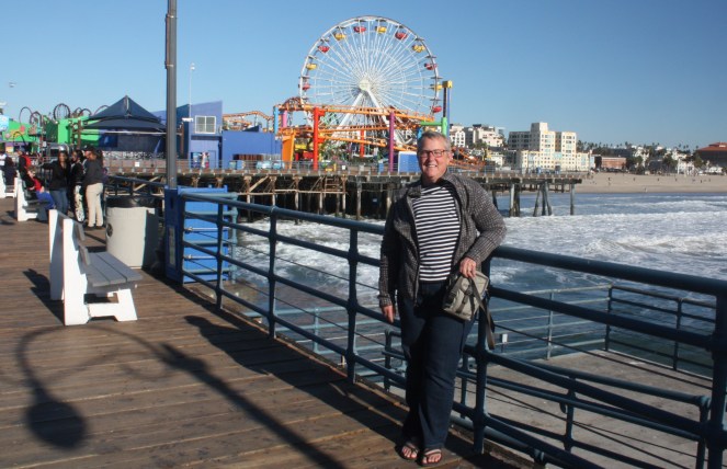
Chula Vista, CA
Yesterday was Thanksgiving in the United States of America. The campground was packed with families either camping here while visiting nearby family, or just spending a few days together in the campground. Living in a campground you have a little bit of a window into how other people live since you’re packed in to a small space and you spend so much time outside. Just a walk to the washroom is instructional.
Camping is a great thing for kids to grow up doing and I love staying in parks where there are lots around. I avoid the 55+ ones for that reason. Given that the wifi is practically non-existent or useless in many campgrounds and lots of the sites don’t have cable hookup, kids are forced to find other things to do, which their parent encourage (“get out of that trailer, now!”). And they do. In most cases their parents do stuff with them. The playgrounds are swarming with little tots to early teens with parents standing and sitting around the perimeter chatting among themselves. You really have to drive 5 mph through the park because there are so many kids and adults on the roadways on their bikes, etc. In the early evening you can hear “Home free” throughout the park as a game of hide and seek breaks out which takes me back to my own youth. The young teens find each other and swarm from one part of the park to another in a pack.
One of the things that surprises me is how much paraphernalia people brought with them specifically for preparing their dinner. (some of this happens even when it’s not Thanksgiving but things seemed to be on overdrive this weekend). Patios were covered with propane ovens, stoves and/or deep fryers. The little chimney fireplaces augmented the fire pits provided. Folding tables were produced to add to the picnic table supplied at each spot. Pop up canopies and tents with sides used by event companies were produced. Cases of drinks were piled high. Lights of all kinds were added – some Christmas lights, some fancy lanterns, and strings of red, white and blue ones. Even the LED ropes were laid along the outline of the patios in a couple of instances.
As the day progressed and the preparations for dinner were well underway, groups played games of horse shoe and other tossing games, threw footballs around, rode bikes or scooters (both human energy and electric models), and lots of people sat around their big screen TVs built into their huge rigs doing that other traditional Thanksgiving thing, watching football. At least they were outside.
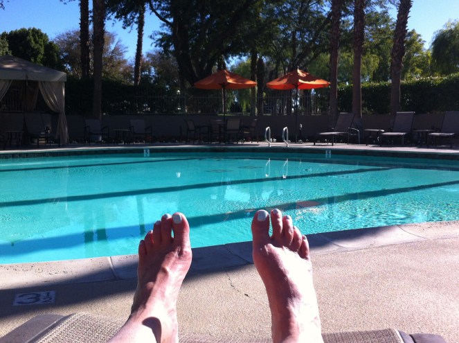
I enjoyed sitting around reading and chatting with people as they passed by, and given the weak wifi, even finished a 786 page book I’d only started a few days ago. By early afternoon I was ready to venture out to see some more of San Diego. I chose to go to the Cabrillo National Monument, which had been recommended to me by a fellow camper (and former Canadian), and to re-visit Coronado.
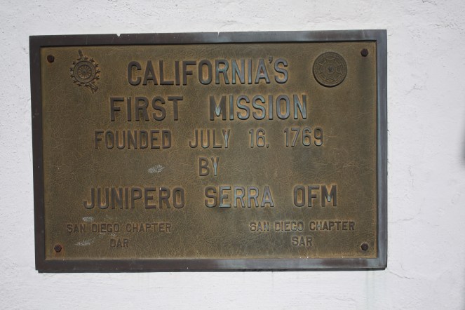
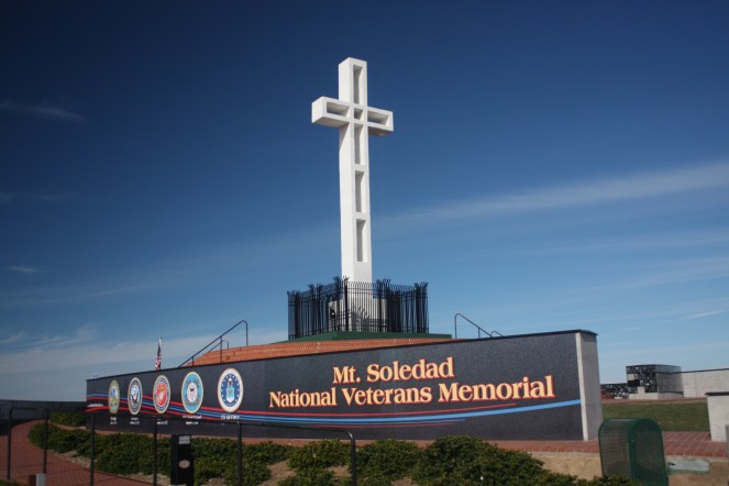
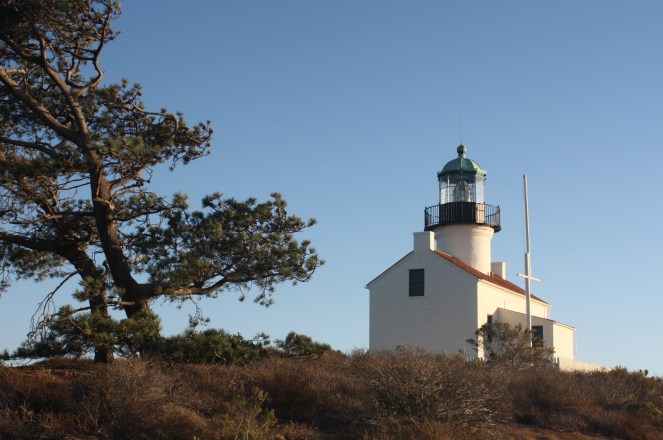
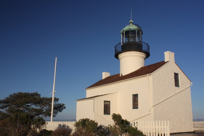
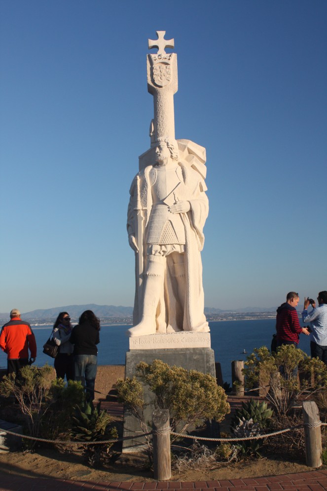
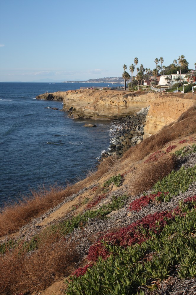
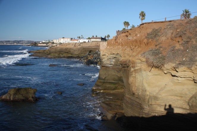
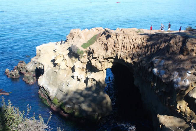
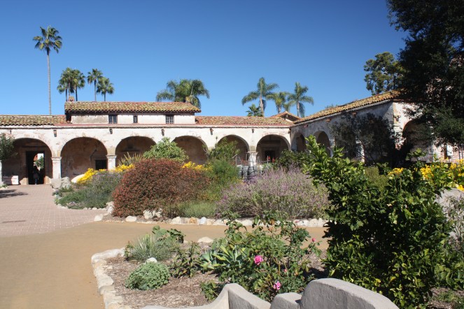
Cabrillo National Monument is on the tip of Point Loma, a high point overlooking San Diego and Coronado, and it’s where Juan Rodriguez Cabrillo was the first European to set foot on the west coast of the US in 1542. The park includes a visitor centre, Point Loma lighthouse, hiking trails and tidal pools for exploring. Unfortunately, I hadn’t clued in that since it was Thanksgiving Day, it was closed. So I’ll have to try to fit it in again before I leave Tuesday next week for Palm Springs.
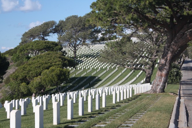
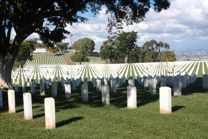
But I did have a chance to wander through the Fort Rosecrans National Cemetery also located on Point Loma. The “national cemetery” designates important cemeteries where military personnel, veterans and their spouses and children are usually buried. Arlington National Cemetery across the river from Washington, DC. which has 400,000 graves is the best known, but there are 147 of them across the US. The Fort Rosecrans one has approximately 100,000 graves (which still seems like an overwhelming number) in the same kind of layout as Arlington. It was an appropriate place to spend some time on Thanksgiving I thought.
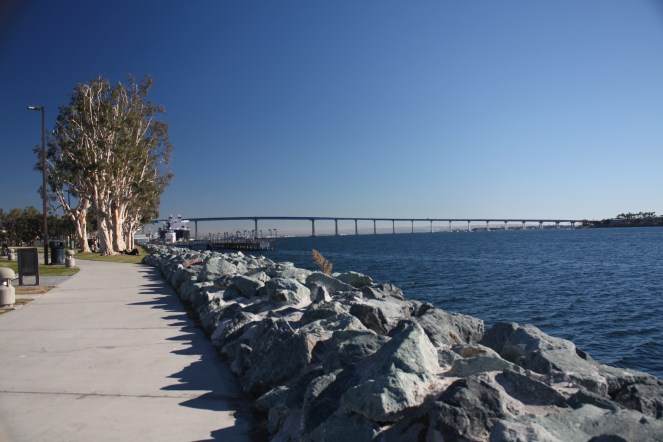
Then I was on to Coronado, across a huge big bridge on Highway 75 running off Interstate 5. I learned something new while looking up Coronado to see if it was truly an island as it is sometimes called. Seems it’s a “tied-Island”. The definition I found is as follows:
“Tied islands, or land-tied islands as they are often known, are landforms consisting of an island that is connected to land only by a tombolo: a spit of beach materials connected to land at both ends.”
Who knew?
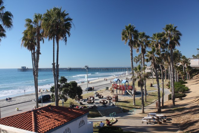
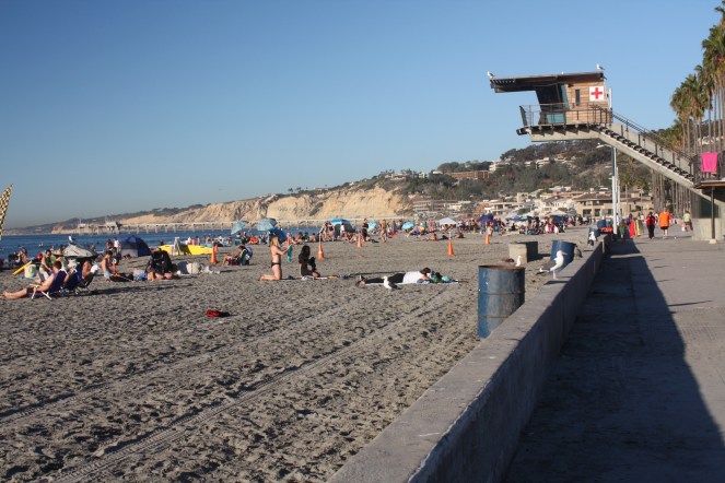
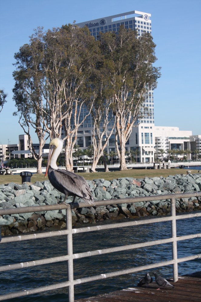
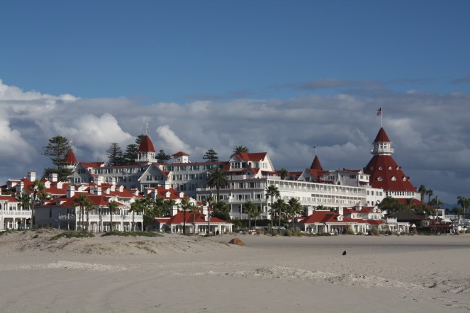
Coronado is an upscale neighbourhood whose economy is tied to the local tourism business. There is a beach that was once rated as a top10 beach on the continent, and is similar to many of the California beaches, long and wide, with fine white sand. In addition to the historic Hotel Del Coronado there are other major hotels and smaller ones running along the beach along with some newer mega-houses and smaller older ones. I had been to Coronado almost 30 years ago and stayed at the Hotel Del Coronado when we attended a sales conference in the late 80s.
The Hotel Del Coronado, shown above, has a long and interesting history. Architecturally, it’s classified as a wooden Victorian Beach Resort genre, and is the second largest wooden structure in the US (after the Tillamook Air Museum in Tillamook, OR which I saw earlier this fall). It’s a California Historical Landmark which, when it opened in 1888, was the largest resort hotel in the world. It was also the first hotel to have electric lighting and the first electrically lit outdoor Christmas tree on the hotel’s lawn (1904). When we stayed at the hotel in the late 80s, the power frequently went off between 4 and 5 pm during the high demand of people getting prepared for dinner. Hopefully by now it’s been re-wired.
Many celebrities have stayed there. Presidents Taft, Wilson, Roosevelt, Eisenhower, JFK, Johnson, Nixon, Ford, Carter, Reagan, HW Bush, Clinton, GW Bush, and Obama to name a few. Hollywood celebrities Douglas Fairbanks, Rudolph Valentino, Charlie Chaplin, Clark Gable, Errol Flynn and Mae West were frequent guests. There is even a rumour that Edward, Prince of Wales met Wallis Simpson there in 1920 but in both of their memoirs they noted they met much later.
There is also a rumour that the hotel is haunted by the ghost of a woman dying of cancer, who shot herself at the hotel in the late 1800’s.