Charlene’s trip home on Monday was uneventful but very long. Unfortunately mine was a bit of an adventure with my first flight being cancelled by United just as we arrived at the airport. The new routing and a mechanical problem delay had me dashing through immigration, to the inter-terminal train, through security and sprinting to the finish line which resulted in me being the last passenger on the flight from Newark to Ottawa. My Nexus card, and having just carry-on luggage made it possible and the snafu actually got me in to Ottawa earlier than my original flight, so all good.
Scottish National War Memorial, Edinburgh Castle
I’ve had time to catch up on some sleep, get some movement (besides walking) back into my body through a physio appointment and a yoga class, and go through all my posts and pictures and to contemplate the trip a little. And what a great trip it was!
High Tea at Edinburgh Castle
First of all, having my sister, Charlene, experience the Gaelic Explorer with me was so fabulous. She’s a great traveller and despite getting a cold part way through, she was a trooper and wouldn’t waste a minute of the time we had by resting to try to shake it. We have similar interests and getting to do the hikes on the Isles of Man and Mull together was a special opportunity. And of course, the day on Skye when we were able to get a picture of the McKinnon Clan castle was very special and so grateful to share that with Charlene.
Eilean Donan Castle
One of the main impressions I’m left with is the kindness and friendliness of the people of Ireland, Northern Ireland, the Isle of Man and Scotland. People were willing to help or just chat wherever we travelled. Another take away was the Norse influence in the region. I had no idea how long the Vikings had stayed in the places to which they had travelled and how much influence they had on the English language. This was especially apparent in Kirkwall in the Orkney Islands, but also in the Isle of Man.
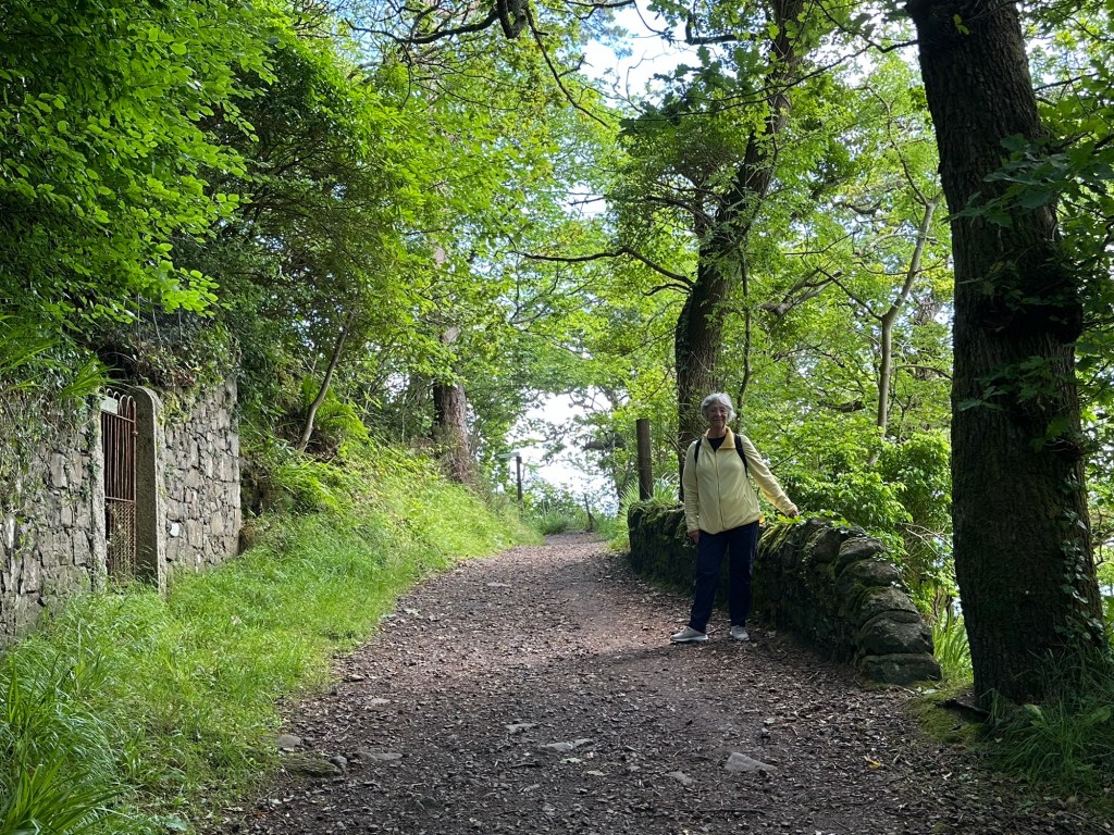
Charlene on the Coastal Pathway on the Isle of Man
Our weather was amazing, cool but with sunshine for most of our days- perfect for touring and all the walking we did. (We averaged 12,000 steps per day) The one day we did have rain, wind and really cool temperatures was in the Orkney Islands, where it seemed to add to the experience rather than take away from it. When it counted, we had really usable weather, even if that meant layering up with fleece and rain jackets for breaking the wind. And a couple of days were downright warm and I almost put on a sleeveless shirt one day.
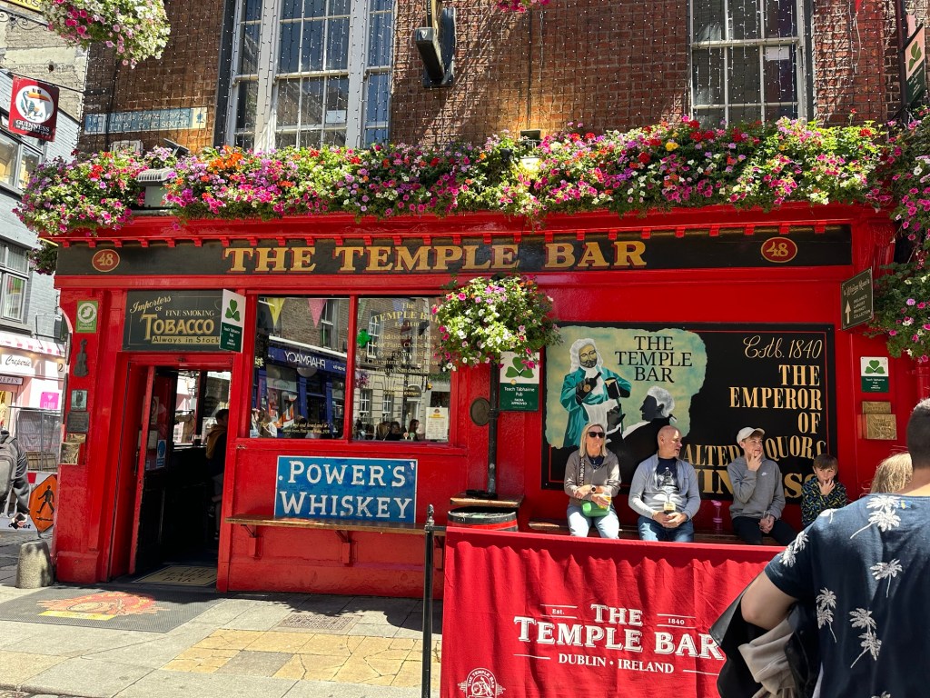
Temple Bar, Dublin
We had amazing guides along the way and the excursions put together by Windstar were terrific. We missed out on a couple of experiences because we left it til too late to book, but I think in both cases, it worked out that the ones that we chose as back ups were great if not better. Windstar did its amazing job of service and food. We had one little hitch on board. Our travel agent didn’t specify that we wanted separate beds and we were in a cabin where the beds were not easily separated. Housekeeping managed to make it work, and in the end, Charlene got a wonderful little window seat because the bed was pushed up against the window.
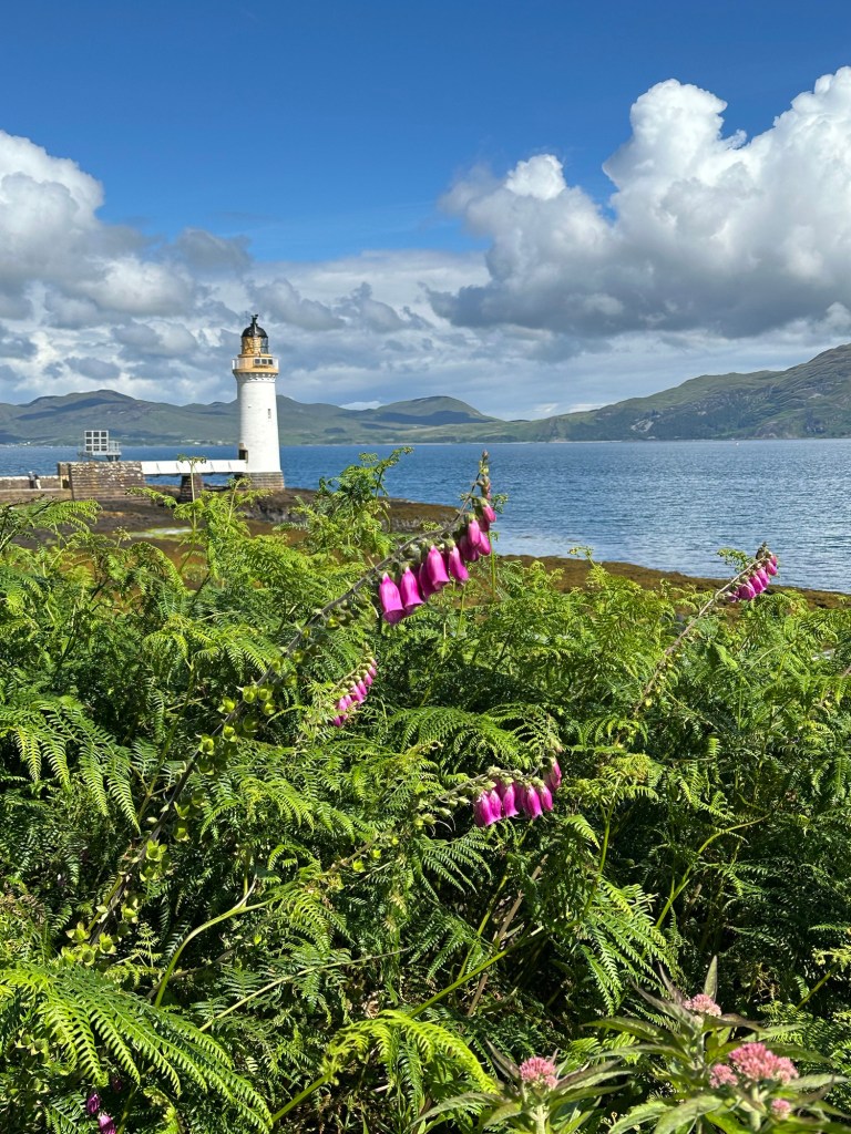
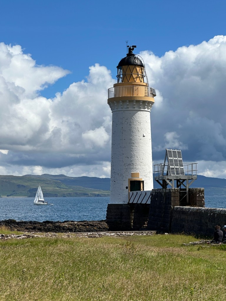
Lighthouse just outside Tobermory, Isle of Mull
I have added some of my favourite pics from the trip to this final blog on our Gaelic Explorer. Thanks for your kind comments about the blog and thanks for coming along on the adventure.
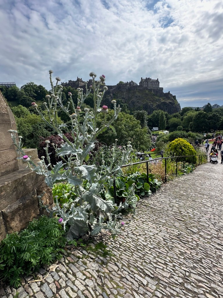
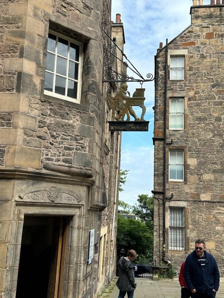
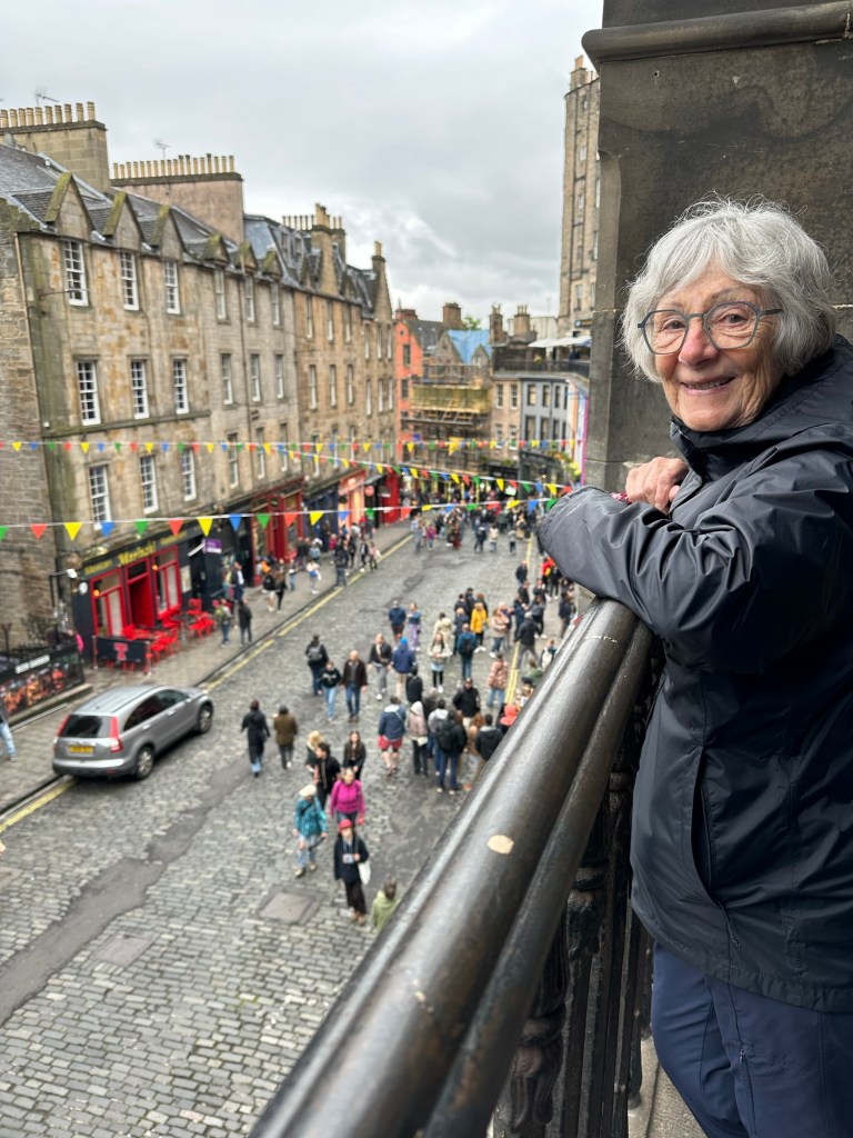
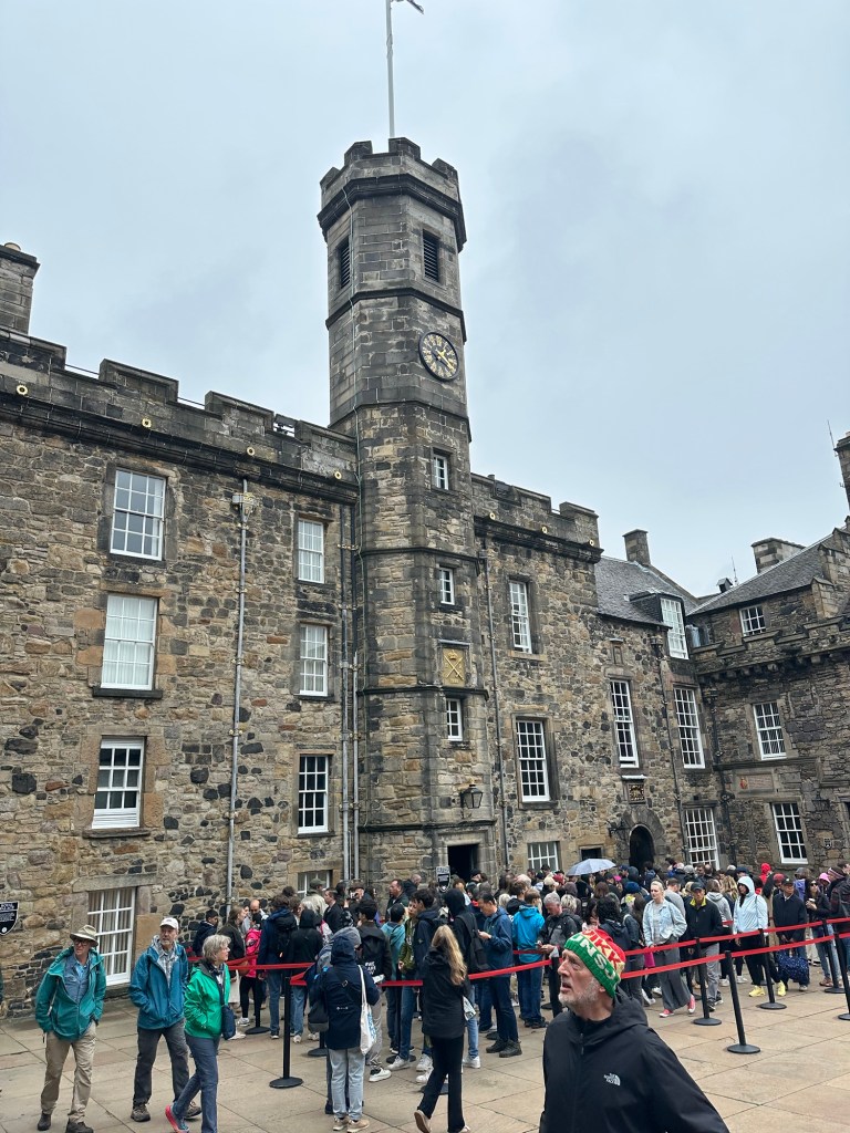
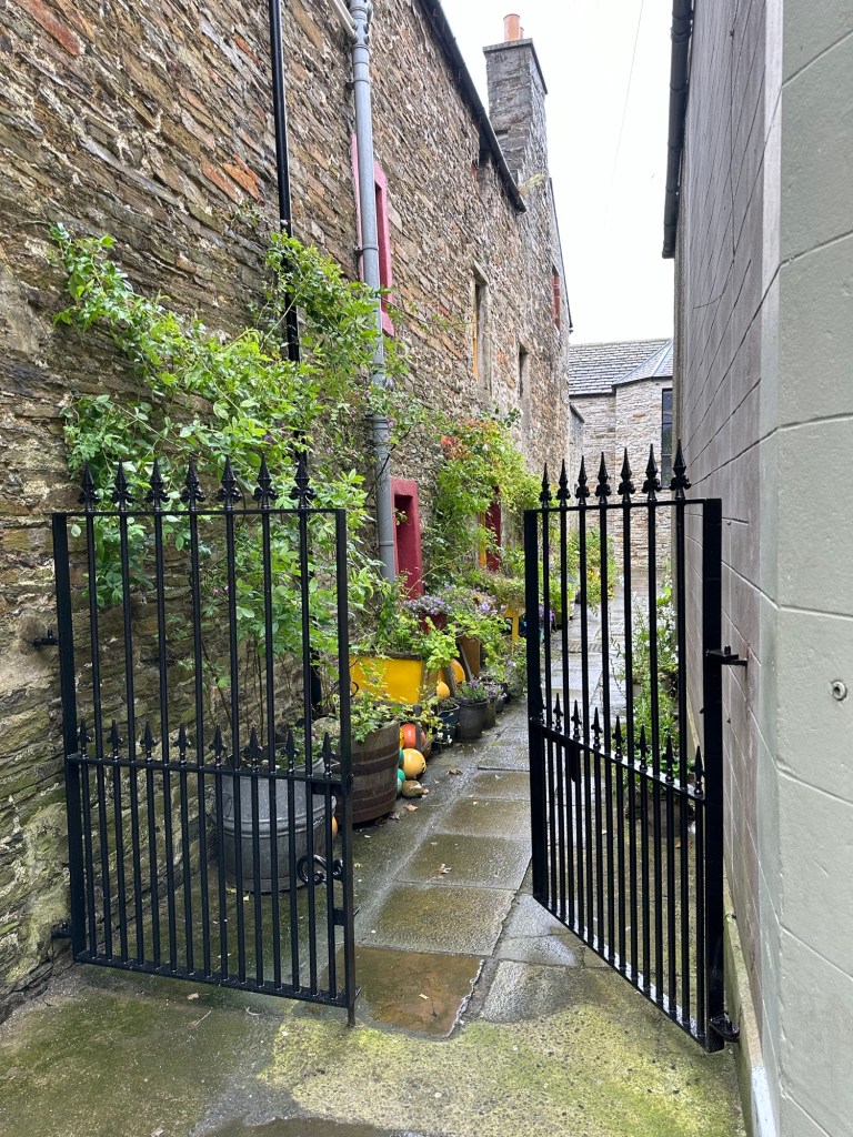
It’s our last day in Edinburgh and we wanted to make the most of it so we decided to do a historical walking tour of the old town. We had walked the Royal Mile up and down a couple of times on our way to Tea and the Castle tour yesterday and doing a bit of looking in the shops the previous day but wanted to do it with a guide who could fill us in on some of the rich history of this amazing city.
Edinburgh Castle from Princes Street
As directed, we met up with our guide Georgia at a coffee shop on a side street off the Royal Mile just east of North Bridge. As more and more people arrived it appeared we were to be a very large group but turns out there were two guides and so we ended up in a very nimble group of about 15. The sea of humanity along the Royal Mile got denser and denser as the day progressed and as we got nearer the Castle. Georgia took us through closes into courtyards and around the back of buildings such as St. Giles Church along the way so that we could get away from the crowds and we could hear her. She mentioned that next month it will be even more crowded as the Festivals and the Tattoo attract even more visitors to the city.
(I will take this opportunity to remind readers that my interpretation of things said by guides may be wrong and, as I’m sure you can believe, some of the stories have been embellished somewhat to make them more interesting. I’m not an expert in this area and am only conveying stories that were told to us by the various guides throughout our trip as I remember them.)
I’ll also take this opportunity to apologize for the length of this and some of the other blogs on this trip. Just so much to talk about!
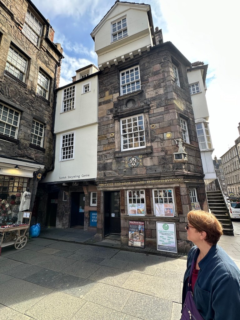
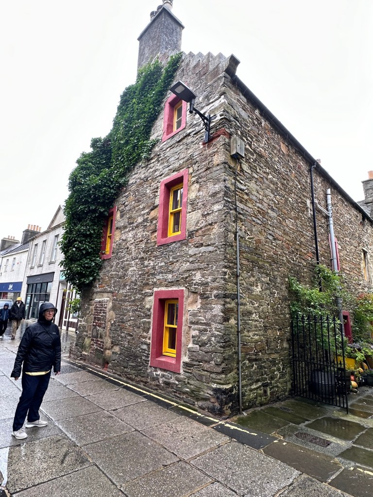
Our first stop was outside the oldest house on the Royal Mile, built in approximately 1400, that became the house of John Knox. Knox led the Protestant reform movement in 1550 and who, in 1559, declared himself the high minister of St Giles. Queen Elizabeth I was not keen on Knox because among other things he made no secret of his dislike for female monarchs.
The oldest house in Edinburgh where John Knox once lived.
In the 1600s, there were active witch trials in Edinburgh and women were very careful not to exhibit any signs that they might be a witch. Just outside the John Knox house was one of the few remaining (and capped) stone cisterns that showed wear on the left where women would put their left knee as they used their right hand to gather the water. One of the beliefs at the time was that witches were left handed. There were over 300 women burned at the stake in the Old Town and Georgia explained why there may have been so many. If they wouldn’t admit to being a witch, suspected witches were placed in a barrel into which nails had been hammered and then they were rolled down a hill until they pleaded guilty!
Our guide Georgia, and one of the last remaining cisterns
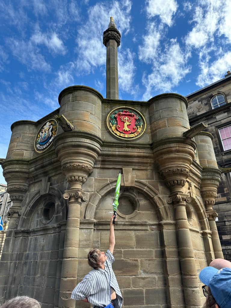
Throughout our travels with Georgia she pointed out that in the 1600 and 1700s, Edinburgh was not such a great place to live but that hundreds has flocked to the city because the countryside was even worse. Edinburgh was crowded and polluted and was a rough place. She showed us areas where public hangings took place and other forms of punishment were dished out. In a square in front of St. Giles Church what is now a stone monument was originally made from wood, and anyone convicted of theft would be nailed through the hand using large iron pegs and left there for 24 – 48 hours. They could try and get free from the peg, causing even more damage to the hand or stay to endure the additional humiliation of townspeople coming by to spit, or through rotten food or excrement at them until they were released.
This monument originally was a wooden structure where criminals were punished by various means.
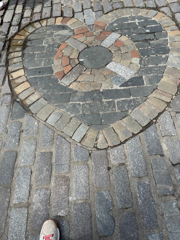
In this same area there is a heart formed by the stone work on the ground which is where the door to the jail was located. As townspeople went by the jail they spat on the ground at the entrance to the jail to show their disgust for the crimes committed by those jailed there. The tradition of spitting on that spot has continued and even to this day, our guide said people sometimes do participate in the tradition more for the shock value than anything else.
We stopped in a courtyard named Makar’s Court, where Georgia described for us what it was like to live in the 1600’s in Edinburgh. Then 16,000 people were already living in this area, in buildings that were 4 -5 stories on the front side and 8 – 10 on the back. The poor lived at ground level, with the middle class living on the floors in the middle and upper classes on the top floors. Of course there was no sewage system back on the 1600s, and chamber pots from the upper floors were dumped out the window in the evening after dark, falling on the ground outside the windows of those on the lower level. The good news for them is that because of being built on the hill, the sewage ran off, aided by the frequent overnight rains. There was smoke in the air from the many fireplaces and industries making the air sometimes unbearable.
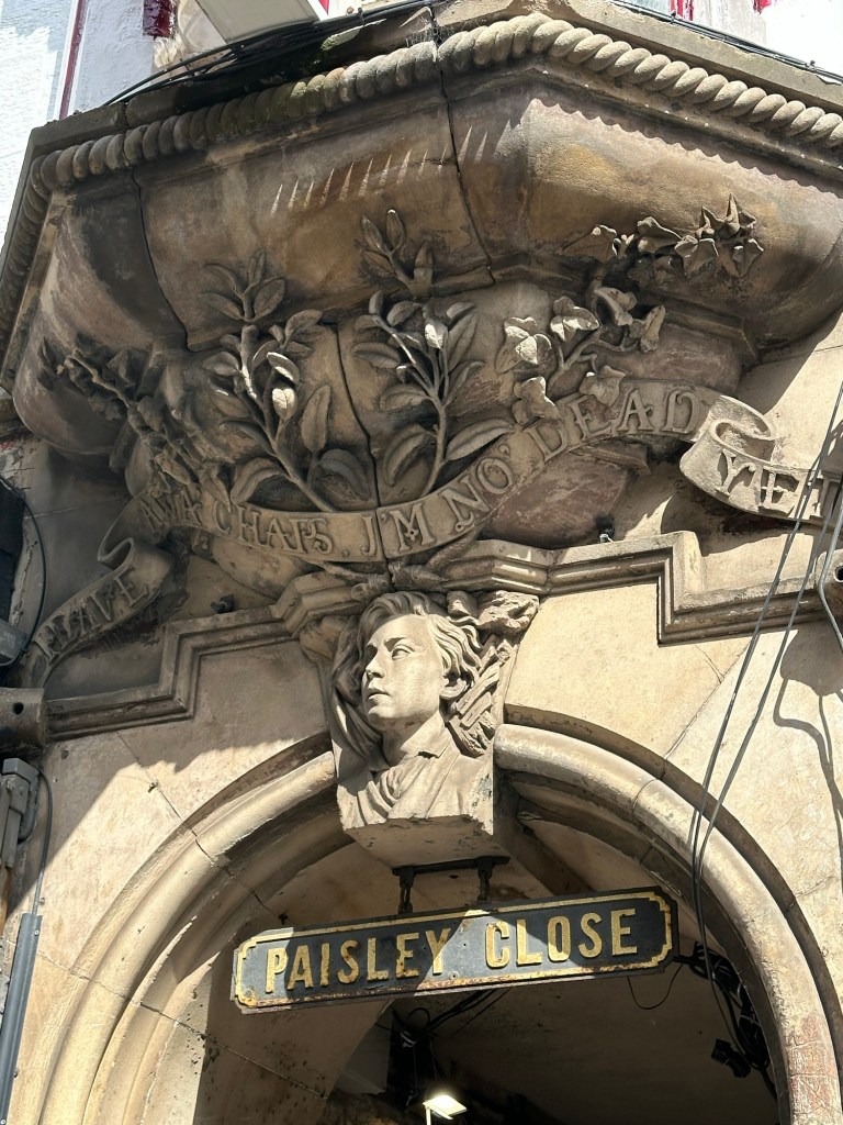
A young lad was buried by a 7 story building collapsing on him here but was rescued and survived after yelling out “Heave awa’ lads, I’m no’ dead yet!”
There seem to be lots of stories of the dark side of Edinburgh and even “haunted” tours and nighttime tours with stories of witches and covens and body snatchers in the earlier centuries. In the 1800s, the City built over 120 underground vaults and roads under the surface roads in the west side of the city near South Bridge with the notion that they would be rented out to shop keepers and it would become an underground shopping area. However, they didn’t build them with any water proofing and the vaults got flooded out. The city sealed up the vaults in 1865, but there are still some passages into them under businesses in the area, known to the local guides and people who work there.
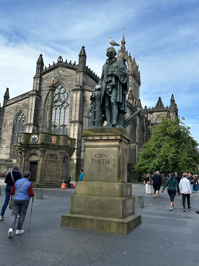
As we walked along the Royal Mile, we came across a statue of Adam Smith, and Georgia used the opportunity to speak about the period of Scottish Enlightenment in the 18th century, early 19th century of which Adam Smith was a part. The period’s culture was based on the gathering of deep thinkers in Edinburgh, in the Societies and Clubs there and around the 5 universities. Voltaire called Edinburgh the home of civilization in referring to this period. Adam Smith (1723-1790) was one of those deep thinkers, a philosopher, and economist who some called the Father of Economics or Capitalism. Our guide remarked that the pigeons seemed to enjoy sitting on Adam Smith’s head and the streaks of guano on his head made one wonder if not everyone, or at least not the seagulls thought his ideas were sound.
Also at the same location on the Royal Mile is a statue of David Hume, part of the Scottish Enlightenment movement who was a philosopher and critic of the church and who looked at economics and medicine through a scientific lens. I don’t know how it started or the significance of it, but apparently rubbing the bronze foot of the David Hume statue will bring the person doing the rubbing good luck. Lots of people must believe it because Hume’s foot has the patina rubbed off. And apparently putting construction cones on his head is a “thing” as well.
David Hume
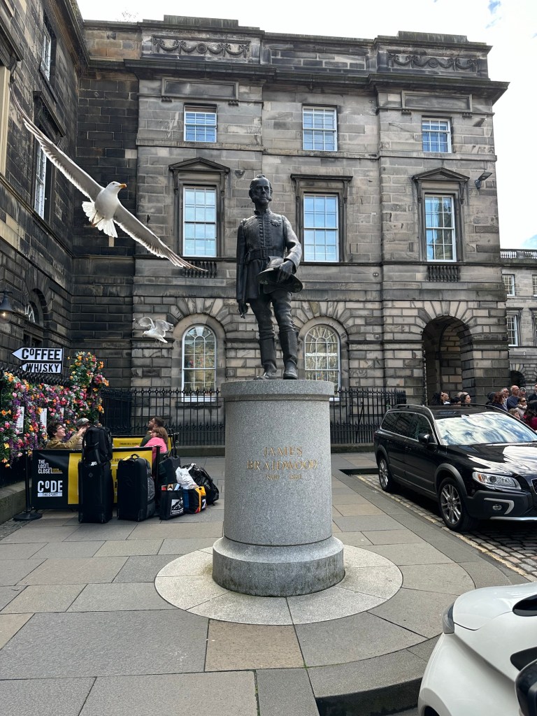
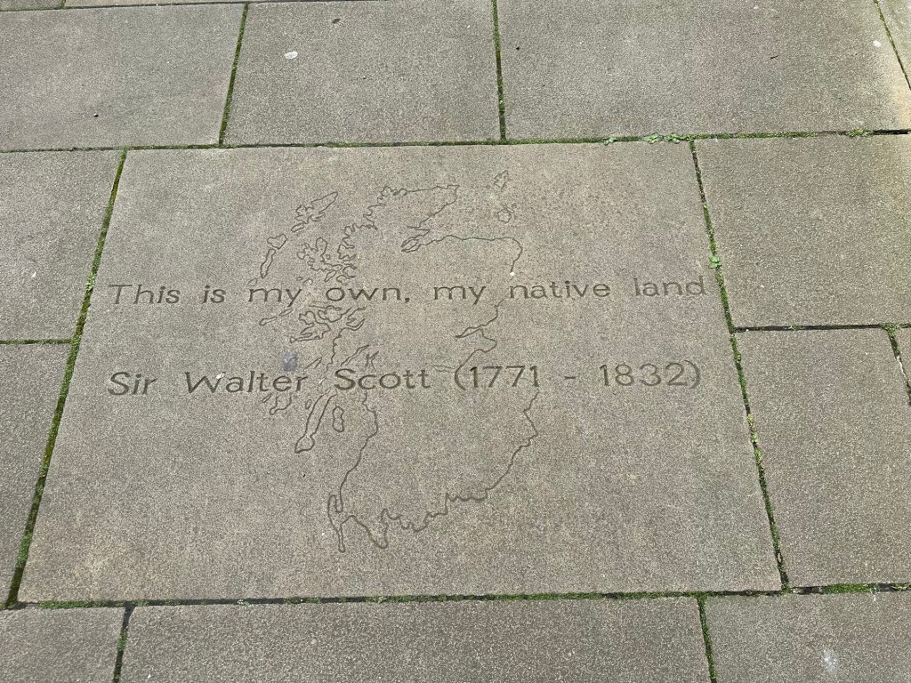
Literary writers and other artists such as Sir Walter Scott and Robert Burns established the city as a center for literary excellence. Also part of the Enlightenment period, James Watt, a mechanical engineer improved on the original design of the steam engine which was fundamental to the success of the Industrial Revolution. James Braidwood, whose statue is also in this area was the innovator who came up with the concept of putting all the fire equipment in one location and dispatching from there. Up until then, fire trucks in different locations would be engaged by different people and a fire might be right next to the location of the fire truck but the truck would not attend that fire since they were not engaged to do so. Theories of geology also progressed and became a modern science during this time primarily through the work of James Hutton, an Edinburgh geologist.
James Braidwood. I captured the seagull just seconds before he swooshed just over my head
We stopped to look at the courtyard and the city council building just off of the Royal Mile and Georgia used it as an example of the fact that because the “High Street” (Royal Mile) ran along the back of a ridge between Edinburgh Castle and Holyrood House and the land sloped away on both sides, the buildings were like ice bergs. We could see the top 4 stories of the City Hall, but it was actually 14 stories with 10 of them going down the side of the hill.
Charlene in Writer’s Courtyard Writer’s Courtyard In Writer’s Courtyard
Georgia told us stories of some of the people for whom pubs have been named such as the Deacon Brodie Tavern. Brodie was a deacon in the church, a city councillor, a cabinet maker and locksmith, who turned to robbing the very people he made cabinets for to be able to finance his mistresses and his lifestyle. He did such a good job of his double life that Council appointed him to be in charge of the investigation into the robberies which he had committed. When he was finally caught and hanged there were 40,000 people there to see the hanging. It is thought that the dichotomy of Deacon’s personalities fascinated Robert Louis Stevenson and he based the book the Strange Case of Dr. Jekyll and Mr. Hyde about it.
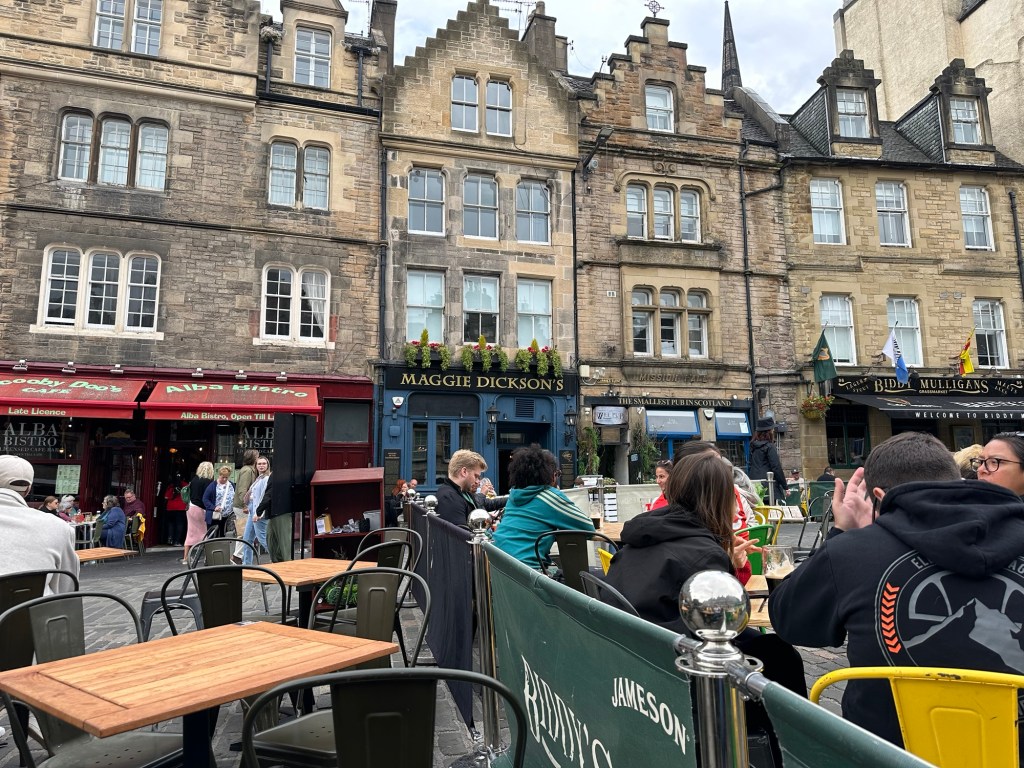
And jumping ahead just a bit, after the tour we ate lunch on a patio in the Grassmarket area called the Maggie Dickson Pub. The Reader’s Digest version of the story goes that Maggie was abandoned by her husband and so went out to work as a bar maid. She fell in love with the bar owner’s son, and got pregnant by the son which she hid for the duration of the pregnancy. She abandoned the baby which got traced back to her and so she was sentenced to be hanged. She was hanged in the public square but scared the pants off the hearse driver who removed her body by sitting up in the back of his hearse. Because she had technically been hanged, just not killed, they let her off the hook, the husband came back and they lived happily ever after.
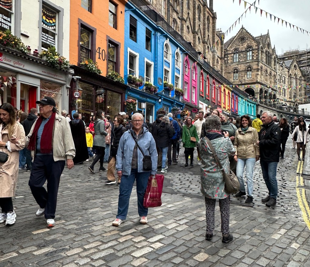
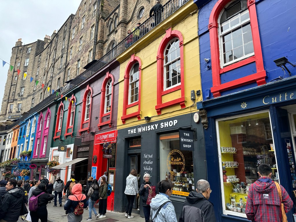
Georgia led us down what she called the most Instagrammable street in Edinburgh, Victoria Street in the Grassmarket area. It should not be difficult to figure out where the area got its name. Not only was feed for cows and horses sold here, but also the cows and horses. There is a street just down from Victoria called CowsGate, yup, where the cows were driven into the area. We had visited this area yesterday, and yes, you’ll notice pictures of it in my post.
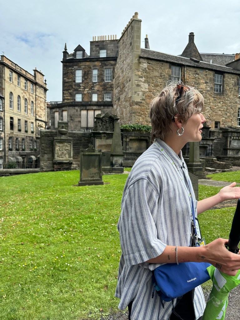
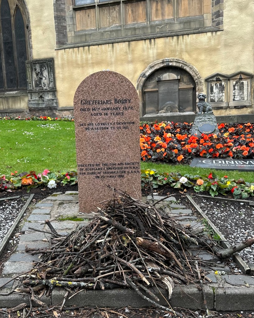
Our last stop was around the corner from Grassmarket in the Greyfriars Cemetery. This cemetery is famous for two things. The first of which is that JK Rowling did much of her writing of the Harry Potter books in a nearby pub, and some of the names of characters in the books came from the gravestones in the cemetery. When she had writers block, she would also walk through the graveyard to clear her head or look for inspiration.
Just behind our guide’s head you can see a building with the windows boarded up. This is the pub where JK Rowling sat to write much of the Harry Potter books.
The second reason for our visit to the graveyard is to see the grave of a Skye Terrior named Greyfriers Bobby. The story goes that after his master John’s death, Bobby stayed by his grave every day for 14 years until his own death in 1872. It’s said that at 1 pm every day, when the 1 o’clock gun was fired he left for a short time to get his lunch which was provided by the neighbours and friends of John who were moved by the dog’s loyalty. A Disney movie and novel have been written about this story, and it even has its own conspiracy theory that it was actually 4 different dogs who were trained to stay by the grave over the 14 years and not just one. Who knows, but makes for a nice story. There is also a statue of Bobby on the main street near the cemetery whose nose has been replaced 4 times because so many people stop to rub its nose.
Greyfrier’s Bobby’s graveThe Church at Greyfriers Cemetery
Although we toured only the Old Town portion today, we have driven through the New Town, just to the north of our hotel on our Hop on Hop off bus trip. We talked about the New Town area with the guide because someone asked about a partly finished monument on Calton Hill that can be seen from high spots in Old Town and which looks rather like a Greek monument. The monument started in 1826 apparently was part of a move during the Enlightenment to spruce up Edinburgh and live up to its nickname, Athens of the North which it received because of its deep thinkers. In the 18th century New Town was planned and laid out to reflect the shape of the Union Flag, but was too intricate to work. The new design included wider streets to allow for horse and carriages to turn around, open squares and Grecian-style buildings.
Fun Fact’s:
⁃ Edinburgh had a knick name of Old Reekie back in the day and our guide explained that it was because of the dense population and lack of sanitation that it got that name. Gardens were planted in the courtyards of by many of the people who lived there.
⁃ We heard the song we typically only hear at New Years, Auld Lang Syn, played by pipers throughout our visit to Edinburgh. It is based on a folk sound and poem written by Robert Burns and the current version comes from 1799.
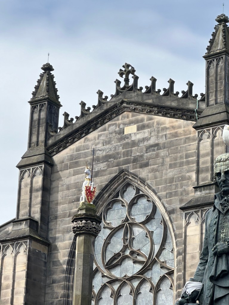
⁃ the national animal of Scotland is the Unicorn, a demonstration of how much the Scots and the English didn’t get along. A Unicorn was chosen because it’s the only animal that can best a lion, the national animal of England.
Hard to see, but this white unicorn at the top of this monument is the official animal of Scotland.
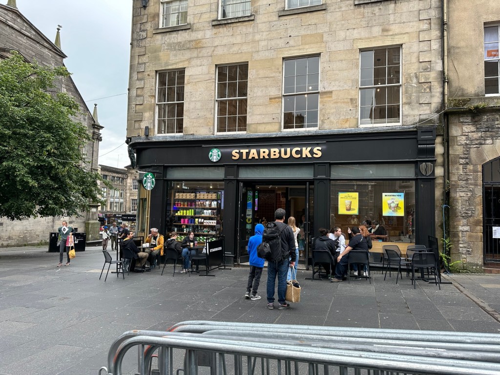
– oh yes, and on the Royal Mile there is another institution, the Starbucks.
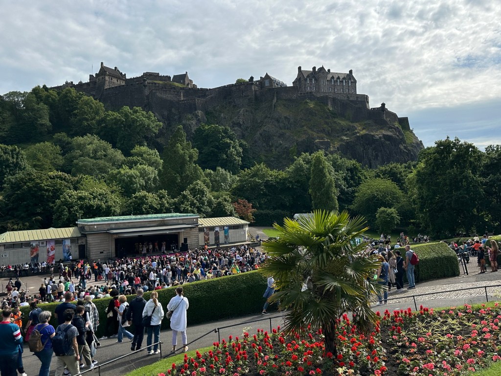
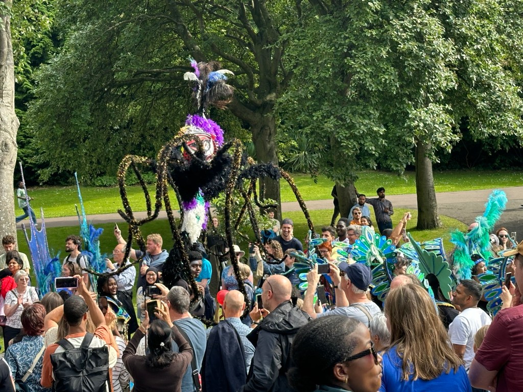
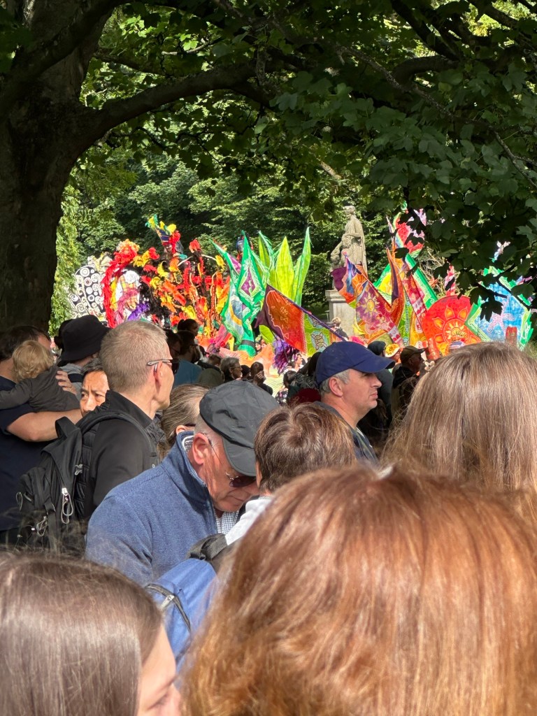
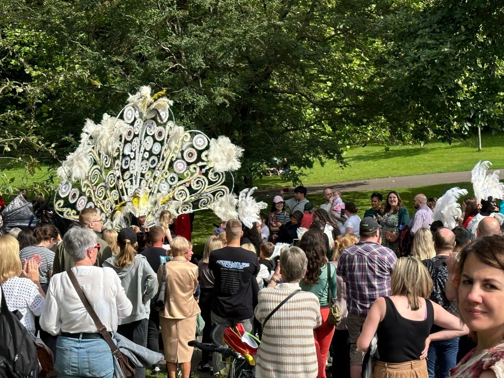
At the end of the day we were bushed, but after a short rest we walked east on Princes Street looking for both our tram stop that we need to take tomorrow to the airport and maybe something to eat. Instead we found a huge festival parade happening. The following are some not very good pictures of it. We feel really lame eating dinner at our hotel again rather than finding a cool place to eat, but we were just so tired with all the walking this week that we couldn’t talk ourselves into walking more today. Instead we got packed and enjoyed a light dinner at our hotel. Not a fireworks way to end the vacation but that’s all that we have left in the tank after a very busy and satisfying week.
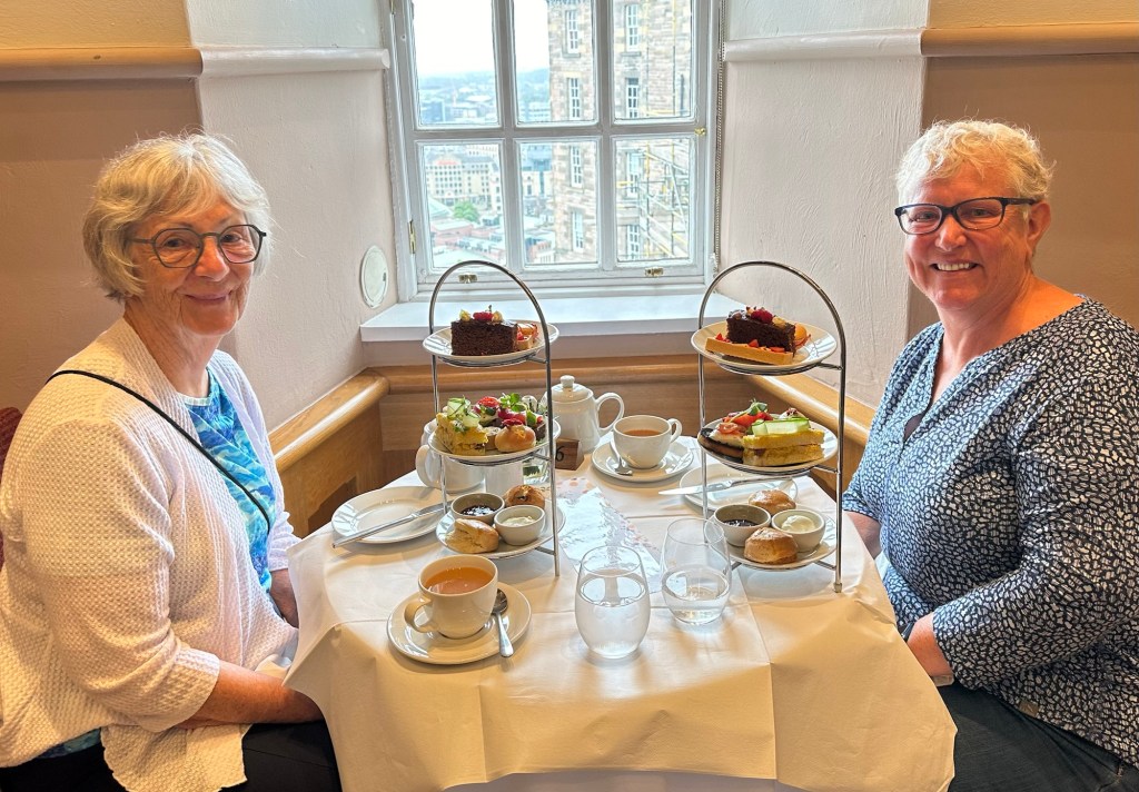
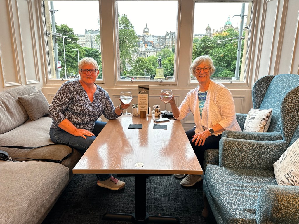
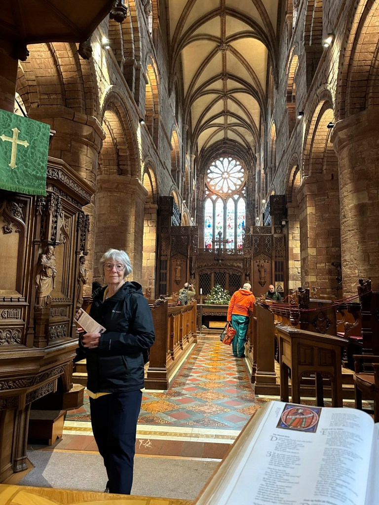
From the time I started planning my trip to Scotland, I have been dreaming about this day. High tea at Edinburgh Castle. I didn’t even give Charlene an option. But I’ve started half way through the day so let me back up.
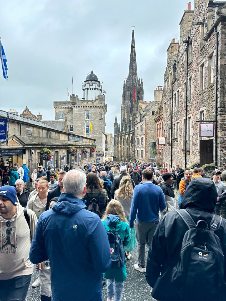
The Royal Mile – noonish on a Saturday
After yesterday’s sunshine we were a little disappointed in the light rain today, but it really wasn’t more than a bit of a mist, kind of like Vancouver rain. And it had stopped by the time we were at the Edinburgh Castle end of the Royal Mile.
We started out just after 10 – having let ourselves have a wee lay-in this morning – and slowly made our way along the Royal Mile. There were already crowds along the streets and sidewalks, people wearing all manner of rain wear, or not, or dangerously carrying umbrellas.
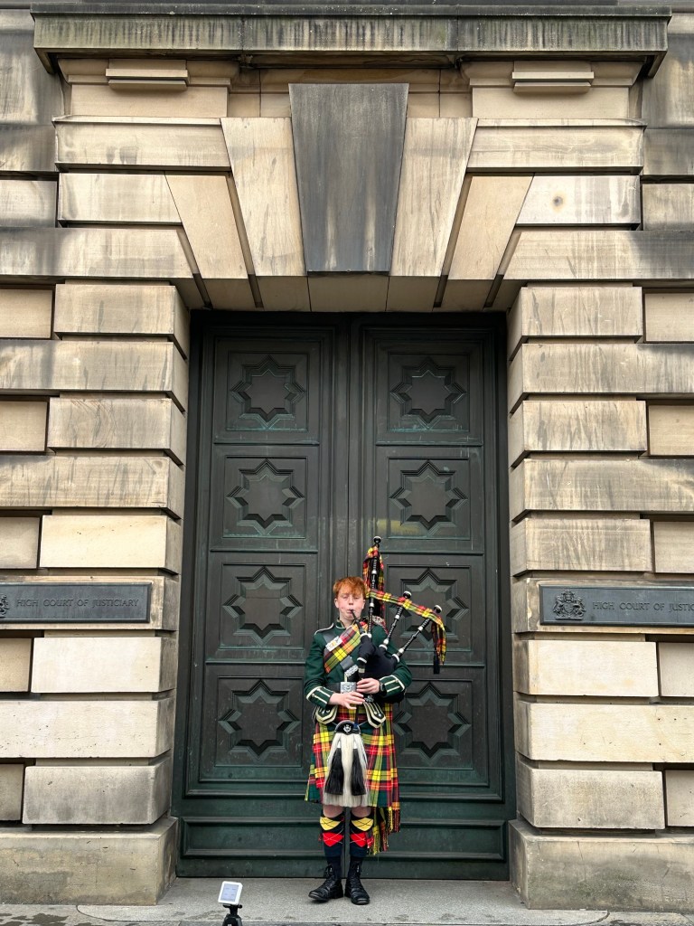
The sound of bagpipes reverberates through the city almost constantly.
This young lad wasn’t the best bagpiper we have encountered but he certainly looked the part! I love the sound of the pipes and have really enjoyed hearing them pretty much everywhere we’ve gone. There was one young girl playing the fiddle further along the street but it was too crowded with people to get a picture.
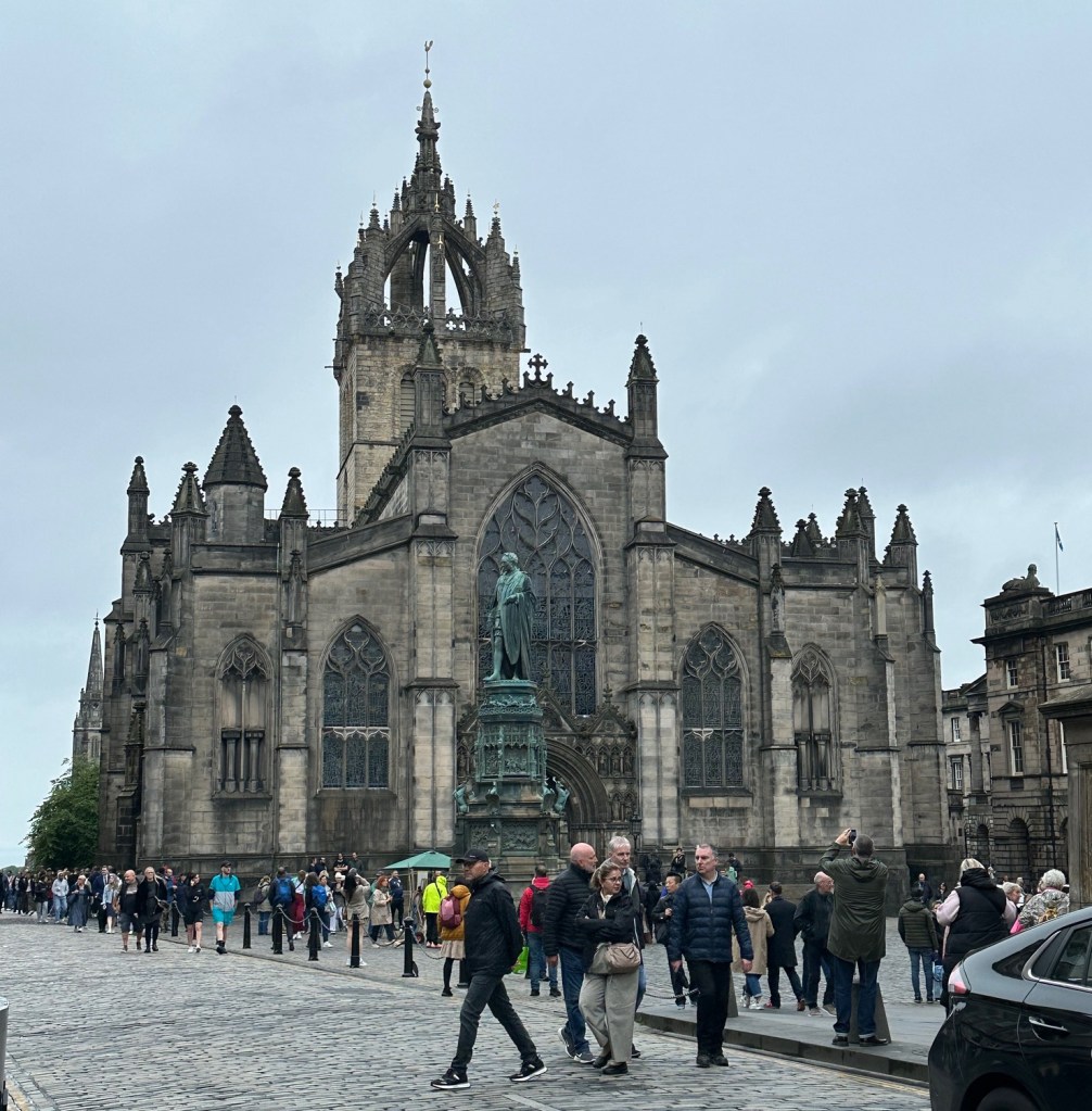
St. Giles Church, where Queen Elizabeth lay in repose before travelling to London for her funeral.
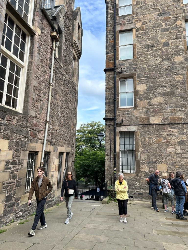
We wandered in and out of some shops, and of course found some samples of our McKinnon Tartan. We both bemoaned the fact that with only carry on luggage, shopping to any extent is quite out of the picture. So frig magnets it is. As we wandered we poked our heads down various “closes” running off of the Royal Mile. They are so intriguing pathways through the buildings lining the roadway, some leading to courtyards and some heading down what looks like endless stairs. We have been intrigued as well by the multi levels of the city. It seems quite confusing but I guess you get to know what close or road takes you to the right place.
Overlooking Victoria Street in GrassMarket area
We wondered down a side road off the Royal Mile and found a lookout over a lively street below. It was Victoria Street in the GrassMarket area. We went down the staircase to the street level and walked down this vividly coloured street full of restaurants and shops. I’m not particularly into Harry Potter but if you were, there are lots of spots to check out. The pub where JK Rowling wrote most of the books was lost to a fire a few years ago, but there is still a store of Harry Potter themed things and some other references to places that inspired the books.
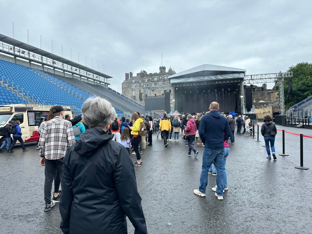
Victoria Street in GrassMarketVictoria Street in GrassMarketThe bleachers in front of the entrance to Edinburgh Castle where concerts and the Tattoo take place.
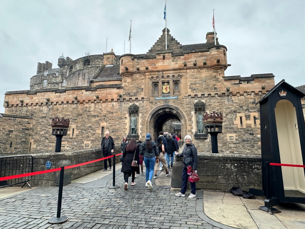
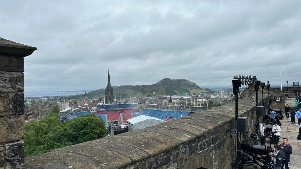
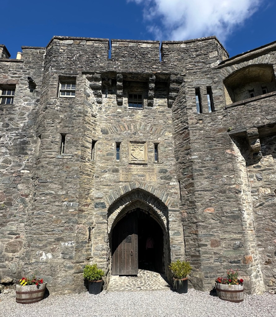
Then it was time to head up to the castle for our 1 pm entry time. You pretty much have to pre-order timed tickets for entry into the castle, for guided tours, or for tea at the Tea Rooms and I got our tickets ages ago. Today, the castle entrance was sold out long before noon.
This large area before the castle entrance is used for various concerts and the famous Edinburgh Tattoo which happens in August. It rather takes away from the entrance to the castle but I can imagine it provides a great venue.
Charlene in front of the Entrance to Edinburgh Castle
Despite getting a map and directions from the info desk as to how to find the Tea Room, we had to ask another staff member once we were further along into the castle. It is huge, with winding pathways and many levels. We were lots early, so stopped to see some of the buildings along the way.
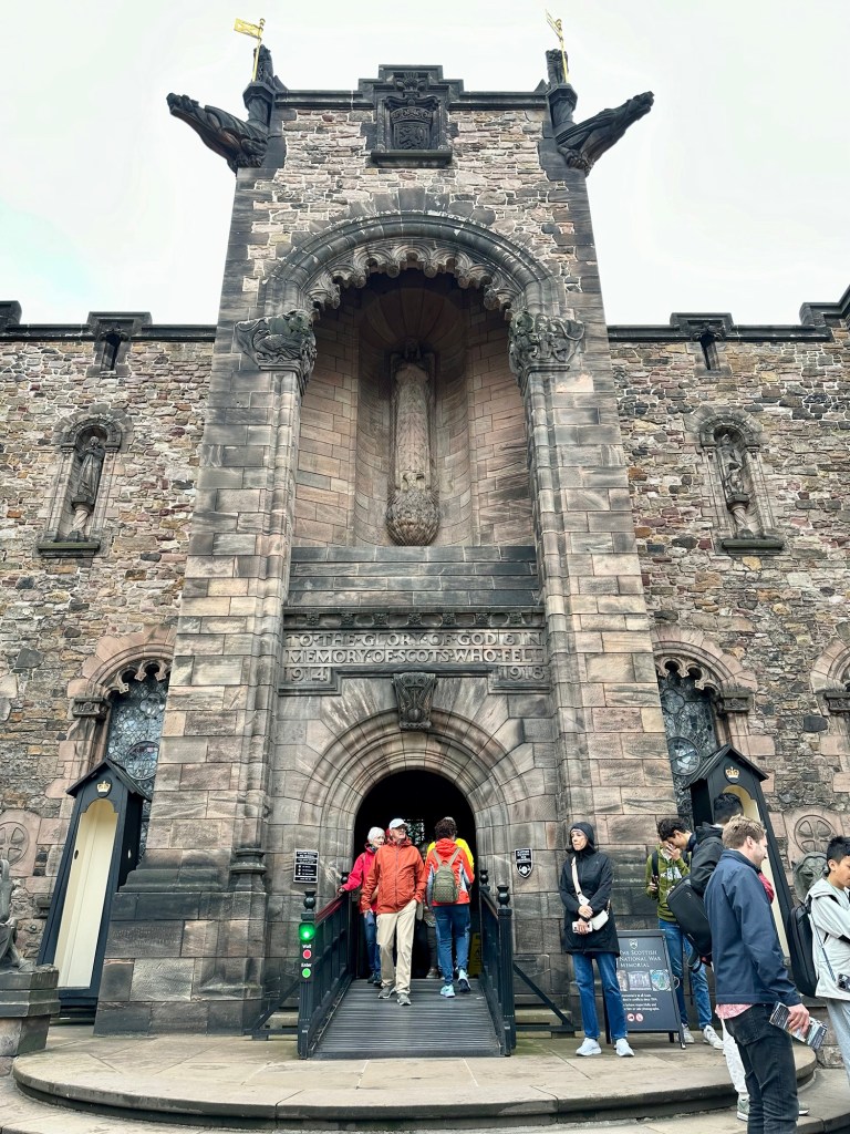
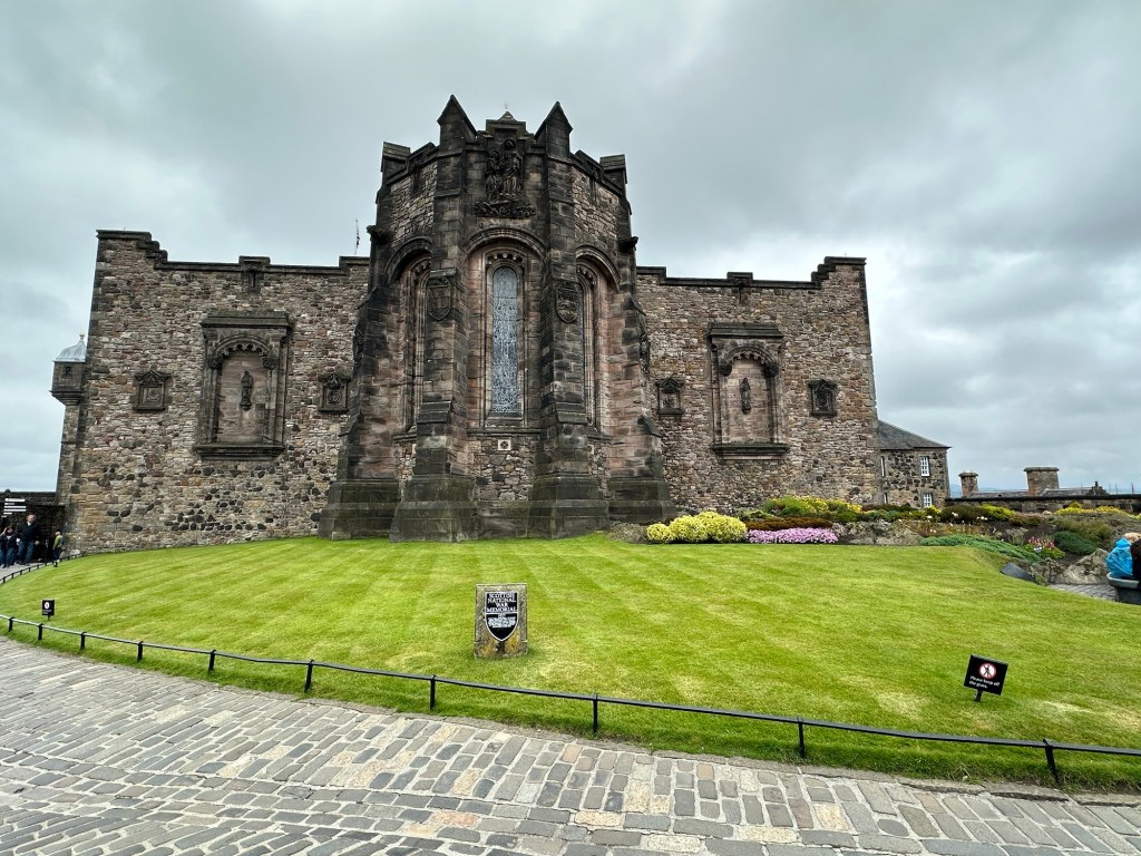
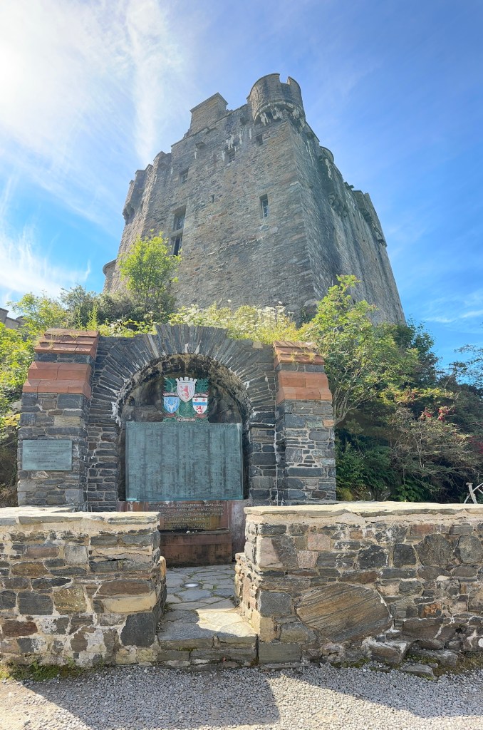
Scottish National War Memorial
The Scottish National War Memorial building was one of my favourites but no photography is allowed inside so don’t have pictures. It has various panels for various different wars in which the Scots have participated. It’s beautifully done. One in five Scots who enlisted during the First World War never came home.
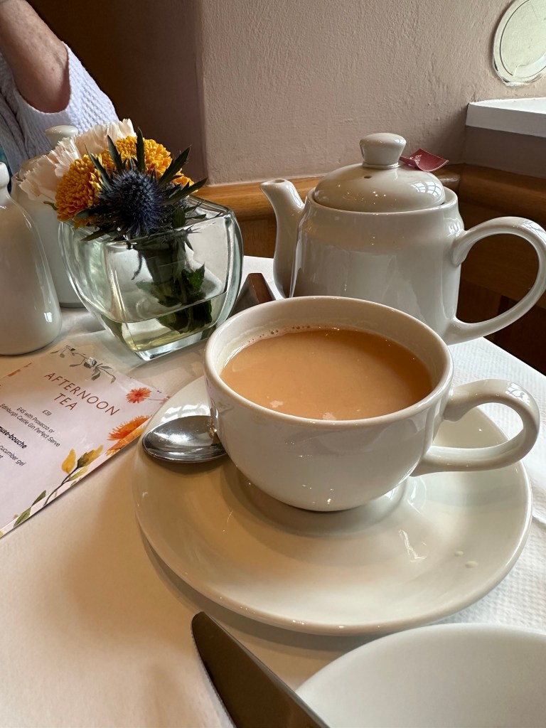
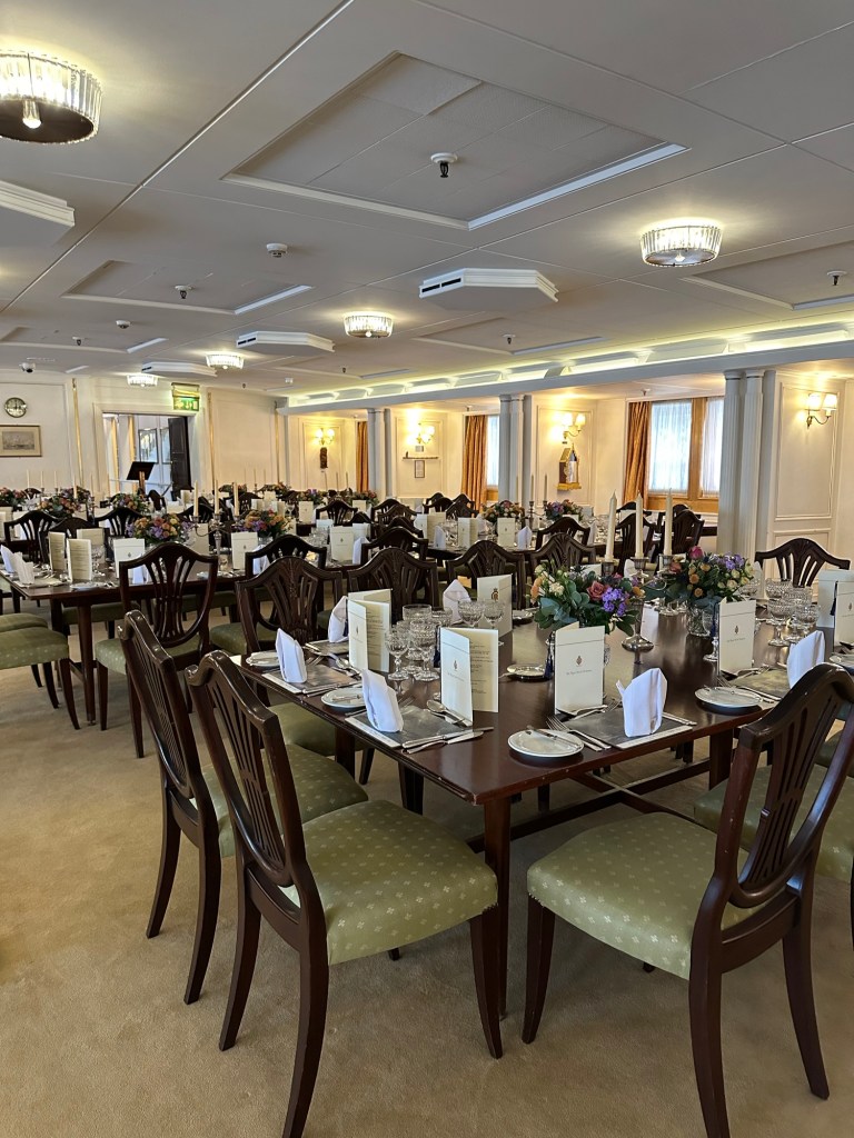
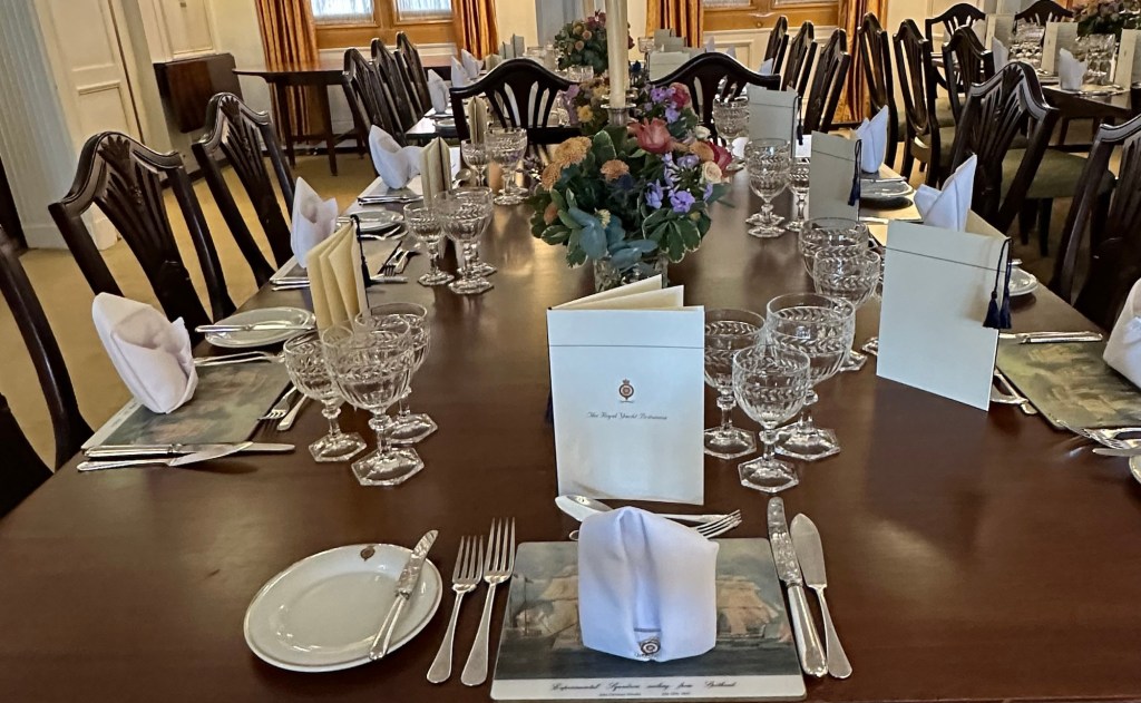
High Tea is pretty amazing anytime, but how you could you beat having it at Edinburgh Castle?
Then it was time to head to the Tea Room in the Queen Anne Building across the courtyard. The interior of the building was modern in start contrast to the rest of the castle we’d seen so far. It was a large room, and not even half full, so guess High Tea isn’t everyone’s “thing”. But my goodness did I enjoy it. Every last morsel on the stand was so tasty and presented in such an artist manner.
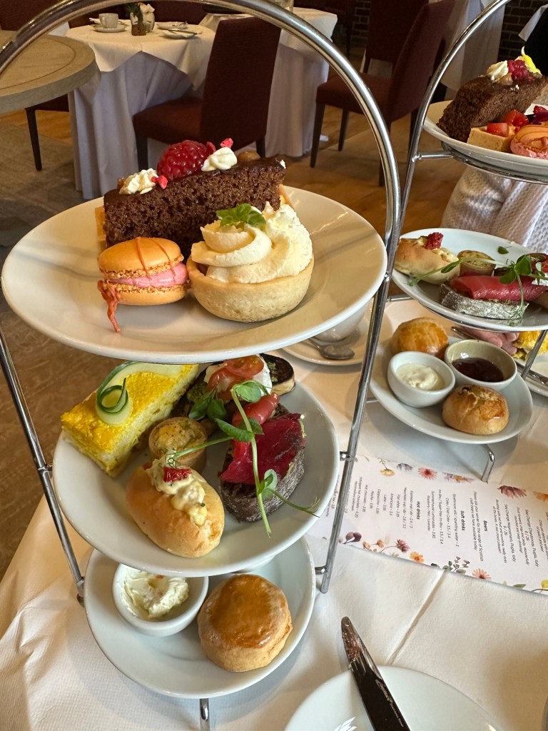
The tray of goodies, and yes there was one of these for each of us.
Among my favourites were the Cranley Farm coronation chicken finger with cucumber ribbon, Black Crowdie and leek quiche topped with Katy Roger’s cream (whoever she is) (the wee round on on the middle shelf didn’t look like much but was so full of flavours it was amazing), Sticky Toffee, and the orange macaroon which was a sunny burst of flavour in my mouth. The scones and clotted cream and preserves were delightful as one would expect. The Empress Hotel in Victoria comes close to this experience, but Edinburgh Castle might be just a tad cooler location.
The Honours of Scotland: the Scottish Crown Jewels
After our tea, we waddled out and made sure to see the Scottish Crown Jewels, called “The Honours”. There was a queue but it moved quickly. In an area with thick vault doors on either side, and displayed behind thick glass were the oldest Crown Jewels in Britain: the Crown, Sceptre and Sword of State used in the coronation of Mary Queen of Scots, in 1543. The Crown Jewels were removed from the castle to keep them from Oliver Cromwell’s army and in 1707 they were locked in a chest and sealed away only to be discovered by Sir Walter Scott. Again, no photography was allowed.
Note the crown even on top of the light fixture.
The tour then went through the Royal Apartments and the Birthplace of King James VI, son of Mary Queen of Scots. The room where King James VI was born was tiny and because of the way the walls were set, they had mirrors to show you around the corner, but I couldn’t see much, if anything, in the room.
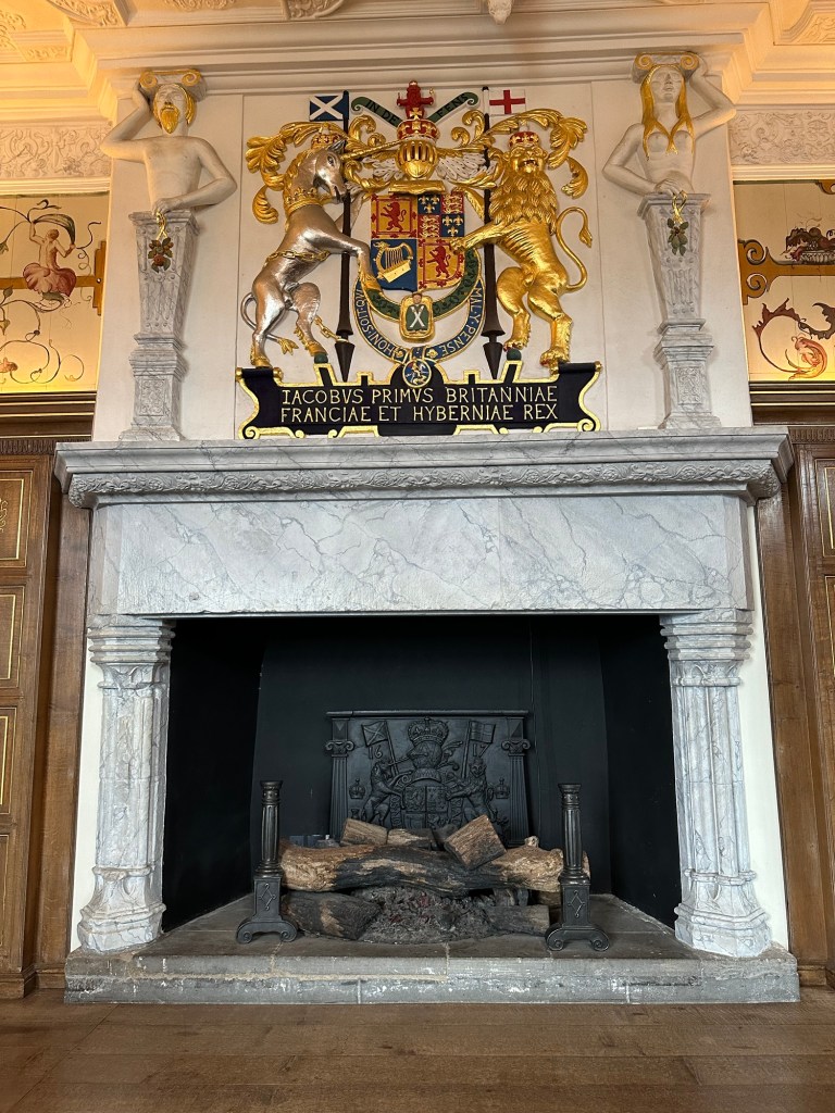
The photo doesn’t do it justice but this fireplace is huge!
This fireplace in the living area of the living quarters was outstanding. It is hard to get perspective but it was the full height of a room that had unusually high ceilings.
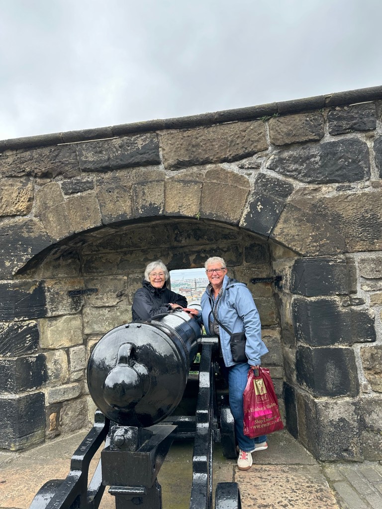
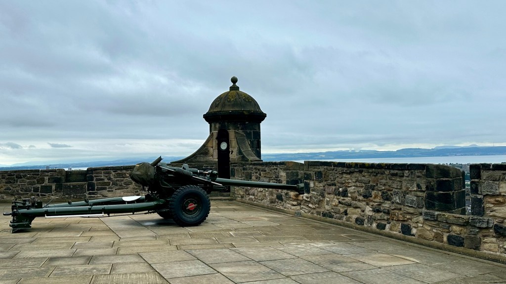
One of the canons along the fortifications.
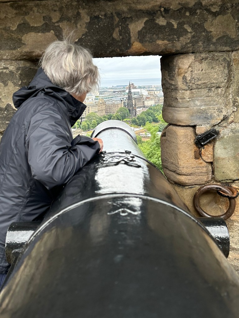
We wandered around the various outside walls and fortified areas and stopped to have our picture taken at this particular canon, because it was aimed almost right at our hotel!
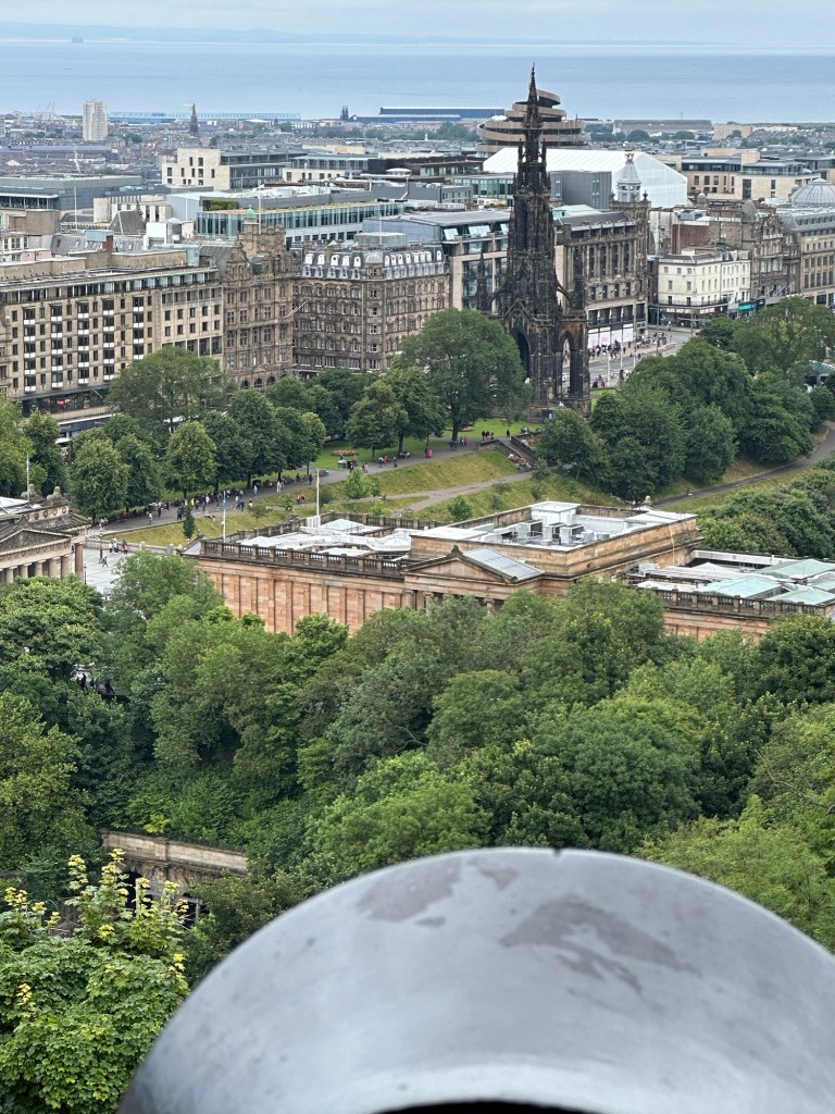
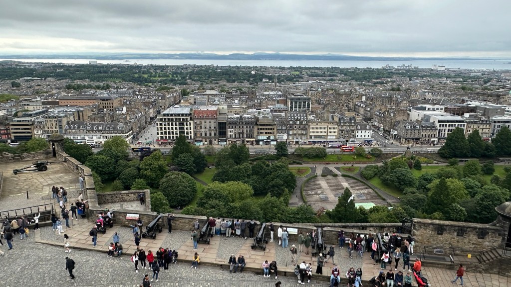
It’s aimed right at our hotel! Our hotel is just to the left of the dark gothic monument to Walter Scott in the distance. It’s the one with the white portal windows on the top floor. Our room is on the side facing to the side street and we’ve got a pretty good view of the castle. The Scottish National War Memorial from the other side.
One thing that struck me wandering through the castle was how well they have presented the castle grounds. There are grass patches and flowers where available and greenery where it can be used. The front of the National War Memorial is a good example. We also talked today about how clean Edinburgh and really all the places we’ve travelled on this trip have been. Especially for such a windy place.
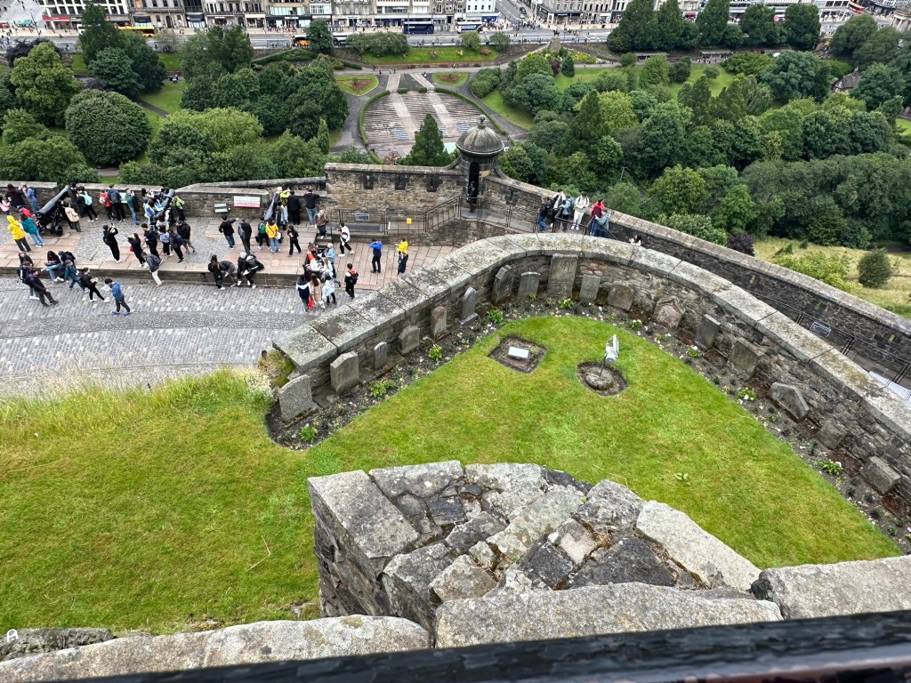
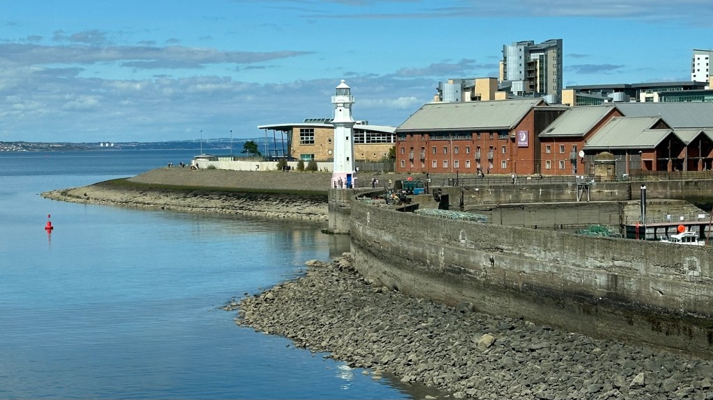
Looking out toward Leith where the cruise ship terminal is locatedThis area is a dog cemetery used since Queen Victoria’s reign as a burial place for regimental mascots and officers’ dogs. At the other end of the Royal Mile from Edinburgh Castle is Arthur’s Seat.
We had originally thought we might be able to climb up Arthur’s Seat, but by the end of the trip we decided the increase in elevation just required too much time and energy and we’d have to give up seeing something else.
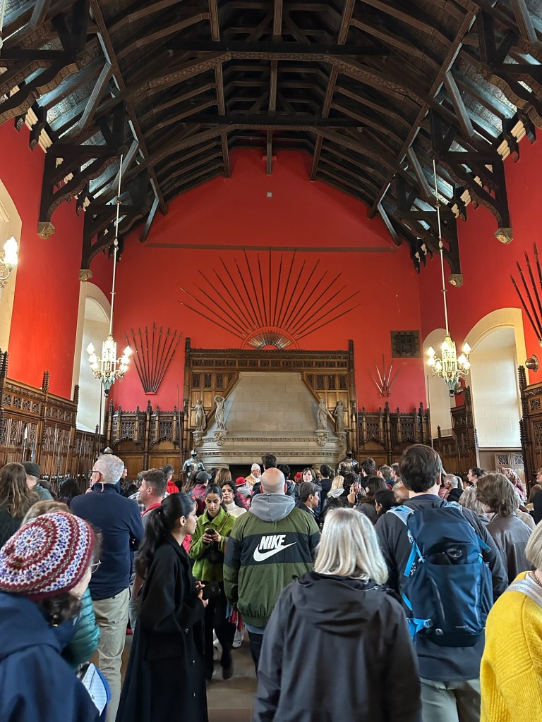
Great Hall
Different parts of the Castle were added at different times. The Great Hall was completed in 1511 for King James IV. It has beautiful beams in the ceiling and a wooden roof. In the picture of the Great Hall you can see a black square to the right of the fireplace and half way up the wall. This was a window from the King’s apartment so he could keep an eye on what was happening in the Hall. The room was adorned with all sorts of armour and swords, guns and pistols. The King, however, died in battle in 1513 so he didn’t have long to enjoy this Hall.
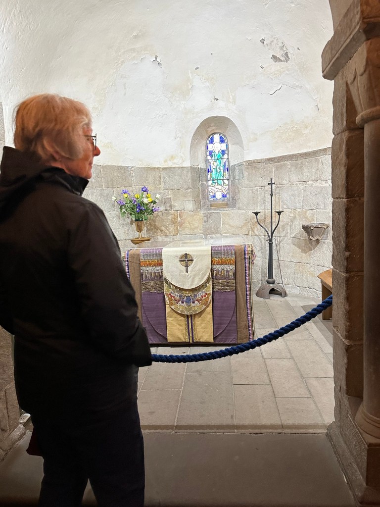
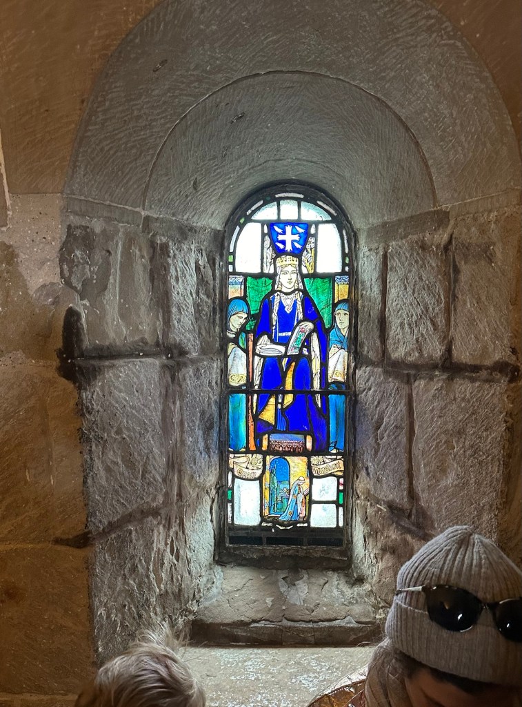
St Margaret’s Chapel
St Margaret’s Chapel is a lovely, very wee Chapel, and the oldest building in Edinburgh (1130). They still hold weddings and Christenings here.
St Margaret’s ChapelLooking down on to Princes Street GardensGreenery and flowers throughout the propertyThe One O’clock Gun
The firing of the One O’clock gun dates back to 1861 and there was a huge crowd to witness its firing today while we were on our way up to tea. This gun is obviously not from 1861. In 2001 this gun was installed.
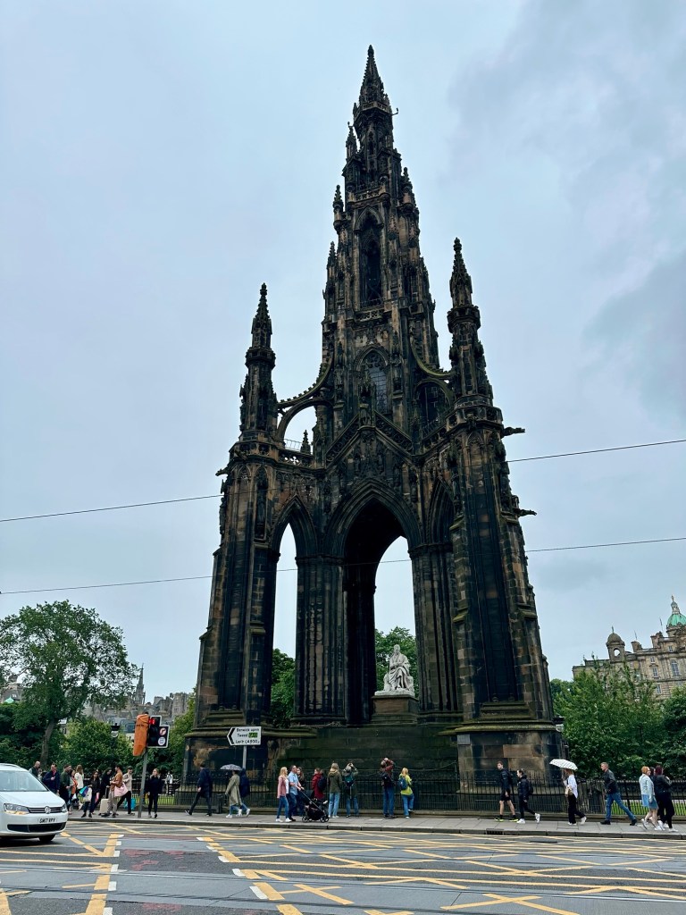
Monument to Sir Walter Scott
Our legs done in for the day, we wandered a different route back to our hotel where we collapsed and rested long enough to be rejuvenated enough to enjoy a very nice Edinburgh Gin and tonic in the lounge of our hotel where we also had a light dinner. (After our huge High Tea lunch!)
A celebratory Edinburgh Gin and Tonic. Fantastically smooth gin.
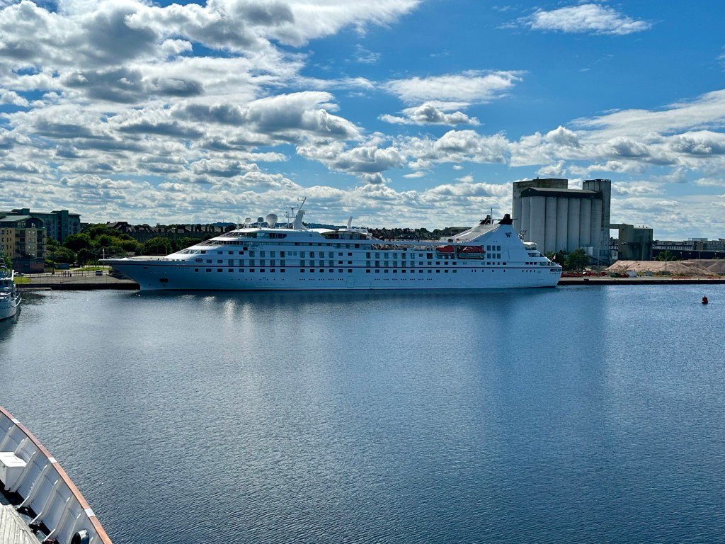
Sadly, we said goodbye to the Star Legend this morning.
After a great week that started in Dublin we came to the end of our fabulous cruise adventure this morning. It was hard to say goodbye to the luxury and service of this great ship and cruise line. The good news is two fold. One, I’ve already got my next cruise with them booked and two, we still have 3 nights in Edinburgh to enjoy so it’s not the end of our adventure.
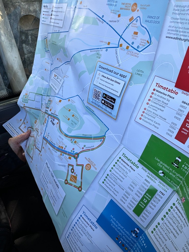
Upon exit from the cruise terminal on the harbour of the Firth of Forth there were several volunteers who were helping people make disembarking arrangements. Many were waiting for taxis, but we opted to take the newish tram into the city with helpful advice from a volunteer. It was fast, efficient, cheap and an adventure. Our hotel was about a 3 minute walk from the tram station and we found it no problem. The hotel is an older one, but comfortable enough and more reasonable than many others I researched. It was too early to check in so we dumped our suitcases off at the hotel and went exploring. Once again we chose a hop-on, hop-off bus to give us an overview of the city and allow us to get oriented. We first did a tour of the Old Town area where the live guide gave us a pile of great info, little of which I remember.
I do remember a story of Sir Walter Scott, to whom one of the most iconic landmarks in Edinburgh is dedicated and stands directly across the street from our hotel. In addition to being the poet and author that he’s known for, it is said that he was knighted for neither of those, but for the fact he located “the Honours”, the crown of the King of Scotland after they had been hidden to keep them from Oliver Cromwell’s army.
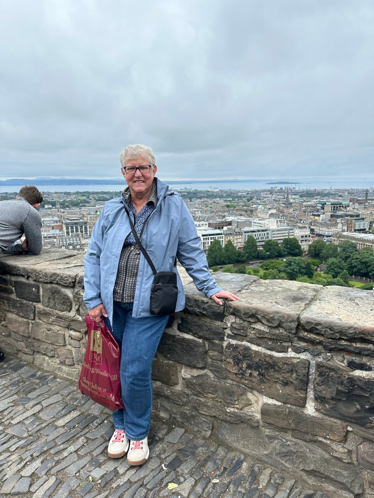
My companion is rather quiet today.
After doing one loop of the Red Line we hopped off and walked to the Royal Mile to find tea and a scone. By now the early clouds had burned off and the sun had broken out and it was a glorious blue sky day. Still it wasn’t too crowded on the Royal Mile and we found a great little spot where the scones were excellent.
I didn’t take too many pictures today and I have to say that to this point, Edinburgh was a bit overwhelming. I couldn’t decide what to aim the camera at so I didn’t aim it at anything and just took the experience all in. So much to see, so many stories to hear, so much fabulous architecture, so many levels to the city, and so many scones to eat.
Fun Facts about Edinburgh:
– Edinburgh Castle, which is an overwhelmingly dominant feature of the city is perched atop Castle Rock, which is an extinct volcano. At one p.m. every day, the “One O’Clock Gun” fires a shot from the castle.
– The Royal Mile is actually 1 mile, and 107 yards long.
– Edinburgh is supposedly the most green city in the UK, with more trees per person than any other city.
– Edinburgh was JK Rowlings inspiration for the Harry Potter books and she wrote much of them in this city.
– they spell whiskey, “whisky” here.
– Sir Sean Connery was born in Edinburgh (1930) as was Robert Louis Stevenson, the novelist, essayist and poet (1850)
– when driving over the cobblestones of Edinburgh, the buses tend to shake and rattle a bit and that’s called being “shuggled”.
Here we are on a hop-on-hop-off bus again.
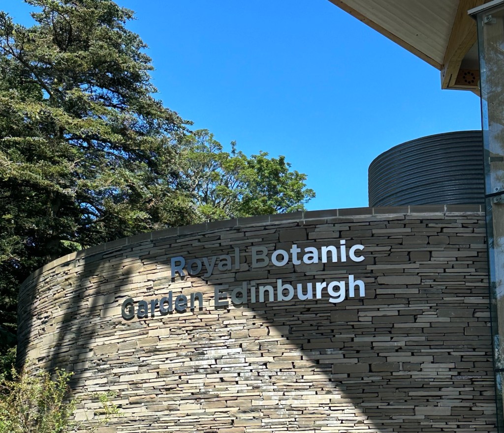
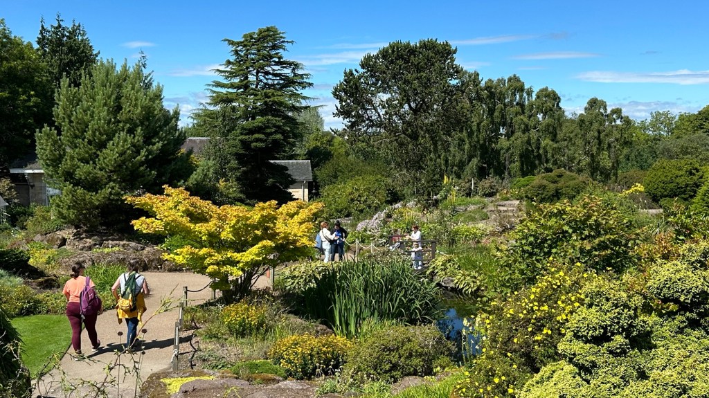
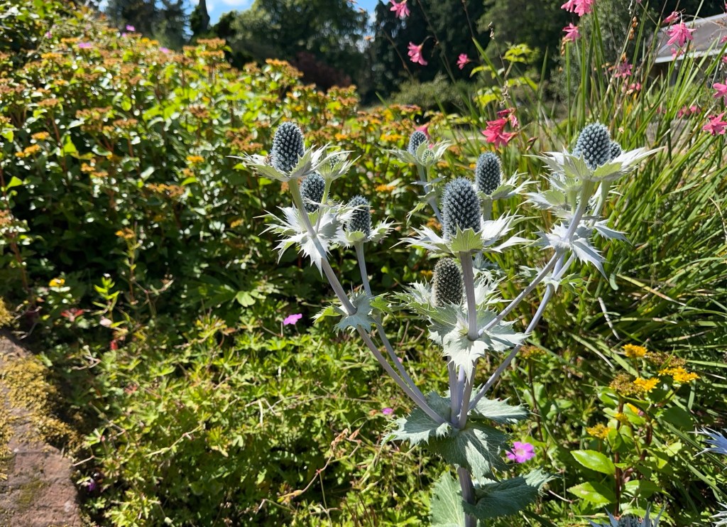
Next it was on to the HOHO Bus again and this time to the Blue Line which went a little further afield than the Old Town. It headed north toward the Firth of Forth through interesting neighbourhoods along the way. We decided it was such a beautiful day that a walk in the Royal Botanic Garden would be nice. And it was. We have missed the rhododendron and azalea blooms as it’s too late in the season, but the woodland forest trails, and the rock garden were beautifully done. We spent about an hour wandering the trails and then were off again to the next destination.
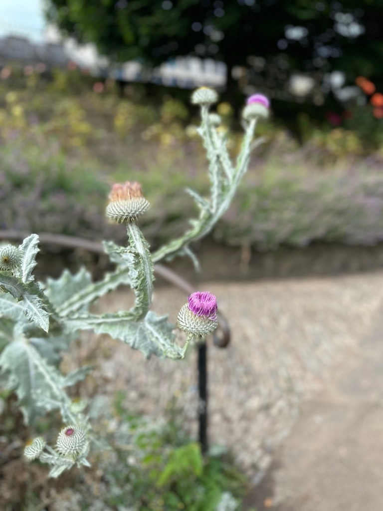
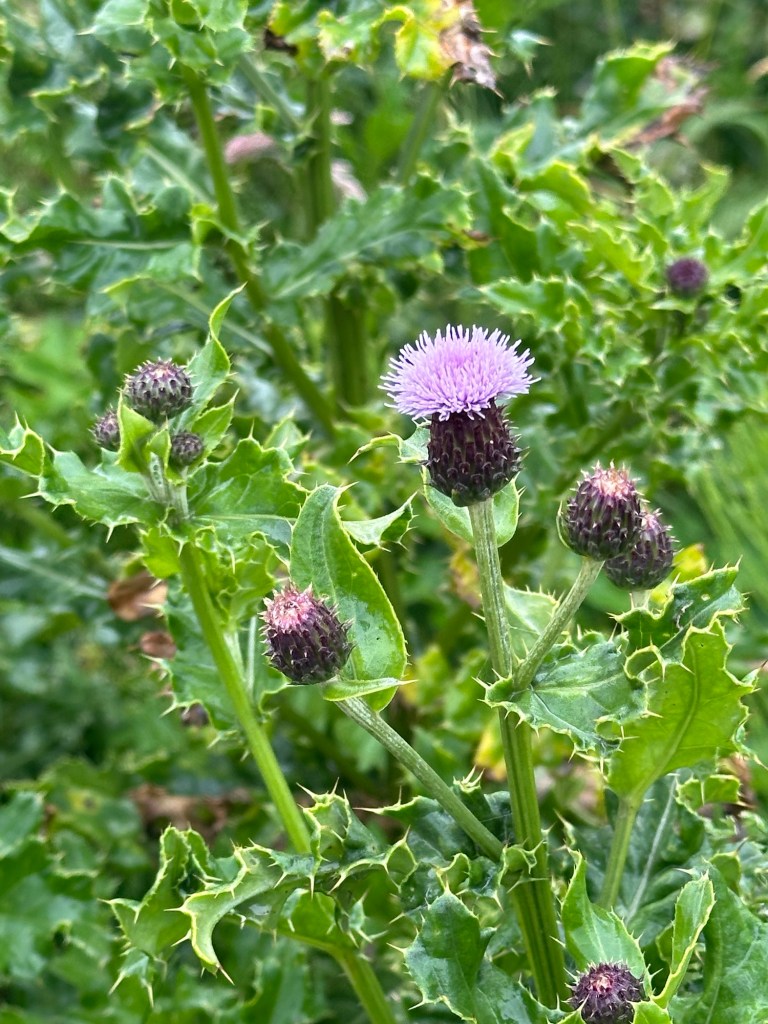
The Royal Botanical Garden Edinburgh EntranceOf course there was a bridge so a Kodak momentPlaying with portrait modeThis grouping of daisies was stunning. Why is it that we feel like we need to take pictures of people when we see bridges in the gardens. They had a beautiful rock garden so nicely done. Some sort of exotic thistle
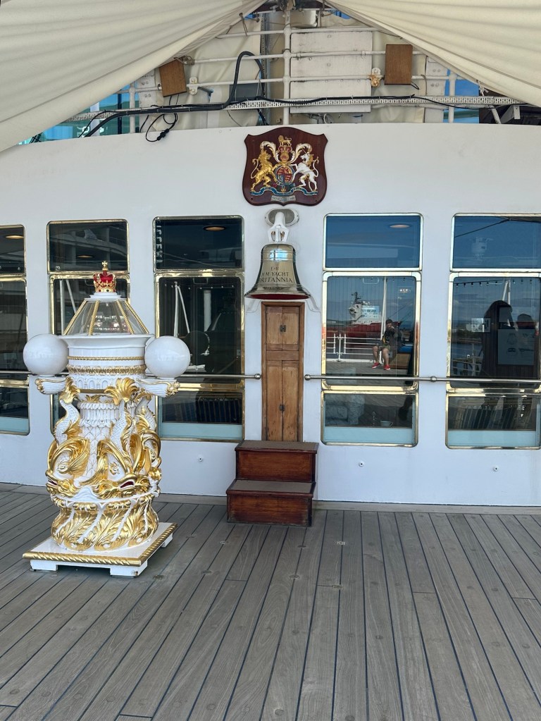
The bus headed toward and along the Firth and past the New Haven Harbour and we arrived at the Royal Britannia exhibit, back at the cruise ship terminal area where we landed on the Star Legend this morning.
New Haven Harbour along the Firth of Forth. Say that three times.
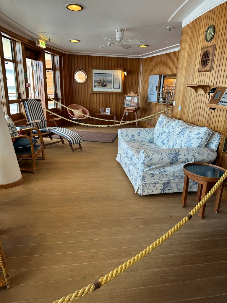
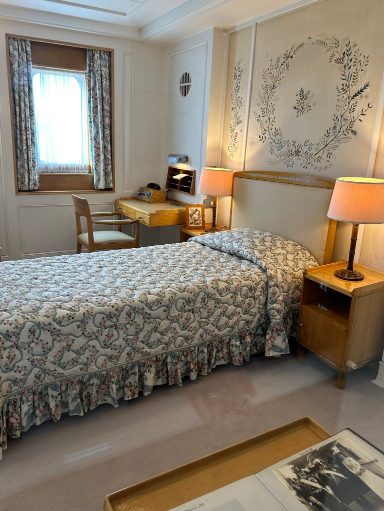
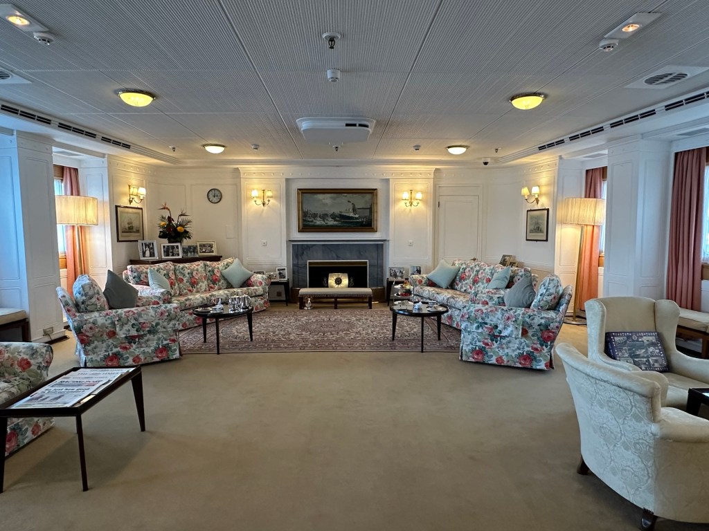
The tour of the Britannia was really interesting. They are still working on the infrastructure for the exhibit and it will be a really great experience when they’re finished. We got to see pretty much all areas of the ship from the Commander’s post to the medical centre.
The ship’s Bell from the HM Yacht Britannia Sitting room off the private deck said to be one of the Queen’s favourite rooms. The Queen’s bedroomThe formal dining room. The place settings were meticulously laid out and even measured with a ruler to be precise. The entertaining space
We took the Blue Line bus back to the start and headed on foot to our hotel beat after nearly 13,000 steps and 8 km of walking today. Luckily the hotel has a really comfortable lounge and dining room as we didn’t feel very adventurous and certainly didn’t feel like hoofing it anywhere this evening. We were tucked in pretty early but anxious to get exploring in the morning.
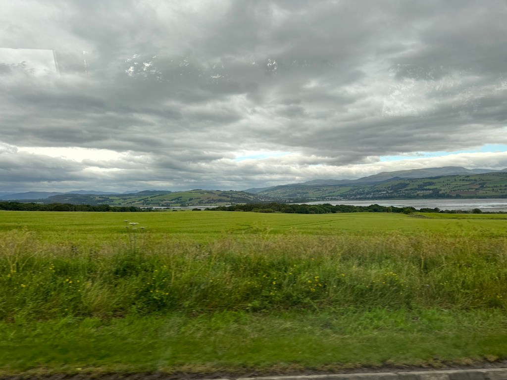
Leaving the ship to travel to Loch Ness – pic from the bus so not great quality.
We have sailed south through the North Sea, and in to Cromarty Firth (an estuary or narrow inlet) and we are now anchored in the busy deep water port harbour at Invergordon, Scotland. This port was a naval base during the 1st and 2nd world wars and now is a transportation hub and servicing hub for the North Sea Oil Rigs.
Inverness on the River Ness, where it meets Moray Firth.
We left the dock very early this morning for our excursion because the ship will be leaving port early afternoon to make the long haul to Leith (Edinburgh) for tomorrow morning. Our route took us through some gorgeous scenery of the highlands and through Inverness, 24 miles to the south, the capital of the Highlands. Inverness has a population of 80,000 and has a strong economy based on Life Sciences companies and tourism.
The area around Inverness is rich in history, and the Jacobite uprisings to restore the House of Stuart to the British throne. The Battle of Culloden is nearby, where the Jacobites were outnumbered and out powered by the British and they were weak from fatigue and hunger fighting for Bonnie Prince Charlie. There are stories of Flora MacDonald and how she was able to help him escape to the Isle of Skye after the battle of Culloden in 1746. Prince Charlie was dressed as “Betty Burke”, Flora’s Irish maidservant, and they escaped to Skye just moments before the British militia landed nearby.
Our guide gave us some information regarding the Highlands as we travelled the country side. I have to admit that I’m getting pretty brain dead and just enjoyed the ride for most of today without taking notes or really listening at times.
Fun Facts about the Highlands:
– a population of 240,000 are spread throughout a huge territory, producing a density of only 12 people per square mile, some of the lowest in all of Europe.
-Whisky is “The water of life” in Gaelic.
– 1.3 million bottles of whisky per year are produced in the Highlands, and shipped to many countries – top 3 France, India, and the US.
– the main industries are Forestry (farmed), Farming, tourism
-43% of highlanders are employed in the tourism industry.
– difference in rainfall from east to west of the Highlands ( Isle of Mull has 240 days of rain whereas the East has only 150)
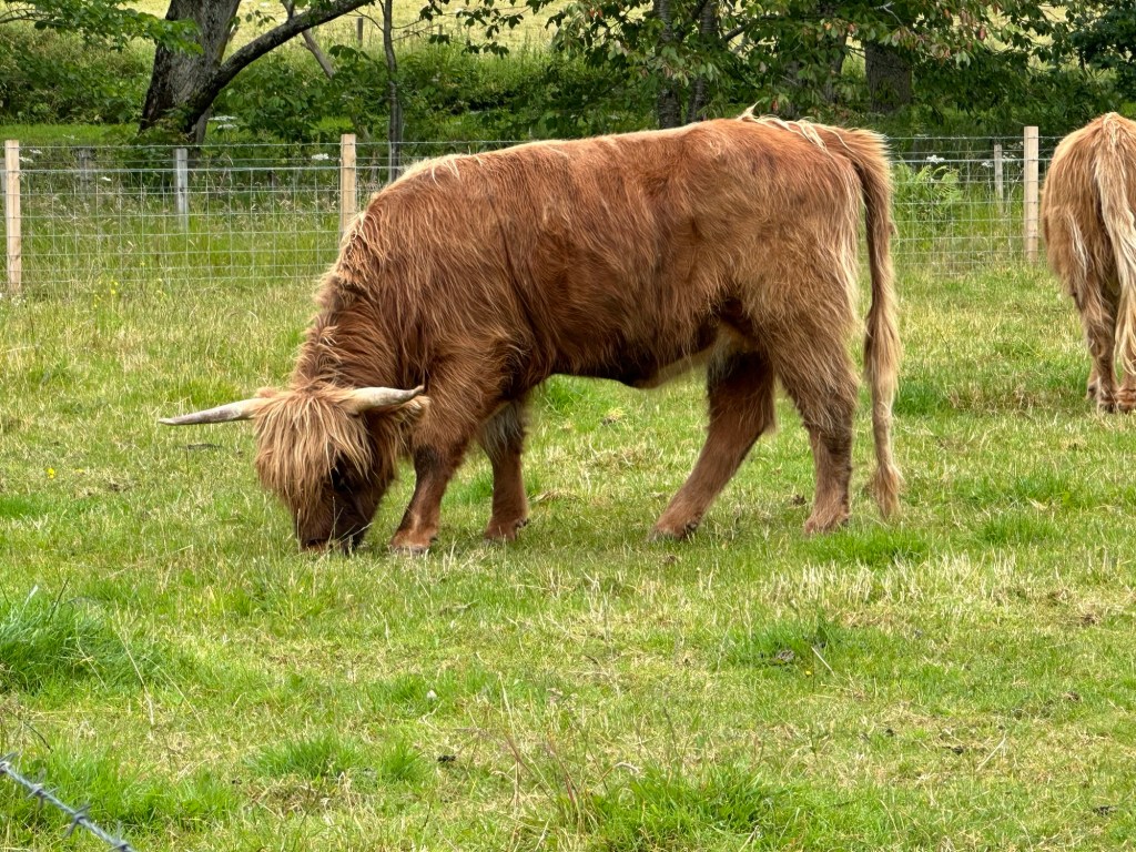
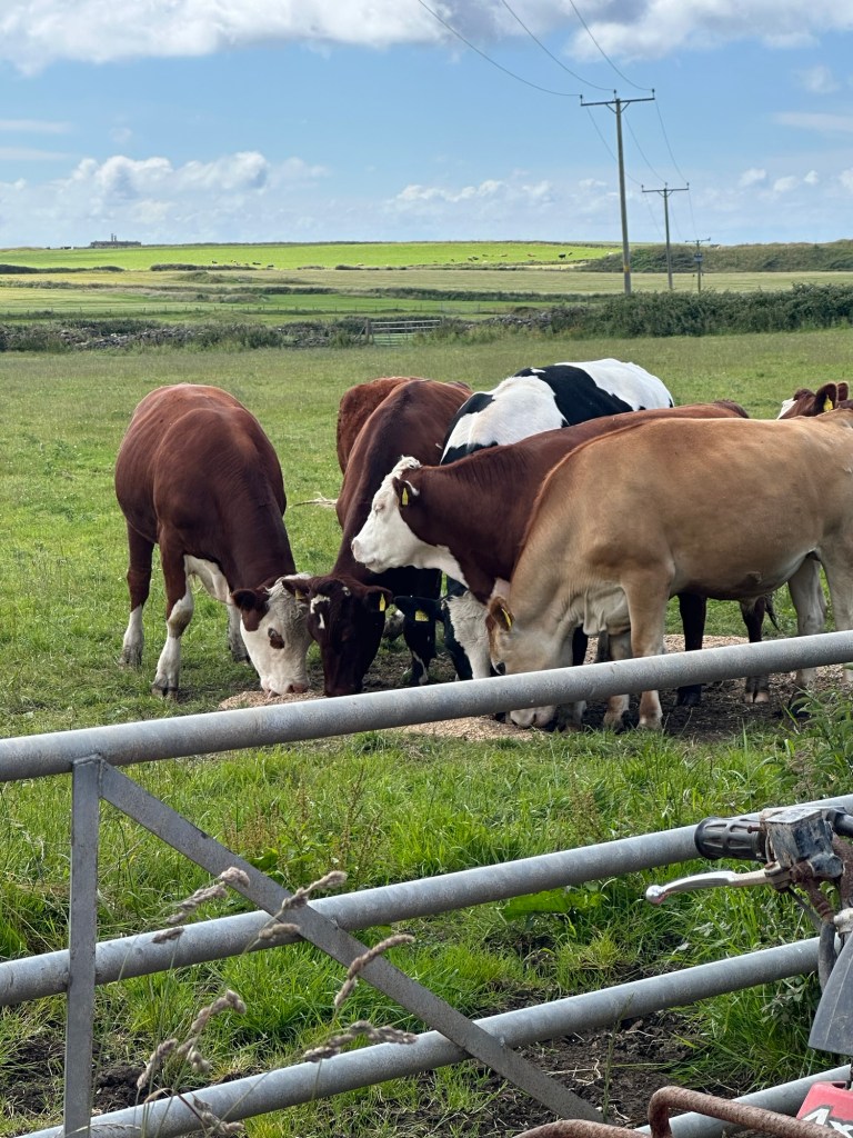
-Highland cows or coos are the oldest bred of cattle in the world. They have shaggy coats (which keep them warm in the brutal Highland winters) and horns and are raised mostly for the meat. They can live for 20 years.
Harry the Highland Cow or Coo
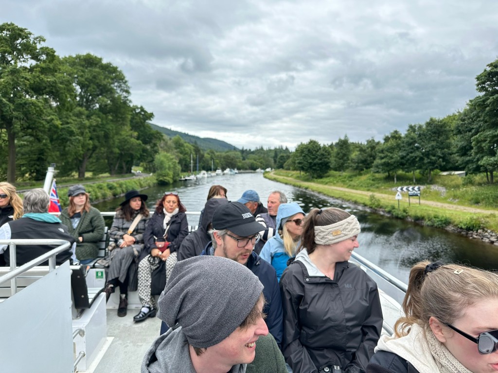
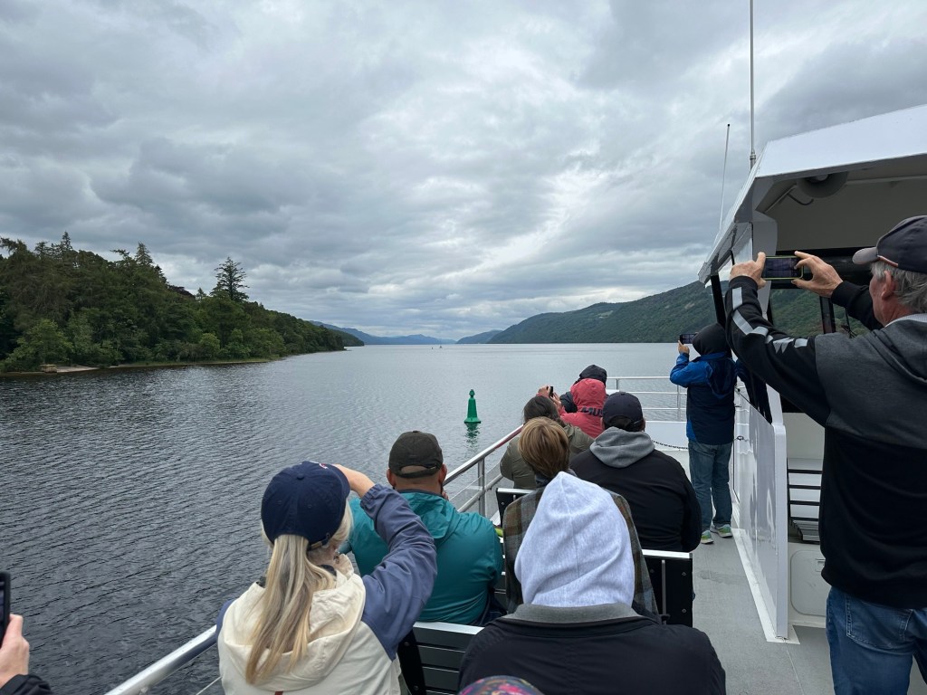
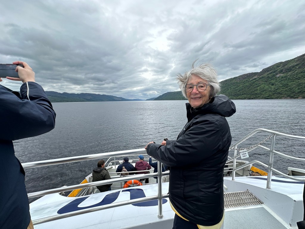
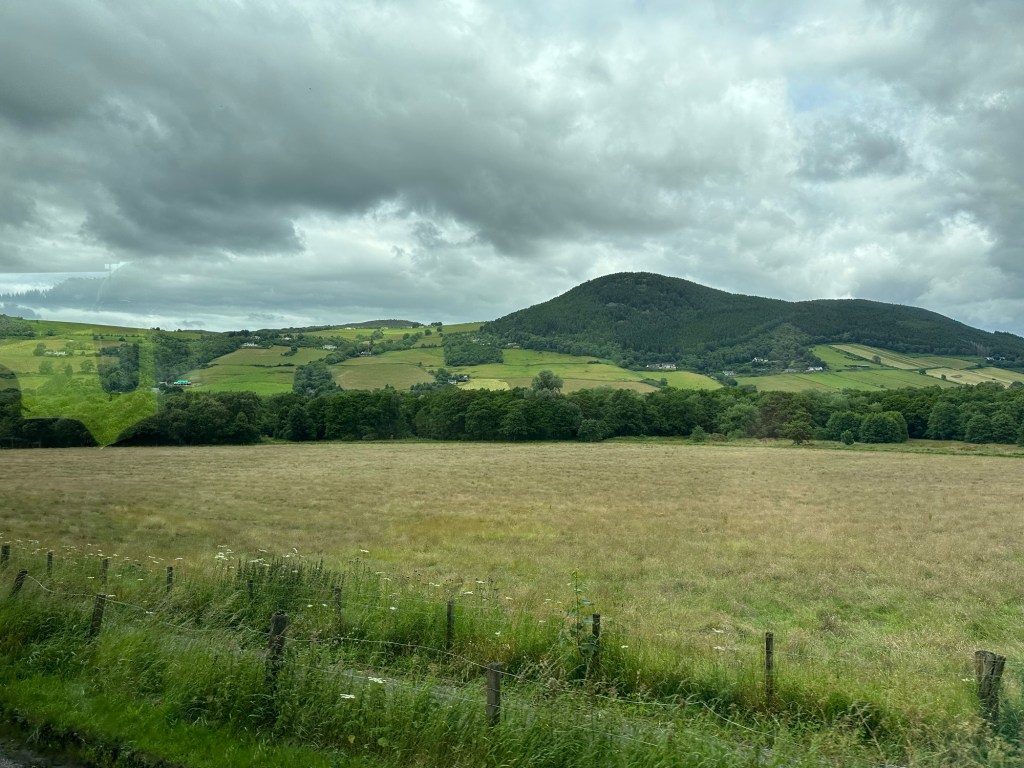
After an hour or so we arrived at the Loch Ness Boat mooring, on the Caledonian canal (designed by Thomas Telford, a very prolific engineer and designer of infrastructure throughout Scotland). The Canal joins 4 lochs and allows boats to navigate the 65 miles from Inverness to Fort William.
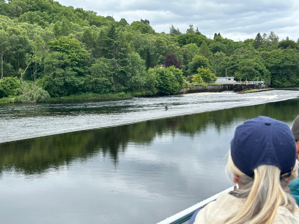
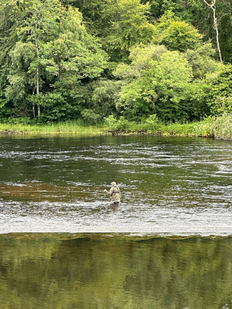
Our “boarding pass”On board our boat heading down the Caledonian Canal on our way to Nessie huntingThe Ness River nor the canal are deep, and this is a spot where the the river and canal divide, and apparently a good fishing spot
Fisher in the middle of the river, only up to his hips. Great salmon fishing apparently. The Scots pronounce the “l” in salmon.
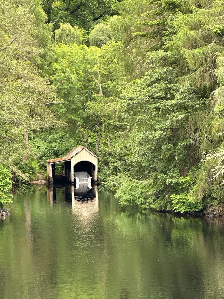
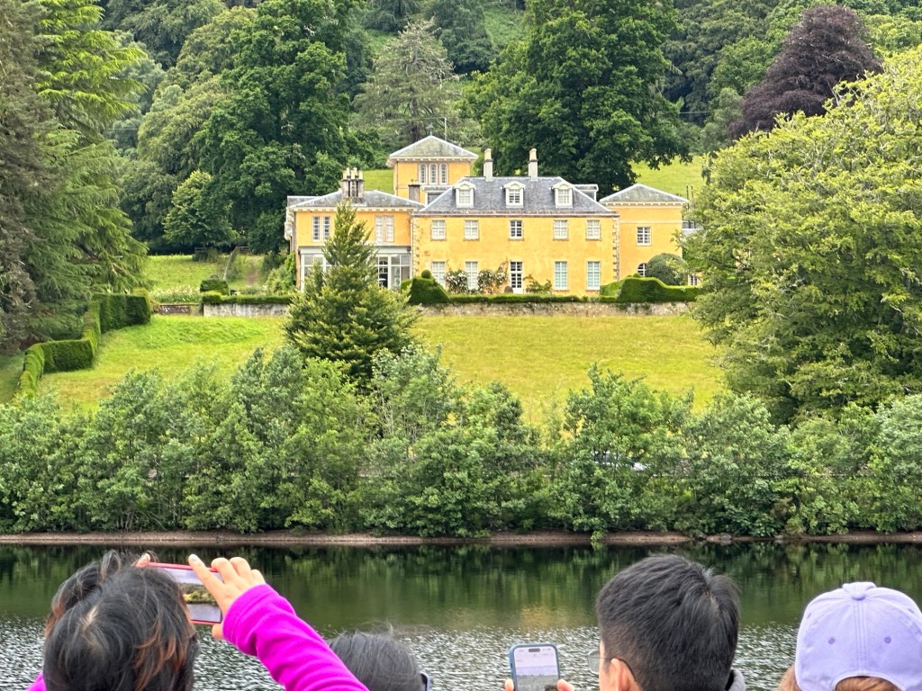
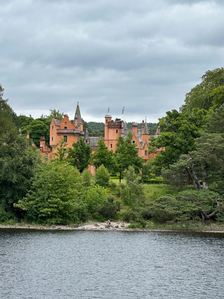
A hidden boat house Some incredible mansions along the river/lakeWhere the Ness River enters Loch Ness
The first Loch the Caledonian Canal empties into is our destination for today, Loch Ness. It is 23 miles in length and up to 230 metres deep, the largest body of water in Britain by volume and the 3rd deepest lake of Europe.
Another mansion on the lake Char on the look out for Nessie
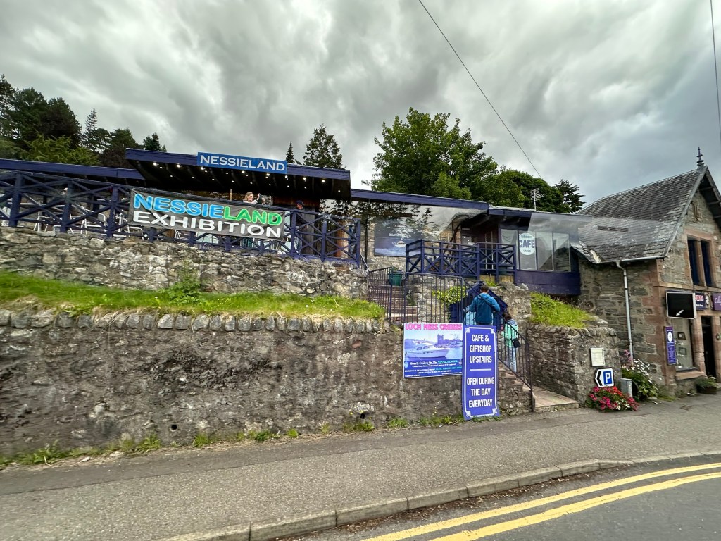
You will all have heard about the legend of the Loch Ness Monster, Nessie. A surgeon, Robert Kenneth Wilson’s photo of 1934 which supposedly showed the head and neck of the monster, has been considered a hoax since 1994 and the photographer has admitted to it being a doctored picture. But that hasn’t stopped the world-wide interest in hunting for Nessie, including sonar explorations and DNA surveys. There is a fellow who lives on the Loch who has sold all his worldly belongings and lives in a travel trailer and spends every waking moment on the lookout for Nessie. We didn’t see her.
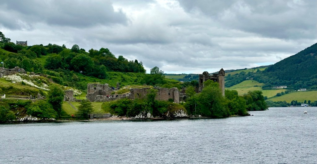
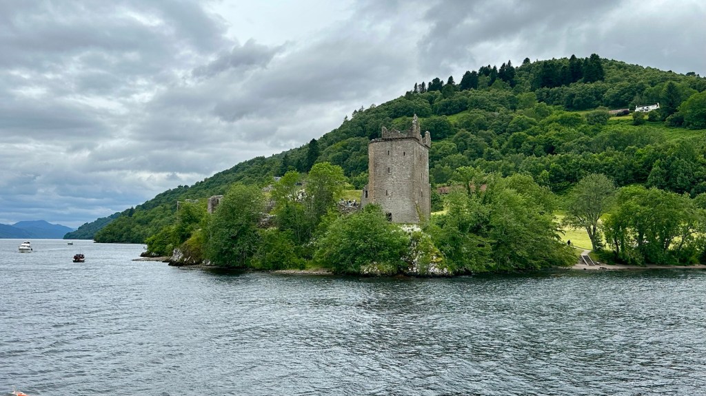
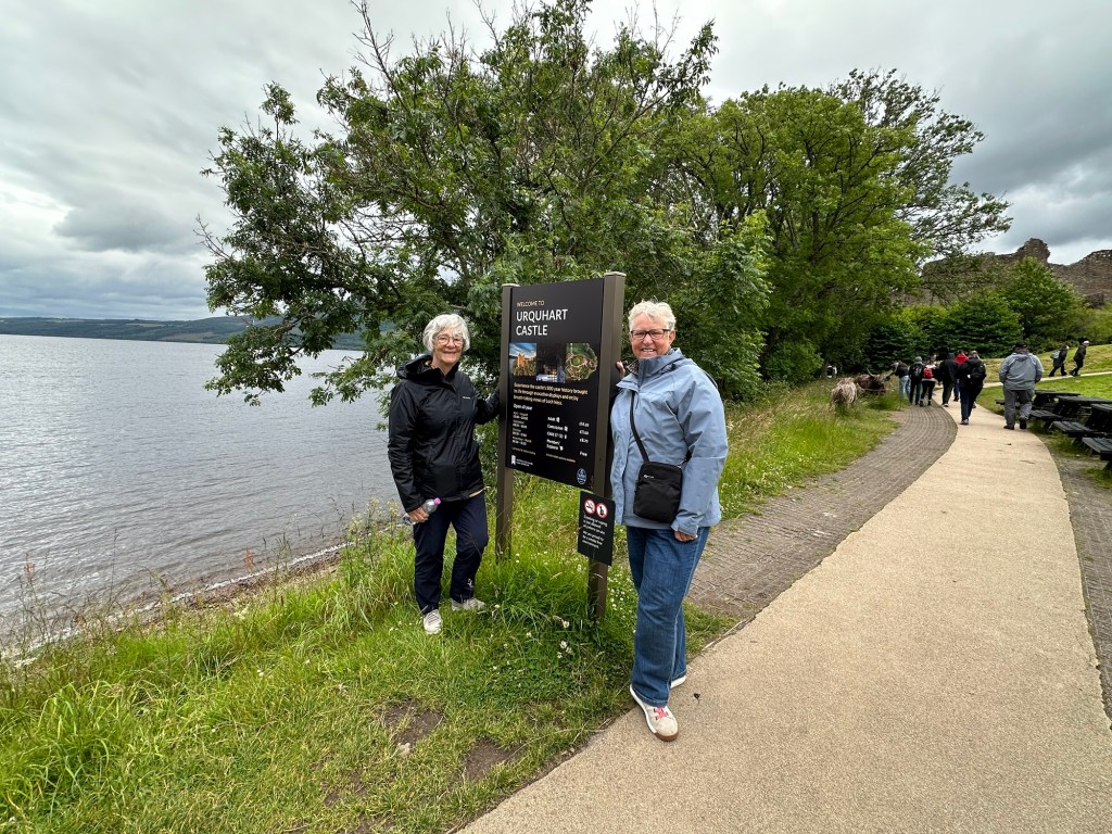
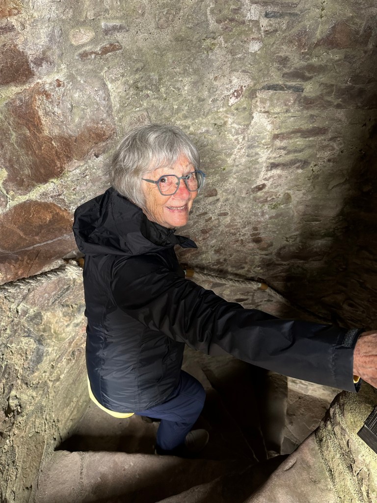
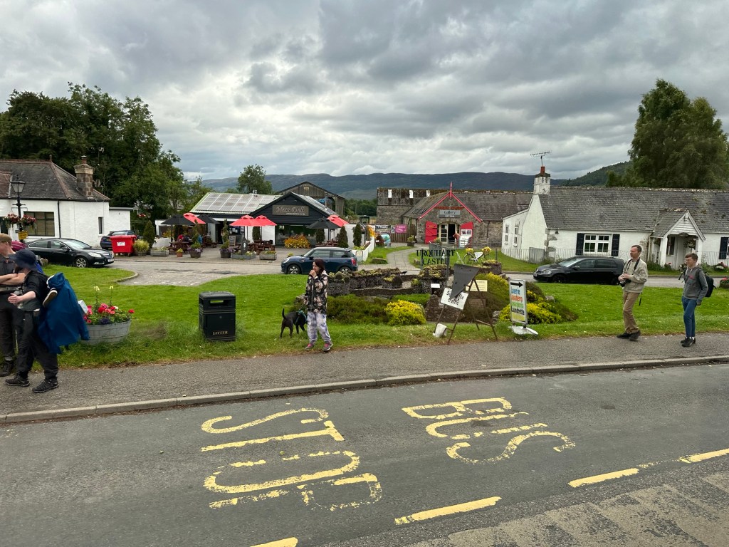
We did however see Urquhart Castle ruins and we left our boat to take more passengers on the return trip so that we could tour the ruins.
Our first sighting of Urquhart Castle ruins
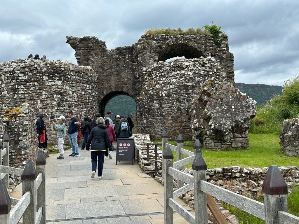
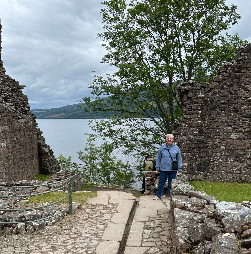
Urquhart Castle was built in the 13th century and was once one of Scotland’s largest castles. Control of the castle passed back and forth between the Scots and the English and the last British soldiers garrisoned here during the Jacobite Rising blew up the castle when they left. The north tower is the only element of the castle still somewhat intact.
The tower of Urquhart Castle Oh look, we were together on this trip! Some of the remaining walls of the castle.Going into the dungeon, no, not really. coming down for the second floorAbsolutely beautiful countryside Tourism around the Loch Ness Nessie
As you can see, a lot of local tourism has sprouted up around the Nessie legend. There are themes parks, hotels, playgrounds etc all dedicated to the search for Nessie.
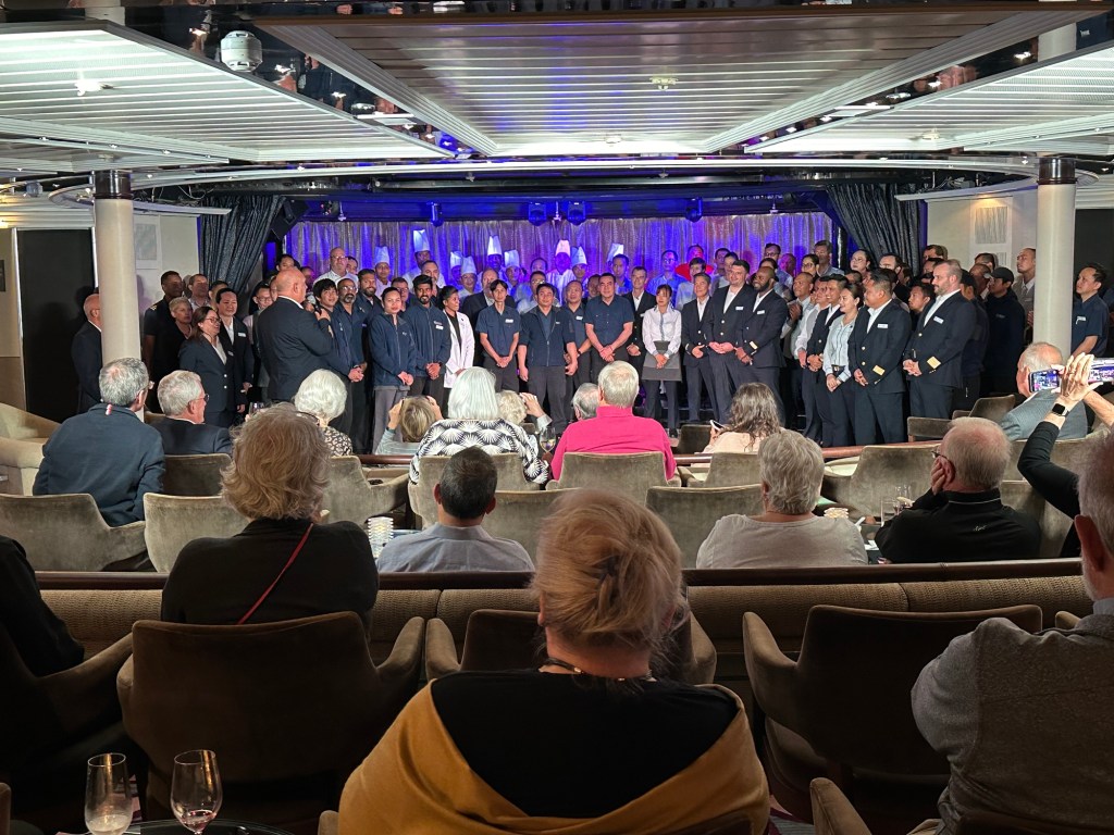
We made our way back to the ship and sadly spent some time this afternoon packing to leave the ship in Edinburgh tomorrow. There was a farewell event in the lounge for the Captain of the ship to introduce the officers and as many of the crew as could abandon their posts. They are the hardest working team, and yet they seem to have some fun along the way. Windstar does some things good, and some things great. And their onboard staff make them great.
The Farewell to the passengers from the Captain and crew of the Star Legend.
Sadly we leave the ship, but happily we have 3 nights in Edinburgh before heading home.
Today the rainy and cooler weather caught up with us. We feel very lucky to have had such great weather up until now so we’re not going to grumble about a little rain, cold and wind. Well, maybe a little. The wind was really piercing and we were both chilled to the bone by the end of our excursion today. A warm shower felt great at the end of the day. It was a long but really enjoyable day and in a place that quite frankly I never imagined I’d get.
A bright welcome despite the grey day.
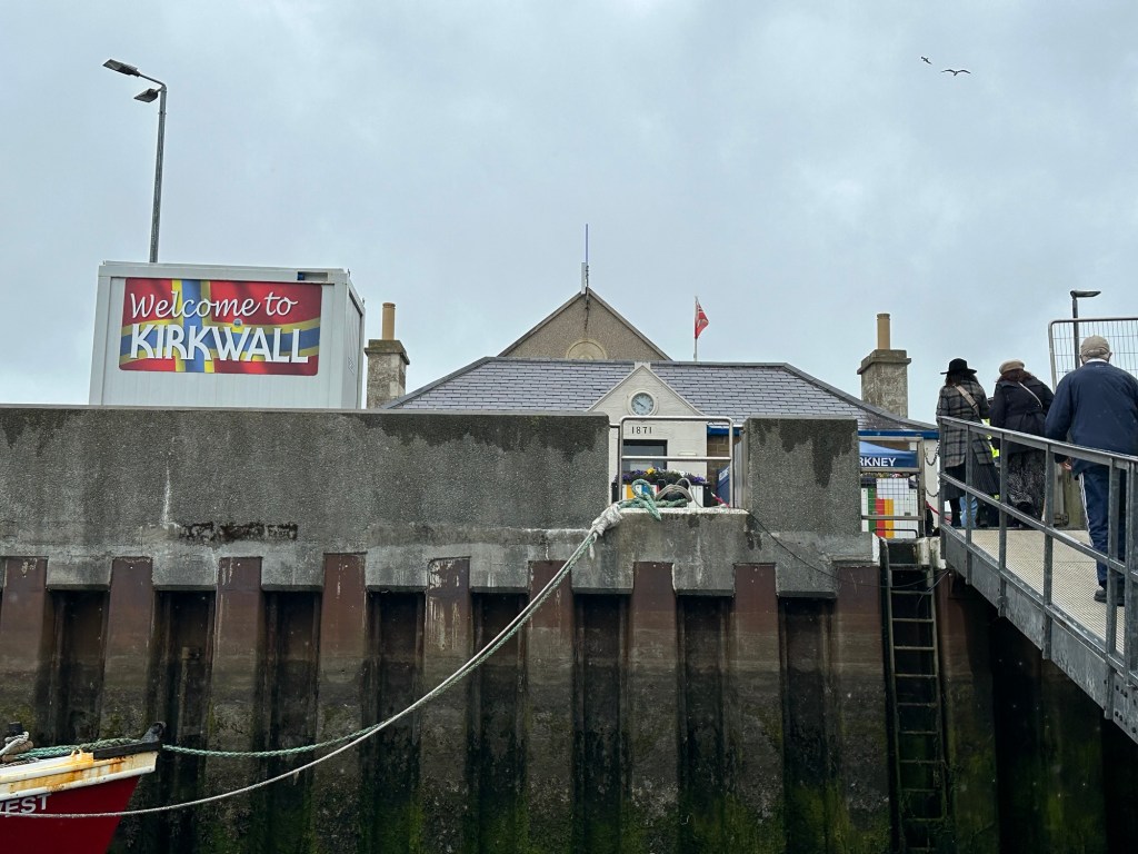
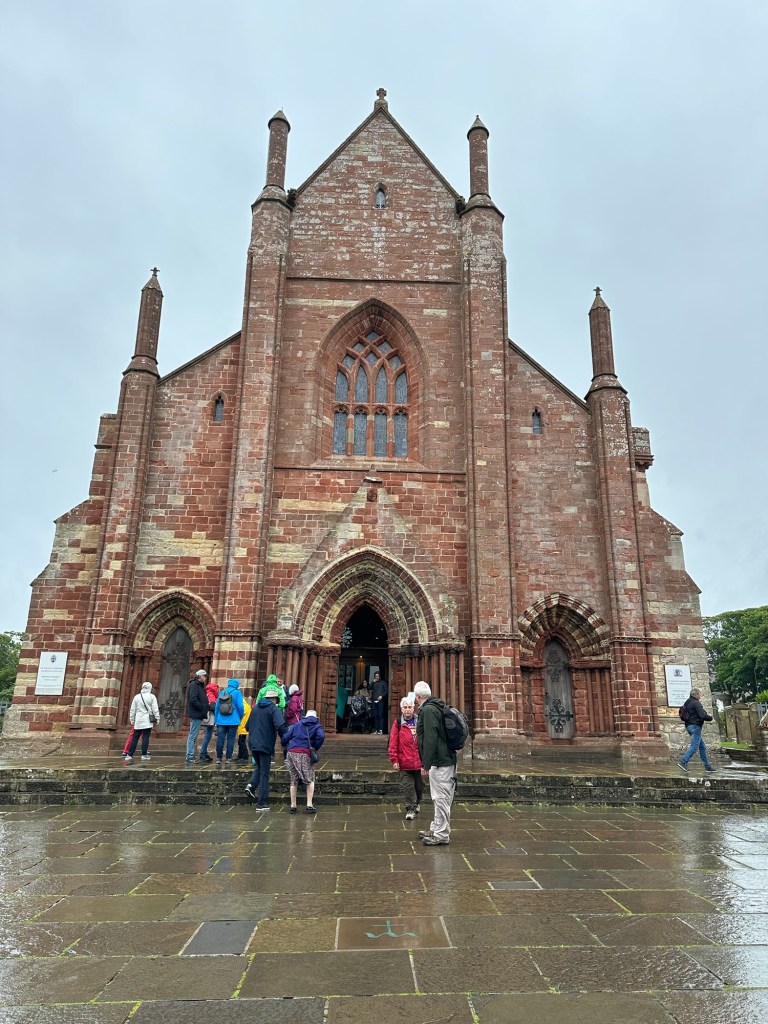
We docked early this morning in Kirkwall, the capital of the Orkney Islands. The Orkney islands are almost as far north as you can get in Scotland, and walking through Kirkwall, and learning about the history, it almost felt like we’d hit Norway by mistake. The Orkney Islands were part of the Norse empire after they conquered the Pict people, the original people of this whole area. The Vikings called them Pict people because they had many tattoos all over their bodies and Pict is the word for pictures in their language. In the 15th century (1468) the Orkney Islands became part of Scotland (as well as the Shetland Islands) after an unpaid dowery situation between the two countries.
Grey and drizzly main shopping street in Kirkwall. Some amazing shops. Great quality and local artisans.
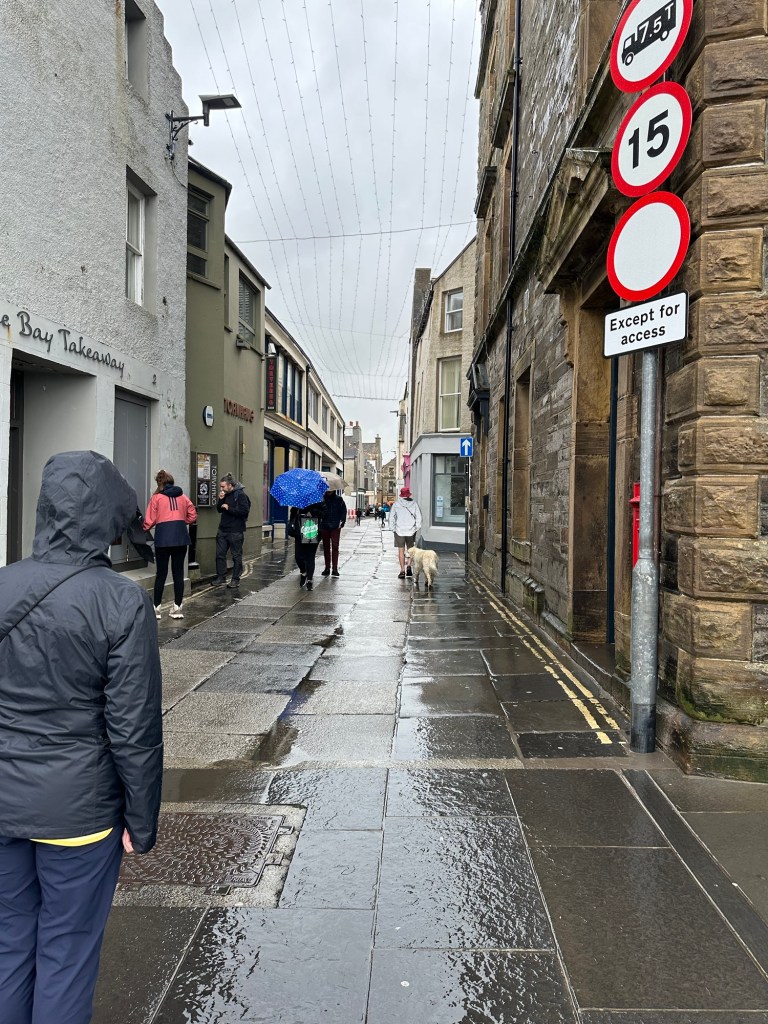
The Star Legend was anchored just off shore at the Kirkwall harbour which was a busy place most days, with the fishing fleet and a ferry depot. Our excursion today was not until 12:45 so we decided to tender in and explore Kirkwall in the morning, grab something to eat and then go on our excursion. It was a challenging exit from the ship to the tender due to the waves and swell, but the crew does an amazing job of making sure everyone is safe and feels that way. It was drizzling as we made our way from the tender dock up the main connecting street to High Street, where we found a lovely selection of shops, bakeries and restaurants. It was relatively quiet through the wet stone streets, with a solo bag piper playing in the mist making it quite magical. A lovely mood. Our destination was St Magnus Cathedral whose unique building could easily be seen from the whole town however it took some time to get there with stops in shops along the way. No one ought to get excited, I didn’t actually buy anything in said shops. But it was fun looking.
This garden looked inviting. Love the red and yellow windows/frames
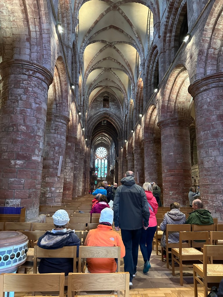
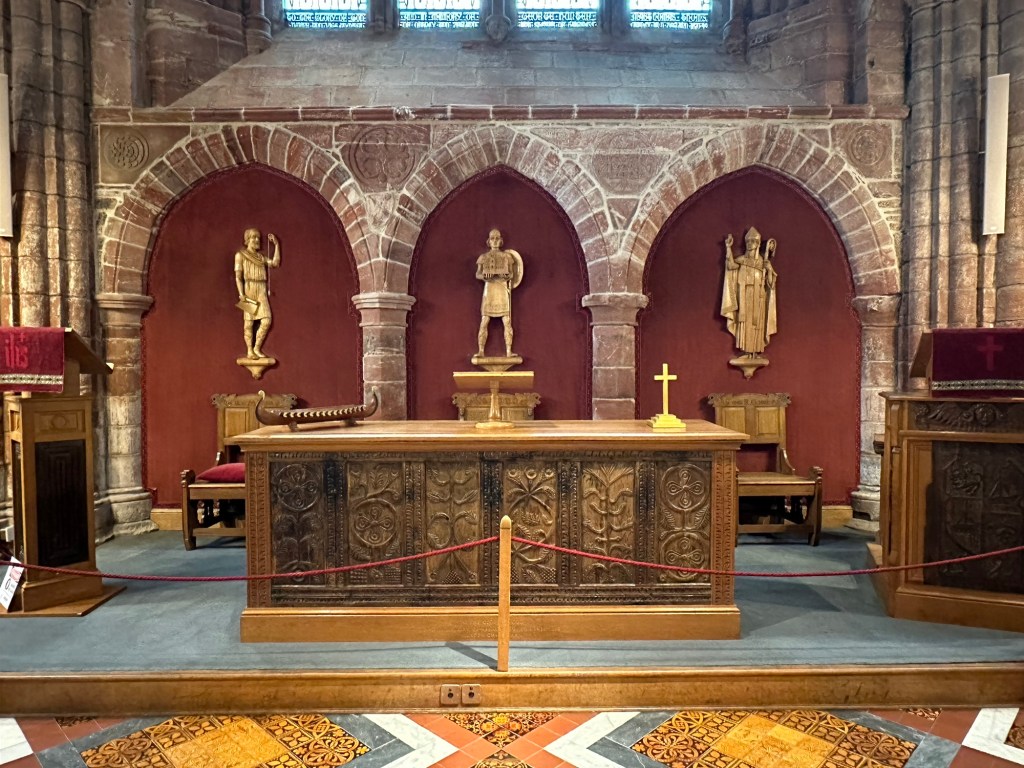
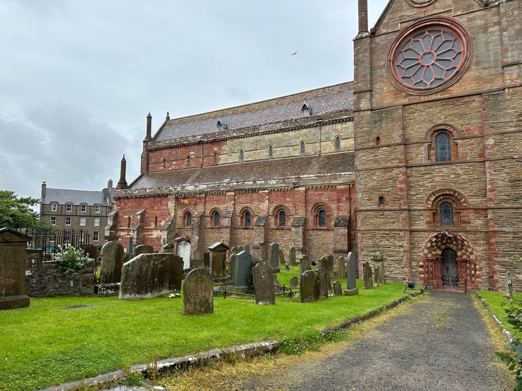
St Magnus Cathedral is primarily used by the congregation of the Church of Scotland, but is owned by the people of Kirkwall and is used by whichever Christian religion wishes to hold services or masses in it. The exterior of the church is unique because of the two-tone (red and yellow) sandstone from which it’s made. It was founded in 1137 but was added on to and restored in the 1850s and again in 1913. The cathedral’s beautiful stained glass windows were designed and installed in the 1920s.
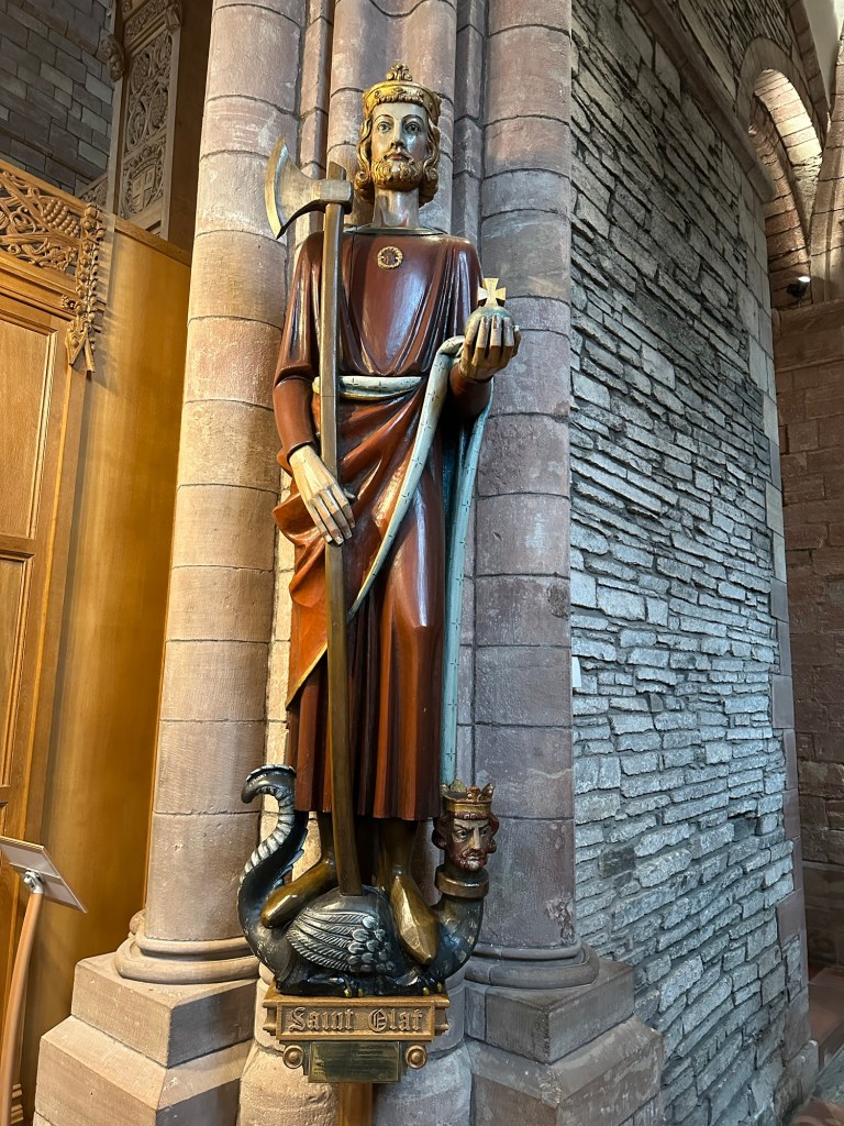
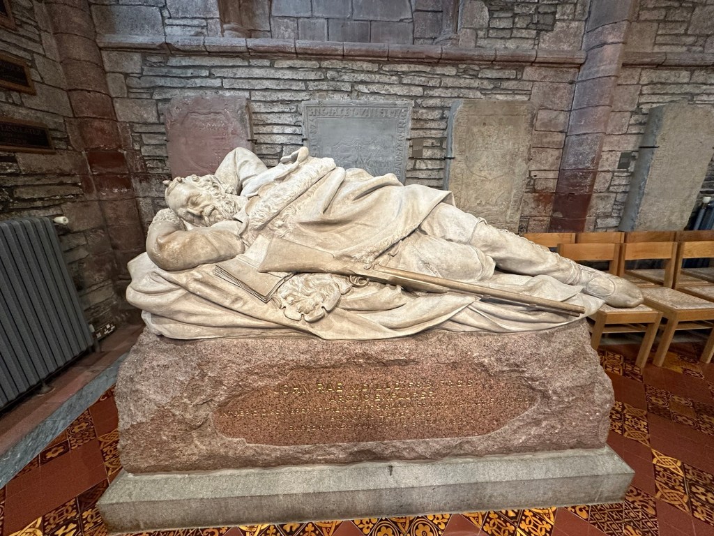
St Magnus ChurchInside St MagnusInside St MagnusSaint OlafCheck out the Viking shipDr John Rae – Canadian Arctic Explorer
It was at St Magnus that we learned there is an interesting connection between the Orkney Islands and Canada. Many Orcadians were recruited to work for the Hudson’s Bay company in their outposts through Canada. In the church we came across a reposed statue of Dr John Rae, an Orcadian, who was an employee of HBC, and explorer of the Canadian Arctic and discoverer of an important part of the Northwest Passage. He is buried in their cemetery.
The gravestones looked ancient.
As we were leaving the church, tourists from one of the mid-sized cruise ships that docked just after we did today were streaming into the church and the streets of Kirkwall were teeming with people. We were really glad we got a relatively early start. Also, because of all the activity, we decided to grab a bite early and stopped in a cafe to get some tea and oat cakes. They were served with butter and shredded cheese, which seemed a very strange way to present them.
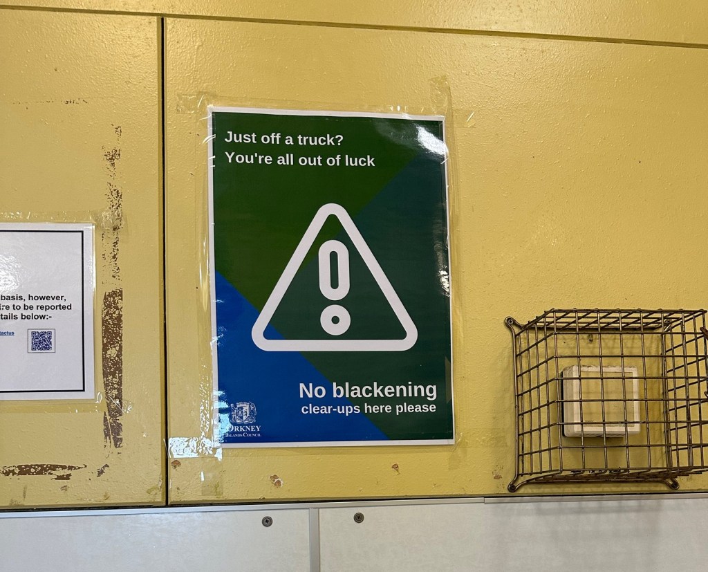
No blackening clear-ups?
I couldn’t resist taking a picture of this sign and asking someone at the information tent what it was all about. One of the wonderful volunteers who greeted us as we came off the ship explained to us that as part of the pre-wedding rituals in the Orkney Islands, the grooms men and brides maids cover the groom and bride with molasses, soot, eggs, fish guts, manure and various other disgusting substances and take them for a ride in the back of a pick up truck. A BBC article I read on the subject noted that “a Blackening, is known for taking disgusting behaviour to another level.” Apparently there have been complaints that the bride and grooms sometimes use the public toilets (which is where I took this picture) to clean up after the Blackening and the Council has put up these signs to try and put a stop to it.
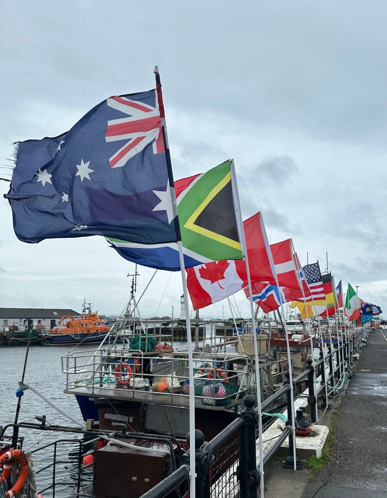
Canada in a prominent position on the wharf
Our tour for the afternoon started at the dock so we headed back there to join up with our group. We were able to get on the bus that we’d be using a few minutes early and got out of the rain for a bit. Our guide for the day was Andie and he was an excellent guide. Char noticed that he spoke off the top of his head whereas many of our guides have used notes. I was wondering out loud where one of the flags was from among the group that were lining the dock, and the bus driver overheard, got off the bus and went and pulled the flag out of it holder to look at the base of it and then put it back in. He got back on the bus and said, Panama. I asked how he knew the name would be there, and he said because he also works on the docks and one of his jobs is to help the guy that changes the flags each day! They have the country roster of each of the cruise ships crew and passengers and they put up a flag to represent each of those countries on the dock. Every day! Sorry, I digress.
As we drove through the lovely green but windswept and pretty much treeless countryside with various small fields separated by dry stone dykes our guide told us about the Orkney Islands and Kirkwall. There are 60 islands in the group of Orkney Islands, 20 of which are populated with 23,000 inhabitants all together and 8,000 of which reside in Kirkwall.
The main industries on the Orkney islands is farming and its supporting industries, (beef, dairy, sheep), and Tourism. Eighty percent of the land is cultivated and used for farming, lots of which is sheep grazing. They don’t use the wool commercially, but rather sell the young animals for meat. Two hundred and forty cruise ships will stop in Kirkwall this year, mostly smaller ships (average size being only 500 passengers). They also have fish farms in various spots throughout the islands.
The islands are far north, (around 59 degrees north), but they have relatively mild winters due to the warm Gulf Stream waters. In the summer it is light from 5 am to 11 pm but in the winter, the days are dramatically short. Peat was the main source of fuel traditionally but they are gradually changing over to renewable resources. We saw quite a few wind turbines in our travels.
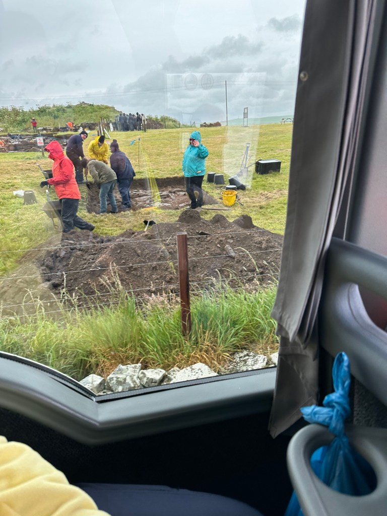
Taken from the bus window as we didn’t stop. This is a dig site.
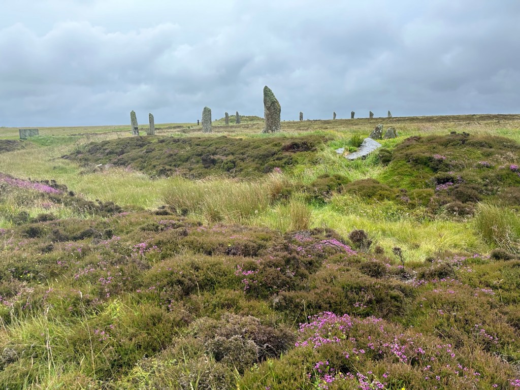
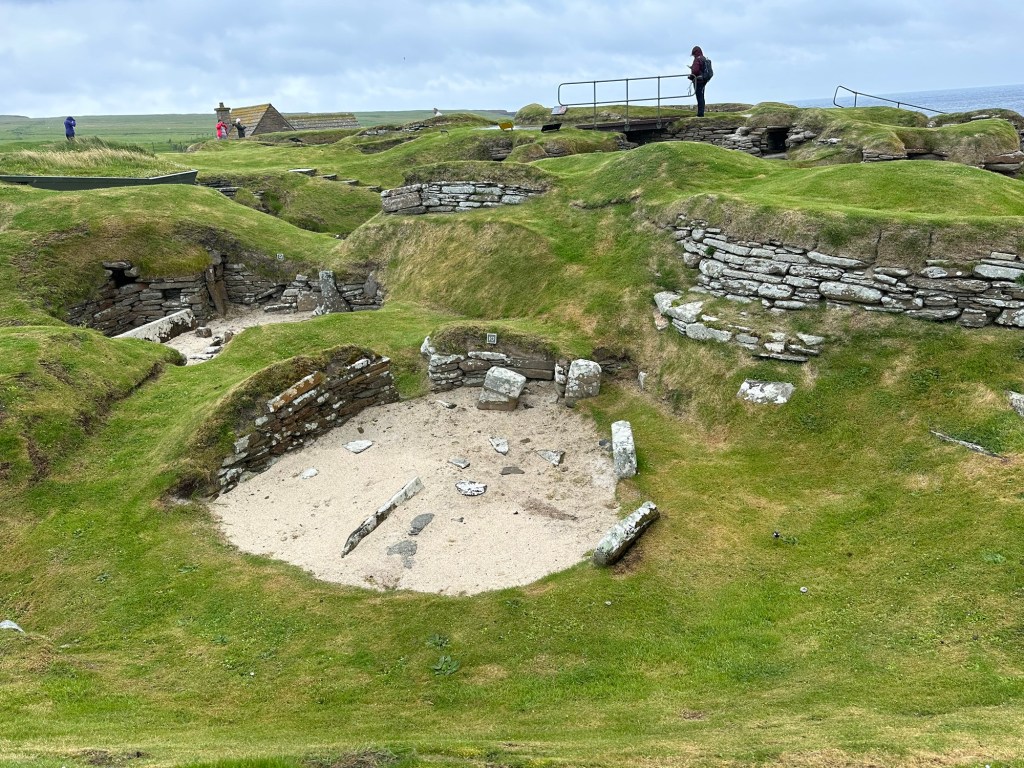
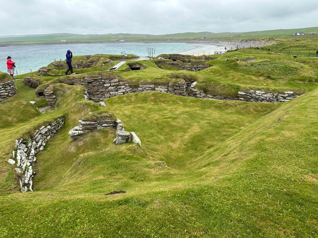
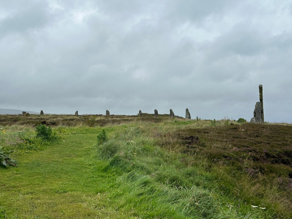
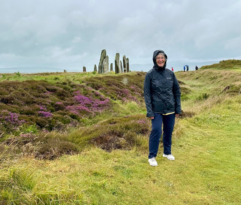
We were traveling across the rugged beauty of the island today to see a UNESCO World Heritage Site, including a stone circle from 3100 bc (800 years before Stonehenge) and a village which was from roughly the same period which was found quite by accident. Both were fascinating. We passed an active excavation site that our guide worked on which has been so rich in discoveries that after this season of digging they’re going to shut down the site, and re-bury it to preserve the site while they spend years cataloging and preserving the artifacts.
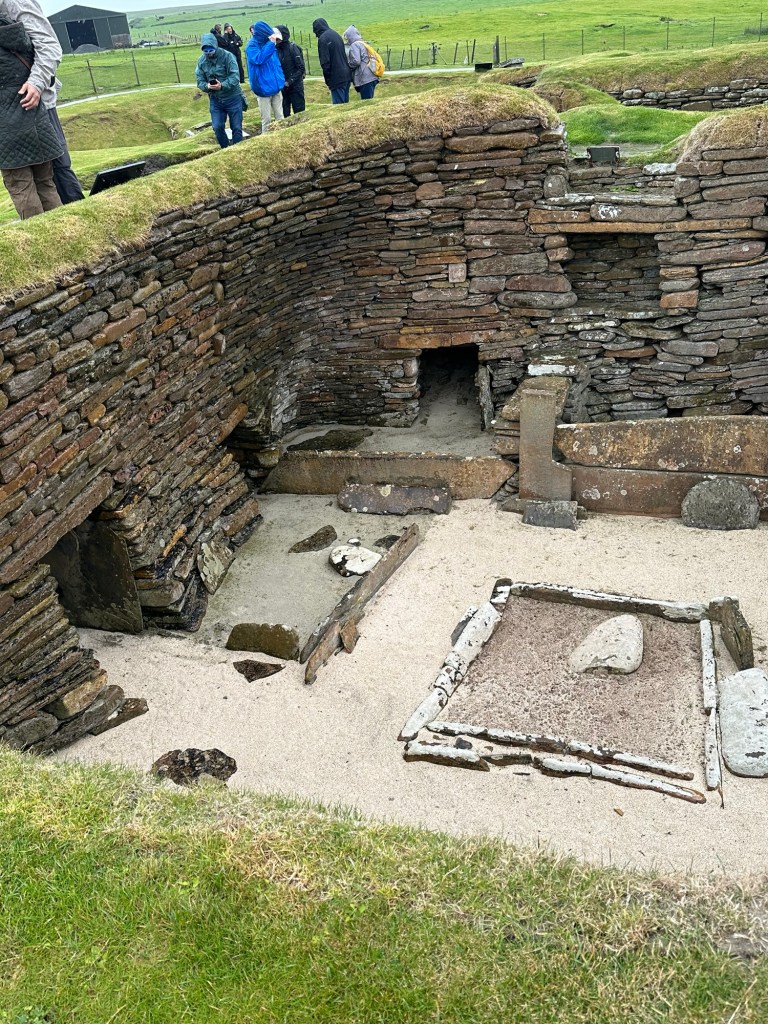
In 1850 a huge storm with wild winds removed a whole lot of sand from an area which revealed what is now called Shara Brae (meaning village under hills). It is a village which has been dated to be from 3100 BC, 4000 years before the Vikings arrived or the pyramids were built!. It is believed that a maximum of 125 people lived at this site at any one time but that it was abandoned after 600-800 years probably because it was close to the shoreline and they may have lost even more of the site to the sea than the 10 homes we visited today. It was a bit like a rabbit warren, built into the ground, with tunnels connecting the individual living spaces. The space has been really well presented with a visitor centre and great information posted throughout the site, and we would have probably stayed longer if it weren’t for the cold wind off the water and rain.
They have covered some of the excavations to preserve them. Fire pit in the middle, beds on along the wallsHaha, I think Charlene is a tad cold.
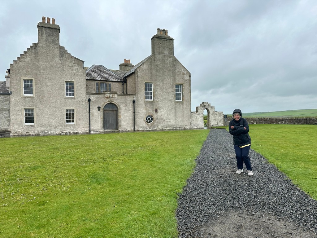
Also on the site of Shara Brae we visited Skaill House, the 17th Century mansion of the 12th Laird Major Malcolm MacRae, It has been restored and opened to the public
The china of Captain Cook! Living area
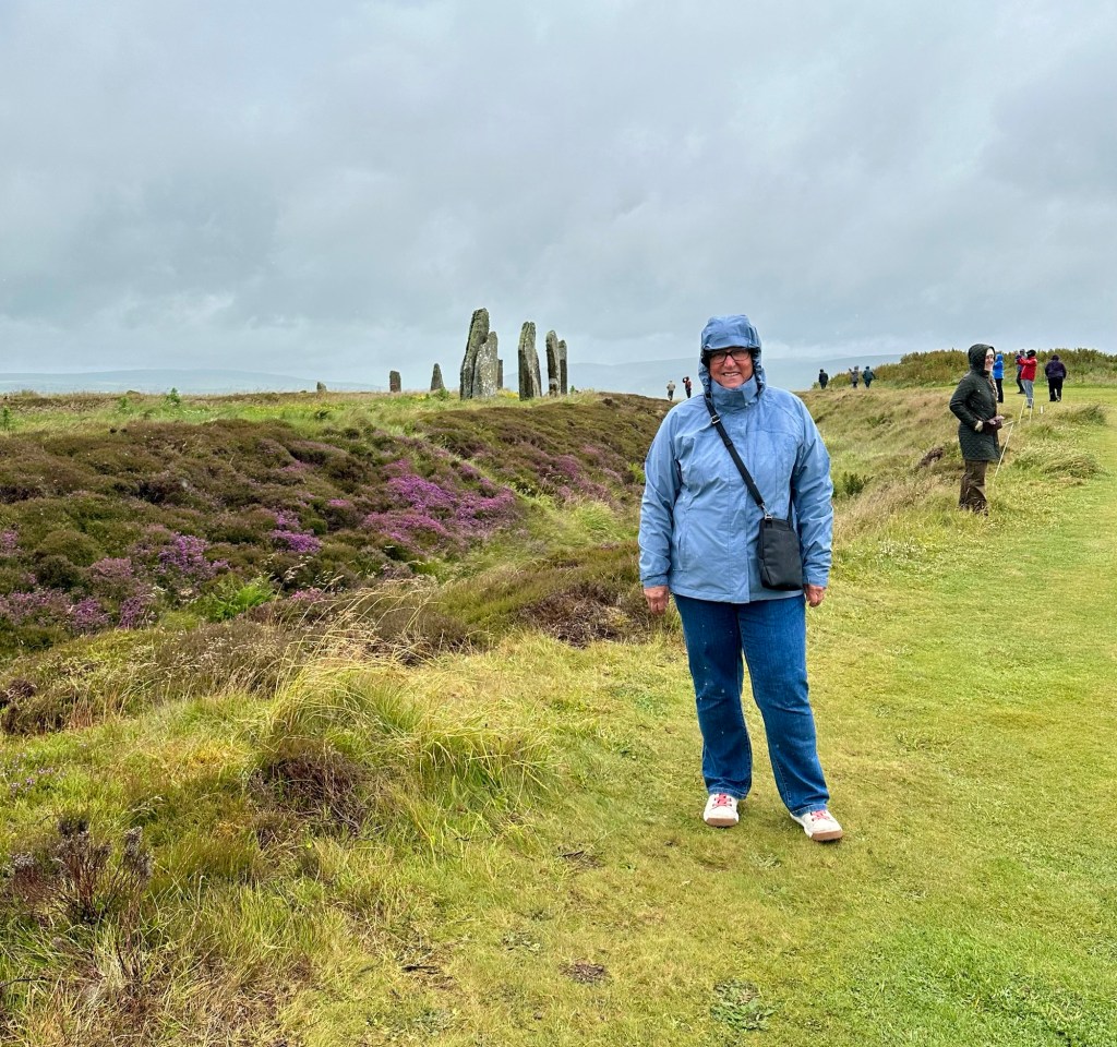
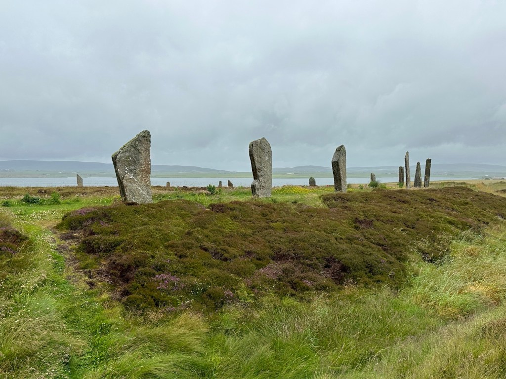
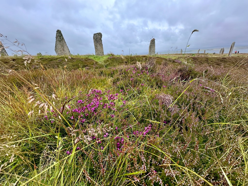
Then we travelled back the way we had come to a stone circle called Ring of Brodger. It has been dated to be just a little younger than the village at Shara Brae, around 2600 BC. Twenty seven huge stones remain and are arranged in a circle and it’s imagined that there were likely originally 60 but the others have been either vandalized or struck by lightning. It has a ditch around the circle, so it is called a “Henge” monument, like Stone Henge. It’s been calculated that it would have taken 80,000 man hours to dig the ditch. One of the other nearby smaller stone circles does have an astrological orientation, but it doesn’t seem this one does. The stones have been brought from different parts of the island which they can determine by the different types of rock. It’s theorized that this might have been a meeting place with the people from the region that the stone was from standing with their stone around in the circle. One of the “fairy stories” of the area is that the stones were formerly giants that lived on the islands who got together to have a party and the gods gave their permission to do so but said they must finish partying by sunrise. And when they were still partying at sunrise they were turned to stone.
Do I look cold and wet?
It would have been great to have a longer look and contemplate what it all meant but the wind, cold and rain had us practically running around the circle of stones and back to the bus.
Beautiful heather just starting to come out on the hillsides The 45 degree angle of the top of many of these stones is just because of the way the stone naturally breaks. Heather and StonesSome of the stones have fallen over and they’ve just left them where they fell
Our guide told us the significance of the area to both World Wars on the way back to the ship. A plane attacked this area of the Orkneys on March 16, 1940 at the beginning of WW II and it killed the first civilian killed in the war in the British Isles.
The Orkney Islands were used as a navy base in both world wars, in an area called the Scapa Flow, where the surrounding islands provide protection and the fleet could be protected on all sides. In WW I 120 ships were harboured there. It was important to keep the navy fleet up in the north of Scotland to keep the German navy bottled up and keep them from getting into the Atlantic.
At the end of the war, as part of the Nov 1918 Treaty of Versailles negotiation, Germany had to hand over their 74 navy ships by sailing them into the Scapa Flow area. They did so, but the German commander had no intention of handing over the ships and communicated with each of the ships captains and in unison on one day in June 1919 they sank their own ships. The British sailers figured out what was going on and managed to save some of the ships, but 52 were sunk. The fleeing German sailers rowed to saved themselves, but the British sailers killed 9 Germans. They were the last military men to be killed in WW I.
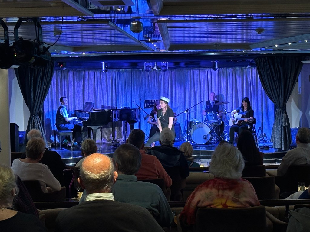
The Orkney family band who performed on the ship.
Once safely on the Star Legend we hurried to the lounge because the entertainment crew had organized a ceilidh with a local Orkney family group. I loved the music and if there was any question before about whether the east coast of Canada has been influenced by the immigration of people from Ireland and Scotland, that question was dispelled in my mind when I heard their music. I could have been sitting in a concert in any of the Atlantic Provinces rather than in the Orkney Islands the music was so familiar. If I shut my eyes I was back at the Women’s Institute Hall in Stanley Bridge, PEI.
This has been one of my favourite days despite the weather.
First of all, to those of you who get an email with my blog when I post, I apologize that the pictures don’t come through. I have no idea how to fix that but you can see them if you take the link to the actual blog.
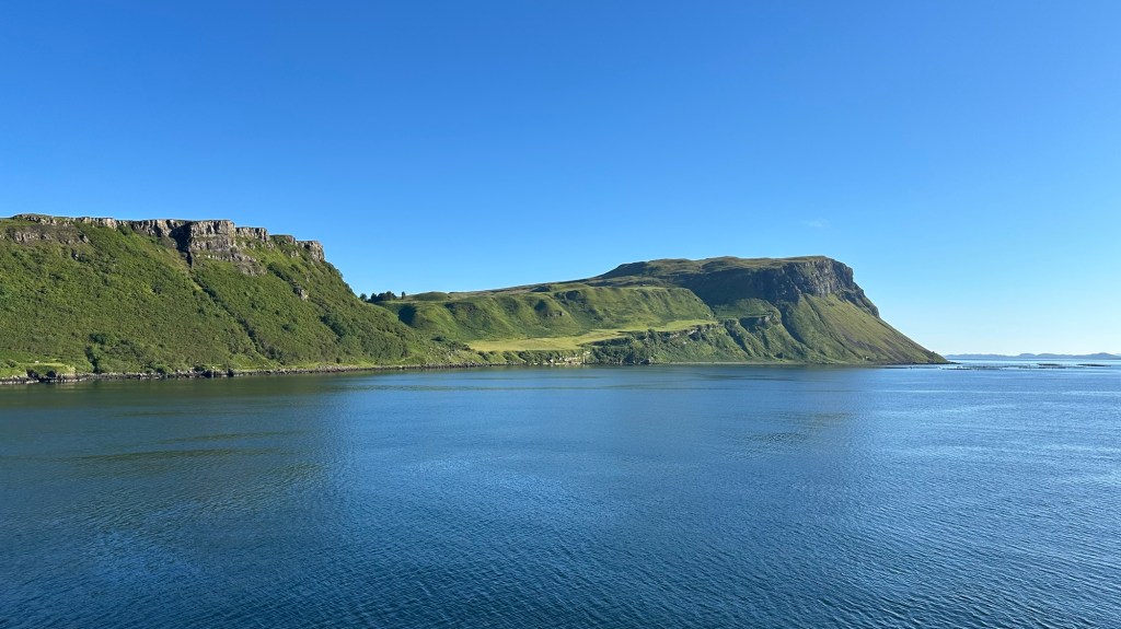
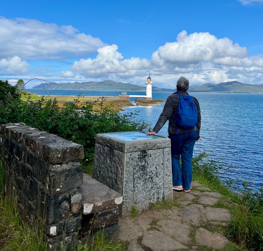
Today my blog is going to be a little different. Today is an important day on our trip. Today was the reason I started on this adventure and my sister joined with me. Today we set foot on the Isle of Skye where some of our ancestors originated. Today we saw and took pictures (granted, from a distance) of the remains of the McKinnon clan castle, named Caisteal Maol or Castle Moyle, in a town named Kyleakin. Today we came within less than 100 miles of where we believe our great, great grandfather, Duncan McKinnon was born.
Our view of Skye from the ship this morning
Today I feel a little like life has come full circle. Duncan McKinnon, my great, great grandfather, had a daughter named Amelia who married a fellow named Benjamin. They had several children, one was my grandmother, Edith. Fast forward and my daughter Gillian and her husband Philip had a son 5 years ago and named him Benjamin not knowing our family heritage. Then they had a daughter just over 2 years ago who they named Amelia Edith and I was so pleased that they paid tribute to my heritage using my grandmother’s name, Edith. (Coincidentally, Edith is also the first name of my sister Charlene who is travelling with me. Because her travel documents list Edith as her first name, the crew is calling her Edith, even though she uses her second name Charlene. She’s even given up correcting them. I’m calling her Edi from now on) When I told my siblings about the name Edith being given to the new little Amelia (“Millie”) my (much) older sister Lynn told me about Amelia and Benjamin to my shock. None of us had any idea. Today has been an emotional day.
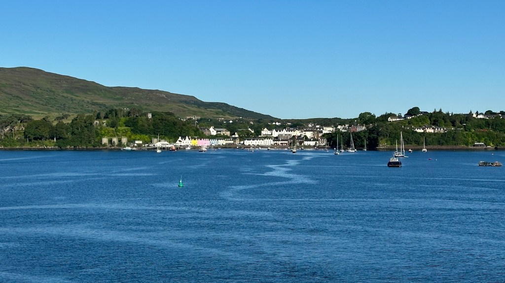
Our view of Portree from the ship this morning
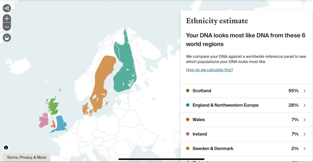
I knew that there was Scottish blood in our background but I had no idea it was as high as it is until I received the results of my DNA test. Here are the results:
Then I saw this tour of Scotland with Windstar and I knew I had to do it. But I never expected to be able to get as close to important sites in our family history as we have. Now, with that background to put today into context, we resume to regular programming…. I’m sorry to the millennials and younger who will not understand that reference.
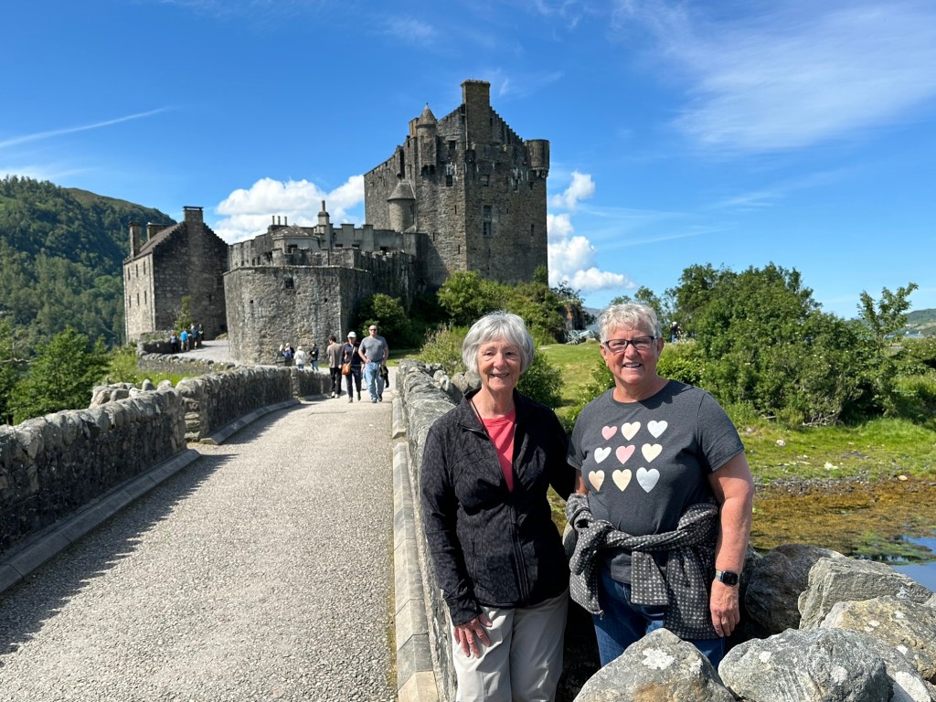
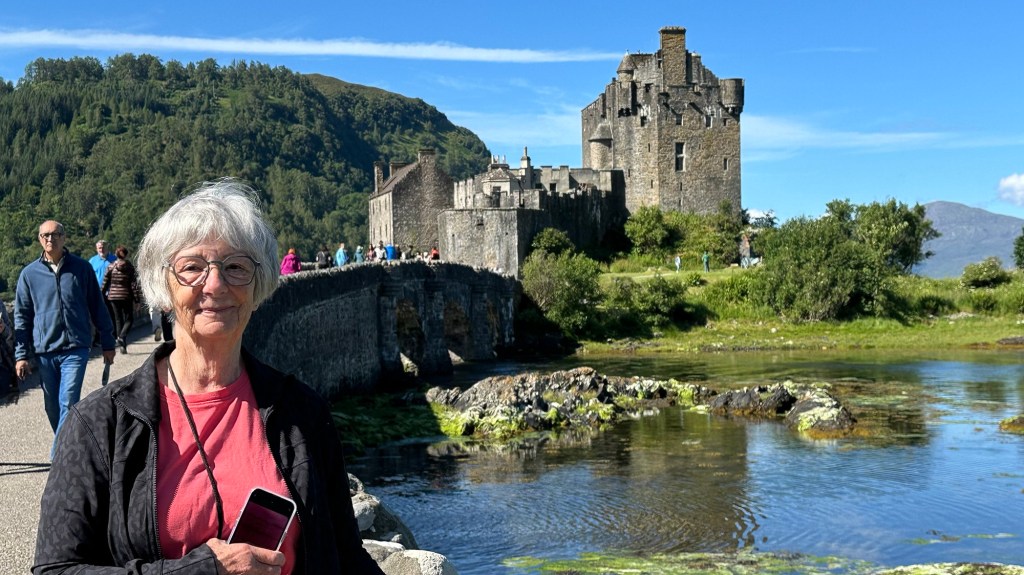
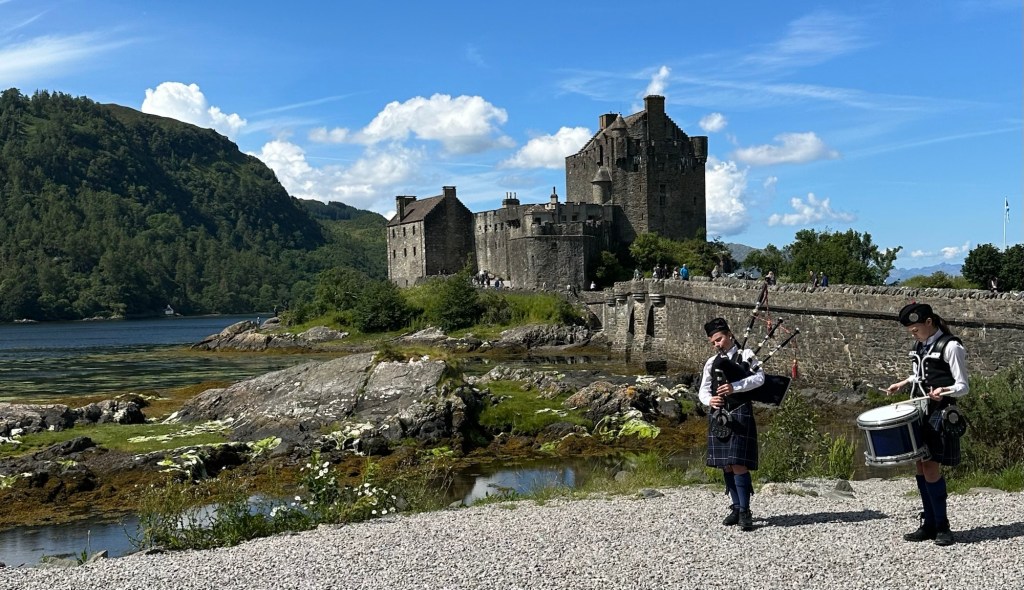
Our first glimpse of this remarkable McRae Clan castle
Our morning started off with beautiful blue skies and we were so thankful once again for the wonderful weather we’ve experienced. Our excursion today was to travel from the port town of Portree on the Isle of Skye over the bridge to the mainland to the Eileen Donan Castle. This is the ancestral castle of the MacRae Clan, which had fallen into disrepair but was purchased back by the MacRae Clan in 1911 by Lt Colonel John MacRae-Gilstrap. He and Farquhar MacRae painstakingly reconstructed the castle formally completing it in 1932. It is now open to the public and a fee maintains the property. The dependents of the MacRaes do get together there from time to time.
The castle is on an island and you have to cross this bridge to get to it.
Twenty or so fellow travellers piled on to the bus near the dock and amazingly and with great driving skill on the part of our driver, our bus didn’t scrape the sides of the stone roadway leading up a steep incline out of the harbour with just barely enough room to pass. We got a quick peek at the town of Portree which promised to provide some shopping opportunities before heading out on to the highway. We had a beautiful trip along the coast and through various small towns. Along the way we saw small crofts (farms) with many, many sheep, a thatched roof cottage, a waterfall, a shinty pitch (a game which they claimed was a precursor to hockey in North America), and grand views of the Red Cuillins mountains of Skye.
The front entrance of the castle protected by a one tonne gate that can be lowered down in front of the wooden door.
Finally we crossed over the very nicely designed but controversial Skye Bridge joining the Isle of Skye to the mainland. It seems that most bridges linking islands to the mainland become controversial possibly because there are always those people who don’t want to see their way of life changed. This one had a couple of elements to it. The bridge was financed by a Private Financial Investment program of the government and a Germain company did the planning and development of the bridge. In order to reclaim the cost of the project the company implemented tolls on the bridge that stayed in place until the protests finally caused the government to buy out the Germany company and the tolls were removed 10 years later. The rumour mill claims that a certain woman, now passed, who lived in Buckingham Palace made a call to the German company during their planning stages to ensure her private yacht would be able to get under the bridge. Its centre span is rather high.
From inside the castle
We arrived at the Eileen Donan Castle and had an hour and 15 minutes to tour the castle. It feels a little like a cross between a private residence and a museum. Sorry we couldn’t take pictures inside. It was furnished throughout (including some very life-like and a little creepy historical figures), and we were able to tour most areas of the castle. The “keep” or living space was really cozy and warm, and the entertaining space had high ceilings and was rather grand. The bedrooms were tiny, as were the beds. No wonder they had large families back then. The front stairways were narrow enough, but the back staircases were barely large enough for me to get through sideways. There were lots of artifacts on display as well as pictures and some life-like ducks and chickens hanging in the larder along with other animals curing. The brochure notes that weddings can be booked into the castle which would be amazing.
Char and I with one of the 4 lochs surrounding the castle in behind us.
Interesting to us, as Canadians, was that there were two displays that were tributes to Canadian physician, Lt. Col. John McRae who, in 1915, wrote the war poem, “In Flanders Fields”. One of the displays included a huge mock up of the stamp issued by the Canadian post office a few years ago.
I loved the pop of red
We circled around the outside of the castle which is set both strategically and beautifully at the intersection of 4 or 6 lochs (I saw mention in the material to both numbers) to take some pictures, and found that it was already time to get back to the bus. The time had just flown.
A memorial wall on the back of the castle.The backside of the castle looks formidable to enter. And of course there were pipes and drums.
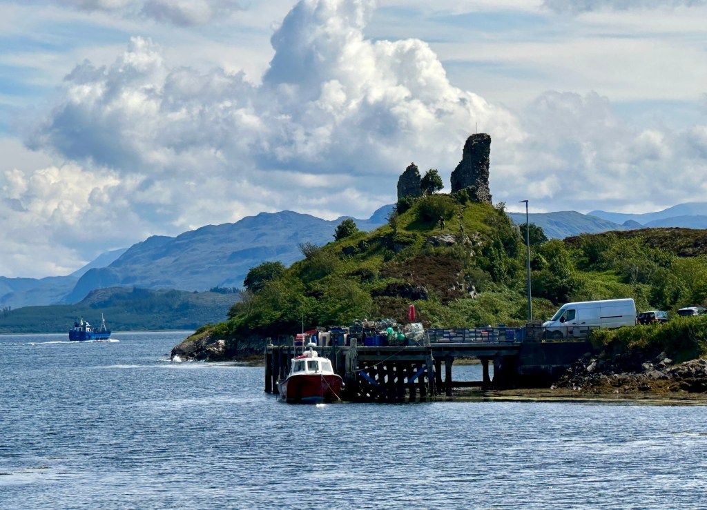
We hoped on the bus to head back to the ship but shortly after the bridge we turned off in the town of Kyleakin where we stopped and in the distance and at the end of the street we saw what looked like the McKinnon castle ruins visible on a high point of land. I had spoken to the local tour guide at the beginning of the tour about wanting to see our clan’s castle ruins in Kyleakin and she said that we would be making a Kodak Moment stop there to take pictures of the bridge. When everyone got off I asked the guide if Char and I could get closer to take some pictures. She said she would hold the bus if I hurried down and around the corner where she thought I could get a reasonable picture. So off I went, running! Char came far enough to be able to see the castle ruins and to take a picture of me running. Such a historical event really is picture worthy! My heart was pounding both from the exertion but also because it truly seemed like a momentous moment. You can read about the castle and the McKinnons at this link.
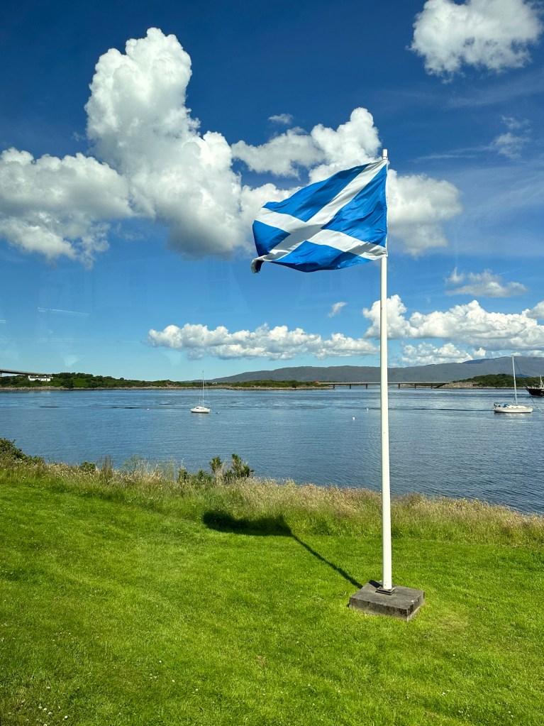
The Flag of Scotland A waterfall The Star Pride anchored quite far out but still in calm water. If you look closely you can see Lois running to the end of the street to get a picture.
Back on board we followed our usual routine of listening to the lectures, attending tomorrow’s port info session and had another lovely dinner in Amphora. By the time we came back to our cabin, no less than 5 people who had been on the bus this morning asked why on earth I’d taken off running down the street at the photo stop. And I’m happy to explain the connection we have to this wonderful place.
Today we stepped foot in Scotland, the land of some of our ancestors, for the first time. I didn’t kiss the ground but it did feel significant.
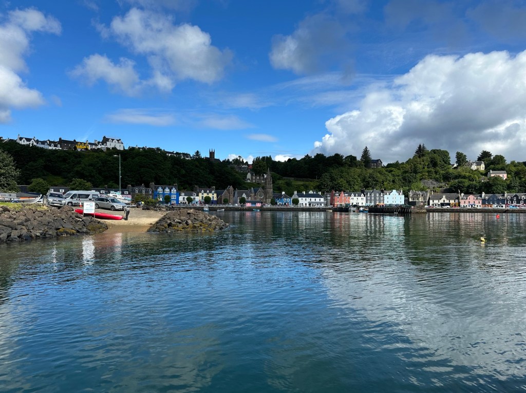
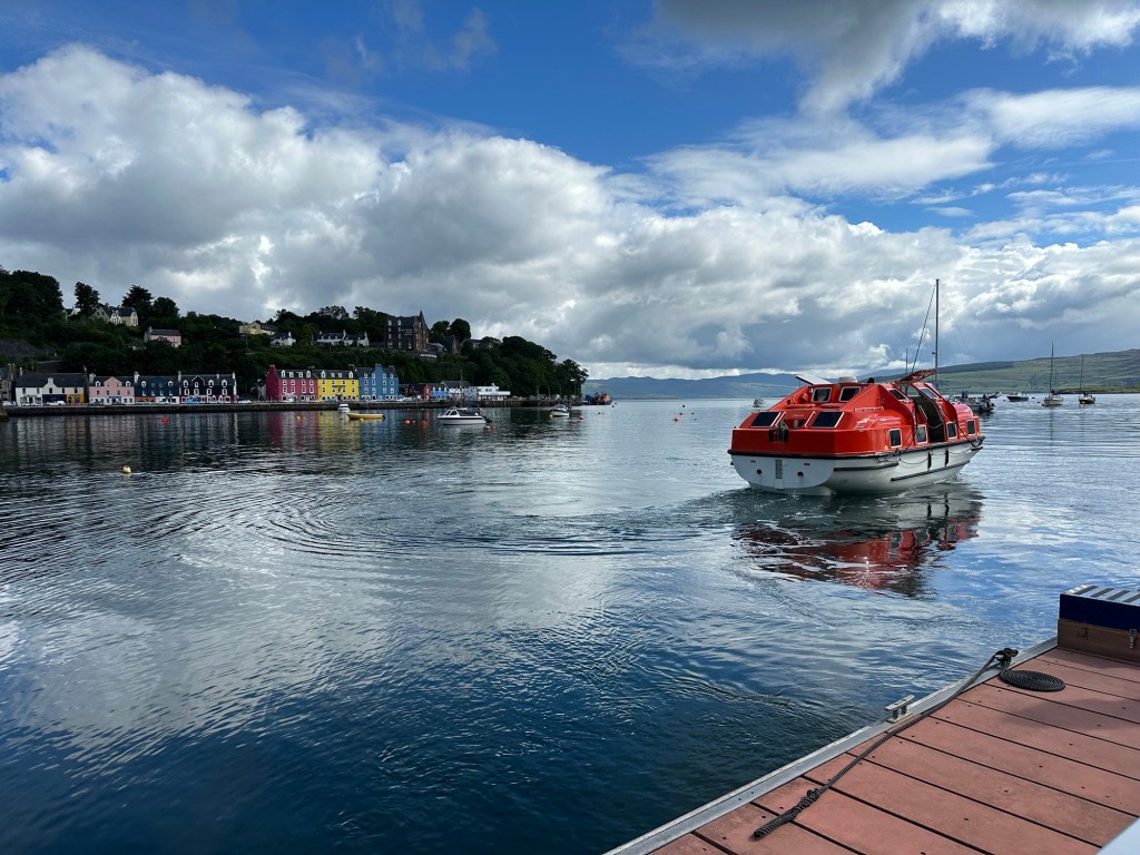
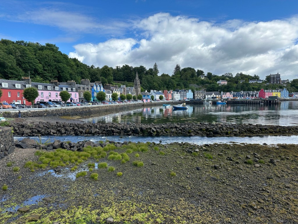
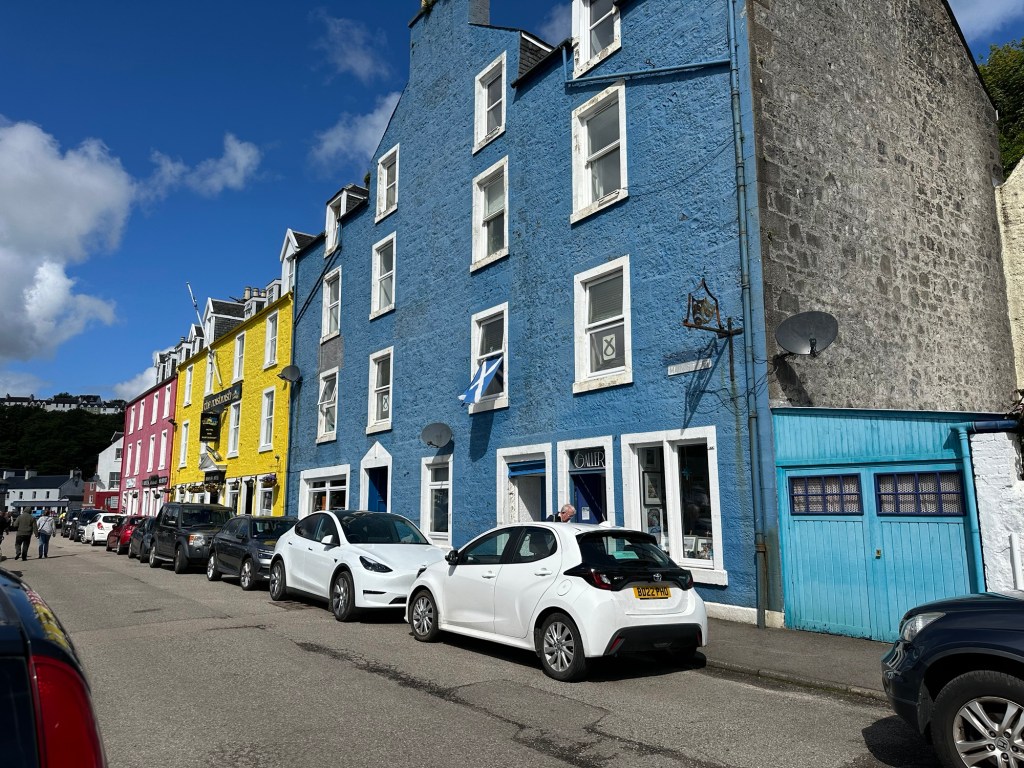
The cute little port of Tobermory
We are on the Isle of Mull, one of the 80 or so islands of the Inner Hebrides on the west side of Scotland. Only thirty five of the islands are inhabited. The Isle of Mull is the second largest of the inner Hebrides after Skye, and the 4th largest in Scotland and all of Great Britain.
Our ride to the port at Tobermory, on the island of Mull
The island has a population of approximately 3000 with 1000 of them living in the capital of Tobermory. The economy of the island is based on fishing, tourism and whisky distilling. The climate of the islands is moderated by the Gulf Stream.
Tobermory, Isle of Mull
In the 18th and 19th centuries there was a tremendous population decrease due to forced emigration called the Highland Clearances. Starting in 1750, landlords wishing to increase their income evicted those renting small fields and created larger farms to increase farming efficiency and secure better rent. The larger fields ended up making industrialization of farming easier to scale.
Historically, two Gaelic subgroups, the Picts and the Gales were the ancestors, and for 400 years the island became part of the Norse kingdom along with the Isle of Man and Skye. In 1266 the area was transferred to Scotland by the Treaty of Perth in 1266. These people with Norse Gaelic roots became the controlling clans of the Macleans, MacLeods and the MacDonalds.
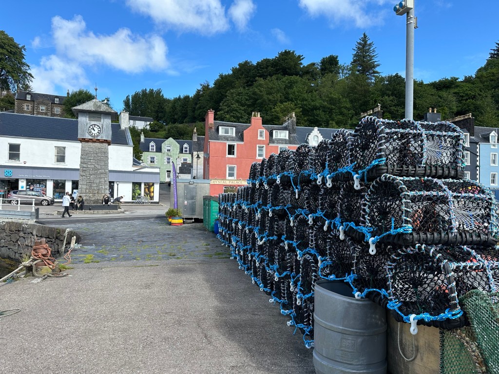
Lobster Pots
Then starting in 1841, when those that had lost their land could not find appropriate accommodation and were living in overcrowded rentals, and had no ability to support themselves were given “assisted passages”. Basically the landlords paid tenants their passage to other countries and the tenants had no option but to go. The Highland potato famine also struck at the end of the period exacerbating the decline in population to the point where the area has the most sparsely populated area in Europe.
What’s down this alley?
Tobermory, the capital of the Island of Mull and a great natural harbour, is in the northern part of the island, and started as a fishing port in 1788. The name Tobermory is derived from the Gaelic “the well of Mary”. It’s said by some that the Virgin Mary had appeared at a nearby well.
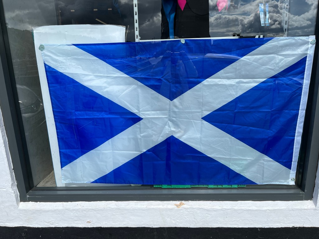
The flag of Scotland.
When the Spanish Armada were fleeing the English in 1588, one ship by the name of Florencia, anchored in the harbour of Tobermory to take on provisions. A fight about settling the bill broke out and before anyone knew it, the ship was on fire and sank to the bottom of the bay. There was a reported 300,000 pounds sterling of gold on board, and despite numerous expeditions no treasure has ever been recovered.
Of interest to us as Canadians was that in the mid-1800s, emigrant sailors travelled to Canada and specifically to Lake Huron in Ontario and founded the small community of Tobermory at the tip of the Bruce Peninsula. There are twin harbours known locally as Big Tub and Little Tub which provide safe harbour on Lake Huron which can get as rough as the oceans. I have visited Tobermory a couple of times and have even taken a boat tour which takes tourists to see two ships that have sunk into the harbour! Small world.
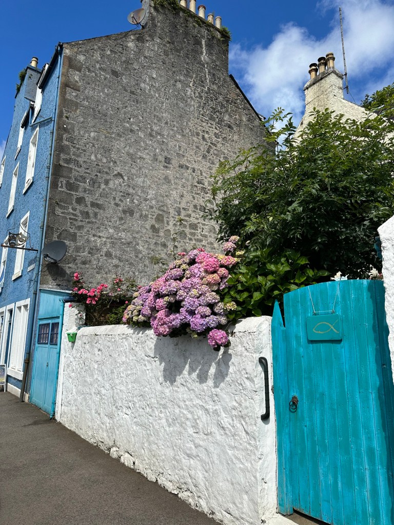
The front street of TobermoryWow, colour!
Charlene and I didn’t book a tour today, partly because the one we really wanted to take was fully booked and partly because we were happy to just have a bit of a slower day. We slept in a little, ok, well one of us slept in a lot! And we got a late start, but took the tender in to wander through the port town of colourful buildings housing restaurants, gift shops, a grocery store, a liquor store, etc. all along the Main Street. Immediately after getting off the ship we saw one of the destinations for a tour today, the Tobermory distillery. It was started in 1798, and has made a scotch whisky named Ledaig for generations.
Charlene in her natural environment
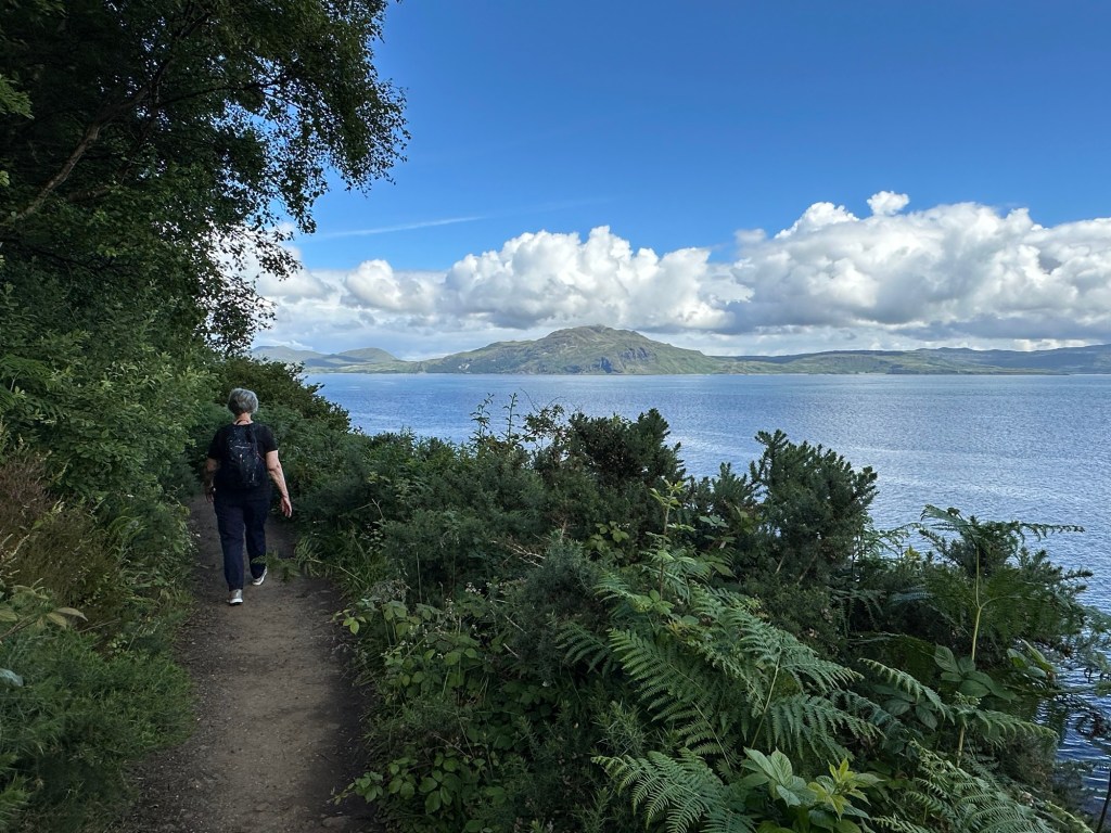
We thought we might hike to a park with trails along the coastal trail to several waterfalls, but after talking to a local, decided instead to head in the opposite direction because there was a pathway also along the coastal route to a lighthouse! It was the right decision. The pathway was a bit muddy in a couple of places but otherwise easy to walk through the trees and wild flowers along the ocean.
Lois in her happy place
And our weather couldn’t have been more perfect. Again we really lucked out. One of the locals told one of the other passengers that we had brought the sun and warmth with us as it’s been a cold and rainy spring and early summer. It is the first day of sun and warmth of the season.
Break timeWhat’s around this corner?A little colour
After 2 kilometres we came to the lighthouse on a point of land along the sound. The lighthouse keeper’s house was large and looked quite luxurious compared to many I’ve seen. It was the perfect thing to do today.
Oh look! A lighthouse! Contemplating life. Rubha nan Gall Lighthouse. 1 of 200 around the Scottish coastline. Busy as a beeOh look, the Star LegendA well deserved lunch with the beautiful island of Mull in the background.
After our return trip down the same pathway we headed back to the ship, and while I thought I’d get my blog done early today, I ended up talking to some passengers and got none of it done until after dinner. I did get a chance for one last shot of the lighthouse as we left port this afternoon. Another interesting and fun day.
Today’s destination was a port in Northern Ireland in a little coastal town named Portrush. We were anchored today rather than docked so had to tender in. The swells were really intense leaving the ship so all hands were on deck to help passengers from the gangway to the tender. Adventure in travel. We are now in the Atlantic, having left the Irish Sea behind.
Can you believe it!
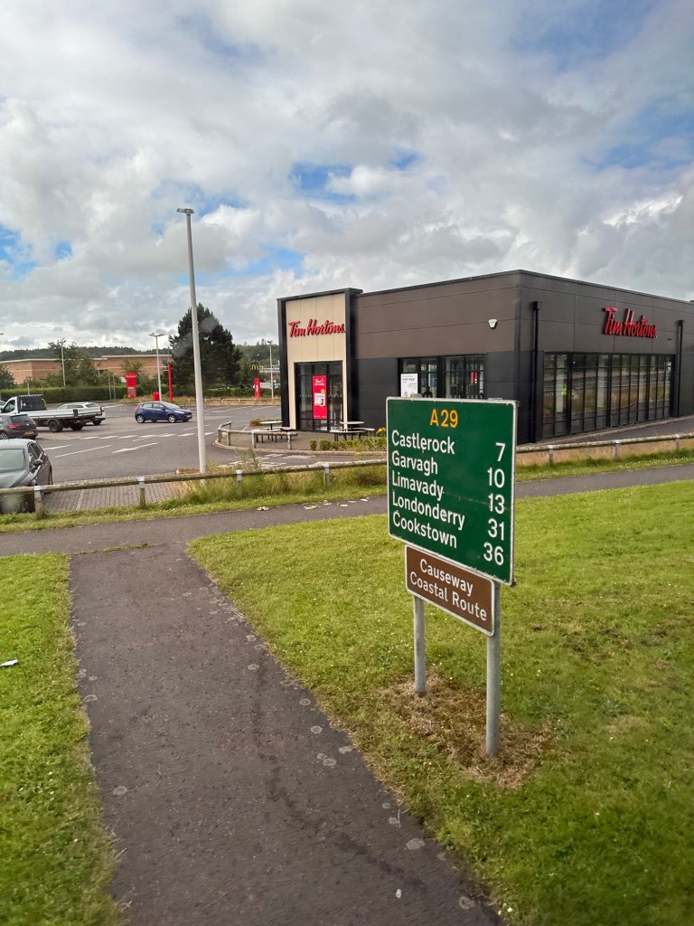
It was really quiet this morning in Portrush when the group of 15 or so of us met our tour guide David and hopped on our bus on our way to Londonderry (or Derry – explanation to follow) this morning. Portrush is apparently well known for their two excellent golf courses. One has hosted the British open twice in history and will be hosting again in 2026. For you golf fans, Rory McIlroy is from just south of Belfast just an hour from Portrush. We were just minutes into our ride when wouldn’t you know, a Tim Horton’s appeared on the horizon! Haha, surprised the heck out of me. The Americans on the bus pointed it out to me but I already had the picture.
We travelled south west to reach our destination through beautiful pastoral scenery and lovely neighbourhoods of wealthy looking homes. There were rolling hills covered in small farms divided by hedges with hundreds of sheep and a million shades of green. It’s called the Emerald Isle for a reason. The highest point is 2400 feet but it rises quickly from the ocean in places.
We passed a town called Limivady which we were told is where the very familiar Irish song, “Danny Boy” was written however it appears to me that although the person in Limivady did have something to do the song it was not actually written there and so the claim makes for a nice story but is a bit of an exaggeration.
David filled our heads with information along the way, and between him, and the talk by our onboard lecturer, my head is ready to explode. And yet I don’t really have a firm grasp of “the Troubles”, which thankfully are somewhat settled. It seems like it is just under the radar though and hopefully will stay there. No one seemed to want to talk about it and I haven’t read sufficiently to know enough to convey a big picture so I’m just going to stick to some details which we’ve been told about along the way today.
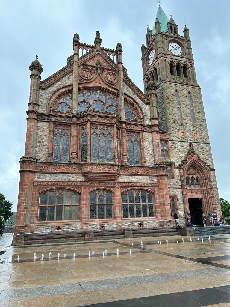
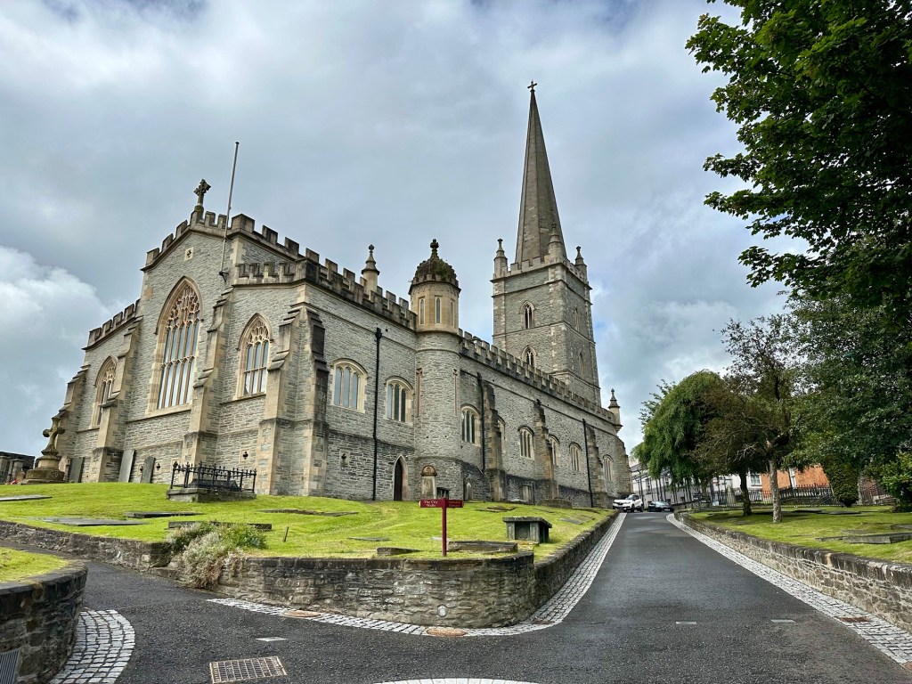
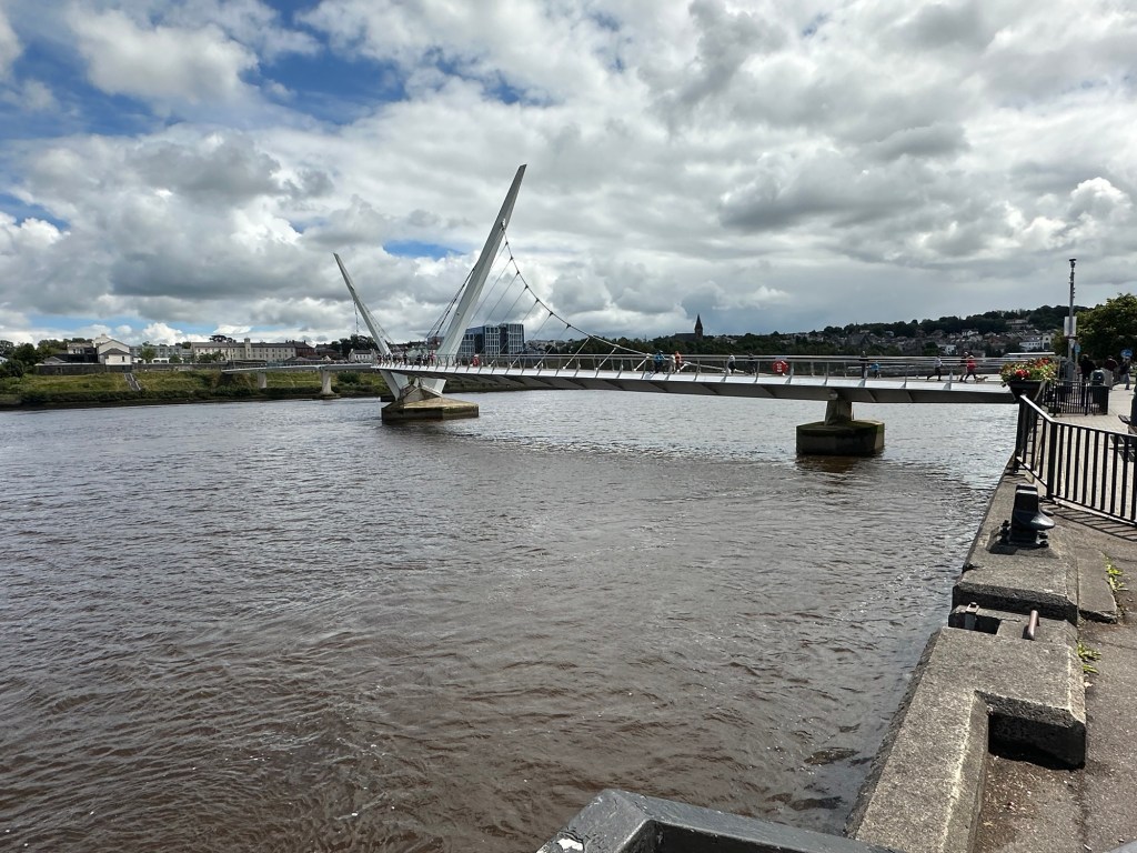
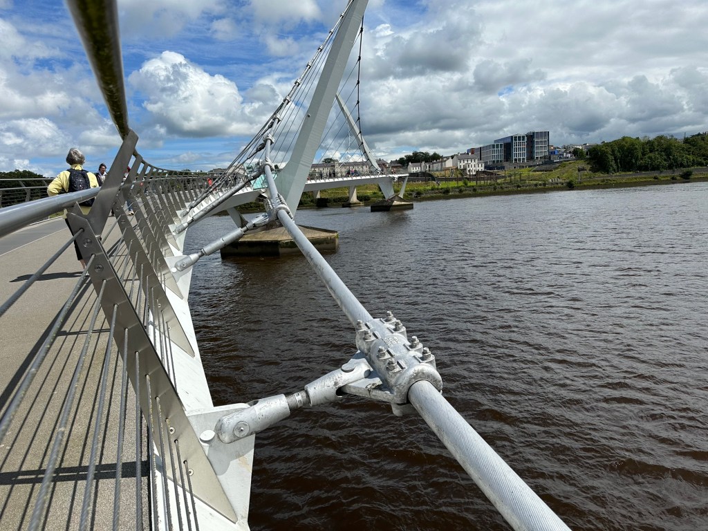
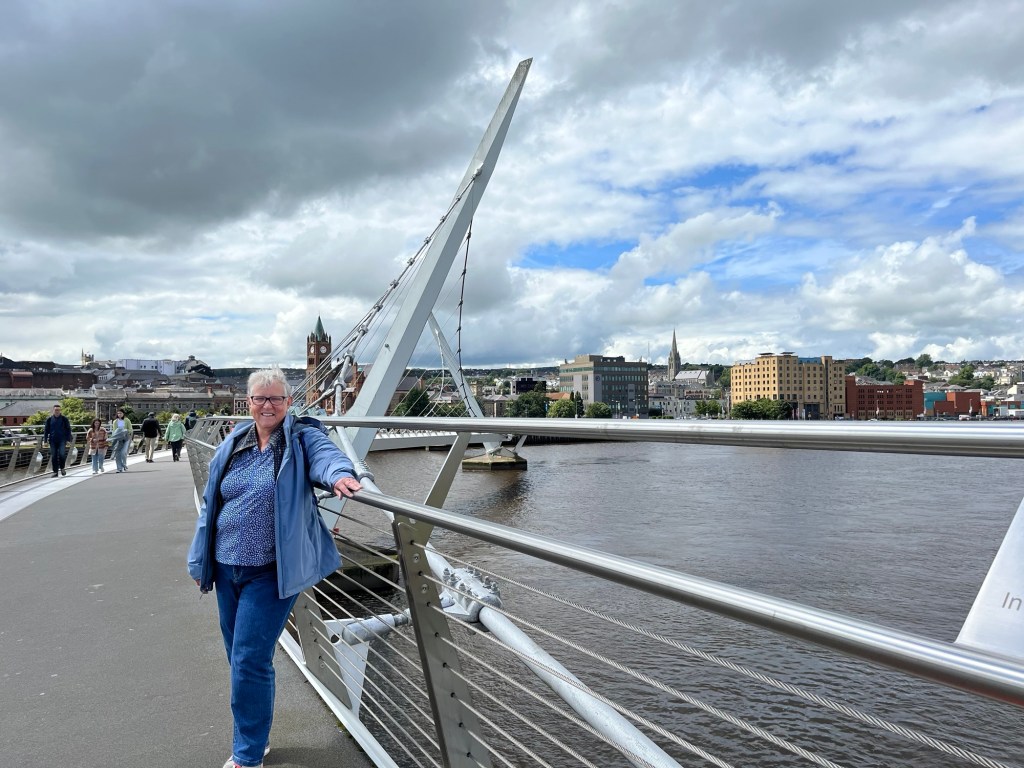
Once we’d arrived in Londonderry we crossed over the Foyle River on a unique two level bridge. The Foyle River flows in to the Foyle Lough and then into the Atlantic. (The Irish call estuaries Lough and the Scots call them Loch). We left the bus at the beautiful town hall in Londonderry and proceeded (after the necessary pit stop) on a walking tour of the city.
Derry City Hall A square beside the city hall in Derry
It is a relatively small city of 115,000 people but Belfast, the capital is not large either at 291,000 or 450,000 in the greater Belfast area. The official name of the city is Londonderry and those that are happy with Northern Ireland being part of Britain are happy to call it that. However, those Protestants that would still like the north to be separate still doggedly refer to it as Derry. I’m going to call it Derry, as our guide did, not as a political statement but because it’s shorter to type!
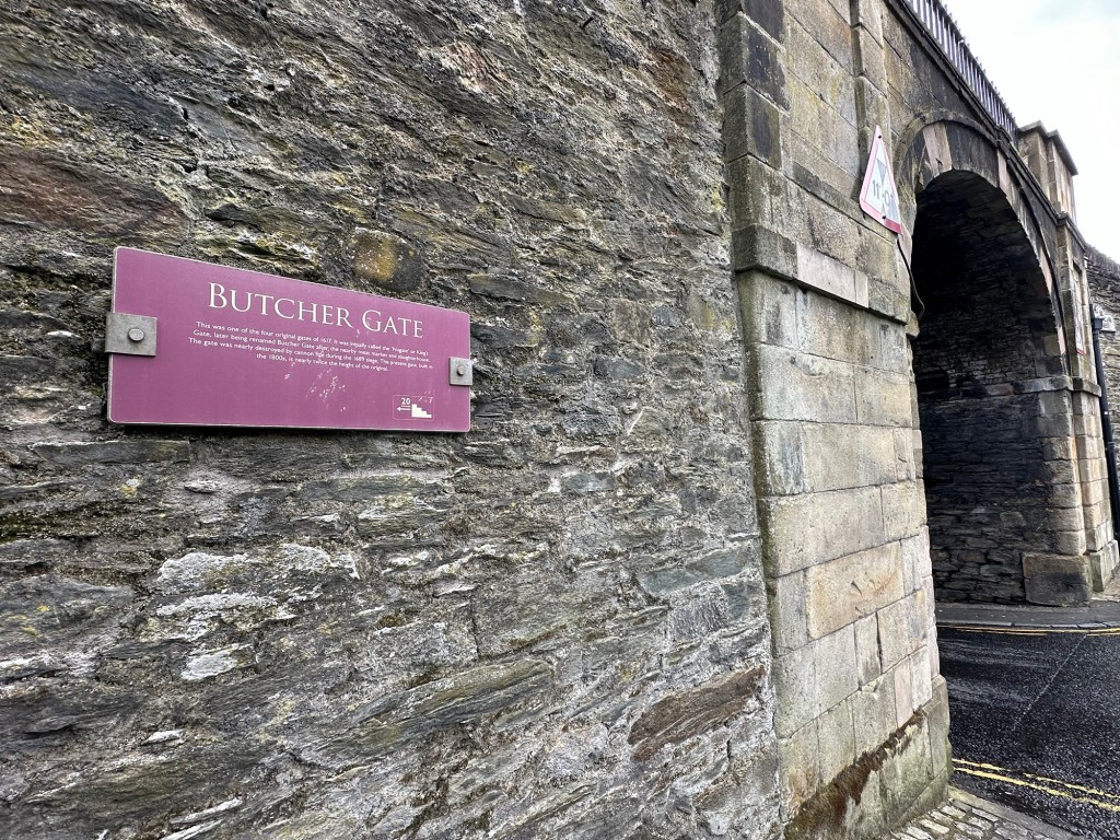
Derry is reputed to be the only remaining completely walled city in Ireland built between 1613 and 1618, and our guide had us remembering other walled cities we’d visited. Dubrovnik and Split in Croatia, San Juan Puerto Rico, Quebec City Canada, and Rye England all came to my mind but I’m sure there are others. But then he pointed out that part of the wall has been removed to build the Millenium Forum Theatre.
It was quiet in Derry too, and was spitting just a little with rain as we walked the somewhat wet streets under one of the 4 gates of the old city and up on to the wall. Along the way he talked a little about the ancient history of the city and the more recent Troubles. We stopped at the site of Butcher Gate, named for the butcher shops that historically lined at street nearby and David told us the story of Bloody Sunday, one of the most significant clashes in the conflict.
Butcher Gate overlooks the area of the city called Bogside, where a majority of Catholics lived. On January 30, 1972 there was a civil rights march in the Bogside area, when one of the British soldiers accidentally shot a bullet in the air, which started on onslaught of gunfire from the British soldiers into the crowd. Fourteen people died and many other victims were injured while fleeing or helping the wounded. It was the most people killed in a single incident during the conflict and worst mass shooting in northern irish history. It obviously worsened the hostilities toward the British and the was a surge in support for the IRA.
The area of Bogside outside the city wallNote the thatched roof. Our guide David A lovely mural visible from walkway along the wall. Oh, and election posters!
We went down from the wall, into the city and walked through the narrow streets toward the beautiful St. Columb’s Cathedral which we were told is a classic example of “vertical gothic” architecture build in 1633. I have no idea what vertical gothic means, something else to look up when I have time.
St. Columb’s Anglican Cathedral
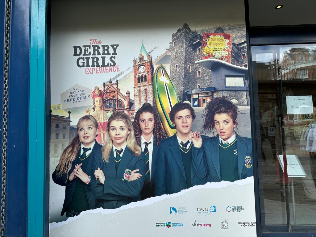
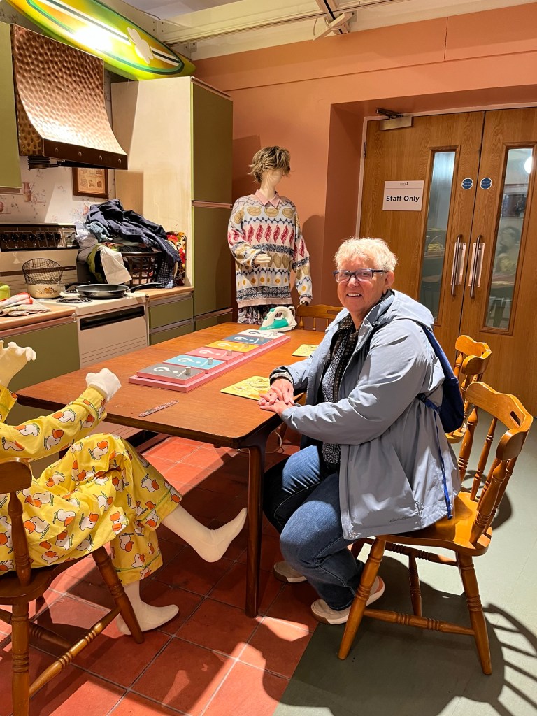
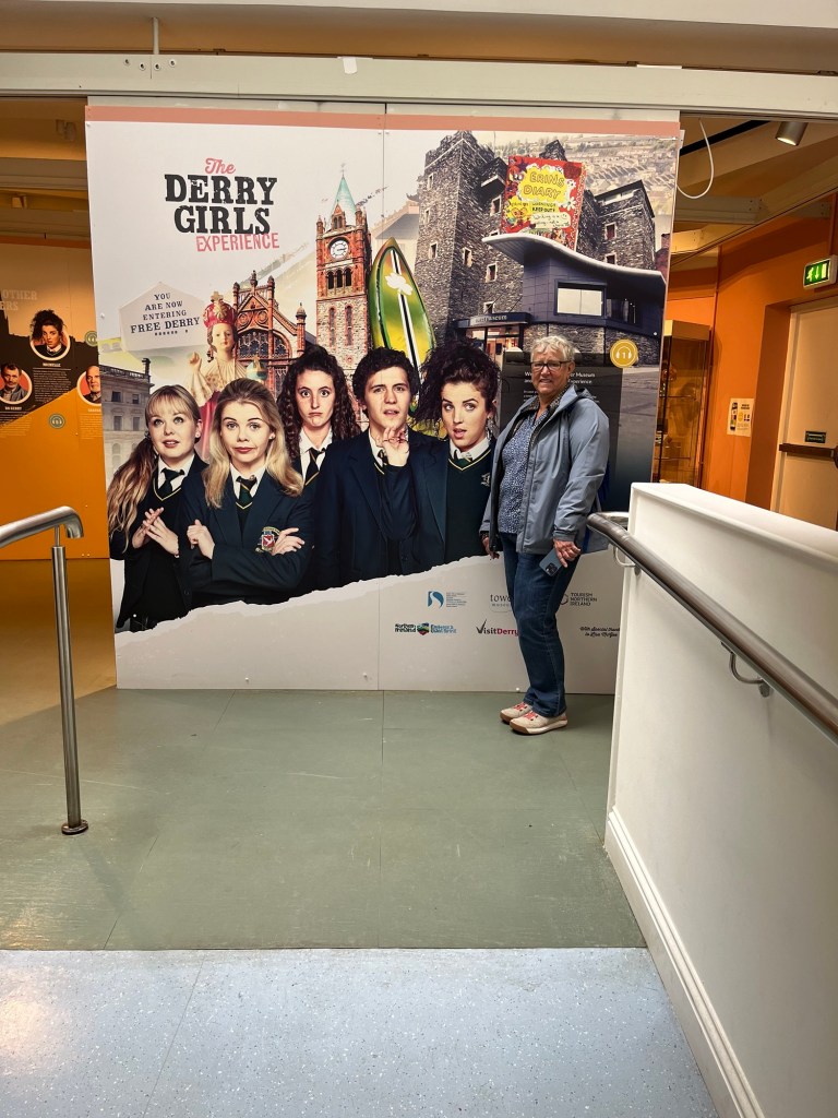
Next it was on to the Tower Museum where we had an hour of free time. There were three exhibits that were really well done. The first was about one of the ships of the Spanish Armada that floundered off the coast, the next was a timeline of the history of Derry and the third was the most exciting to many of our group, the display of props and sets from a well known series now apparently on Netflix called the Derry Girls. It ran for 3 years starting in 2018 and was based on and filmed in Derry. Charlene took my picture on the set for Cara.
Me on the set of Derry GirlsAt the Tower Museum
After our time at the museum we walked for just a few minutes (but practically straight up hill) to a pub, called the Badger for lunch. We discussed what great shape we’d be in if we lived there because everything is up or down hill. The lunch was a nice shrimp salad, a very hearty and nice tasting stewed beef over mashed potatoes, and a dessert that we couldn’t really identify. The problem with the main dish was that the portion was so huge that it was rather off-putting. Most of us only ate 1/2 of what we were served.
Our free time before boarding the bus to take us back to Portrush we spent walking over to the river to take pictures of the Peace Bridge that we’d seen when coming into the city. It is a beautiful pedestrian bridge over the Foyle River which joins two neighbours that were formerly primarily Protestant on one side and primarily Catholic on the other, which our guide said did help with relations between the two neighbourhoods. It was paid for by the EU before Brexit. One wonders if they asked for their money back.
The Peace BridgeThe Peace Bridge
We piled back on to the bus and headed back to Portrush to take the tender back to the ship. It was our night at Candles, one of the specialty restaurants and we wonderful service and a fabulous meal of Filet Mignon. More beef! I’m going to have to eat only veggies for weeks.
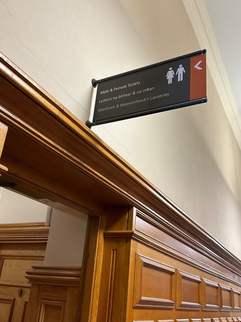
Note the three languages: English, Irish and Scottish Gaelic. And check out the Scottish! Back into the tender dock in Portrush
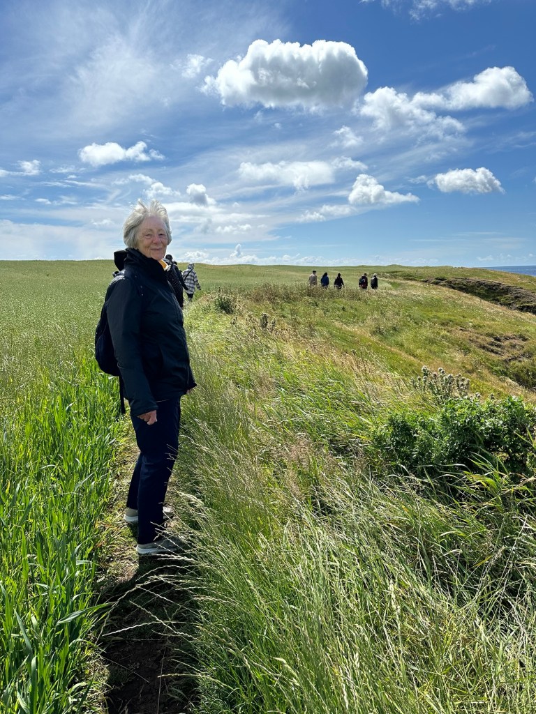
Today was forecast to be raining and only about 12 degrees for our planned excursion to the Isle of Man which included a lengthy walk along some country roads, and the coastal pathway. So we were a little apprehensive about whether 3 layers of clothing was going to be enough. It turned out to be a lovely day, although fresh and windy, but with no rain and mostly sunshine. We took our various layers off and put them back on probably 5 times.
Some day I’m going to take a vacation that doesn’t require another vacation upon my return. Today we walked 7.84 km or 12,490 steps. But it was a very lovely 7.84 km full on interesting facts and stories about fairies and Vikings thanks to our outstanding guides, Jack and Tim.
The Isle of Man is located in the Irish Sea, equidistant from England and Ireland and its strategic location made it important in world trade routes and it helped the allies in the Second World War. It is approximately 33 miles long and 12 – 13 miles across. Its GDP is 6.5 million pounds.
We started our tour of the self governing dependancy of England this morning in the capital and largest town on the Isle of Man, Douglas where the ship was docked for the day. The Isle of Man is owned by King Charles, and he allows the residents of the island nation to live there free from taxes, although the citizens do pay taxes to the government of the island and the island in turn pays England for protection given they have no military.
Jack starting us off on tour.
There are two things the island is know for: the annual Tourist Trophy (TT) motorcycle race and as the place from where Manx cats originated. One of the excursions was a motor tricycle ride around the actual route the race takes, but stupidly we missed out booking it before it was sold out. They, of course, do the track at normal speeds whereas the speeds of the TT racers average 136 mph, and that’s with slowing down to on all the twists and turns of the roads. There is also a shorter race called the Manx Grand Prix for which they are starting to set up the viewing stands and bumpers along the course.
Manx cats are very obviously different from other cats in that they have no tail, or if they have one, it’s just a stub of a tail. They believe this was caused by a really strong mutant dominant gene that has been able to withstand generations of births.
Economically, the island is interesting, and despite the fact that we all visited them today, their tourism industry only makes up 1% of their economy. The island has very favourable tax laws for offshore wealthy investors and it has become an offshore financial centre contributing to 11% of their GDP. On line betting is huge here making up 16% of the economy and 11% is from insurance. The island has a history as a tax haven as there is no corporate tax, no inheritance tax and no capital gains tax. (Think I could move my cottage to the Isle of Man from Ontario?) They have a 22% personal tax rate compared to the rate of 20% in the UK.
As with many parts of the world in this area, the Vikings broadened their empire on to this island with their pillaging and waring, and there are Viking ruins on the island that have been carbon dated to 800- 1000. But I’m getting ahead of myself.
A group of 12 of us left the town of Douglas on a small coach, headed for the town of Castletown where our historical walking tour would begin. We were in the able hands of guides Jack and Tim, who were full of tidbits of information, and a large dose of legend and myths. Just after we left Douglas Jack told us he needed our help because there is a belief that there are Fairies living under a bridge we were about to cross and if we didn’t acknowledge the Fairies we may feel their wrath with back luck. So everyone on the bus cooperated with a loud “good morning, Fairies” and we had only good luck the rest of the day.
We arrived in Castletown in no time and had a bathroom break before heading out. As the name would imply, we there is a castle in the town which we didn’t have time to see which has been in use for various purposed for over 6500 years.
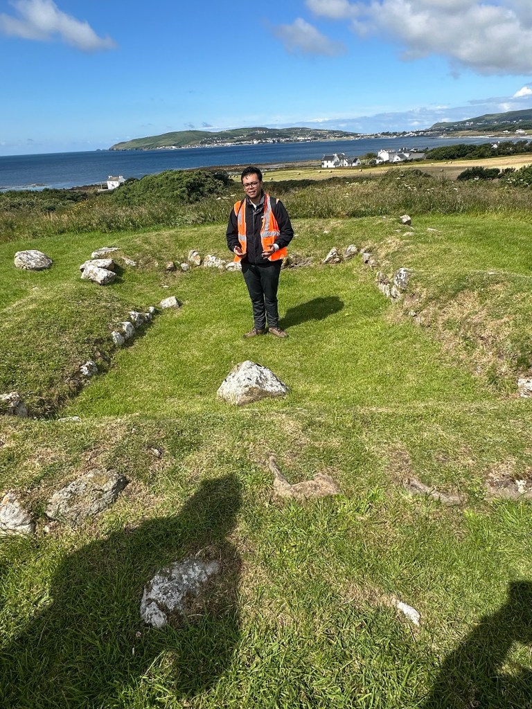
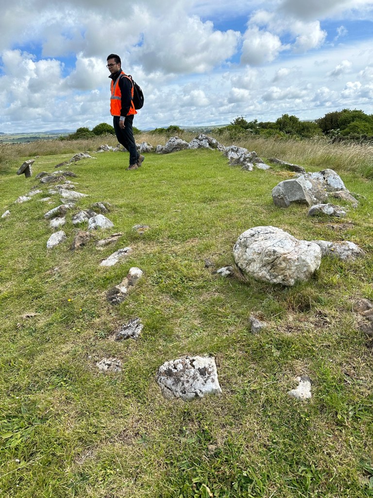
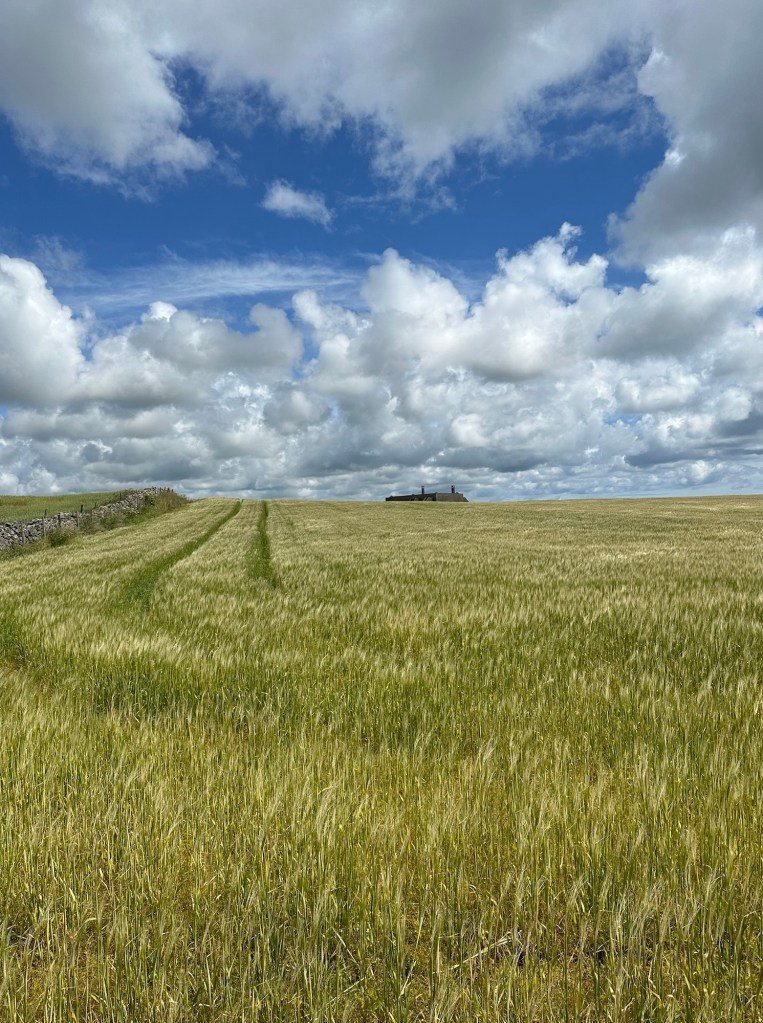
We were driven to the start of a country road, just off a highway, where we started our hike. It was a beautiful bucolic walk, with a history lesson thrown in.
In the Balladoole Historic Monument Site, we saw the remains of an early Christian chapel called a Keeill, from the 10th – 11th century. The missionaries of the time had a belief that instead of building big churches for the people to come to, that they should take the religion to the people. And these small Keeills were built all over the countryside.
Further along were graves dating back the 9th century where a Viking ship had been uncovered along with the bones of a warrior and his wife and animals. It was the custom of wives to be buried with their husbands, whether they were alive or dead at the time! It was believed that this would have been an important person because the ship and the bodies would have had to be hauled up the hill to the top of this hill to be buried.
On route to the Coastal walkway we trooped through a farm yard and past a quarry. The limestone from this quarry is out of sink with the rest of the area as it’s black from the volcanic rock all around. Rock from this quarry was used on the steps of St. Paul’s Cathedral in London.
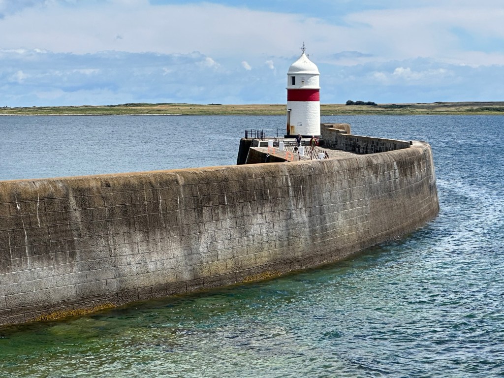
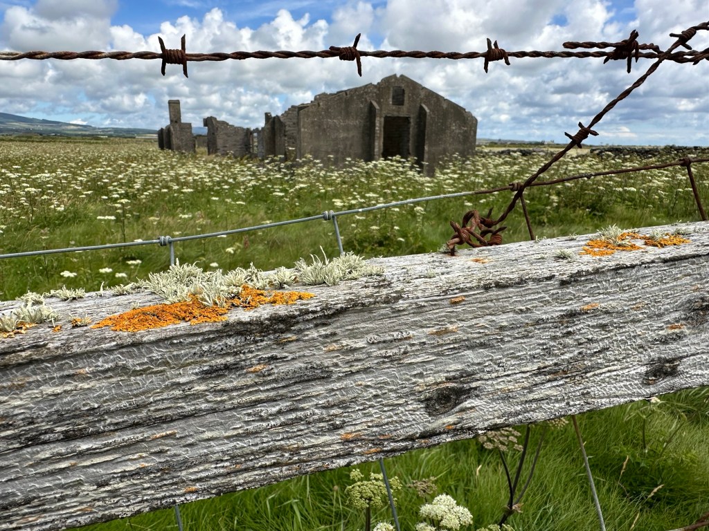
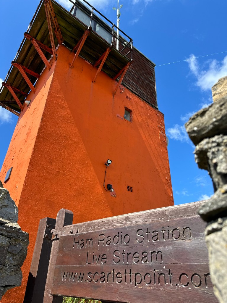
We continued along a road down to the Irish Sea where we joined the coastal walk and followed it all the way back to the town of Castletown. We came upon some ruins of stone buildings in a group across the farm land that were used as training locations for the RAF when radar was first introduced. They were used during WWII to spot planes on route to England as an early warning system. There was also a Ham Radio Station along the coast that the guides didn’t know much about, but was of course of interest to me.
The coastal path ended back in Castletown where we visited the town square which was bustling with a huge big screen tv showing Wimbledon tennis. We stopped for some ice cream before heading back to the bus and then back to the ship. I managed to get some pictures of the Castle but didn’t get a chance to go inside.
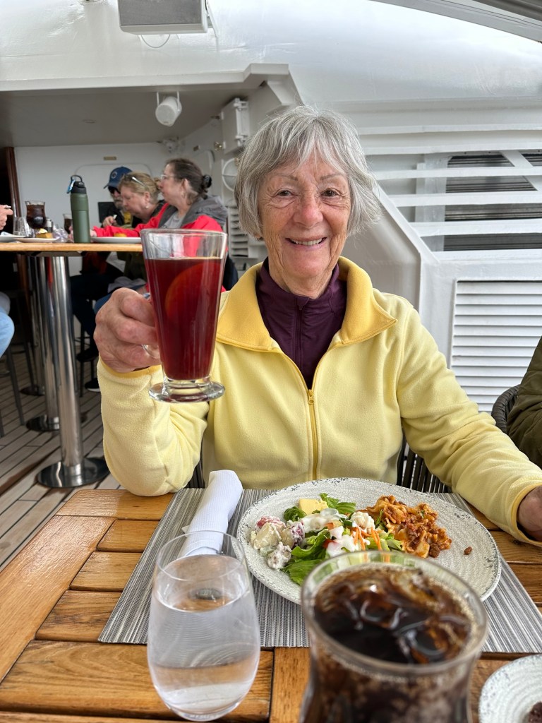
We barely got back in time for Char to enjoy some Scandinavian Glogg that they were offering as the special drink today. She said it was almost as good as what her family makes.
We enjoyed a presentation on how to use your iPhone camera to the best advantage and another by a History Professor on the history of the Isle of Man, and our next two stops. So great to get such good information. Then it was time for dinner at the Spanish tapas specialty restaurant with my favourite churro and chocolate dessert. We’re exhausted already but a nap this afternoon helped.
Fun facts:
⁃ The Beegees were born on Island of Man before moving to Australia.
⁃ They derive 6% of their electricity from burning rubbish (killing two birds with one stone).
⁃ There is a tram that runs from Douglas north and another one south that some of our fellow passengers went on today.
⁃ They use Manx pounds in the same denominations as the English pounds but it cannot be used as currency in any of the other countries of the UK. (Although British pounds can be used in Manx)
⁃ It is unsure where the name of the Isle of Man comes from but could have been from the legendary Manannan Mac Lir who protected the island against invaders by providing mist/fog to keep it from view.
⁃ The symbol of the Isle of Man is that of three legs joined in the middle. The motto of the Manx people is that no matter what is thrown at them, they’ll always land on their feet.