2026 Windstar Cruise

Canada II vs the Stars and Stripes

So, I’m actually home safe and sound, having arrived at 2 am to -10 degrees and blowing snow. But got behind in my blogging, so am writing this while starting the many loads of laundry I have to do now that I’m home.  

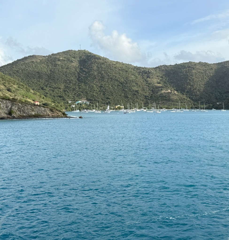
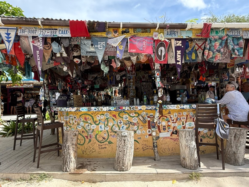
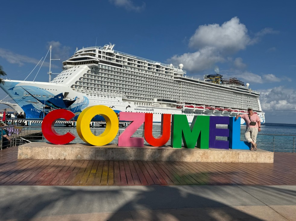
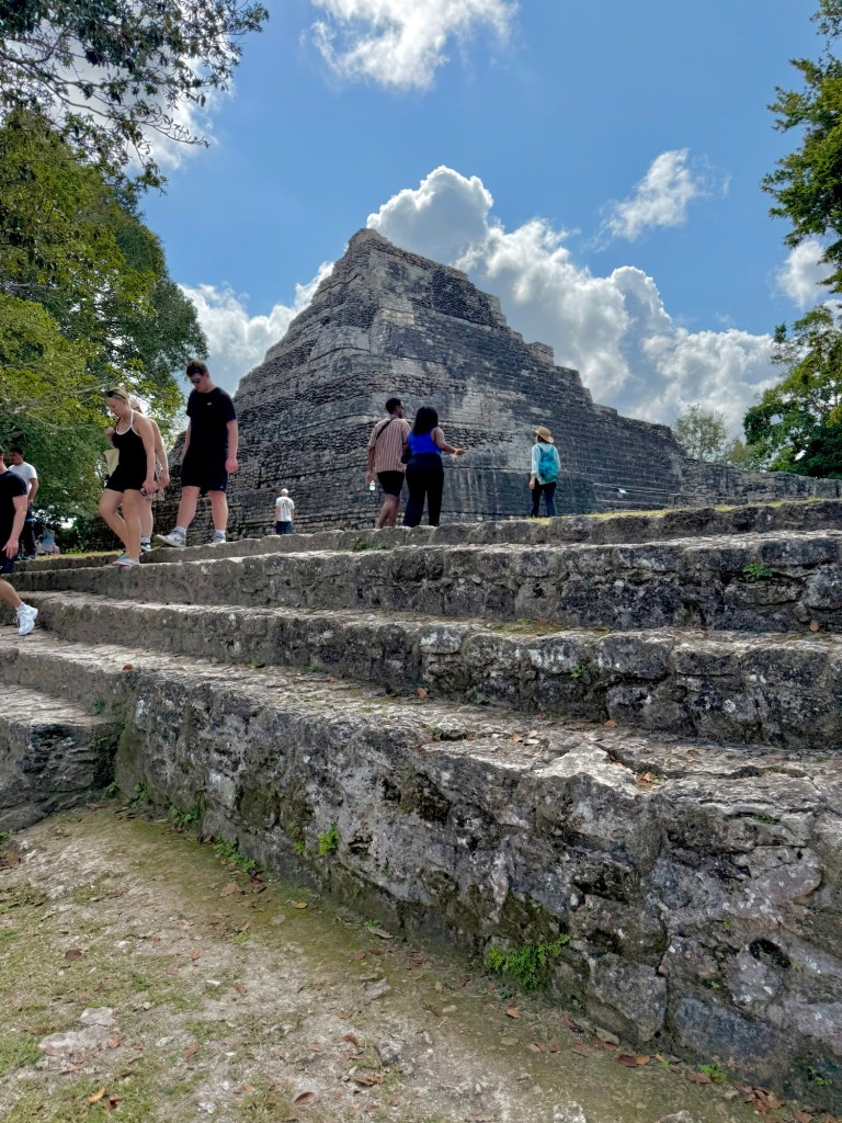
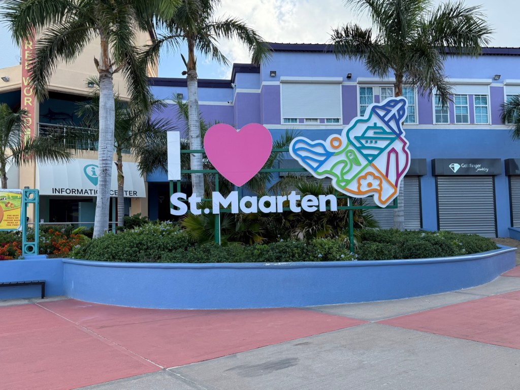
Our final port of call on this cruise was St Martin, an island split between France and Holland, it has a population of only about 80,000.  But each year, more than 2 million tourists visit the island countries, many fly into Princess Juliana International Airport, but the majority arrive, as we did on a passenger ship.  They can have up to 6 of the biggies on any given day. 

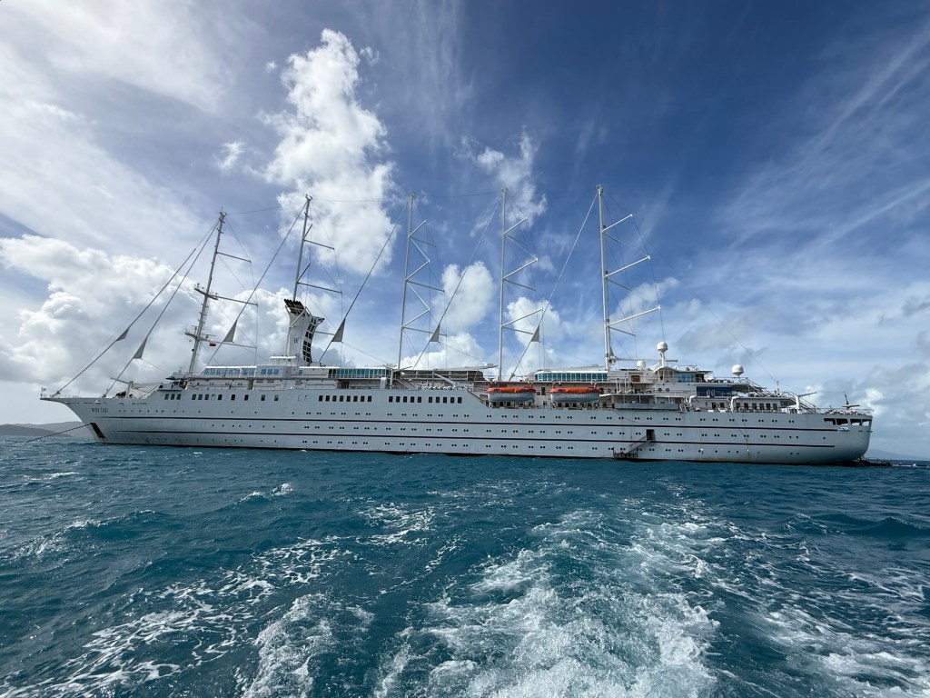
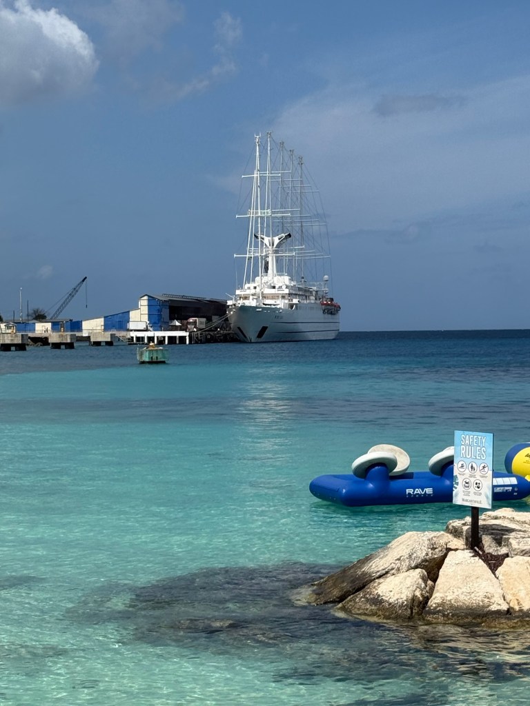
Yesterday there were actually 3 Windstar ships in port which is an incredibly uncommon occurrence. The Wind Spirit joined us early in the morning so I saw her in port, but later in the day, the newest ship in the fleet, the Wind Seeker, pulled in behind the Wind Spirit in a docking location where one of the big ones usually ties up. Sorry I missed seeing her.  

The Wind Spirit
The Windsurf in front, with the Wind Spirit at the next berth.

The infrastructure of the island is not sufficient to deal with all those visitors. The traffic was horrendous, and the airport, although recently opened at twice the size of the previous one, was overflowing with people without seating and air conditioning for it seemed like half the people. Because the post-security areas are so congested I suspect, they don’t let anyone check in until 3 hours before their flights and so the pre-security areas is crazy busy with hardly any seating and limited eating opportunities.  And most cruise ships want you off by 9 am and hotels have 11 checkout and flights not going out til 4 or 5.  

The boarding lounge for 4 flights all going out within an hour

Anyway I’m ahead of myself. 

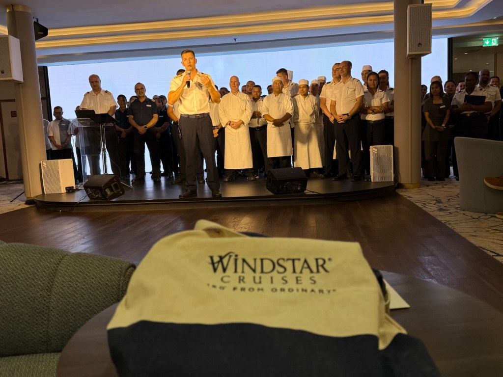
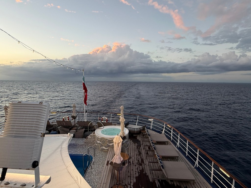
Departing the ship is incredibly tough, especially after 19 days. The Captain, General Hotel Manager, and Housekeeping Manager were on hand to wish us good bye, and the General Hotel Manager gave me a big hug. We had a lovely dinner with him mid-cruise (one of the perks of being a loyal customer) and now we’re best buddies. The Captain also gave me a warm good bye even though one evening I had the audacity to ask him if we were going in the right direction!  Clair and I were sitting on the deck one evening when the Captain was strolling the deck (he’s out and about a lot and totally accessible with an open bridge policy). We had just noticed that we had continued in a northerly direction from Cozumel because we could still see the lights of the mainland of Mexico.  We knew that leaving from Cozumel we should be turning east to head toward the Caymans. After some joking that he had no idea where we were because he’d been sleeping all day (a common thread of his comments is that his crew on the bridge does all the work), he told us that there was a marine conservation park that we needed to go around before heading east. He even called us out at the Captain’s reception the next night in a teasing way and I know I turned bright red and it wasn’t from the sun.  

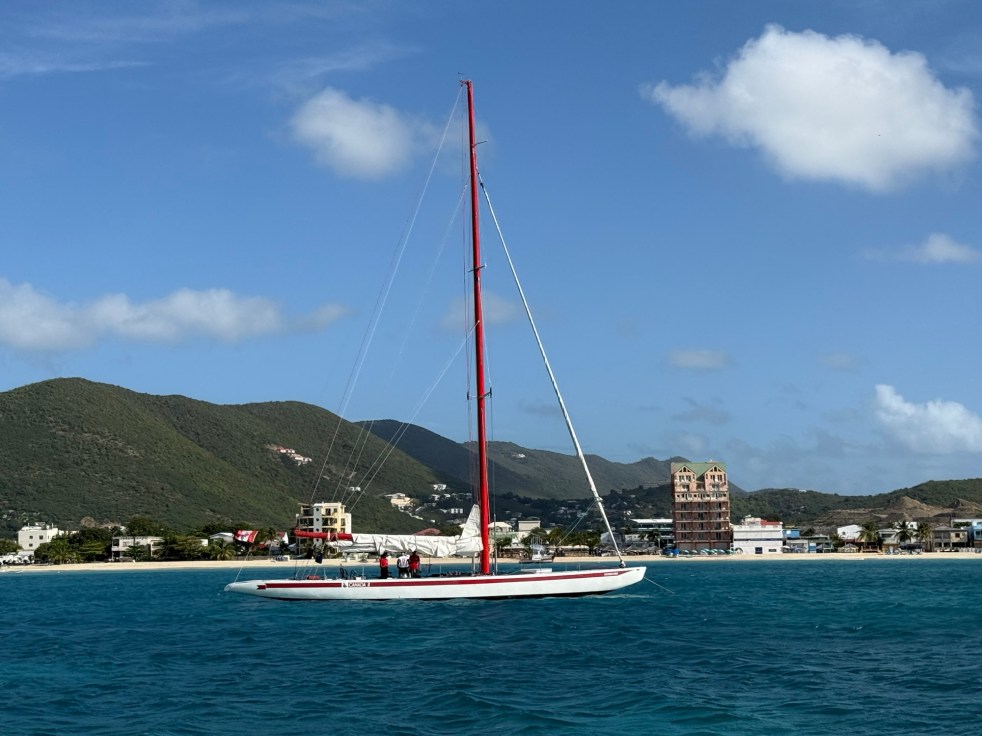
But I had one last hurrah before heading to the airport to catch my 5 pm flight. I signed up to participate in a sailboat race on one of the retired 12 Meter America’s Cup boats living in St Martin.  This was not a sit and watch for a lovely sight seeing kind of experience, it was a full on participatory adventure. I should also add, that I have very little sailing experience and I have to admit that I was a little nervous about it all, but hey, pushing outside our comfort zone is what travel experiences is all about. I should also point out that my terminology might be wrong in a number of instances in this post!  

So we were ferried out to the two boats, Canada II and Stars and Stripes, after being split into two groups – the Canadian and American teams. They thought they were just going to arbitrarily divide the group of 30 into the two teams, but the Canadians, me included, insisted on going on Canada II.  There were only 5 of us, but we were mighty! As we were walking to the dock, one of the Americans joked that if the Canadian boat lost then Canada should become the 51st state. I said loud enough for several people to hear, “I bet he thinks he’s funny” and got some knowing nods from people. After 19 days on the Windsurf there had been no animosity among the mostly American and Canadian guests and I was kind of surprised to see it come out at this point. Anyway, I put it aside and carried on.

Canada II waiting for our arrival

On our way out to the boats, the captain for each boat went through the participants on his boat and assigned each person to a role. He did a great job of assessing people quickly. He said to me and 3 others, “you’re in the back with me”. I had no idea what that meant. I couldn’t hear what the other roles were, except I heard someone assigned as the bartender. (There wasn’t a lot of time for even passing out water!)

Transferring from the ferry boat to Canada II

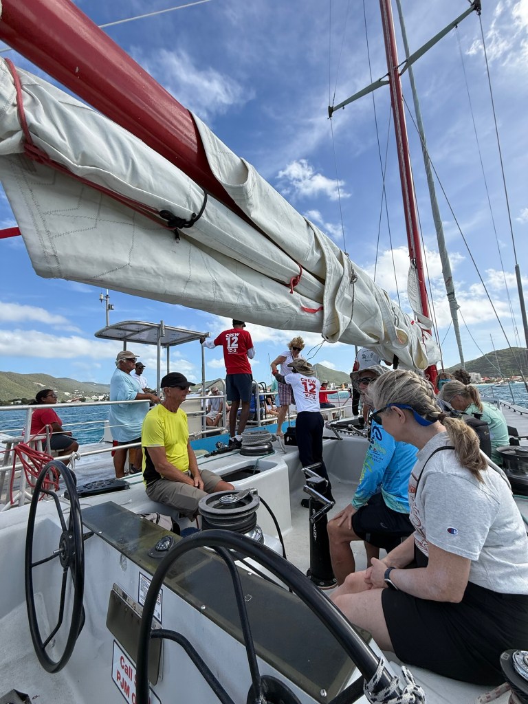
After transferring to the 12 meter old, but still amazing looking boats, the captain and 2 other crew members filled everyone in on their jobs on the boat. I was assigned to what I think was a tailing winch along with another fellow newbie. I was responsible for setting, and releasing the winch and the other with using the handle to tighten the line. It seems like a simple task, but under the pressure of the moment, I was sweating it out worried whether I would do the right thing when called upon. Haha, he forgot to tell me that at times I’d have to pull the line to tighten it up on the winch and had to call to me twice at one point because I didn’t know he was talking to me. Very stressful!  But the Captain’s manner was really great, and he was being careful to make sure we stayed safe.  As he said, he hadn’t lost anyone overboard in the several years he’d been doing this, and no one had lost any body parts, and believe me there was the opportunity to do either of those things if not careful. 

This was the other team in the cockpit across from my partner and I. She is doing the same role on that side that I did on my side. See the foot braces on the floor?
My winch set up

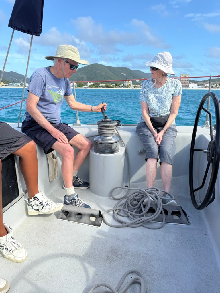
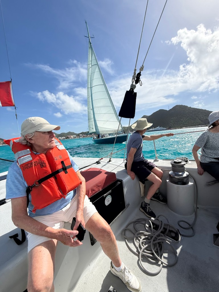
After both boat’s new crew had been trained, we were off for the starting line. We did several circuits of the course which involved both tacking legs and down wind runs and of course rounding two buoys.  It was very intense at times, and I discovered what the metal foot braces on the floor of the boat were for. We were so heeled over so far that I was practically vertical pressing into the braces with my feet, and hanging on to the life line for literal dear life. There were yelled instructions to each of the teams making adjustments as we went with the crew doing the bulk of the heavy work, and helping out where some of the crew weren’t that great at their jobs (like the fellow that was supposed to be using the handle on the winch to tighten the line and kept turning it the wrong way and too slowly – I even reached over and moved it the right way and helped him winch at one point). 

Hoisting the main sail
Being briefed on the course
Making our way to the starting line
Stars and Stripes
The island behind us. Not that I had time to admire the view.
Another view of the Stars and Stripes with St Martin in behind.

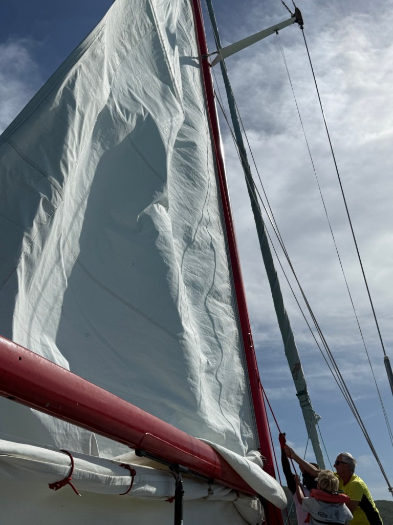
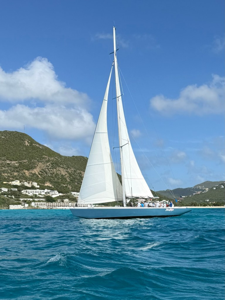
There was the snap of the sails, the wind in our faces, the occasional cold splash of some waves breaking over the boat and being so heeled over I thought for sure we were going to go over. And we were going fast! You’ll notice there aren’t a lot of pictures during this time because my hands were busy either releasing, setting up, pulling or hanging on for dear life. What. A. Rush.  

In the end, I guess the Stars and Stripes won, but we were at totally different parts of the course at times and I lost track of how often we’d rounded buoys, and was surprised, and totally disappointed when he said, “OK, everyone can stand down and we’ll take her in.” 

What an amazing experience! So glad I put up with being sweaty, and salt sprayed as I made my way home on two flights and didn’t get home til 2 am.  

What a great way to end the 3 weeks. Thanks for coming along on this journey with me again.

With all that’s going on around us in the world, travel is getting more “interesting” but I refuse to give up exploring. Where shall we go next? 

2026 Windstar Cruise

Two times, lucky! 

Virgin Gorda is our second stop in the British Virgin Islands, after visiting Jost Van Dyke yesterday. And it’s my second attempt of actually doing something here. On a previous cruise we were meant to stop at Prickly Pear, a national park on the island, for our Beach Barbeque, but because of the swells making the entrance between islands difficult, the Captain made the tough decision to anchor off the main city of Spanish Town and it meant that we had the beach BBQ on deck instead. Hardly the same ambiance. This time, thankfully, the weather, winds and seas cooperated.

This morning we had one of those “core memory”excursions on Virgin Gorda to an area called “The Baths” in Devils Bay. This area has rock structures which are unique to this island in the BVI and unique to this part of the island. They are massive boulder-type formations and the way the boulders have been scattered along the edge of the bay creates interesting caves, tunnels and pools. 

Our transportation was different on this island. Our busses didn’t have skinny aisles, or small seats, but rather was bench seats for 4 across, with no sides! There was a roof to keep the Caribbean sun off thankfully, but the sides were open to let the breezes through. It allowed for great scenery viewing but some of the curves were a little unsettling. I forgot to take pictures of the buses. I really have to get a better photographer.  

We did the usual Kodak moment stops, a coupe of times on our way over the back of the island and down the other side. We were able to have a look at Spanish Town as we crossed the island at a skinny park to get to the National Park. Our driver pointed out one of the nearby islands that has some wind turbines on it and we were told that Sir Richard Branson owned that island and another and that he could often be scene riding his bike on Virgin Gorda. Given the hilly island, he must be in very good shape! If you have a cool $60,000 you too could stay at a deluxe room on the island.  

Richard Branson’s island is the last one you can barely see on the far top-left
You can just make out a small island at the top left. It’s one of the two that Richard Branson owns.

Once arrived we started this adventure with an easy hike down to Devil’s Beach from where our buses were parked on a small hill. In no time we reached a beautiful beach, and started our adventure through the huge boulders to get to the next beach area. 

On our way down to Devil’s Beach
A photo op on the way down
Near the beach

What came next was was not a normal lazy walk on the beach. There were some areas we could walk along with the beautiful sand under our feet, others where we had to wade in knee deep water and some where we had to climb or descend stairs, or climb across rocks using a rope to help. It felt a little bit like being Fred in the Flintstones!  

The water was crystal clear and pretty much body temperature so it was really comfortable. The name for The Baths comes from the pools of water in various spots that seemed like bathing areas, and also the geological term for the boulders which is ”batholith”.

The light in the various sections of the caves formed by stacked boulders was so soft and magical, it gave everyone a lovely glow. We could see patches of blue sky overhead at some points and at others we were in a completely enclosed space. Some of the chambers had an ethereal or cathedral feel, and it reminded me how awesome it is to spend time in nature, whatever its form. 

Scrambling along the rock at the top of the ladder while also twisting and bending to get through the opening.
One of the man-made structures to help us along our route.
Clair had to bend over to get through this one.
Into another chamber
A peak at the sea in between structures
This was probably the most challenging. It required us coming down on these stairs sideways while leaning over to avoid hitting our noggins.
The light shining through into this cave or chamber was beautiful

Clair in the beautiful soft light.
Ok,this was the most challenging. There was a rope anchored into the rock to help us across this angled boulder, that was wet and sandy and although not obvious from the picture it was really slanted.
Coming out the other side.

After about 20 – 30 minutes, we reached the next beach safely, and were able to enjoy the beach, stop for a drink or shop. However, those that intended to swim were disappointed because the red flag was flying. It was pretty rough in the unsheltered areas with a bit of an undertow. 

All in all it was an awe inspiring activity and I’m so glad we challenged ourselves to do it. I had a “Thank you, Braxton” moment once again when I was able to manage the physically challenges easily. That will keep me motivated for another few months of training. 

The sunshine was so bright I couldn’t see if those toes were in focus and they’re not. Oh well.

After the compulsory and congratulatory (we made it through The Baths) rum punch or “baby juice” (without the rum) we climbed on to our buses and took a different route back to the tender dock. Enroute we stopped at another scenic view point. This time the overlook had a spectacular view of an almost deserted white sand beach. We were told that this was one of only two public beaches which are accessible by car. But on a beautiful day, there were only a handful of people enjoying it.At the end of the beach there was a modern home with a patch of bare land slightly up the hill from it. Our guide told us that the owners of the home purchased the home and property above them when it came on the market and they tore down the house that was on the property to put in a heliport.  

We went by tender directly to Prickly Pear Park for a beach barbecue set up for us by the amazing staff at Windstar. They set up a wonderful lunch including chicken, burgers, fish in foil, salads, and all the fixings. They also set up a full bar, have massages on the beach you can book and they bring the water toys over from the ship (kayaks, SUPs, etc).

We had enough sun this morning so we spent a little time at the pool in the shade once back on the ship, but then the ritual shower/nap/trivia/port talk took us to the time for the farewell reception, hosted by Captain Maren.

We have really been enjoying one of the performers on the ship, a violinist, and he played some iconic tunes for our enjoyment before Captain Maren introduced his whole team from the engine room to housekeeping to the wait staff and the deck crew. The stage was packed. They got a standing ovation from the packed house, and it was clear they were all a little taken aback. The Captain said they have never received such an overwhelming response and thanks from the passengers. They deserved it. They work so hard and provide us with special care wherever they are stationed on the ship. Your table and seats in the bar area now in the sun, just a minute we’ll move the table and chairs for you. Want another English Breakfast tea in a take away cup, no problem. Want a cookie to go with that, or a scone with jam and whip cream? Nothing is too much trouble. 

Danyi, a master on the strings, both violin and guitar and I think piano too.
Matt O’ the Entertainment Manager and Trivia host extraordinaire.
Captain Maren from Croatia.

Then it was dinner in the main dining room for the last time on this cruise and unfortunately our favourite server’s section was already full because we dilly-dallied speaking with our entertainment manager in the lounge. But we went to his section to say good bye after our dinner and got big hugs from him and his assistant server.

Today was an awesome day as it always seems to be when I’m around or on the water. (BTW, Wait til tomorrow’s post! ) 

And then there were no more excuses, I had to pack because suitcases had to be out by 6:30 and customers started at 7:45 in the morning. 

2026 Windstar Cruise

My 19 day cruise is down to 3 nights, sigh.

Leaving the Surf and heading in to the Beach

I’m coming to the realization that after 3 more sleeps, there will be no one to make me a cheese omelette, well done, or bring me my English Breakfast tea without even having to ask for it. And I’m pretty sure the snow has not all melted at home.  Sigh. Oh well, will enjoy our last few days to the fullest. 

We are down to two last stops on this fabulous cruise, and they are both in the British Virgin Islands (BVI). Jost Van Dyke today and Virgin Gorda tomorrow. Then it’s on to Sint Maarten/Saint-Martin for one last adventure before flying home Saturday afternoon. 

There are 4 larger islands in the BVI archipelago and a bunch of small ones. Tortola is the largest and the capital, Road Town, is located there but the other 3 are Anegada, Jost Van Dyck and Virgin Gorda. The population of this British Overseas Territory is about 36,000, with most of the population in Tortola and on 16 of the more than 50 islands.  

Unlike other Caribbean islands it’s thought that Joost Van Dyck a Dutch privateer and perhaps sometimes pirate may have been the first one to discover this island; however, it was British Quakers fleeing persecution in England in the 1700s that first settled here. The island citizens were granted British citizenship in 2002. The current population is only approximately 300. 

It’s thought that Joost Van Dyke and other pirates used the many bays and inlets as hiding places for their ships. Eventually sugar cane and cotton were grown on the island, which would have employed slaves although they were emancipated in all of BVI in 1838.  

This island and many in the BVI were hit hard by Category 5 hurricanes, Irma and Maria, both in 2017. Most buildings were destroyed and the island was stripped of it’s vegetation. The islanders were mainly on their own and they worked together to combine their resources. The one remaining working refrigerator was at a beach bar named Foxy’s Tamarind Bar and Restaurant and all food that could be preserved was brought there. Foxy is a natural leader in the community and for his efforts, he was knighted in 1968 for his humanitarian efforts, and in other projects for improving life in BVI. 

The draw to Jost Van Dyke is the many beautiful white sand beaches and coves around the islands that are ideal for boating. The bay at Great Harbour is the most well known and biggest, with White Beach in the next bay as a close second. There are restaurants and bars along both beaches some of which are really well known. After the emancipation, charcoal, a byproduct of the cotton and sugar cane industries became a viable export.  

White Bay

Jost Van Dyke’s population is unusual for the Caribbean because of its population’s young age. Nearly half the residents are under the age of 35 and almost 70% under the age of 50. Perhaps because of this, two of the most famous beach bars in the Caribbean are on the beaches of White Bay and Grand Harbour.  Foxy’s and the Soggy Dollar Bar are institutions and a frequent stop by the yachting community. The Soggy Dollar Bar has been given credit for being the birthplace of the drink called the Painkiller. The bar’s name comes from the practice of the many boaters who drop anchor in the bay and then swim in to the beach to enjoy a few drinks or meal, and yup, their dollars get soggy.  

Great Harbour

Another bit of trivia we learned the last time we were here is that the architect and designer of the US Capital building in 1793 in Washington DC, William Thornton, is from Jost Van Dyke. He received $500 and a building lot in the city of Washington for his composition. He was trained as a medical doctor in Great Britain and then moved to Washington where he continued to have influence on architecture there. 

The last time I was here, I took a snorkeling adventure but we decided not to book an excursion for today but rather had a leisurely wake up and then grabbed a tender over to Great Harbour to check out the beach and Foxy’s Bar.  The tender made its way around the plethora of lovely yachts anchored throughout this pretty perfect bay. 

This church was destroyed by the hurricanes and hasn’t been re-built
The island’s cemetery

We sauntered along the alluring white sand beach with a stop for the required toe nails picture! There were some other shops and bars along the way, but they weren’t very appealing, and our goal was at the end of the beach, Foxy’s. It’s quite the place. Charming in a dowdy, run down kind of way. Surprisingly, it had one of the nicest souvenir shops we’ve seen, with reasonable prices and nice quality.   

Those of you who know me well will be shocked to hear that I participated in a strawberry margarita at 10:55 in the morning! I’m not sure it actually had alcohol in it, though, as it didn’t seem to have any effect. Just seemed like the right thing to do at an enticing, charming and fun place in the British Virgin Islands.   

The Windstar Wind Spirit was in the same port today. It normally has 4 masts but one is broken. She’s going in for refit in a couple of weeks.

Our days have pretty much followed the same pattern of going out on an excursion, coming back for lunch, hanging out in the shade at the pool, and then cleaning up, napping and getting ready for Trivia. We’re terrible at it, but the Entertainment Manager, Matt O (for O’Brien) is a great host and it’s always a million laughs.  Then it’s on to the Shore talk to learn about tomorrow and then time to eat again!  And then time to sleep again! Live just doesn’t get better, does it? 

On the days when we take a tender, there is usually iced tea and water, along with cookies set up for us on the pier to enjoy while waiting a few minutes for the next tender.
And here it is.
2026 Windstar Cruise

Our Second Stop in Dominican Republic

The Chavon River

Today we arrived in the port of the city of La Romana where we are once again tucked safe and sound just inside the mouth of a river, this time the Rio Romana. It is a small but nice cruise ship facility and when the busses rolled up to great us, man were we excited. More on that later. 

First a little history of La Romana. The city was founded in 1897, as a port for export of timber and other goods and then in 1917, with the completion of a large sugar mill, the economy was revved up attracting workers from across the Caribbean to La Romana. 

By the way, gold mining is the second most important industry in Dominican Republic with the opening of the Pueblo Viejo mine, as a joint venture between Canadian company, Barrick Gold and Newmont Corporation from Denver.  It is one of the largest gold mines in the world.  

In recent years, the economy has shifted to tourism. The construction of Casa de Campo made it an attractive high end destination and one of our stops for today. There are 7 cruise ship piers, 7 international airports around the country to help facilitate the 11 million tourists per year who arrive in Dominican Republic heading to the beautiful beaches on the island.  Punta Cana is the main tourist area and is a two hour drive to the east of where we are docked today. 

Some fun facts given to us by our guide today:

  • Dominican Republic shares the island with the country of Haiti which is on the west end of the island. 
  • It is situated in the Caribbean, only 112 km from Puerto Rico and about the same distance from the eastern point of Cuba. 
  • there are more than 400 rivers in Puerto Rico
  • 65% of the land is covered by National Parks
  • $200 per month is the average salary
  • There is both private and public medical and education here
  • Cars are expensive but homes are relatively cheap
  • The national drink is rum. 

Our tour started today boarding beautiful large and modern tour busses that were large enough that we didn’t have to double up and we didn’t have to squeeze sideways down the length of the bus to get on. Very exciting after some of the modes of transportation we’ve had starting with a Dodge Van that must have been one of the original models off the production line. 

The U.S. company that built the sugar mill, also built homes for its workers that came to run the plant. The cruise ship port was very near the mill and we passed many of these lovely homes with really well maintained properties as we traversed the neighbourhood as we started our day of exploration. 

We didn’t have to travel far out of town to reach our initial destination, of Cueva de las Maravilla. (Cave of Wonders National Park). It was a really well maintained park with great facilities and fantastic lighted pathways and stairs into a huge area of caves where the original people of the area, the Taino people had made ancient paintings, petroglyphs, pictographs and paintings.  

Hard to get a sense of scale here, but this is a huge area
The blue colour is from the lighting effects

The pictures don’t really show the beauty of the caves, with the great job they have done of lighting the various features, not to mention the stairs and pathways. The lights were on motion sensors and changed from time to time to profile certain features. Describing it, it sounds like it might be gaudy, but it really wasn’t. My favourite spot was the Water Mirror Gallery, and you can see the effect somewhat in the pictures. 

Water Mirror Gallery
Clair looking up!

It was 235 stairs down and 235 up to experience the main part of the caves, so our step and stair counts were high again today. 

They also have an iguana conservation facility at this site, to try and save the endangered Rhinoceros Iguanas that are unique to this island. They’re big fellas! 

Those beautiful busses took us back toward the city and to a small portion of Casa de Campo that we visited today, the Altos de Chavon. 

Casa de Campo is one of the most exclusive resort destinations in Dominican Republic on 7,000 acres, and including a hotel, resort, residential community with such amenities as 3 golf courses, marina, tennis courts, equestrian centre and polo facilities. 

It is also home to Altos de Chavon (High River), which is a re-creation of a 16th century Mediterranean-style village, on a hill top overlooking the Chavon River. It also has a cultural centre, archeological museum, and a 5,000 seat amphitheater where you’d swear you were in a Roman ruin somewhere. It was inaugurated in 1982 with an HBO live special with Frank Sinatra. Others to have performed there include Sting, Elton John, Michael Bublé, Andrea Bocelli, Gloria Estefan, Marc Anthony, Air Supply, and Julio Iglesias. They were setting up for a concert on Feb 28, with a performer whose name I didn’t recognize when we were there today. 

The stone is all coral

Walking around Altos de Chavon, you had to be amazed at the artistry and workmanship of the village, all done by local artisans. The gardens, statues and stonework were just beautiful, as were the hills and river below. 

It is not only a tourist attraction, but is also home to the Altos de Chavon School of design, affiliated with the Parsons School of Design in New York City which is consistently ranked as a leading art and design school in the U.S and the world. The students here live above the shops and restaurants and there are active studios throughout the property for various mediums such as pottery, weaving, silk-screening etc. What a fabulous environment to be inspired by as an artist! 

We didn’t have much time there and we could have spent all day, but it was great to get a cursory look anyway. It was really hot (not complaining, just stating a fact), so it was pretty quiet on the bus trip back to the Wind Surf.

Oh look, a proper lighthouse!
Heading SSE for the British Virgin Islands

It’s sadly only 4 sleeps til I head for home, with a sea day tomorrow, a day anchored at Jost Van Dyke, British Virgin Islands (BVI), and our final day at Virgin Gorda, BVI before our disembarkation at Saint Marten on Saturday. The time has gone by fast, but I miss my little humans, so will be ok with heading home. Now if the snow would all just melt before I got there I’d be a happy camper.  

2026 Windstar Cruise

Santo Domingo-the oldest of everything in the Americas

Fortaleza Ozama as we were enjoying our deck barbecue tonight.

We have been so lucky with the weather on this trip. The week previous to us getting on Wind Surf was reported by the passengers on board when we joined as cold and rainy all week. We had rain in Bocas Del Toro and a few little drops a couple times when a cloud went overhead but 99.9% of the time it’s been warm with beautiful blue skies. I’m not going to complain about the humidity of 85% today as we climbed down and then back up the steps at the caves.  Getting too close to heading for home to do that. 

Our Wind Surf docked on the Ozama River, in a very safe port

Today we visited the capital city of Dominican Republic, Santo Domingo. It’s also the oldest continuously inhabited European Settlement that became a city in the Americas founded by the brother of Christopher Columbus, Diego Columbus, in 1496. He was also the Governor of the Indies in 1509. 

The Fort upon arrival at noon.

It also makes claim to having the first cathedral in the Americas (which we visited today), the first university and the first hospital and monastery in the New World. Unlike his father’s remains, it is widely agreed that Diego’s remains finally resting place is in the Cathedral in Seville Spain. It’s not clear where Christopher Columbus’ remains are, because both Seville and Santo Domingo make claim to them. His remains were moved several times and it’s possible the ashes became separated and some do lie in both locations. DNA testing has been done on the ashes in Seville but Santo Domingo would not allow the ashes her to be tested and it’s generally accepted that they are in Seville, Spain. I have a picture of his mausoleum from my visit to Seville years ago. 

Its Colonial Zone, which is what the oldest part of the city is referred to as, is a UNESCO World Heritage Site and we were docked right across the street from one end of the zone, where we can practically touch the Fortaleza Ozama, the Spanish Fort that made up part of the Colonial Zone. 

The city’s population is approximately 4 million, and it’s divided east/west by the Ozama River with the Colonial City on the west side. 

The Columbus Lighthouse or Faro de Colombo projects intense light beams into the sky on special occasions and they can be scene as far away as Puerto Rico. 

We left the ship late today, as we didn’t dock until noon and jumped on another of the skinny busses for our afternoon tour. First stop, the Three Eyes Caves (Los Tres Ojos National Park). There are apparently 48,000 caves in the limestone on the Dominican Republic side of the island shared by it and Haiti, and these are but 3, that are easily accessible. 

See the tiny people down there, that gives you an idea how many stairs we had to walk up and down to see the caves.
The entrance to the walkway through the open air caves

We walked down many stairs in 85% humidity to see each of the three caves, each quite different, but all three with beautiful clear turquoise water. They reminded me of the Cenotes in the Yucatan peninsula in Mexico which are also sink holes caused by the erosion of the limestone.  One of them is called El Lago de las Damas, because apparently women and children used to swim without clothes in the past. Another of the caves has a hand-pulled “ferry” which goes from one of the caves to a fourth cave that we didn’t go on as it is deemed not really safe after it tipped over not too long ago with children aboard.  

Where a stalagmite and stalactite met

The caves have been used to film some movies including Tarzan and Jurassic Park.  

A more shallow one
Haha, Clair thought this might have said, “Don’t pee on Gram “ but it means don’t walk on the grass.
The unsafe raft that people were willing to get on.

Our next stop was the Columbus Lighthouse (Faro a Colon) which actually has nothing to do with marine navigation, but rather is a mausoleum monument  dedicated to Christopher Columbus to store his remains. It is a huge, amazing structure based on plans by a Scottish Architect. The structure is 245 meters long, by 66 meters wide, by 59 meters high built in 12 sections. 

The Columbus Lighthouse
The PopeMobile from the visit by John Paul II

It was inaugurated in 1992 in time for the 500th anniversary of Columbus’s first voyage. the inauguration was attended by Pope John Paul II. Eighty-five Latin American States put the funding of approximately $70 million US together for it. The names of the countries who contributed to it are located in the cement walls that surround a long centre courtyard in the shape of a cross. 

A stature and sarcophagus of Christopher Columbus are placed at the intersection of the two lines of the cross. Plexiglass protects the statue from weather and up to a Class 5 or 6 hurricane. On the ground level of each side of the structure running lengthwise are historical accounting of Columbus travel, information on the countries who contributed to the monument and on the floors above are the offices and embassies of many of the countries who paid for the monument. As we walked down the length of the inside of the monument we could feel a cool breeze and it was apparently designed to feature the easterly breeze that pushed Columbus from Europe to the Caribbean. 

The mausoleum and statue where Columbus’s ashes are supposed to be buried.
Inside the Lighthouse

We next visited the Colonial City with a start at the Catedral Primada de las Americas, or the Basiclica Cathedral of Santa Maria la Menor. It is the oldest cathedral of the Americas, and is a UNESCO World Heritage Site. It is built in a combination of Gothic and Renaissance architectural styles with construction beginning in 1512 and completed in 1540. After visiting the cathedral we walked down what was supposedly the oldest street in the Americas.  Are you seeing a pattern here. I’m not sure which of these claims is true or not, although ChatGPT agreed with most of the claims, so who knew.  

Colonial Santo Domingo has a decidedly Spanish feel to it.
Cool nativity scene characters waiting for Christmas
Main entrance t the Cathedral

It is a beautiful city that reminded me of Panama City, Cartagena, and places in Spain such as Seville. It’s too bad that it was such a short stop as there was much more to see, but we ran out of time and energy. We did almost 10,000 steps in the heat and humidity today and were thankful that it was the deck barbecue night so we could chill.  

2026 Windstar Cruise

Yeah mon

Usually we’re docked by the time we’re waking up but today we awoke to a bit of cloud, and the ship was still underway just off the northern coast of Jamaica. We chugged along the coast line to the port of town of Ocho Rios as we had our breakfast and watched the island go by. We docked at a more industrial pier and surprisingly we are the only ship in port today. 

One of the things that Jamaica is best known for is that it is where Ian Fleming created the character of James Bond, and he wrote all 14 of his original 007 books at his home on the north coast of Jamaica called Goldeneye. You may recognize that name from a couple of the movie names. Some of the James Bond movies have been filmed here as well. One of the bits of trivia we learned was that when Fleming was looking for a name for the 007 character he wanted the most non-descriptive Anglo Saxon name he could think of for the character. He was looking at the books in his library and saw the name of the author of a book on the birds of the West Indies, James Bond and that fit the bill. 

And then there is Bob Marley, of course, who was born here and is buried in the village where he was born, along with his guitar, a bible, and a ring given to him by Ethiopian Emperor Haile Selassie, in a mausoleum 6 feet above ground and facing east. It’s quite the tourist attraction apparently. 

There are almost 3 million people living in Jamaica. Kingston, on the south east shore is the capital and home to 1.3 million. The Head of State is King Charles III, as Jamaica is part of the British Commonwealth. The Government consists of elected members of the House of Representatives and the  Governor General, appointed by the King, appoints the Prime Minister, traditionally the leader of the political party who are in a majority in the House.  They also have a nominated upper house, or Senate. 

Hurricane Melissa hit Jamaica on October 28, 2025, just 4 months ago, and was one of the most powerful Atlantic hurricanes on record and the strongest to hit Jamaica. They had sustained winds of 185 miles per hour, but mainly to the south east side of the island near Kingston.  We were originally scheduled to dock in Kingston, but the change was made after the hurricane to stop in Ocho Rios instead. The hurricane caused 8 billion dollars in damage and the island is still recovering. You can see places where roofs have been blown away, and there are blue tarps over many buildings to stop the leaks.  Canada provided over $7 million in humanitarian assistance to Jamaica for emergency food, relief supplies, water and sanitation and hygiene support. 

Sugar cane, from which the famous Jamaican rum from 6 distilleries on the island is made is the largest “legal” crop of the island. Jamaican rum is shipped to 66 countries around the world. You can guess what the illegal crop might be. 

The Blue Mountain Range Peak, the highest point in Jamaica, is 2,256 meters above sea level (7,402 feet), and much of the island is over 300 meters (1000 ft) high. Coffee is grown at the high altitude and Blue Mountain Coffee is one of the biggest exports. Other exports are bananas, cocoanuts, and Allspice used for making jerk dishes.  Allspice is the dried unripe berry of the allspice tree. Our guide picked some leaves of an Allspice tree for us and it smells like cinnamon, nutmeg and cloves all wrapped up in one. 

They also mine Bauxite and historically Russian companies have had interests in the mining companies and it is exported to Russia. The export numbers in more recent times are not clear, given the sanctions against Russia. It is used in the production of aluminum. Also mined is limestone and silica sand. 

Limestone mine
Limestone ready to be used in road and other construction

It is perhaps an urban myth, but maybe based on some truth that there are more churches per square mile in Jamaica than anywhere in the world. And folk lore also says that there are more rum bars in Jamaica per square mile than anywhere in the world. We did see lots of both on our travels around the island. 

Ocho Rios is Spanish for Eight Rivers, although there are now only 4 rivers flowing, there were originally 8. The population in this tourist town is approximately 10,000. This is where we started our “Panoramic Tour” today. Our guide was great, with lots of information, anecdotes and jokes.

We headed up the hillside on a road called Fern Gully which is a scenic, three-mile-long road, built on an old riverbed that winds through a rainforest with a canopy of ferns and tropical trees. We saw quite a lot of evidence of Hurricane Melissa, and the guide mentioned that the roadway was a lot brighter in this area since the hurricane because so many of the trees had been uprooted or their limbs broken. 

There are farms in the 1000 ft level of the mountain where the rainforest has been hacked back and the red soil is very fertile. Corn and potatoes are grown as well as other green products for which the island is very well known. Usain Bolt’s father has also attributed Usain’s sprinting success to his diet on the yellow yams grown on the island. Castor trees grow beans from which oil is extracted for medicinal uses and they also have a plant from which they can extract iodine.  

Iodine comes from this plant

We went through several little towns and it was really interesting to see the homes and businesses on the back routes. We even saw a football (soccer in North America) pitch with some goats giving the grass a trim.  

A local football field

Our guide stopped the bus several times to pick leaves or fruit to show us some of the plants that are familiar to us, but we may not know what they look like before they are processed.  

We stopped at a restaurant on the side of the mountain overlooking Ocho Rios for a washroom break and to take pictures from their outside patio. It was gorgeous looking down on the harbour where the water was a beautiful shade edged with white beaches and resorts. We could just barely see the 5 masts of our Wind Surf poking up from its dock behind the trees.  

Our little ship is down there with the masts just barely sticking up above the trees
Overlooking Ocho Rios

We wound through the rough country roads back down to Ocho Rios and made the compulsory stop at a souvenir store, which had coffee and rum to taste test. Since I drink neither I wandered the t-shirt selection. If you’re looking for something in green and yellow (colours of the Jamaican flag) or with Bob Marley on it, this is your place.  

We then bussed over to Island Market which was a secure small shopping mall full of souvenir shops and restaurants near the harbour to allow for more opportunities for the local vendors to extract some of our cash from us. They were not successful. I’m not a very good shopper or maybe I am, depending on your point of view.  

Back on board the ship we were delayed leaving because the provisioning took longer than anticipated. “Island Time” I suppose.  But we weren’t fussed about it as we had no where else to be. Some big black clouds were forming as we left and we could see that the island was getting some rain, but we managed to avoid the storm and move on to what we hope will be a blue sky day at sea tomorrow. 

There is an absolutely fabulous violinist on board as part of the onboard entertainment, and we have really enjoyed listening to him in the lounge and the outside aft deck called the Compass Rose. He plays a wide cross section of music genres to recorded background music. Tonight he wandered through the dining room as we had dinner. So lovely.  Great way to end another day in paradise.  

2026 Windstar Cruise

Cayman Brac is next up!

Another picture of our lovely Wind Surf. We keep joking about wanting to get pictures of the ship with her sails up, but if we were able to do that, she’d be sailing without us!

Overnight we moved 145 km east from Grand Cayman to the smaller island of Cayman Brac where the Wind Surf “drifted” for a few hours while we had a chance to explore the island.  

“Brac” means cliff in Gaelic, and a cliff definitely dominates the landscape on this, the second-largest of the Cayman Islands.  The cliff is limestone and is highest at the eastern end of the long, thin island where it rises to 140 feet. 

Whereas Georgetown on Grand Cayman looks like many North American cities, with bad traffic and subdivisions, Cayman Brac is “wilder” with no traffic to speak of, numerous caves and hiking trails, some requiring real climbers because they scale the cliff on the steep side.  There are shipwrecks for divers and birders will appreciate the Brac Parrot Reserve. 

Years ago, birders would have appreciated the healthy population of Brown Boobys the island had but they were in serious jeopardy of being wiped out on this island because of the abundant feral cats who ate the eggs, chicks and even sometimes the adults. Conservation efforts of humanely dealing with the feral cats are underway and appear to be working and it’s hoped the Booby’s will be back. 

This is Windstar’s first stop at this island and we were apparently the first cruise ship to stop here because there was a lot of hoopla about our arrival. A band greeted us at Scotts Beach Pier along with a line of tents with some of the locals selling handicrafts. Rumour was that the Minister of Tourism was there when the first tender landed this morning and our Destination Manager told us tonight that there was a TV crew there this morning to get a story about it.

Our group of about 25 piled on to a school bus to head out on a 2 hour tour of the island (echo – “a two hour tour”). Our first stop was to a small museum not far from the pier where our tenders landed. It was quite small, but full of all sorts of artifacts and infographics about the history of the island and its people. We saw several names of locals whose history is also appreciated by naming of streets, hospitals, etc throughout the island. 

Our stop at the museum

On display across the street from the museum was a traditional blue Cayman catboat first introduced in 1905 by Captain Daniel Jervis of Cayman Brac. The design of the cat boat had the single mast at the front of the vessel making them great for transporting freight, and for fishing and turtling, which was traditionally practiced.  

Cayman Cat Boat

Next our bus driver took us along a low coastal road toward the eastern end of the island for a look at Long Beach, which our guide warned wasn’t a beach at all. And it wasn’t. A short walk down a trail took us out to a section of the coast line that was scattered with piles of coral remnants and rose above the surf by enough of a height that if one fell off the edge, it would be a disaster given the sharp coral rocks and drop.  It gave us a great view of the bluff rising out of the sea at the eastern end of the island though and a chance to feel the sea breeze on our faces. 

The bluff
Some of the coral remnants
Some Brain Coral remnants

Piling back on to the school bus we were off to the Cayman Brac Lighthouse which our guide warned us wasn’t like a traditional light house and it wasn’t. It wasn’t very exciting at all, but as you can imagine the lighthouse  (or more correctly light tower) was erected at the highest part of the island and so the view of the ocean below was lovely. And a pathway which started at the lighthouse took us to a spot where we carefully walked through the sharp coral remnants toward the edge of the bluff which dropped down the 140 feet to the water’s edge. Our guide assisted us to a place on the edge that was relatively safe to sit and took pictures of each of our groups for us. It was a little scary but had breathtaking views. The poor bus driver knew that we were pressed for time and he was getting impatient but our guide was so patient to help everyone get their best possible experience.  

The Lighthouse or rather Lighttower
Clair and I on the edge of the bluff.
Looking down from the bluff

Thankfully, no one fell over the edge, and we were safely off to our last stop, Rebecca’s Cave. In 1932, a hurricane named the Cuba-Brownsville hit Cayman Brac, and caused enormous destruction. People hid in the many caves around the island to wait out the storm and spent up to 2 days inside. They came out when they thought the storm had passed to survey the damage, but the storm had doubled back and hit the island again. 

Rebecca was a young child of 18 months and her mother carried her to the cave to try to save them both. The story most likely has been enhanced as the repeating of oral history added some drama, but the story goes that the child was swept out of her mother’s arms into the waves that they were making their way through to get to the cave, but she was saved by someone nearby who passed her back to her mother.  The mother and baby sought refuge with others in Bat Hole, but the baby had sustained some injuries and died either from her injuries or perhaps pneumonia which is another version. In any case, the family buried the child Rebecca in the Bat Hole cave and her grave is marked with sea shells, and visited by descendants each year on her birthday. We entered the cave today to see the grave, in the cave now re-named Rebecca’s Cave.

Rebecca’s grave

And yup, there were bats there too. Our guide told us to look at the ground where we were standing and there were shells from almonds the fruit bats had brought back to the cave to eat all over the floor, and hanging in depressions in the ceiling to try and outwit the owls who would like them for dinner were the bats. He made the sound of an owl and the bats immediately took off to fly around the cave and into an area deeper in the cave. I was not impressed. I was doing amazingly well at managing to be in a cave and didn’t need to have bats added into the drama.  

The bats clinging to the ceiling trying to avoid detection by owls

We did a drive-by look at the airport, of which the locals seemed extraordinarily proud, on our way back to the pier. It is an international airport as they get one flight a week from the U.S. The majority of the flights are from or to, Grand Cayman, and Little Cayman.

It was an interesting and fun day on Cayman Brac and we headed out of the bay just after 1 pm on our way to our stop in Jamaica tomorrow. We had movie trivia this afternoon with us having to name the movie having been shown the poster for the movie. I was of no help at all to Clair, I’m afraid, as I only knew the obvious ones. Tomorrow is back to general knowledge trivia where I can usually be of help with the science and geography questions. 

2026 Windstar Cruise

Grand Cayman, second time around

The water storage urns at Pedro Castle

In 1998 we first visited Grand Cayman off one of the larger cruise ships and went on a catamaran excursion to Sting Ray Alley.  Gill was 12 at the time and had to be convinced to get in the water with the Sting Rays.  But she did it.  

Today we arrived into the harbour at the capital of Georgetown early this morning in an attempt to get a jump start on the other cruise ships.  We had an independent excursion scheduled and we met our driver/guide with no problem despite the mayhem in the cruise port. Turns out Clair and I had another private tour as no other guests joined us. Guess we don’t pick the popular ones!  

Look, a Timmy’s!

Our driver/guide Victor had spent some time in the waters off the Canadian east coast, having worked on freighters for many years. It was interesting to hear his stories. He then went on to explain some basic information about Grand Cayman on route to our first stop. 

Grand Cayman consists of the three islands of Grand Cayman, Cayman Brac, and Little Cayman. We will visit two on this trip.  This group of islands is located just 150 miles south of Cuba and about the same distance north west of Jamaica. It has beautiful beaches, including the famous 7 Mile Beach, which attract so many visitors but  which we didn’t see today.  

Once again, history is repeated here as in 1504 Christopher Columbus discovered Grand Cayman on his last trip to the Americas and claimed it for Spain. In 1670 Britain and Spain signed the Treaty of Madrid which gave the Cayman Islands to Britain. They are part of the British Commonwealth and have an appointed Governor who is replaced every 4 years by Britain and a Lt. Governor who is democratically elected every 4 years along with 14 Members of their Parliament.  

There are approximately 80,000 people living on these small islands with the vast majority living in Georgetown on Grand Cayman. It’s a very diverse population, coming from 140 or so countries around the world with a lot of Canadian and American Ex-Pats living on Little Cayman. English is the official language although most speak Spanish as well. They drive on the other side of the road than us and there are a number of roundabouts that had me shuddering trying to figure out which way to go through them.  Lucky thing I wasn’t driving!  

Historically, turtles were harvested for their meat but that practise was abolished in 1980. The Silver Thatch Palm, their national tree was used to make silver thatch rope which was a big industry, selling piles to Cuba and Jamaica until the 1960s when other cheaper sources or rope became available.  

A small Silver Thatch Palm

The two largest industries now are tourism and banking, and I saw both a RBC and a Scotia bank in our travels today, as well as a Timmy’s!  A third industry growing on Grand Cayman is that of health tourism. There is a Heart Institute that is attracting many patients coming here for heart surgery, which can be done for roughly half the price of the US. 

Their education system is built on both the US and British systems. And there is no property or income tax. The government is able to fund its programs from service fees alone.  Our driver claimed that crime is low, and that police don’t carry guns. He said that homelessness is very rare and that the government does look after those in that position. The average temperature is 82 F year round and the air quality is good. Sound like you’d like to move here? Me too, except for the hurricanes whose season is June to November. The last big one here was Ivan in 2004, and it was a category 5.5 which did a lot of damage to the infrastructure but there was no loss of life.  

Driving around the island to get to our tour destinations today if felt very North American, unlike other islands we’ve visited. It has Burger Kings, and Wendy’s, the roads are phenomenal, and there are a plethora of shopping malls, and subdivisions. 

So, for our tours today, our first stop is Pedro Castle, also know as Pedro St. James. But don’t expect to see pictures of what your imagination conjures up when you think castle. This historic property is a National Historic Site often referred to as the “Birthplace of Democracy in the Cayman Islands” as it hosted the first elected parliament in 1831 around its dining table. The proclamation of the abolishment of slavery was read from the stop of the steps on the second floor in 1835. 

The dining room where the first elected members of their parliament met.
Outdoor kitchen

We first toured the three story, stone building that was originally a plantation house with a great guide who gave us some history of the building and the family that built it and how it was left to deteriorate and then brought back to its former grandeur by the the government. None of the furnishings are original, but it has been faithfully recreated to give us the idea of what it looked like including the outdoor kitchen and the stone portion of the house that was used as a jail.  

Not a real person BTW

There is also an awesome theatre which I would think holds 100 people that has re-creations of part of the house and the yard, and which is very interactive. In the beginning a thunderstorm is re-created, with claps of thunder and very realistic lightening as well as the sound of rain on the tin roof, and water spilling off the roof into the rain barrel set to the side of the seating area.  A movie tells the story of the family that were the original inhabitants of the home, and its history. I’m not going to get in to all the history but it involves the beginnings of the country’s democracy with some excitement from a death of a family member from lightning strike. 

Great views from all the rooms in the house.

There is also a Blue Iguana Conservation Habitat, where we ended up spending most of our time.  The Blue Iguana is an endangered and protected species, and they are doing conservation work at the Habitat. We only had time to see a small portion of the garden in our short stay there, and opted to do the Orchid loop, an oh, my goodness were they beautiful. 

The great lawn that goes down to the shoreline, with a gazebo for shade in a corner of the yard offers great views of the Caribbean as does the building itself as you can see from the pictures.  

Next we were off to the Queen Elizabeth II Botanic Park. It’s a 65 acre park, some of which is manicured, and some left wild.  There is a lake and lily pond and it has different sections where special plants are profiled. It even has a splash pad for children which was definitely in good use when we were there if the giggles and delighted screams coming from that area were any indication. 

Sitting pretty for us to take its picture
Look at those claws!
Looks prehistoric doesn’t it?
Something just a little prettier.

Then it was back on to the tender and the ship for a quiet afternoon. It was hot and humid, especially in the garden so we were happy to just chill this afternoon. Of course I was watching the score from the Women’s Gold Medal round as it was happening, and was so sorry to see the end result. Sounds like the women should be holding their heads high, but I saw a group picture that had disappointment written all over all of their faces. Fingers crossed for the Men in their pursuit of gold.  

Our ship “drifting” all day and waiting for our return. It’s really, really deep just a short distance off land here, and difficult to anchor, so the ships just keep the engines on low and keep the ship more or less in place until they’re ready to steam off. There were at last 4 of the big ones out there with us today.

2026 Windstar Cruise

A leisurely day in paradise

This is not our ship but it was blocking the view of the Surf tucked in behind it.

Before I start on today’s blog, let me backtrack to last evening. After dinner there was a special performance by one of the onboard artists in the lounge.  The stage was set with dozens of candles with the piano set with a backdrop of the skyline of NYC. The pianist/singer was fantastic. She has an amazing voice and played piano with seeming ease. She told us she played by ear, and had learned with the help of her grandfather who also played by ear. It was a lovely send off for the guests leaving today.  

Back in our early cruising days in the late 80s and 90s, we visited Cozumel on a cruise ship, but I’m afraid I remember nothing about it!  

I’m back today in the Cruise ship port just outside of town along with hundreds of other passengers.  I lost track of the number of ships at 8. The Norwegian Escape and the Queen Elizabeth followed us from Costa Mayo. The Escape is next to us across the pier and it’s like a huge apartment building overlooking a bathtub toy. 

The Mexican island of Cozumel is the 4th most visited port in the world based on total number of passengers, which was a surprise to me.  The first 3 are Miami, and Everglades and Nassau, Bahamas. It sits just offshore of the Playa del Carmen area on the Yucatan Peninsula.  There is a ferry service between the two. It’s a clear day and from the ship we can see all the buildings on the mainland. The island has a population of approximately 100,000 and 2/3 of them live in the city of Cozumel.  

An apartment building moved in next door.

Tourism drives the economy and has since the 1970s. Cattle ranching and logging have also contributed but to a much lesser degree. Outside of the city the people primarily live a traditional agricultural way of life.  

The cruise port area was chaos this morning with passengers disembarking and others meeting up with their guides for excursions. There were a plethora of excursion opportunities to go snorkeling or visit more Mayan ruins but none offered by Windstar, so we decided to just do a little shopping. (but no one at home ought to get excited as we didn’t pick up anything). Then it was back to the ship to chill by the pool and watch the new passengers finding their way around.  

Tomorrow is a day at sea and so won’t post a blog. Back at you from the Cayman Islands.  

2026 Windstar Cruise

Build it and they will come

The tallest of the structures we visited.

Before 2001, the community of Mahahual was a small village in the south of the Yucatan peninsula with no power and no wifi, with other small villages living independant of each other, but trading various goods among themselves. One village might be farmers growing vegetables and the next would be ranchers raising sheep, goats, cows or chickens. Every Saturday each community sent their produce to the neighbouring villages to barter or sell their products to the other communities. There was a path through the jungle to a small beach on the coast that the young people of the area used to ride their bikes to get to the beach. 

All that changed when a Mexican conglomerate decided to develop a purpose-build cruise ship facility to encourage the cruise ships who were stopping at ports up and down the coast bringing hundreds of tourists, and more importantly, tourist dollars, into those ports, to stop here as well. And that they did.  It’s called Costa Maya. 

A fake temple for photo-ops

Starting in 2001, first one ship a week stopped, and then one a day and now the average number of passengers using the facility each day is between 10,000 and 15,000. Three ships were docked there today including us, the Cunard Queen Elizabeth and the Royal Caribbean, Enchantment of the Seas (which I was on in the late 80s or early 90s). Tomorrow they are expecting 6 of them!

Standing on the tallest of the decks of the Wind Surf, looking down the t-shaped pier at the Enchantment of the seas to the left and the Queen Elizabeth in front.
Walking from the ship to the entrance to the port facilities took about 20 minutes! Here I’m at the entrance looking back at the wee Wind Surf with Enchantment of the Seas beside her.

The port facilities are amazing with shops galore, restaurants with all manner of offerings, including seats at the bar which were swings. There are pools with sand around them, and other pools with swim up bars. There is a lagoon full of flamingos, an aviary, a tequila tasting facility and a chocolate exhibit. And of course you need to walk through a maze of all this to leave the terminal to do any activity you have planned for the day. Those activities range from snorkeling on the Mesoamerican Barrier Reef to checking out one of the Mayan Ruins in the area. 

One of the many pools in the cruise ship port.

Today we made our way through the maze and found the kiosk for a locally run and staffed excursion and guiding company with whom we had a booking. Our guide was Joel who is from a local community. He explained to us that he was sent off as a young boy to a nearby city to stay with relatives while he went to school, because there were no schools in their communities in this area. He was one of the few of his peers who learned to read and write and he’s been guiding tourists since the terminal opened in February of 2001. He was a fabulous guide, full of information, great practical guiding skills and a wicked sense of humour.  He started out with 13 of us and ended up with 13 of us after 2 hours of mixing among other groups off the three ships. And, as he pointed out, they were even the same 13 passengers he started with! 

We travelled on a great highway from the port, through some swampy areas and jungle, joining the main highway running from Cancun to the Belize border for a while, and then on to another secondary road for an hour or so to get to our destination, the ruins of Chacchoben. The name is Mayan for Red Corn Area.

These ruins were first mapped out in 1972 by an American university archeologist from New Orleans, and then in 1997 Mexican archeologists uncovered just a few of the mounds. Once uncovered they dug a small tunnel into one of the structures and discovered there were 6 temples, each built completely covering the previous one. 

The first King had a platform built on which he had a small temple built on which to honour the gods and his body was placed there in burial. When a later generation of King came along who thought he was a more superior king he would have the temple completely covered by another layer and his body would be laid to rest there.  This happened 6 times and it wasn’t successive kings but only those with enough power and reach to have the materials and workers to build the next level. 

The structures on this site have only their foundations in place. The temples that would have been found on top of these foundations were removed by treasure hunters before the site was mapped out. 

The structure as it stands today, only a foundation for the temple.
The structure as it would have been with the temple on top of the foundation.

It’s believed that this site started around 400 BC and by 600 AD, it was a huge city with more than 10,000 people living there. There were many temples, each built to honour one of the gods to agriculture Sun, Rain, Wind, Moon, or business, or the economy or war. 

Immediately around the temples, platforms were built around a courtyard and small block houses for the most important people surrounding the king were built on top of the platforms. This was like the downtown centre of the city. In the courtyard area, they lived communally, with the houses only being used for sleeping. 

The platforms remain where houses would have been built around a courtyard.

Beyond this VIP section the regular villagers built their homes mostly out of wood, which have long ago disintegrated with only the platforms remaining.  

The smaller temples were where offerings of food were made to the King by the villagers (taxes), and the larger temples were for offerings to the gods of agriculture such as the sun, moon, wind and rain.  

Interestingly, the Mayans used quarried lime stone to build with and as you can see from the pictures, they cut the pieces small, so they could be hand carried to the construction site since they had no beasts of burden. 

The temples you see are 95% original, with the balance of 5% being restoration or preservation efforts to keep the structures intact. 

Over top of the stones, there was stucco applied and the stucco was painted in bright colours. Although there is no evidence of the stucco or colours on the outside of the structures, they were found on the structures that were on the inner layers of the multilayer temple which had been tunnelled into by archeologists.  

As it may have looked in 600 AD
The main “downtown” section

The last structure we looked at was on a huge platform, measuring 110 meters square and it was their temple to the sun. The Mayans did make blood offerings of humans to the gods during the summer solstice because they believed the gods must be nourished to be able to help them produce good crops in the coming season. They used only the most desirable and highest ranking virgin females, those close to the King and because they didn’t want to use women from their own tribe they apparently fought with surrounding tribes to take away their most desirable women to be sacrificed. 

Hard to tell from a picture, but these are the steps just to reach the platform that the largest structure sits atop.

This was my 5th visit to Mayan ruins and I learn something new each time I visit. There is so much more we learned about the skills at math, understanding of the solar system, and how they believe there are gods in the heavens and also underworld gods, all related to agriculture. They believed the underworld is upside down compared to the world above ground since they had seen bats handing upside down in caves. A very interesting people.  

But my knees are talking to me after climbing up the very high steps both yesterday and today. So some Tylenol will be making an entrance tonight. 

Again, the temple itself is missing and this is just the foundation

Tonight was sadly the farewell party for many of the guests since tomorrow we dock in Cozumel where they will be disembarking. This cruise itinerary is a combination of several different itineraries and different people are on different legs of it. So tonight we said goodbye to some new friends who we’ve met this week but we are delighted that we’re not yet among those heading back to the great white north.