2024 Caribbean Cruise

I really didn’t need a picture of my toes in the Pacific that badly or to travel over the Bridge of the Americas.

I know I kind of signed off the day before yesterday because it was just a travel day. Well, apparently the adventure was meant to continue.

My toes in the Pacific. It’s been too long and too short a time.

Before I explain, I have an admission to make, I sometimes do some of the research for my blogs a day or so in advance and then plug in the specifics of what we did that day before “publishing”. Well, as Karen said to me last evening, “You certainly couldn’t have pre-written this one.”

The start of my trip home was uneventful yesterday morning with an early start to the airport, check in (the driver dropped me at the wrong terminal so I had a very long walk to the right one), and through security (twice, the normal one for everyone just after check in and a second one as international passengers reached our secure gate area). We boarded on time and pushed back even a little early, I had the seat next to me empty, I was doing Sudoko and all was right with the world.

We taxi’d out and just before getting to the take off runway, the plane stopped dead. I thought we were waiting for cross traffic, but no. The Captain came on to tell us that we had a flat tire and would be going back to the terminal. He was hopeful that we’d be back on the aircraft and heading off in just 1-2 hours. That seemed like a long time to change a tire to me, but what do I know about aircraft maintenance. On the way back to the gate the pilot came back on to say that 2 tires had been found and all was well. Part way back we were told to gather up our personal belongings as we’d have to deplane while they changed the tire.

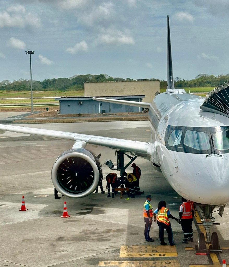
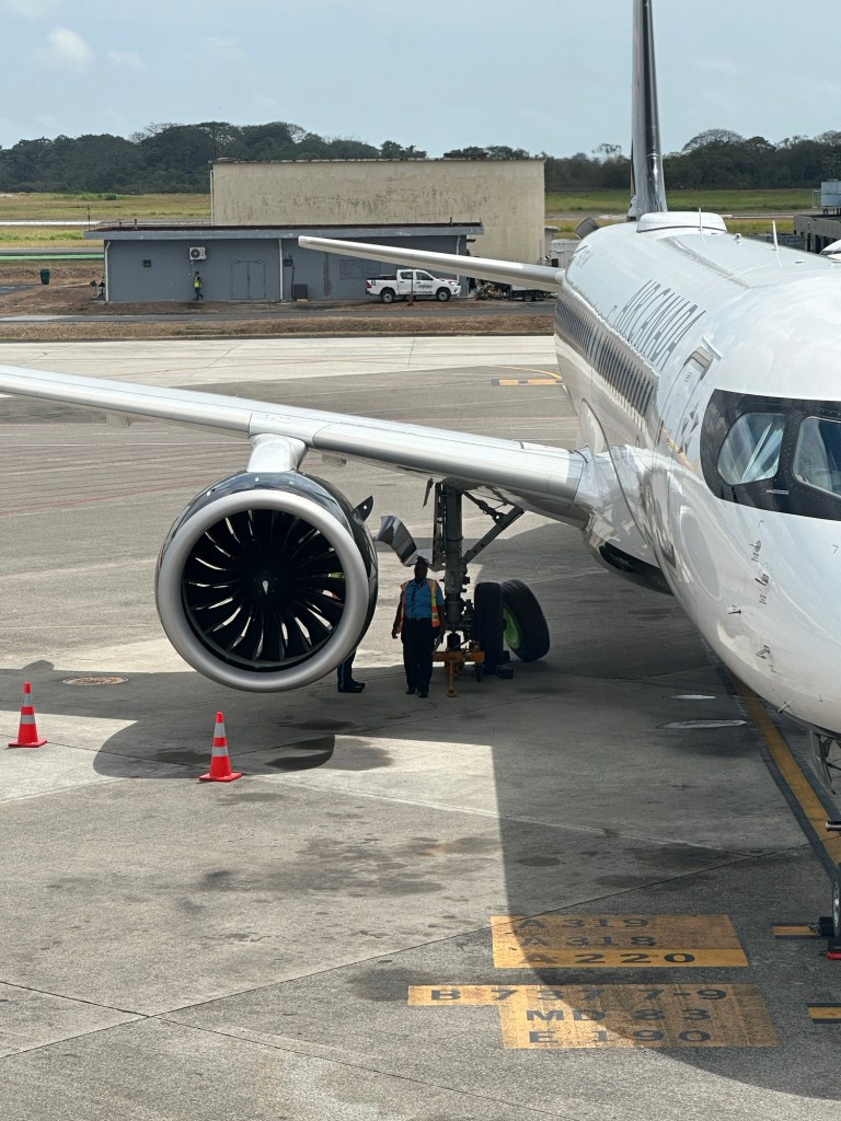
A tire was rolled out and several ground crew were working on getting the tire off the plane. Well, 2 were working and several were supervising. It was quite comical watching them as they were pumping up and down like how you propel the manual rail carts. Next time we looked over, the crew was all gone and the tire was still leaning up against the plane. After 15 – 30 minutes they started unloading the luggage from the plane. We knew that couldn’t be a good sign. Then came the announcement we were dreading, the flight had been cancelled. But, we would all be rescheduled on a flight for today, same times, same seats, etc and given a voucher for an overnight stay at a Westin hotel. So as good Canadians we dutifully stood in a queue to pick up our vouchers. I was resigned to our plight and really it was a more elegant solution than spending the night at Toronto Pearson Airport which was starting to look like a possibility.

Just a security person guarding the tire.

After 30 minutes or so standing in line with no further communication and no movement, they announced we would all be bused to the hotel and we should all proceed to pick up our luggage and we would be directed to the buses. Of course, the buses were not there immediately, and in fact were not there until 1.5 hours later while we stood in the arrivals area of the airport. No seats for any of those that could have used it. No water, now well through lunchtime. And yet, people remained relatively good natured. It was an adventure after all, not just boring uneventful travel.

Finally we were led to the charter bus arrivals area, as one bus had arrived. As human nature would dictate we moved as one herd first to the one bus and then those of us not on the first, to the second bus which was another 15 minutes in getting there. The bus went to and fro’ in the loading area before parking, and the people went to and fro’ along with their luggage. It was like something out of a movie or a dance. Of course all of this in the 30 degree heat and 90% humidity. Some of the passengers with mobility issues were clearly distressed by this point. The crew were assisting those who had ordered wheel chairs, but there were more who could have coped with the regular rigours of travel, but this was exceptional.

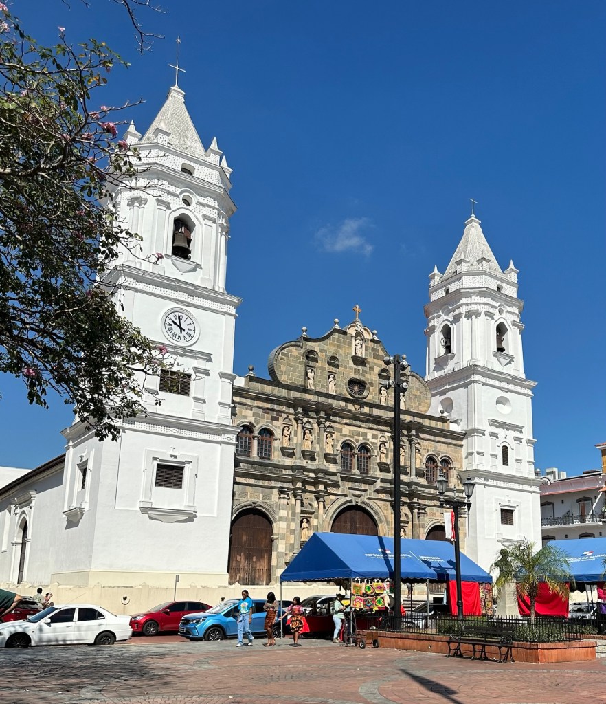
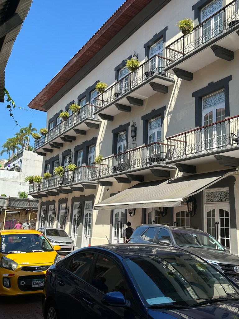
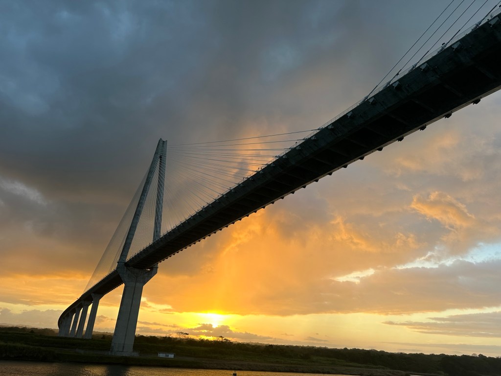
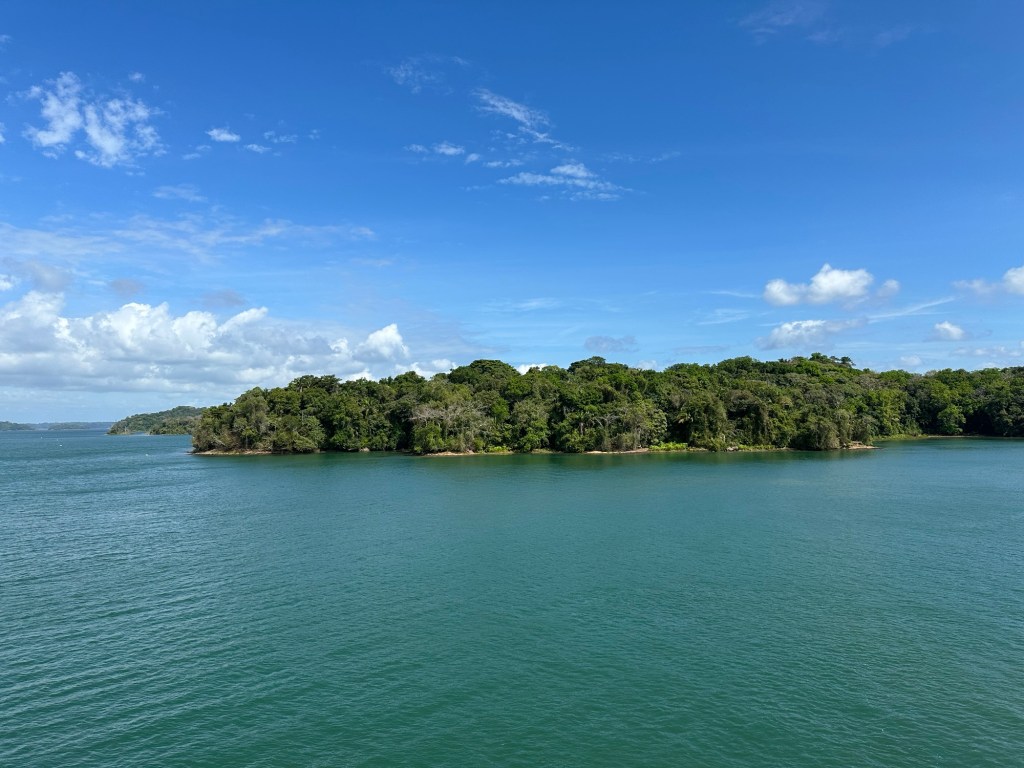
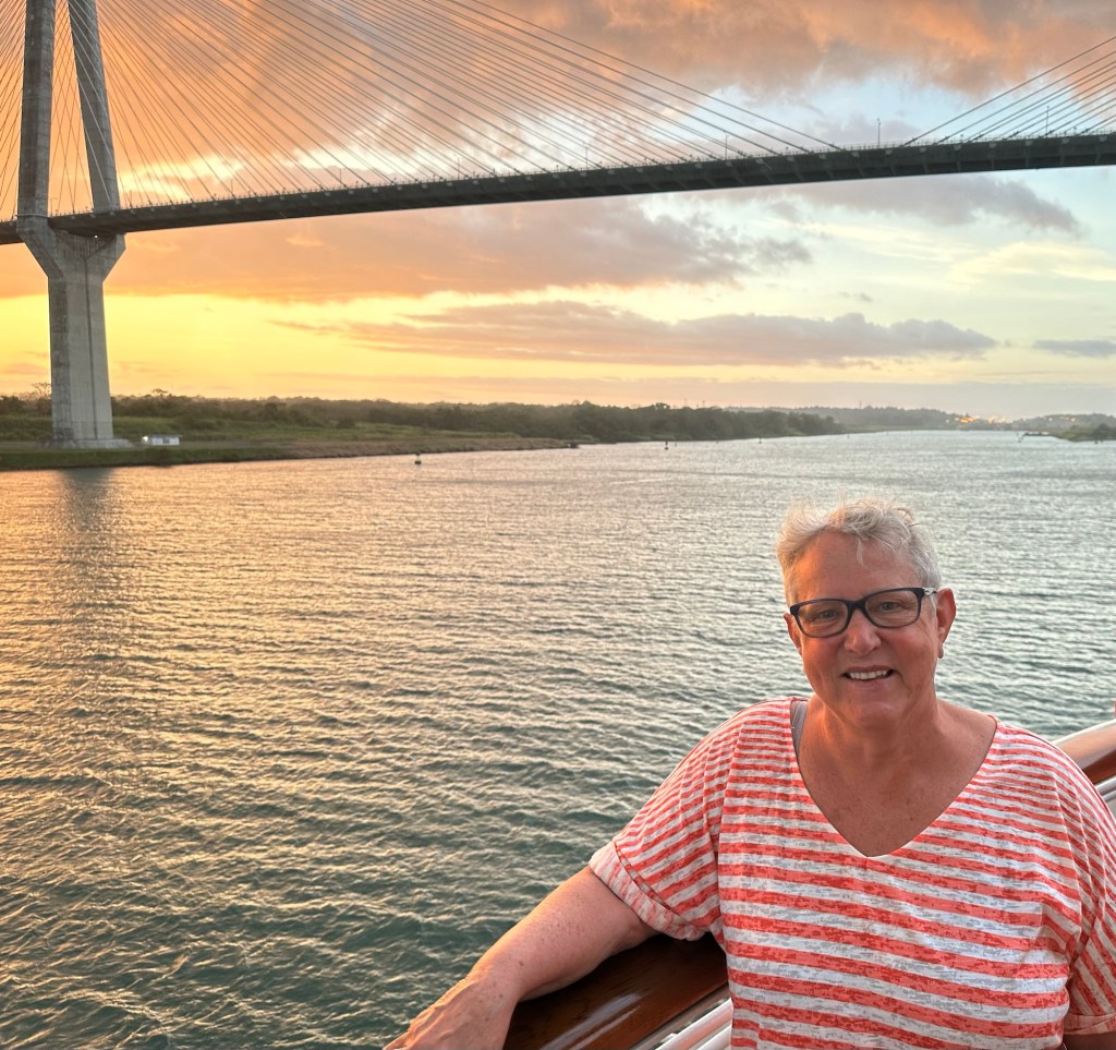
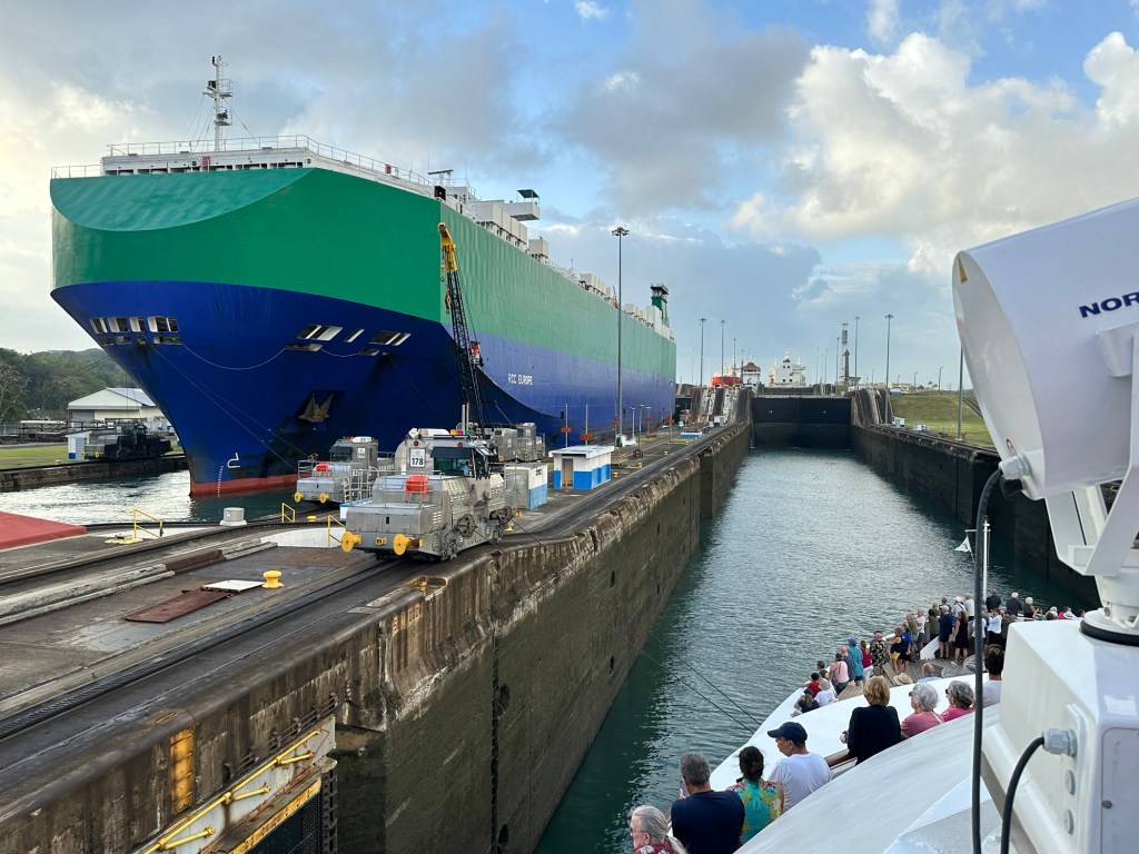
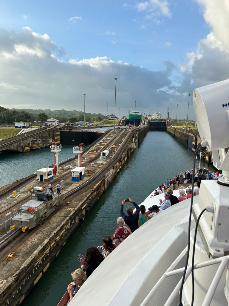
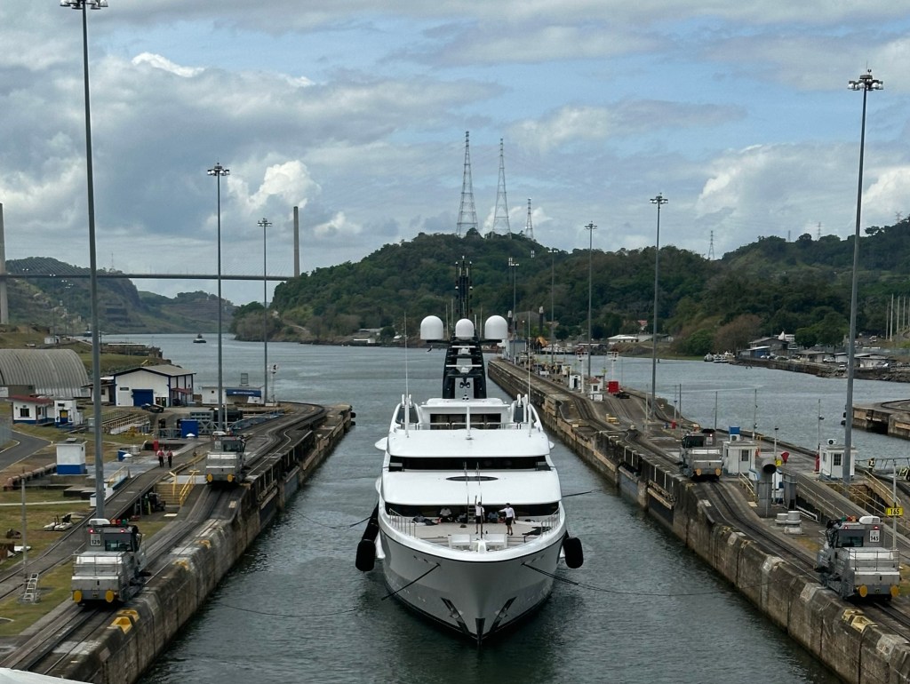
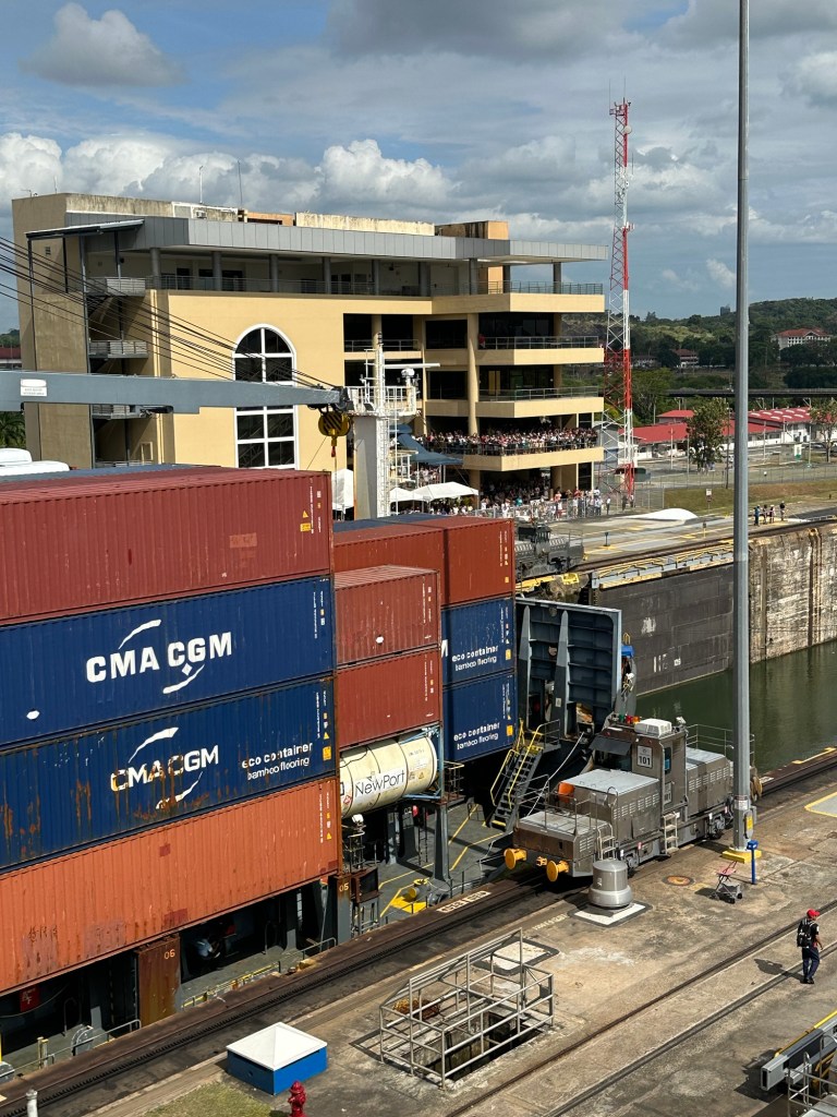
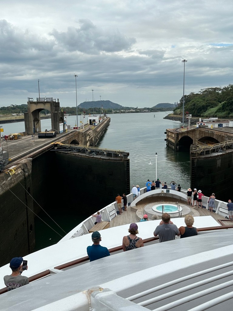
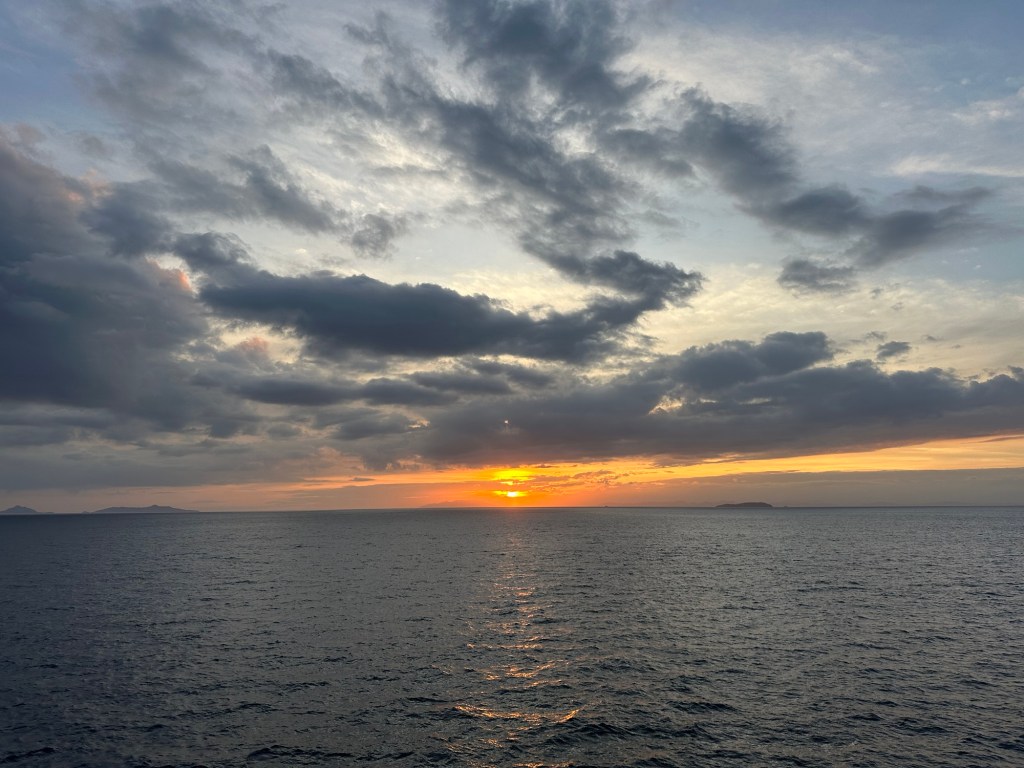
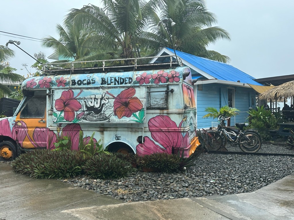
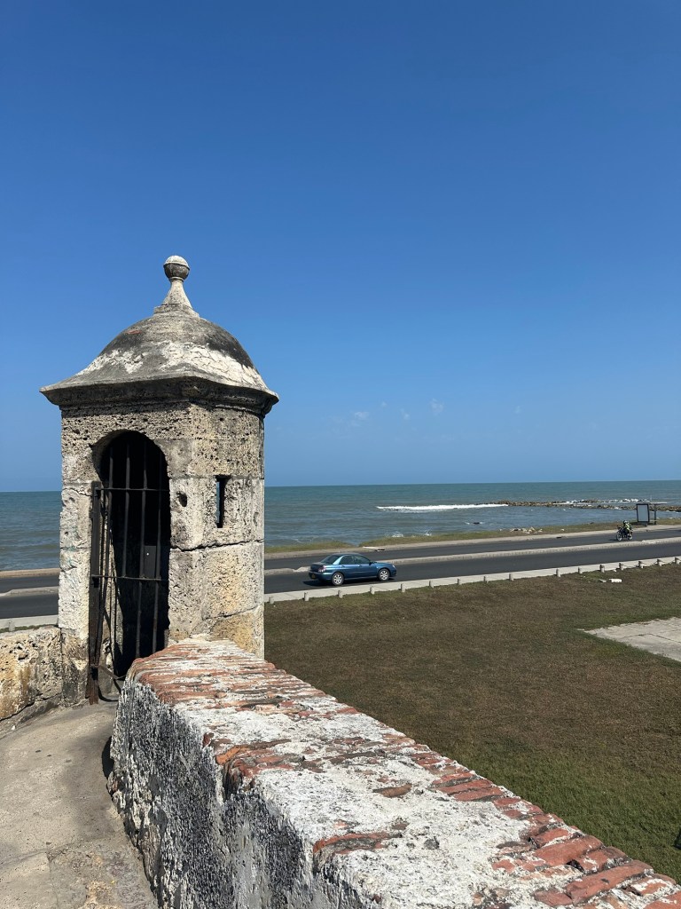
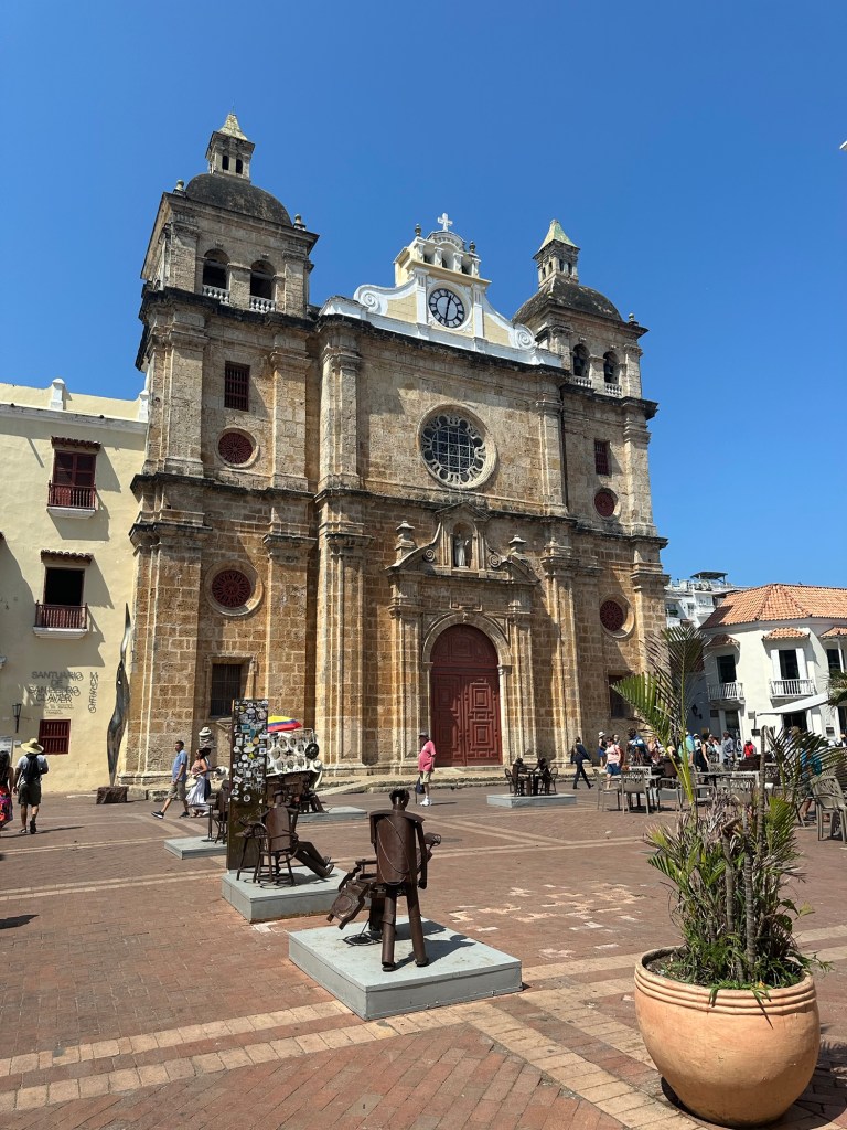
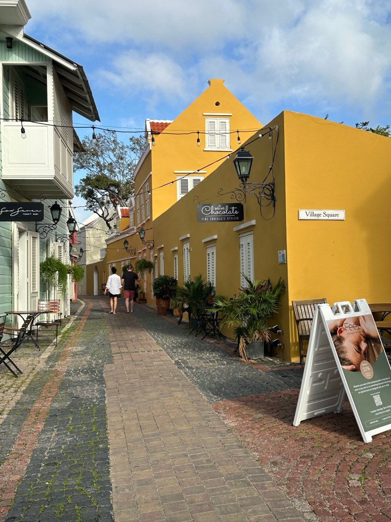
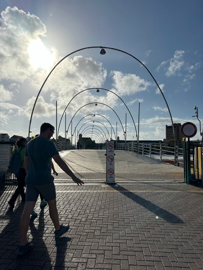
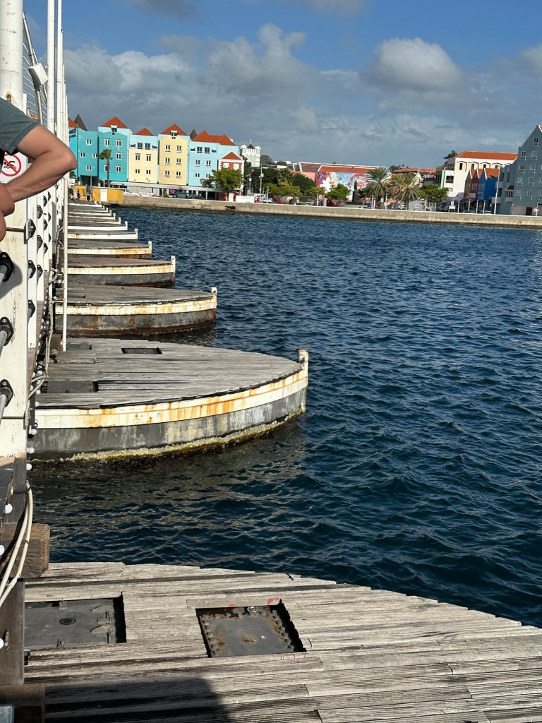
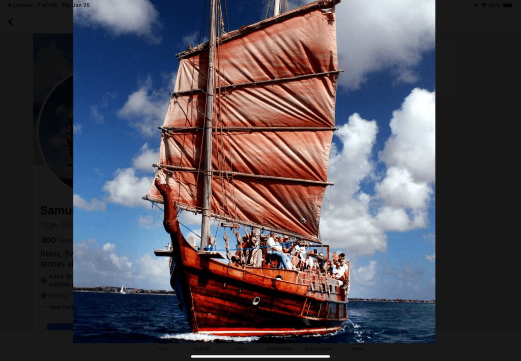
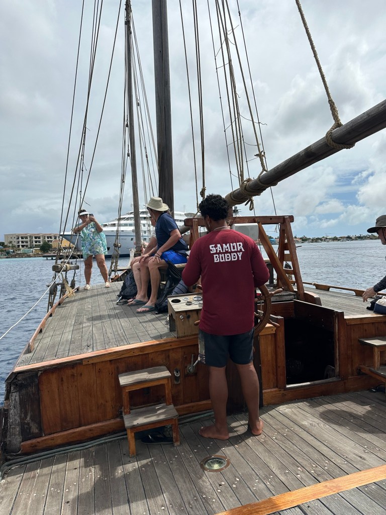
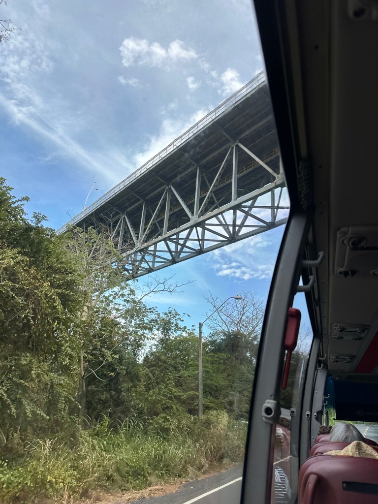
The route from the airport to the hotel took us over the Bridge of the Americas which we had come under just the day before on the Star Pride. It crosses high over the Panama Canal and was the first of the three bridges to be built joining the east to the west of Panama.

Sorry I missed a shot from the bridge as I was too busy gawking.

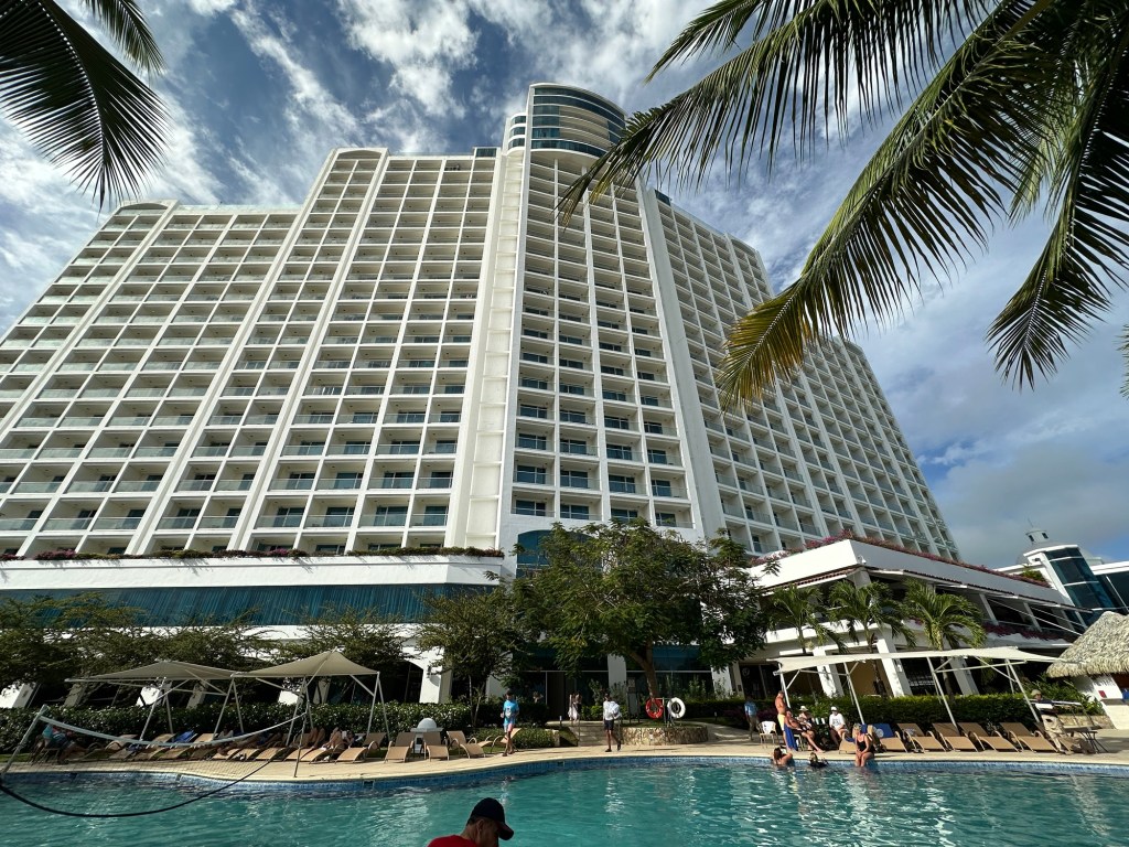
The Westin that they took us to was lovely, however, it’s probably 45 minutes from the airport on a Sunday afternoon. We had to drive back to the airport for our morning flight in Monday morning rush hour traffic. Upon arrival at the hotel, they told us our rooms would not ready until 5 or 5:30pm but that we could use the facilities and have a free lunch at the burger bar, and dinner last night at the buffet on Air Canada’s tab. And we were told that we needed to be down in the lobby for pick up at 5:30 am today, and better to be there for 5:00. Our flight wasn’t until nearly 11 am. Five hours before our flight seems a little extreme, but we were in their hands, I’m afraid.

The Westin Playa something.
Our view while waiting for our room to be ready
The Pacific – tide is out.
The Westin pool area

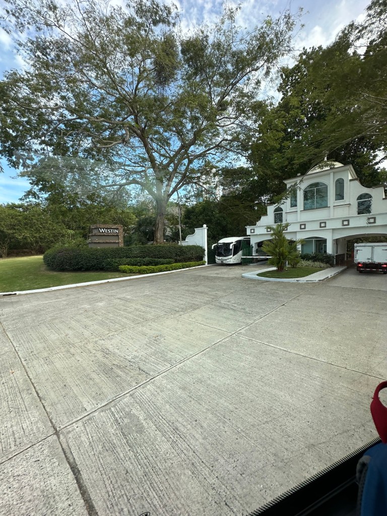
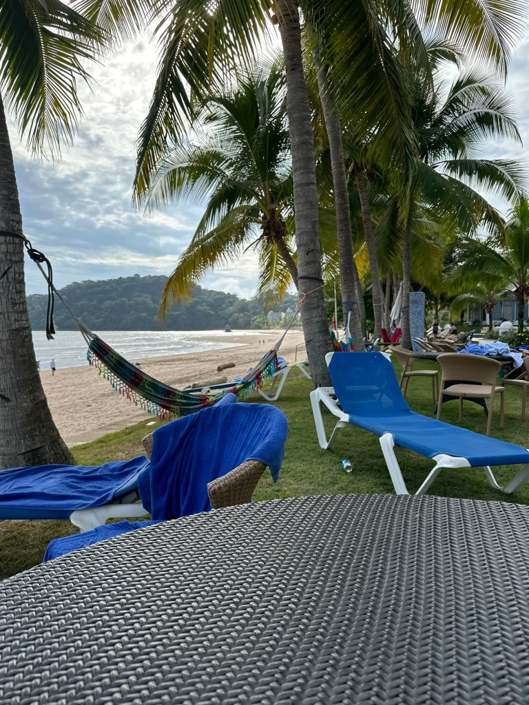
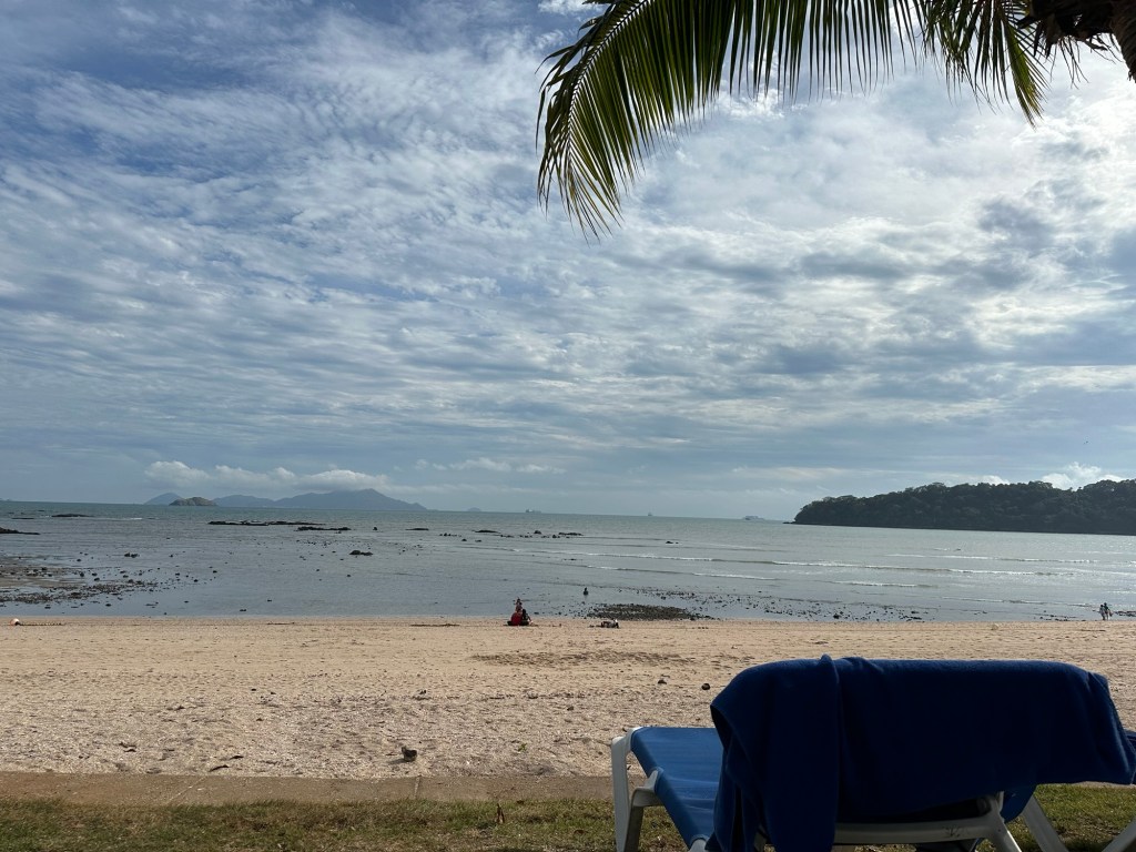
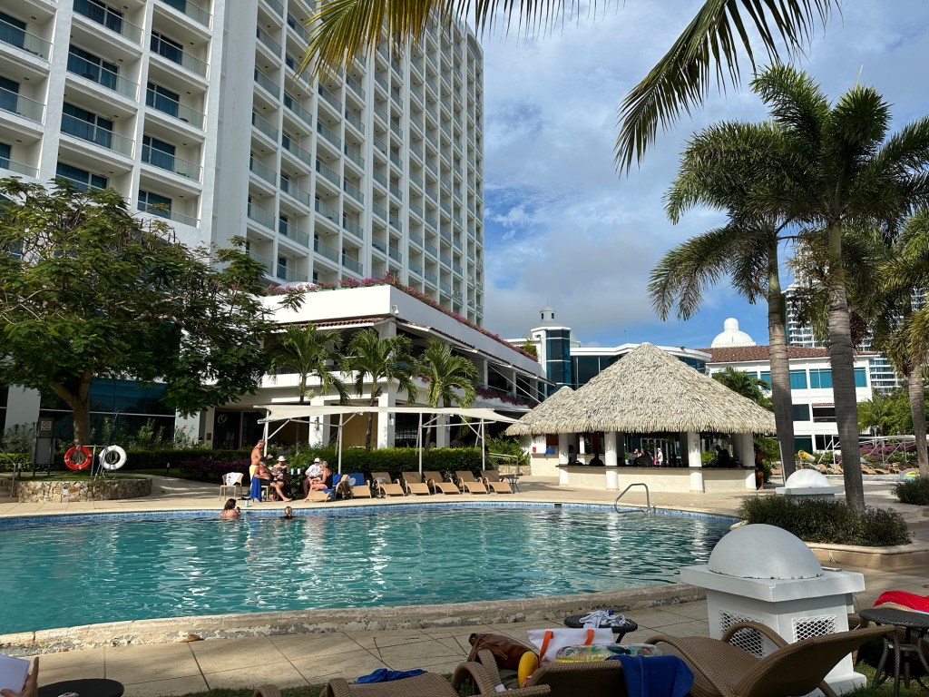
So Karen (who we discovered was on the same flight to Toronto that I was so our travel adventure continued together) and I sat under the palm trees overlooking the Pacific on one side and the beautiful pool area on the other. We got into our rooms around 5:00 and my room was huge! I could have hosted a party in it, too bad to only be using it for a few hours. The buffet was fine, and I tucked in for the night.

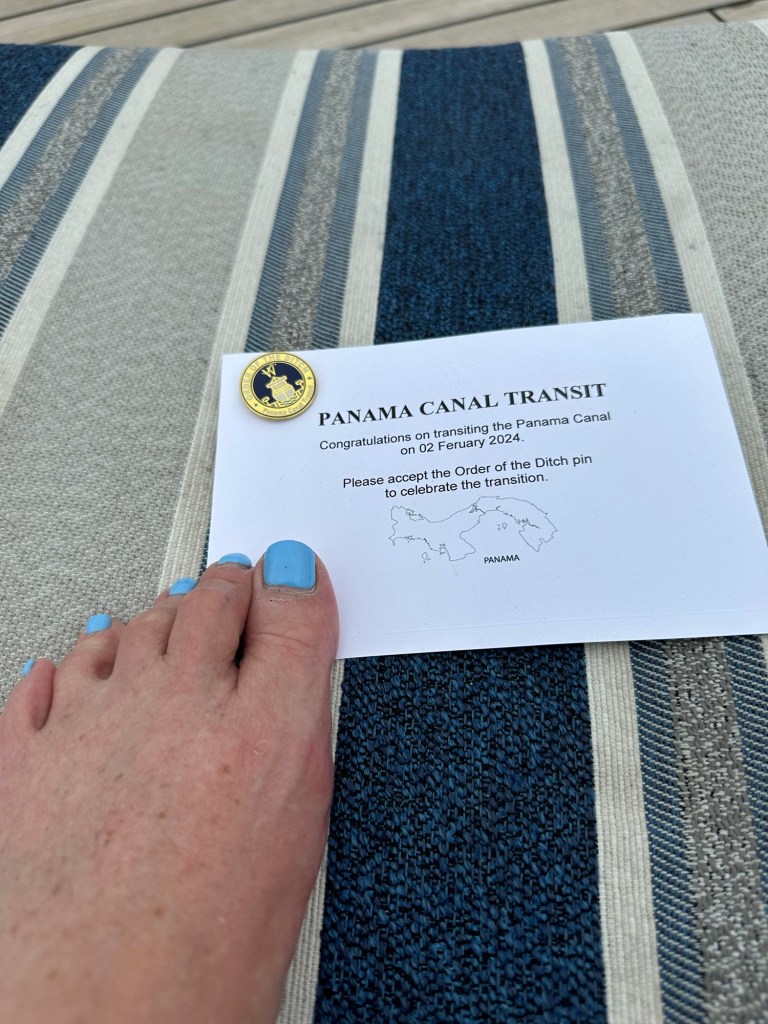
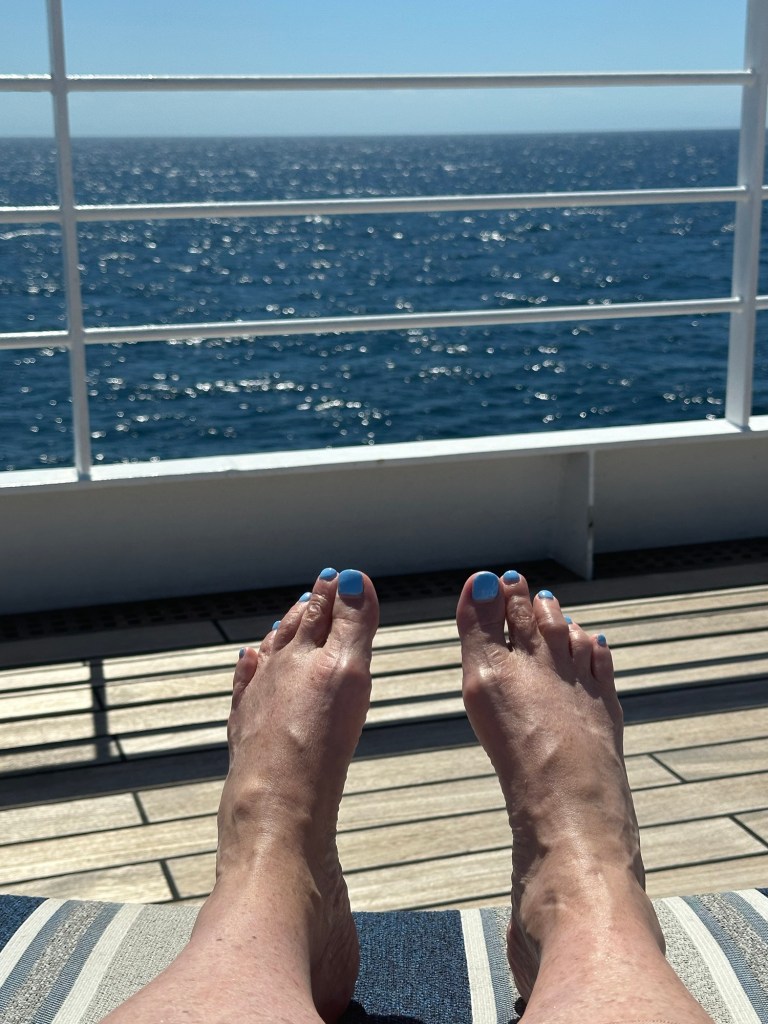
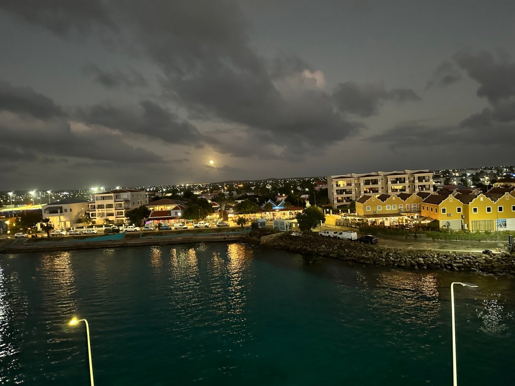
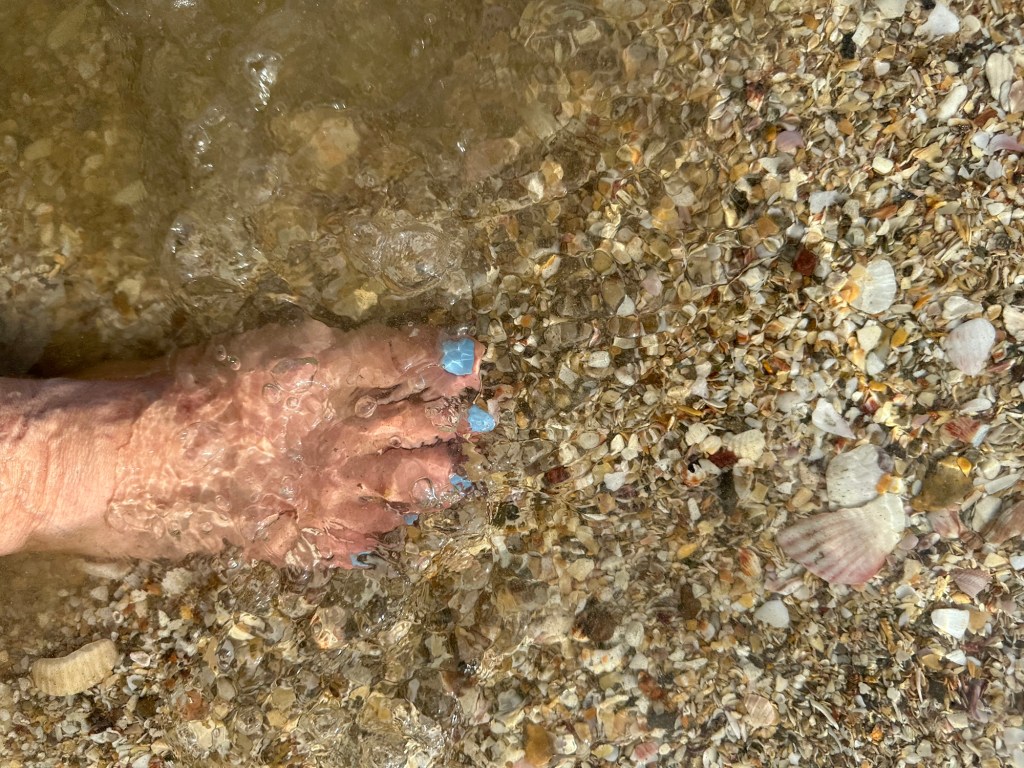
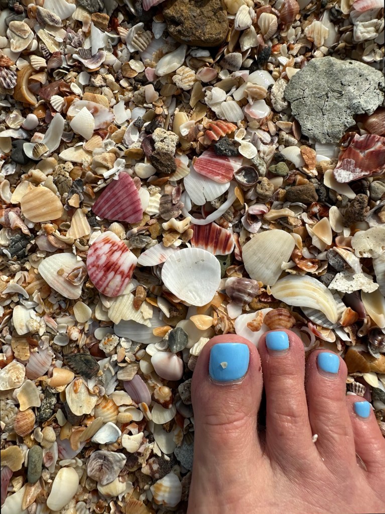
The wifi and cell coverage were not good enough at the hotel to add the picture of my toes or the bridge to my blog or even to post it without pictures, so here I am finishing it up upon arrival home on Monday evening. Yes, we did get picked up at about 5:45 and made it to the airport at 7 for a 10:40 flight. Sigh.

Beautiful shells but ouch!
I’m a little warm!

It’s not the end of my wonderful trip that I was expecting, but really, better to have had the tire go flat before we took off rather than attempting to land on it and better that it happened at the end rather than the beginning of my trip, making me fret about not getting on my cruise on time. Air Canada pulled off some miracles to find a plane full of us rooms for the night, having the hotel prepared with lunch and dinner, and providing transportation. They had coffee, tea and a kind of bread/cake thing this morning at the hotel before leaving. However, throughout, the one thing they could have done a better job of throughout the experience though is communication. I really don’t understand why it’s so hard for them. Even bad news is better than no news. Most people are resilient and will rise to the occasion if you just give them the information they need to process a changing situation.

The rest of today’s journey went almost according to Plan B. I actually got an earlier flight than I was booked on out of Toronto and was the last passenger on the plane. So I thankfully got home an hour early. Be it ever so humble.

I think I’m finally signing off.

2024 Caribbean Cruise

Panama City – a pleasant surprise

Metropolitan Cathedral Basilica of Santa Maria the Ancient

Well, I thought I was done. But on our way to the hotel from the ship today a tour of the three main areas of Panama City was offered, so I took it, of course. We had a great guide, Eduardo. So I thought I’d do a brief summary and provide some pics.

I had no idea what to expect from Panama City and it’s a lovely city from what I’ve seen. One definitely worth revisiting…. Only problem is that my bucket list keeps getting longer because there are so many places that I want to go back to and spend more time!

We started our tour with a drive along the Pacific and the “Canal Zone” for a bit and it was a lovely drive – lots of pathways, Bike paths, and vegetation. Lots of traffic circles. The Canal Zone is a zone 5 miles on either side of the canal that the US was given for their use by the Panamanian government when they took over construction of the canal. The US used it for military facilities and housing for their workers. It is now given back to Panama government and some parts of it provide recreation facilities for the city.

The Pacific

A brightly coloured building we passed when we were still on board Star Pride coming out of the Panama Canal and into the Pacific yesterday, and which we saw during our drive along the Amador Causeway is the Biomuseo. It is a museum dedicated to biodiversity and it was designed by internationally renowned and Canadian-born architect, Frank Gehry.

Frank Gehry designed Biomuseo

As we drove, our guide filled us on some statistics regarding Panama and the city. Of the 4 million people in Panama, 2 million of them live in Panama City. Spanish is the official language of the country but most also speak English as children have been taught English in school for many years. Most Panamanians are Catholic, given its Spanish roots.

According to our guide, there is a good relationship between Panama and the US due to the support given to Panama by the Americans. He said that Panamanians don’t however have a burning desire to join the immigration race to the United States as they have a comfortable life in Panama. Workers are paid a minimum wage of US$650 a month paid twice monthly and our guide felt that anyone that wanted to get ahead could do so in Panama. University is free, they pay $1.25 a pay (or a month – sorry he was talking fast!), for education and $9.00 a pay (or a month) for healthcare. Rent in the high end areas is $ 2000 – 5000 a month, but that’s at the top end. Rent is reasonable in many other areas of the city. They pay 7% tax on all goods, and 10% on Alcohol and cigarettes.

Panamanians are required to vote in elections held every 5 years, and the President cannot run for consecutive terms. There are 7 aboriginal tribes, the Kunas who we learned about in the San Blas islands is the largest.

Our guide pointed out that the canal is the hub of the shipping of vehicles throughout the world and as a result the cost of cars and gas are very reasonable in Panama.

Spain started colonization of the area in 1503, and Panama remained a colony of Spain until 1821. At that time Panama joined Colombia and other formerly Spanish countries in a republic called Gran Colombia in its independence from Spain. Gran Colombia dissolved in 1831. Panama became a republic in 1903 with support from the US. A failed attempt at building a canal was started by France and the project was taken over by the US and completed between 1904 – 1914. (At the start of WWI) In 1955 the US also built a railway line that ran along side the canal across the isthmus. The US continued to exclusively administer the canal until 1977 when the Torrijos-Carter Treaty to completely transfer the canal to Panama effective Dec 31, 1999.

After a quick drive through the modern part of Panama City, our first stop was the old quarter or Casco Viejo (also called Casco Antiguo), the city’s historic area. It was built on a peninsula isolated by the sea and a defensive system of walls in 1673 following the destruction of the original location of Panama Viejo in 1671. More on Panama Viejo later. Casco Viejo was designated a World Heritage Site in 1997.

4 story French design building

As with most historical areas, we had to walk in this area as the streets were narrow and traffic horrendous. It is a beautiful area where the building styles from its roots, French, Spanish and American have been maintained, even in the newer buildings and many of the older ones have been upgraded on the inside. There are some that are just literally facades, and others that are waiting for someone to bring them back to life. Even those buildings must be properly secured to they don’t deteriorate further or create a hazard. Of course there are several churches and one cathedral in this area, some of which have been rebuilt and some that are just ruins.

The building beside the yellow one is simply a facade, with metal sheeting to ensure there will be no material falling on pedestrians or cars.

We saw inside one of the churches, Iglesia San Jose (Saint Joseph Church) to see their beautiful gold altar which was saved from pillaging in another area of the country when the parishioners covered the altar in mud to hide it’s gold leaf.

The area is home to museums, restaurants, boutique hotels, tourist goods stores, and nightclubs. One hotel, the Hyatt Hotel la Compania, was renovated over 7 years, from a whole block of buildings and is tribute to the three styles in the area with French, Spanish and American wings.

The French wing of the Hyatt Hotel la Comania

We came to Independence Square where the beautiful Metropolitan Cathedral Basilica of Santa Maria the Ancient stands. It was the largest Cathedral in Latin American when it was built in 1673. There are sea shells built into the roof of the Cathedral which reflected the moon light acting as a lighthouse for sailors. There are 7 steps on the way up to the cathedral each representing a sin, so that you are sin free arriving at the cathedral. We weren’t able to go inside today as there was a special event happening.

We wandered some more and saw the ruins of the Church of Santa Domingo built in the 1700s. It is said that the square archway in this church was the reason that it was decided to build the canal in Panama instead of some of the other Central American countries that were being considered. The fact that the arch was still standing all these years later, indicated that there was no seismic activity in the area that would affect the canal.

Church of Santa Domingo
One of the cute boutique hotels in this area

We were glad to get back on the air conditioned bus after our long walk thru this area, and glad that our guide had chosen for us to get there early in the tour when it was maybe a bit cooler. It’s very hot and humid here, being only 11 degrees or so from the equator. Next stop, Panama Viejo Museum and Ruins.

One of the ruins at Panama Viejo

Panama Viejo is the area that was the main settlement of aboriginals, mainly fishers and farmers, in the area going back 1500 years. Unfortunately this site was attacked by a British Privateer (or pirate depending on your definitions), Henry Morgan, in 1671. Panama City was not prepared to fend off the attackers, and was poorly led by Donna Juan Perez de Guzman and the battle was short and bloody. The attackers spent a month on the site ransacking and torturing the villagers attempting to find any hidden treasures. When they left, more than half the villagers were dead, injured, sick or missing. From my reading, Captain Henry Morgan was not an explorer looking to claim riches and land for Britain, but instead was out for himself. In any case, you may recognize his name as a British-made rum “Captain Morgan” was named after him.

I have to admit that my attention span had reached its limits by this point and I was glad that we were heading to our hotel for tonight in the Financial District.

Fun Facts:

⁃ Panama’s motto is “Pro Mundi Beneficio,” which means “For the Benefit of the World.”

⁃ The tallest building in Central America, now the JW Marriott in Panama City, used to be called Trump Tower.

⁃ There are no roads between Panama and its neighbour to the south, Colombia because the jungle in that area is so thick and impenetrable.

⁃ Panama exports pineapples, bananas, coffee, and rum.

⁃ A type of coffee called Giesha, grown primarily in Panama, has been named the most expensive coffee in the world. In 2021 a pound of Geisha coffee sold for more than $2500 a pound.

⁃ There is a Smithsonian Institute Nature Centre located at the Pacific Entrance to the Panama Canal in Panama City

⁃ The National Sport of Panama is baseball. An American influence.

⁃ The name Balboa is everywhere in Panama because of the Spanish explorer, Vasco Nunez de Balboa. He was the first European to lead an expedition to reach the Pacific from the Atlantic across the isthmus.

This is just the tip of the iceberg of history of this region and it’s been great dipping my toe into it. (Two figures of speech in one sentence!) I will caution again that I may have messed up in either noting or understanding some of the facts presented in this and other posts, but I try to corroborate stories told to me or the info I dig up but it’s not always possible.

Tonight I ate dinner in the lovely hotel restaurant, having run out of adventurous spirit. And I decided there was no time like the present to get back into healthy eating after 2 weeks on a cruise ship.

Ok, off to bed, as I have an early flight home to Ottawa tomorrow. Hopefully it will be uneventful.

2024 Caribbean Cruise

“Order of the Ditch”

Atlantic Bridge at dawn

Many fellow passengers have been waiting for today and took this specific itinerary to get to experience today. It’s the day we transit the Panama Canal from the Atlantic side to the Pacific. We end the day in Panama City after traversing the 3 lock stations, cuts and lakes. I have to admit that I wasn’t all that excited about it but I recognize that it’s definitely an incredible feat of engineering and ingenuity and I understand its significance to world wide trade. Going through the locks was really interesting, and I was up at 6:30 am to see what was probably the first sun rise of my vacation along with dozens of others on board. I was pleasantly surprised by the views from the ship as we passed through Gatun Lake.

Gatun Lake

There is a plethora of information on the canal, its engineering, its history etc, and I can’t face beginning to distill it into an interesting post. So I’ll provide a bit of information I have gleaned from the on ship guide, and some other info sources, but it’s not at all intensive. Can you tell I’m coming to the end of my journey and I’m a tad weary?

Some Milestones in the Panama Canal History:

1914 – August 15 – The Panama Canal is officially opened

1962- October 12 – the first public crossing, the Bridge of the Americas, is opened for public use on the Pacific side of the canal

1999 – December 31 – Panama takes over the administration and operation of the Canal

2016– June 26 – the expanded canal is officially opened.

2019 – August 2 – Inauguration of the third Bridge of the Atlantic

So yesterday afternoon we beat it out of Bocas del Toro late due to some passengers not getting back on the ship on time. I’m sure the Captain was not pleased as we had to be in moorage at the entrance to the canal by 2 am to secure our reserved spot for today. Windstar pays a premium to be able to book specific dates for their crossings.

The original Panamax locks on the right and the NewPanamax Locks on the left.

We started moving this morning, with a Panamanian pilot on board at about 5 am, and we joined a line of ships moving toward the narrower “Panamax” locks. Just as the sun was rising we went under the high span of the Atlantic Bridge, completed in 2019 that joins the two sides of the isthmus for vehicular traffic.

Large passenger ship in the Neopanamax Locks

There is now a new channel of the canal (finished in 2016), to allow for the super large ships, and the huge passenger ship in line behind us veered off to the port and entered the “Neopanamax Locks” as it was too large to get through the smaller channel. The new channel allows for more and larger traffic, by increasing the width and depth of the locks. The larger ships are 1 1/2 times the size of the previous ships and their capacity is twice as much.

Car Carrier with only 2 ft on either side to spare.

We did not enter the first set of locks until almost 8 am. There were three locks to get us up to the highest point, of Gatun Lake, 85 feet above the ocean. There was a car carrier going through the lock in the other direction which was 106 feet wide. The lock is only 110 feet wide so there was only 2 feet clearance on each side. Tight squeeze!

I’ve “locked through” on numerous occasions on the Rideau system between Ottawa and Kingston and have seen the Sault Ste Marie locks for the lake freighters going through from Lake Huron to Lake Superior so I’m familiar with the operation. Of course, this is a bit larger scale! Something I hadn’t seen before were the small mechanical “mules” that run along the sides of the canal with lines on the ships to make sure they stay centred in the lock. For small ships 2 mules are used but for the larger ones they used 8.

The “mule” on the left attaching the lines to the port side. There was another on the starboard side and then two more on the stern.
This little guy slipped into the lock behind us.
Oh look! A lighthouse! I have no idea why it is needed in the middle of the locks? There are lights all along the sides.

As you have no doubt read, there was a severe water drought in Panama last winter and the number of ships allowed through the locks is dramatically reduced. I think they said from 42 to 22. Many of the large container ships are forced to go around the southern tip of South America as the explorers once did. One of the changes they have made to deal with the water shortage is to re-route water between the two channels while emptying one and filling the other so that less water needs to be used from Gatun Lake.

Miraflores Locks visitor centre.

We locked through the second lock, Pedro Miguel Lock, at approximately 2:00 pm. There was just one small step in this lock to take us down to the level of Miraflores Lake. And then the last step, the Miraflores Locks was two steps of 27 ft each to take us down to the level of the Pacific Ocean. After just 54 miles but an all day adventure we had transited from the Atlantic to the Pacific and earned a pin adding us to the “Order of the Ditch”.

The gates opening to let us through to the Pacific!
Order of the Ditch!

Today, we sadly received Panamanian customs forms, luggage tags and instructions for disembarkation tomorrow morning. The two weeks have flown by and it’s been a fabulous adventure. While I am on this adventure by myself, I have met some wonderful people along the way. I first met Clair from Denver/Wisconsin last year on another Caribbean cruise, and we got on so well that we planned to be on the same cruise at the same time this year. And as it turns out, a friend from Calgary who I haven’t seen for probably 10 years, Karen, unknown to me had booked this very same cruise. So it’s been great to re-connect and spend time with both of them as well as Adrienne last week. We did our own thing sometimes and did things together at others. Always lots to talk about and laughs over our dinners. Tonight the three of us celebrated our last supper at the outdoor Candles Restaurant instead of the main dining room, and it was a lovely evening.

Don’t know if I’ll have time to post tomorrow as I will be disembarking and staying over night one in Panama City before my flight home on Sunday. I hope you have enjoyed this journey. Until next time……..

Sunset over the Pacific Ocean
2024 Caribbean Cruise

Bocas del Toro, Panama

We’re arriving into Boco Town, Boco del Toro in the rain.

Well, our luck ran out. Some days we’ve had passing showers, which come and go, but this morning it is completely socked in with rain as you can tell from my breakfast view.

So snorkelling didn’t happen for me. I was meant to go this morning, and the excursion did go ahead because it’s booked rain or shine. But I figured no point in going when I’d see very little without at least a little more light and likely be uncomfortable on the 30 minute boat ride out and back. I did venture into the town to take a look around because really, when will I be back in Bocas del Toro? I’ve described the experience below.

The tender dock at Bocas Town.

But let me tell you a little about Bocas del Toro. It is a province in the northeast of the mainland of Panama as well an archipelago of 8 islands on the Caribbean side of Panama, almost at the Costa Rican border, near Limon. It is one of the main tourist destinations in Panama, receiving 150,000 tourists per year. However, only smaller cruise ships are able to get into this small port with narrow channels. Many fly in to the “International Airport” of which the island is very proud. It flies a little puddle jumper between here and Costa Rica so it’s designated as International.

The Captain had to slowly pick his way along the channel, with lots of twists and turns to avoid the sand bars and reefs between the islands. We were anchored near the capital of the islands, Bocas Town, on Colon Island where approximately 8000 live.

In this region, you can find the UNESCO World Heritage Site, LaAmistad National Park, which is a marine park off the coast of the mainland named in 1983. Another National Marine Park, Bastimentos is off the coast of Bastimentos Island. Because of its diversity, this area has been called the “Galapagos of the Caribbean”. It provides protection for forests, mangroves, monkeys, sloths, caiman and other reptiles. There is also a nesting site for sea turtles.

Bocas del Toro has been named a “Hope Spot” by the organization called Mission Blue for its work on protecting and restoring the coral reef. According to the organization, “Hope Spots are about recognizing, empowering and supporting individuals and communities around the world in their efforts to protect the ocean”. There are 140 identified at this point.

The Smithsonian Tropical Research institute has a facility in the archipelago because of Bocas del Toro’s diversity of coral and marine life.

Historically, we’re back to talking about good old, Chris Columbus who visited this area on his final voyage in 1502. He took on provisions and made repairs to his ship in the area. Pirates also used the islands as a hideout and so buried treasures stories fly about. The aboriginal people called “Carabaro” were mostly wiped out from diseases the Europeans brought with them.

The next part of the history of this area is different than the other islands Columbus discovered, in that many immigrants from other islands, mainly Jamaica, made Bocas Town on Isla Colon home and built it up to be a thriving business area, marketing cocoa and bananas by the beginning of the 20th century. Unfortunately a banana plague in 1920 put an end to the area’s prosperity. But the park survives as does tourism. And the banana industry has come back, and they now ship about 3/4 of a million tons of bananas per year. Chiquita International is one of the main companies operating in this area. Other crops are now exported, such as cacao, coconuts, and plantains. And of course, tourism is a larger economic driver as ecotourism increases in popularity.

A private home on the water in Bocas Town

Bocas Town, the capital of Bocas del Toro Province and where we are anchored, is at the southern Tip of Isla Colon. It is home to roughly 15,000 people, and there is a strong Afro-Caribbean culture. There are brightly coloured bars and restaurants along the waterfront, many of them on stilts, although I couldn’t get a picture of them as the windows were all closed on the tender due to the rain. Seafood is big here, as are ceviche and plantain chips.

Tip Toe, through the puddles.

Unfortunately the roads in the central part of the town are under construction, and with all the rain today, there were huge mud puddles to navigate around. We went on an adventure anyway, and walked around this interesting little town for an hour or so, in the light rain. There is a sense of the pace slowing down on the island, with lots of spots to grab a coffee or brew and chill. It had a “hippie” or “backpacker” feel, with hostels and reasonable small hotels. There are also some ecolodges and luxury accommodations throughout the islands, so something for everyone. It was really interesting and I’m glad I opted to get on to the island.

I think this may have been here a while.
Not getting too much business today.
Near our tender dock
An herb store.
The tender dock owners private deck overlooking the harbour
One of dozens of restaurants along the waterfront, without many customers today
A resort on one of the islands on our way out of the archipelago

We have left the islands with the Captain once again gingerly making his way out to open water, at least an hour behind schedule because of the late return of some passengers who had wandered into town. We are making our way to our anchorage near the entrance of the Panama Canal which we will be entering at approximately 7 am tomorrow. Many on board have come on this cruise with that as a highlight. So hopefully the weather lifts for tomorrow so we can have good viewing weather. Sadly, only 2 sleeps left on board.

2024 Caribbean Cruise

Cartagena, Colombia Day 2

Fort Jose

Today, I was torn between seeing more of Cartagena and another opportunity to snorkel and I chose the later. None of the other organized tours were appealing, (apiary tour and coffee tour) and it was up to 33 and 90% humidity today again and I just couldn’t convince myself to give up being in the water.

We had an early start, which I did grumble about to the Destination Manager, but it was kind of nice to be out early and back early to relax the rest of the day.

Our speed boat picked us up at a small dock right beside the pier where the Star Pride is docked and in no time we were on our way, double time, out of the harbour ready for adventure. The views of Cartagena as we were leaving the harbour were spectacular. In my mind’s eye when thinking about Cartagena, the historic part of the city was all that I saw. So when I woke up and looked out my window on the first morning I was surprised to see the modern city that I could see from my cabin window. And as I’ve seen more, I’m more surprised by how many modern high rises there are around Cartagena Bay.

Our dock location
Leaving the harbour in Cartagena Bay
On the other side of the bay

Back to today’s adventure, the dive master on this trip was the best we’ve had along the way. He explained things really well, was helpful to those that needed it with their equipment, ran a tight ship and we all had a great time as a result.

On our 30 minute trip to our snorkel site, the he spoke about some of the history and about the forts, on which building started in 1646, and completed in 1759 that protected the harbour. The narrow entrance between the two forts was the only access to the harbour for military ships or pirates since the other channels were too shallow. The forts were built at different heights relative to the water so that the cannon fire would penetrate the ships at various heights and the crossfire was deadly to the incoming foe. The fort on the starboard side, was burned to the ground and was rebuilt more substantially the second go around.

We carried on to Baru Island just offshore, and around the far side of it to a bay in the Bernardo Corals National Natural Park. It took quite some time for everyone to get geared up and into the water, but once in we were guided into more shallow water along the reef to see what we could see. There were many types of coral that I hadn’t seen before as well as some great species of some familiar ones, such as Brain Coral which seem to be quite hardy. And there were lots of little fish, and some larger ones to see in the valleys of the coral and around the larger pieces. We were in the water for 30 minutes or so, and then a few carried on to see more while some had had enough and climbed back on board. Guess which group I was in?

The captain then moved the boat into a very calm bay and served up plantain chips, bananas, and sandwiches. Some people hopped back into the warm sea and had a swim in the very buoyant salt water. When everyone had had enough of the water, we headed back into port.

We had an early departure from Cartagena today as we’re headed all the across the Panamanian Isthmus (205 nautical miles) to a remote island group (San Blas Islands) for our beach day tomorrow. Yay beach day! The Norwegian Cruise Line ship that came in to port as we were headed out snorkelling this morning left just before our pilot came aboard to assist us out of the harbour. On our way out we came close enough to a statue in the harbour, the Virgin Mary and Child, to get this not too clear picture. It’s a relatively calm day today, so should be clear sailing.

The Norwegian Cruise Line ship leaving from the main cruise ship terminal further out of the harbour
Virgin Mary and Child Statue at the entrance to the harbour
2024 Caribbean Cruise

I keep hearing about Cartagena, Columbia

And finally I’m experiencing Cartagena myself. It’s been on my bucket list for ages and now I’ll be raving too. It has an amazing feel of vitality and history. Clearly one day is only enough time to get a sense of the place and to wet the appetite to come back and spend more time.

We arrived here early this morning and I didn’t go snorkelling! (Although I will tomorrow). I did a guided tour of the Old Town and Gethsemani this morning and an evening walking tour of the Gethsemani neighbourhood to see it as it awakens.

Cartagena is a port city and UNESCO World Heritage Site and the walled Old Town has such amazing brightly coloured, colonial architecture, churches, monasteries, plazas, and the street art is a level above anything I’ve seen. It’s often cited as one of the most beautiful cities in the world, and from those that I’ve seen I’d have to agree.

Archeologists have found evidence that people have lived in this area, from around 4000 BC. But Cartagena was founded in 1533 on the site of a Carib Indian settlement. It was rebuilt in 1552 after a fire destroyed many of it’s buildings. It quickly became a main port for the Spanish on the Caribbean coast. It suffered many attacks from pirates, including Sir Francis Drake in 1586, who demanded a random not to destroy the whole city. These attacks precipitated the building of a series of forts and a seven mile wall around the city and 22 bastions, which successfully defended the city from severe attacks. In one attack, 25,000 English soldiers and their fleet of 186 ships was fended off by commander Blas de Lezo, and 2500 poorly trained troops. Don Blas is considered the saviour of Cartagena and there is a statue of him outside San Felipe Fortress. Don Blas, it was said, was only half a man, having lost one eye, one arm and one leg, however it is also said he had 33 children by 25 different women!

Cartagena was one of the first cities in the Spanish empire to proclaim independence from Spain which it did in 1810. Spanish forces retaliated in 1815 and took the city after a four month siege during which 6000 inhabitants died of starvation and disease. But in 1821, Simon Bolivar’s troops defeated the Spaniards after freeing Bogata in 1819.

Fun Facts:

⁃ Colombia is one of 17 megadiverse countries of the world.

⁃ Although there are claims that Cuba was the originator of the Mojito, Colombia’s aboriginals are thought to be the origin. They came up with a mixture of rum, lime juice,mint, and sugar which is believed to be an antidote for dysentery.

⁃ Famous Colombians include Actress Sofia Vergara, Garacia Marquez, (Nobel Prize winner in literature) and singer/songwriter Shakira.

⁃ Coffee is the national symbol of Colombia. Colombia is a primary supplier of Arabica coffee beans to the world and it’s important to the economy. Also, it’s not unusual to see kids drinking coffee in Colombia.

⁃ It’s required by law for radio and tv stations to play the national anthem daily, at 6 am and 6 pm.

⁃ It’s believed that 70-90% of the world’s emerald market is from Colombia and that they are of the best quality. In fact one of the excursions offered is to an emerald facility.

⁃ Colombians like to put cheese in their hot chocolate. The saltiness of the cheese supposedly brings out the other flavours within the chocolate. They use a special cheese that is like a halloumi or mozzarella.

⁃ The condor is the national bird of Colombia

⁃ All men must serve in the military for 2 years when they turn 18 unless there is a medical reason, they are an only child, or if they are married. Our guide said many get married early in Colombia.

To start our day, we were transported along the harbour surrounded by modern high rises, to the Getsemani neighbourhood for the start of our tour. This area is where the poorer of the people of Cartagena lived in early days, and it had become run down and once was the scene of a prolific drug trade. But in the last 10 years the area has been reclaimed and some of the old buildings of this neighbourhood are being turned into cute boutique hotels, and the main floors are retail shops, restaurants and bars. It’s now considered one of the “hippest” neighbourhoods.

We criss crossed some of the most colourful streets and the street art is unbelievable. We got an early start to try and avoid some of the heat but failed. It was 33 and 90% humidity by the time we were done and I was literally soaked all the way through my clothes by the time we got back. An early start was great for moving around and taking pictures, with not too much traffic. Some of the shops were starting to open and we were told that the neighbourhood really gets going by about 8 pm and the dancing in the streets lasts til 2 – 3 in the morning.

From Getsemani, we walked along the top of the wall to see some of the strategic placement of the fortifications and then jumped on the bus to head to where the more wealthy people lived in the Old Town. The difference was very apparent with the homes being larger, with more embellishment such as balconies on the second stories, etc. Such colour, and charm. It was getting busier and the traffic in the narrow streets was crazy. But we tromped around to see many of the special buildings and get a sense of the history of the place. Our guide gave us a lot of history of the place and the buildings. I can’t begin to retell it, and would bore you to death if I did. Hopefully the pictures give you a sense of this special place.

One of the things that is always interesting when travelling are the doorways of the local architecture. And here it is even more interesting because there is meaning to the doors of the homes. Door knockers are very prominent and they even tell a story of what the role in the city the inhabitants played. Lion door knockers meant that this place was home to some in the military. A Reptile meant that they were politicians. A fish meant that these people were businesspeople and a hand meant that this family were close to the church, and the government. Also on most doors there were what our guide called nipples, small knobs of metal. If there were a lot of nipples, it indicated this family was wealthy and if only a few or none, not so much. We headed back to the ship, thankful for the air conditioning in the bus.

Then after lunch, the second shower of the day and a nap, we headed out at 4:30 pm to re-visit Getsemani, in the evening as it was starting to come alive. We were to experience a “full body neighbourhood” as our guide called it. He meant that the environment, music, food and drink would make our whole body come alive.

It was a much more pleasant temperature than earlier in the day, and there was a bit of a breeze. As we walked along streets we had seen this morning, I could not believe the transformation. Chairs and tables suddenly appeared on the side of the streets. Doors that were closed in the morning opened to reveal boutique hotels and charming restaurants and already busy bars. The coming darkness meant lights were coming on to give the streetscape a completely different vibe. Families strolled along the streets or stopped for dinner. Young people gathered to enjoy each other’s company and the food and drink. There was music spilling from every doorway and window. People’s living rooms were open to the street now that it was a little cooler. It was a very comfortable, charming, exciting and vibrant feeling as we walked through the neighbourhood.

We had three specific stops to experience some of the common items that Carteganians eat and drink. First stop was at a coffee shop where they explained the process for roasting and brewing the Arabica beans that Colombia is famous for. I had a couple of sips of their product and it tasted great to me, but I don’t generally drink coffee.

Next we wondered over to another street and sampled an egg arepa. It’s typical street food, with a dough made from corn maze, and stuffed with different fillings and deep fried. It was delicious! Next stop was into the back room of a bar to wash the arepa down with a local beer. I don’t generally drink beer but I have to say that it tasted magnificent after our long and hot walk.

We saw demonstrations of various types of music and dance both in the bar and by street performers.

And then it was back to the ship for the deck barbecue and then the third shower of the day and off to bed. After 17,042 steps, and 9.8 km, I have to think I’ll sleep well tonight.

There are many stories and much history that our guide imparted today, and I’ve only given you a sampling. This is definitely one city I’d highly recommend and it goes back on my bucket list to come and visit for a longer time again.

2024 Caribbean Cruise

Aruba

Our excursion catamaran

We docked early this morning in Oranjestad, the capital of the island of Aruba. For this morning, I chose a snorkel excursion. What else, right? This one was on a very wide catamaran that had shade in many of the areas and so it was a lovely ride. We headed north along the western coast, under sail, checking out the various resorts that line the wonderful white sand beaches of Aruba with barely a break for about 10 km or 45 minutes. One beach of note that our captain pointed out is the widest beach in Aruba, Eagle Beach. It is often rated as one of the best beaches in the world. In fact it was rated second in the top 10 for 2023 by Tripadvisor. It is also home to the nesting grounds of Leatherback Turtles.

Forgot to add this to the blog that I earlier published, but I saw a lighthouse today!

A lighthouse!
There they are again.

While I’m here I’m going to mention what I learned about turtle activity in Aruba today. First of all, there are 4 types of turtles living in the waters around the island, the largest of which is the Leatherback. The other three species are the Loggerhead, the Green and the Hawksbill. We saw about a dozen Green turtles cavorting in the warm sea while bobbing around today.

Our catamaran captain gave us some info on the Leatherbacks, in Aruba in particular, and I’ve research some of the more general info. The nesting season runs from March through September and hatching takes place from May to November. The turtles return to the beach where they hatched to nest as adults. Once they leave their birth beach and head into the seas of the world, they use the earth’s magnetic field to guide their navigation.

If you use your imagination you can see the green turtle in this picture.

Leatherbacks of Aruba lay about 115 eggs in a clutch and the female will nest 6-8 times a season. It’s estimated that only 1 in 1000 hatchlings survives to maturity. In Aruba there is a Foundation Tortugaruba that overseas and helps during the hatching of the turtles by building wooden barricades to route the hatchlings into the ocean. Our guide said that the hatchlings can’t be touched and even our footsteps on the beach can disrupt their nesting, because the feel of the sand from that particular beach imprints on their stomachs as they make their way to the beach so they know where to return.

Picture thanks to Turtugaruba

So, our first snorkel stop was in Catalina Bay, where there was a reef in about 6 – 10 feet of water. It wasn’t rough but there were swells so we had to be careful not to get in too shallow. The reef itself wasn’t in good shape, (pretty bleached) but there were quite a few fish to see. Many schools of small yellow fish were quite remarkable.

Getting ready to go down the stairs. I jumped.

After we’d satisfied our curiosity, we unmoored and went just 5 minutes to our second snorkel site that was a German freighter, the Antilla, that was sunk at the beginning of the the Second World War in 60 feet of water. The Antilla had picked up a cargo load in Galveston, Texas and was starting its return trip to Germany when it got a coded message that they were to stay out of main shipping lanes, and a second message saying they should head toward a neutral port and change the appearance of their ship. They tried to get to Curacao, but the harbour there was already full of German freighters, and so they came on to Aruba and anchored just off shore in Malmok Bay. They were told that they were not to be surrendered if they came into armed conflict. On May 10th, Germany invaded the Netherlands, so the Dutch Government ordered the seizure of all German ships. They were found by the Dutch navy, and surrounded. While the Dutch waited for daylight, the captain of the Antilla prepared to scuttle the ship themselves. He was successful and within a couple of hours, the Antilla was on the bottom of the bay. The crew were imprisoned on Bonaire for the duration of the war.

I didn’t snorkel at the second site as it was a little rough and I’m just not that interested in snorkelling to see ship wrecks. I did that in the Red Sea in Aqaba, Jordan and it was interesting, but would much rather see fish, turtles and coral.

Local swimming hole.

After the few people that went in the second time were finished, we moved on to a lovely bay, near the shore and anchored. It was across from what appeared to be a public swimming area as there were many families climbing through the rocks to reach the cooling water. We wondered what we were waiting for, and it turns out it was for Uber Eats Aruba style. Another boat came along and delivered three big insulated bins full of our individually packaged BBQ lunches. We had ribs, chicken, roll, beans and something else that I wasn’t familiar with. And of course, the ubiquitous rum punch was served to those that wanted it.

Our lunch arriving, Uber Eats Aruba style.
Part of our lunch.

Then it was a lovely, relaxing sail back to our dock, in perfect conditions. It was one of my favourite excursions so far.

Fun Facts:

⁃ There are 26 casinos on Aruba and the bonus is the Aruban government doesn’t tax your winnings!

⁃ Aruba sits outside the hurricane belt so is rarely touched by them.

⁃ I bet you would guess that the national sport obsession on Aruba is cricket based on my previous island visits. Well you’d be wrong. Baseball seems to be the obsession in Aruba, and many Island kids are active in both Little League and the PONY League, and Arubans become major players in the US.

⁃ The current population of Aruba is approximately 112,000 made up of over 90 nationalities and ethnic groups. Among them are sizable European, East Indian, Filipino, and Chinese communities, whose native traditions and cultures are all celebrated on the island.

⁃ I didn’t get a chance to check it out myself, but apparently the unique crushed coral and shell composition of Aruba’s fine, powdery white beaches keeps the sand comfortably cool, even in the heat of the day. So you can get your 10,000 steps on the beach any time of the day.

⁃ We are even closer to Venezuela on Aruba than we were on Curacao. On a clear day you can see it, since it’s only nice miles away.

But I bet you’re wondering about Aruba’s history!

If you read my blog on the history of Bonaire, you can almost just exchange the names with a few small changes. Arawaks here first. Spanish claimed in 1499 but didn’t find gold so not interested, Netherlands wanted it as a naval base for claimed if in 1636. Joined Netherland Antilles in 1954. Broke away from Netherlands Antilles in 1986 and became autonomous and independent territory of the Netherlands.

The capital of Oranjestad Aruba’s main harbour and is a blend of old and new.

From the ship I can see many signs of prominent and luxury retailers on the buildings nearby. There is a tram connecting the cruise ship terminal with downtown, to get passengers more quickly to being separated from some of their cash. It also has stops at monuments and museums along the way. There is no end of restaurants and thriving night life.

Fort Zoutman was built by the Dutch in 1796 and Aruba’s oldest building was built to protect the city from pirates. It was originally called Bay of Horses, because horses were bred and raised here and exported to Curacao. Its current name is after the first Kind Willem van Oranje-Nassau, the first heir to the Dutch House of Orange.

A refinery for crude oil from Venezuela was built in the 1920s which provided jobs and helped to establish a middle class. The economy thrived. In 1959 the first multi-story hotel was built and workers from the oil refinery moved to jobs in tourism when the plant was mechanized and workers were laid off

Unlike many of the Caribbean islands we’ve visited, Aruba’s climate is arid, less than 15 inches of rain a year, and the vegetation is primarily cacti, and aloe plants. There are lots of iguanas and lizards and not much else from the animal kingdom.

Aruba has been present in the fight to slow down climate change, with ambitious targets to reduce their foot print. They experience pollution from the oil refinery, and the desalination plant. They have started using windmills, with a farm on the South Island, and are considering more use of solar, and a waste-to-energy plant. They banned plastic shopping bags, plastic straws, single use plastic cups, and foam plates in the lat 2010s. And they banned sunscreens containing oxybenzone in 2018 as it causes changes in the coral, causing them to not be able to recover from bleaching.

We will miss Adrienne at dinner tonight, and hope she had worry free travel home. Tomorrow will be a day at sea, and so I may take the day off from blogging, although I will likely do some research on our upcoming stops.

2024 Caribbean Cruise

Curaçao – the “Useless Island”

We’re not visiting the ABC Islands in alphabetical order but rather geographic order, (east to west) having stopped at Bonaire yesterday, stopping at Curaçao today, and then on to Aruba tomorrow. We docked in the capital city of Curaçao, Willemstad, with its colourful architecture today. Such an interesting city.

Curaçao is part of the South American continental shelf 37 km off its north coast. Curacao consists of two islands, the main island with its 170,000 inhabitants, and a second smaller, uninhabited island of Klein Curacao.

Its first inhabitants were the Arawak people and it was first visited by the Spanish in 1499 who established settlements and they were joined by the Dutch who established it as a major centre of trade. The Spanish abandoned interest in Curacao when no gold was discovered. (They called it “Useless Island” in Spanish). Curaçao is also the home of the oldest continuously inhabited Jewish community in the western Hemisphere who emigrated from Spain and Portugal in the 1500s.

The Mikve Israel-Emanuel Synagogue – the oldest surviving synagogue in the Americas.

Willemstad is the site of a fabulous natural deep harbour which is protected by a reef with a channel through it into the bay. The Dutch were looking for a source of salt which brought them to Curaçao and during the late 1600s they grew the Dutch West India Company. It also unfortunately become a major centre for the Atlantic Slave Trade in 1660s. Slaves were shipped from their home countries to Curacao and on to work on plantations and salt mines throughout the Caribbean. Slavery was abolished in Curacao in 1863.

The Dutch did have some tussles with the British but it has remained in Dutch hands since 1816. Curacao became one of the “dependencies” of the Netherlands Antilles in 1954 and were granted autonomy. However the Netherlands Antilles dissolved in 2010 (rumour is they didn’t get along too well among themselves) and Curacao and Sint Maarten became countries within the Kingdom of the Netherlands like Aruba had in 1986.

The Dutch monarch is head of state, represented by a governor and a representative of Curacao also resides in the Netherlands and is integrated into the governing structure. A elected Prime Minister presides over a Council of Ministers, who determine policy and they have a unicameral parliament which is elected by proportional representation for no more than five years. Much like other territory structures, Curacao has control over internal affairs, but the Netherlands is responsible for defense, foreign relations, and other international affairs. They share a Court of First Instance with Aruba, Sint Maarten, Bonaire, Sint Eustatius and Saba but the Supreme Court of the Netherlands is the final court of appeal.

The deep harbour can handle large tankers and Curacao refines petroleum from Venezuela, which can then easily be shipped through the nearby Panama Canal.

Fun Facts:

⁃ the island of Curacao is currently home to eight forts which have withstood the test of time.

⁃ There are approximately 40 beaches on Curacao, but some are privately owned by resorts.

⁃ Curacao has many dive sites and is known to be one of the best dive destinations in the Caribbean.

⁃ There are two national parks: Shete Boka National Park (an important nesting site for turtles) and Christoffel National Park. Both parks are located on the northern end of the island.

⁃ Papiamento is the official language, a blend of Spanish, Portuguese and Dutch, but Dutch and English are often used.

⁃ One word of Papiamento that you might hear often is the word “dushi” which can mean “sweet,” “nice,” or “good” when referring to a pretty place, a tasty dish, or a congenial person.

⁃ Iguana is served in stews in Curacao. (Tastes like chicken).

⁃ Curacao liqueur is made from the peels of Iaraha oranges, (a type of Seville oranges) brought to Curacao from Spain in the 1500s.

⁃ Curacao uses desalinated sea water for its drinking water.

⁃ As of 1997, the historic district of Willemstad was added to the UNESCO World Heritage list.

⁃ Curacao’s buildings are apparently bright colours because, according to a law enacted in 1817 by the then Dutch Governor of Curacao, Aruba and Bonaire, Albert Kikkert, houses could not be painted white because the sun’s glare caused headaches and blindness.

My choice of excursion didn’t take me far from the ship today. It was a walking tour of Willemstad. It’s hard to choose an excursion when you have only one day in a port, because there were some others that look interesting too. One took you on a tour of the whole island, others that toured the underground caves, etc. But the historical downtown is pretty special.

We started by going to a neighbourhood called Otrabanda, just a 3 minute walk from the ship. Otrabanda is from the local Papiamento language and means “on the other side” because the city was established with a fort on the other side of the river and when more homes were needed, they started building “on the other side”. It is a UNESCO designated historic neighbourhood full of Dutch Colonial designed buildings. A neighbourhood within Otrabanda, the Kira Hulanda Village, has been redeveloped by a wealthy Dutch businessman taking the run down historic buildings and making them into shops, restaurants, beauty services, a hotel all interspersed with courtyards decorated with beautiful statues and wall murals. It’s really beautifully done.

The Curacao flag, with the base representing the Crown of the Netherlands.

Joining the two sides of the city is uniquely designed Queen Emma Pedestrian Bridge built in 1888. Because it is a shipping channel between the two sides, the bridge needs to let ships through. Instead of building one that raises up to do that, this one was designed to sit on 16 floating pontoons, and it has two engines that swing the bridge sideways across the channel to let ships through. If it’s just a small boat, they only open it a small amount, but if needed it can swing completely open in 5 minutes. However, our guide told us some of the freighters take up to 30 minutes to go through the area. In this case, there is a ferry service that jumps into action to take passengers across only while the bridge is open.

The Queen Emma Pedestrian Bridge
The 16 floating pontoons under the bridge.

We walked across the bridge to the district of Punda, the historic centre of the city, starting in Fort Amsterdam, a UNESCO site. It was built by the Dutch in 1635 as part of their first settlement. and houses the Governor’s office, Council of the Ministers and Government offices. The most recent governor, appointed by the King of the Netherlands, created history by being the first woman in the 300 years of Dutch governors and she refused to live in the Governor’s home and is instead living in her own home. There is a British canon ball still stuck in the wall of the Protestant Church directly across from the governor’s house which couldn’t be removed when they restored the walls of the church and it’s been left as a bit of a message that the British couldn’t take over the Dutch fort.

Governor’s office and historical residence
See the black dot on the column second from the left beside the half circle window? It’s a canon ball stuck in the building.

The architecture of the building in Willemstad has been called Dutch Colonial or Caribbean Baroque. Most people speak at least 2 languages (Papiamento, Dutch) and many speak 4 (Spanish, English). Then we walked past a floating vegetable market where boats from Venezuela have been bringing fresh produce to the side of the canal where the farmers sell their produce for a hundred years They sleep and live on their boats until their produce is gone and they head back to Venezuela to restock.

Venezuelan vegetable market
The veggie vendors ships, with the Star Pride in the background.

And then we were on through the oldest areas of the city, where the facades of the buildings have been preserved and the main level is used for retail. These historic buildings are protected and can’t be modified to the standards that many people would like in order to live in them so they remain empty.

We stopped for a cool drink in the shade before the short walk back to the ship. We lucked out with the weather this morning, and it was blue skies. We’re relaxing this afternoon and it’s the last night before some of my fellow travellers will be leaving the ship in Aruba and more will be joining.

It was fun to watch the departure from Willemstad tonight, and see the pilots and tugs manoeuvring us out of the narrow channel and the Queen Emma Bridge in action.

Mother Nature provided us with a beautiful sun set as we sailed away from Willemstad.

Four of us enjoyed the steak and chop restaurant this evening. Once again too much food! But oh, so good. Three of us are carrying on for another week, but sadly one is on her way home to Denver tomorrow. It’s been a delight to spend time with her this week (thanks for being my snorkelling buddy) and I hope we will have a chance to meet up some other time. Bon Voyage, Adrienne.

2024 Caribbean Cruise

Bonaire – and now for something different

Last night (after I’d sent my blog for the day) it was the much lauded Crew Talent show on the Star Pride. I have seen a couple of them before and they were fun. It is pretty amazing the talent on board. There are many countries represented among the crew and they are proud to show their culture to the passengers. Last night was a guitar/singer from the Philippines, a group from Indonesia doing some choreographed drumming, a singer from the housekeeping crew (mine actually) singing Lady Gaga’s part of Shadow, a fabulous singer from the Bar server team who did justice to The Prayer, and the ever popular grand finale, the synchronized swimming team. A group of about 8 of the housekeeping staff put up a barrier about thigh high to represent the water, and then they do various formations behind it like synchronized swimmers. Hard to explain, but it was hilarious. And the neat thing is that the crew seem to really enjoy doing it. Now on to Bonaire.

The Prayer by Anna. Fabulous talent.

Bonaire started out the same way most of the Caribbean islands, with the native Arawaks, and discovered by the Spanish in 1499. The Spanish depopulated the island by sending the Arawaks to work in mines throughout their empire. Then the Dutch took power in 1634 and saw the potential from the flat topography for harvesting salt. It was very labour intensive and so slaves were put to work in horrific conditions in the salt fields until the abolition of slavery when the salt flats were closed. They lay dormant until World War II when mechanization allowed them to be productive.

In 1954 the country of the Netherlands Antilles came into being and Bonaire was part of it along with Curaçao, Saba, and Sint Eustatius, with the capital in Curaçao. However, the Netherlands Antilles was dissolved in 2010 and Bonaire and other islands, not including Curaçao, now have a “special territory” relationship with the Netherlands.

The islands we’ve visited so far have been quite hilly and lush vegetation with villages dotting the mountain sides, and in flats areas along the shore, however the south of Bonaire is relatively flat with mangroves in places and salt flats in the south. The north is more rugged and hilly, and protected by the Washington-Slagbaai National Park.

Tourism has grown on Bonaire revolving around the bounty of the sea in the form of well preserved coral reefs growing on the leeward side of the island, very close to shore. There are 50+ dive sites available just off shore around the island so it makes for extraordinary access. In fact, just walking along the sea wall this morning we could see beautiful fish in blues, and purples. The island is quite arid with little rainfall because of its location, and the lack of rainfall makes the waters exceptionally clear of silt. The reefs have been protected by establishing an underwater national park that surrounds the island in recent years, although enforcement is always an issue.

Although there has been no industry to have a negative impact on the environment, in recent years concerns have been raised about the health of the reefs, and the growing number of tourists visiting the island. Too much of a good thing. Although many tourists come to stay on the island, ship passenger traffic has increased exponentially.

In 2022 the government implemented a “one ship a day” policy to limit the number of daily visitors and increase both the quality of life of islanders and the tourist experience. Only one of the big cruise ships is allowed into port each day, with the exception of those carrying under 600 passengers which can dock along with the one larger vessel. This is the first full season of this policy so it will be interesting to see how that works out for them.

Bonaire is home to 10,000 Caribbean Flamingos, and it is Bonaire’s national bird. It is one of only four major breeding sites for the Caribbean Flamingo. Three thousand pairs have historically landed in Bonaire in December and some in June to mate, laying just one egg each. In recent years, biologists have noticed that the hatchlings are undernourished and not doing well. Drought, large amounts of Sargassum weed piling up on the shores and stronger winds are all potential causes that are being investigated.

Fun Facts:

⁃ Bonaire is a part of the so-called ABC (Aruba, Bonaire, Curacao) islands close together and near the north coast of Venezuela. They are protected from most hurricanes and have only been hit by the eye of a hurricane on average every 29 years.

⁃ “Divers Paradise” is on the license plates of vehicles in Bonaire.

⁃ Bonaire’s airport is called Flamingo Airport.

⁃ Rincon is Bonaire’s only other town, founded by the Spanish in 1527. It was strategically placed by the Spanish in a valley with lookout points surrounding it so that pirates and other country’s ships couldn’t see it when passing by Bonaire.

⁃ Bonaire has an extensive wet and dry cave system where thousands of bats from nine species call home. They are active at dusk and after dark, hunting for insects, nectar, fish, pollen and fruit.

⁃ Bonaire is south of the hurricane belt, but right in the path of the trade winds, and its almost constant breezes from the east push off rain making it a true island desert.

⁃ Drinking water for the approximate 20,000 inhabitants of Bonaire is produced from desalinated seawater via reversed osmosis and additional treatment steps

⁃ Salt produced on Bonaire by the American company Cargill, can be seen piled in huge pyramids on the southeastern part of the island. The salt is produced by moving sea water through a series of condenser ponds with the water evaporating by the wind and sun. Then when the salinity reaches 25 – 30 percent it’s moved to crystallizer ponds and when more water evaporates and it reaches 37% the salt starts to crystallize and precipitate out of the brine. A microorganism which flourishes in high salinity causes pigments which give the ponds the pink-red colour.

One of the main streets of Kralendijk

Having said how arid it is in Bonaire and that the weather systems get pushed away from the island, today is the first day we’ve had pretty consistent rain! We are docked in the port in Kralendijk, the capital city of Bonaire, and this morning we took a walk down the Main Street of the tourist area, and along a boardwalk right on the sea.

Check out the shoes under the white cap on the left.
Small pieces of coral along the shore.
Doesn’t get a lot fresher than this!

Fortunately the rain held off and it was actually quite hot and sunny. It is a very neat, colourful, orderly, clean and friendly city with many nice shops and restaurants. It feels very Dutch here, with the sound of their language (one of the official languages), and shops with Delft Blue everything. It’s one of the few islands that I might consider a longer visit some time.

One of the shops along the Main Street painted so beautifully
Outside a Delft shop.

We came back to the ship to get ready for our afternoon snorkel adventure on the Samur Sailing Ship. It is an authentic Siamese junk – hand build and carved. It has seen better days. And it was an adventure. We were transferred from the dock in a rubber dingy to the Samur where we had to go from the dingy up the side of the boat, with foot holds that were quite far apart, especially for short people, hanging on for dear life to window frames and railings. Oh, and did I mention while the dingy is bouncing in the waves. Once all aboard, we headed off to an island a short distance off Kralendijk called Klein Bonaire. Oh, and it’s about now that the rain started. And it continued for most of the rest of our excursion until just as we arrived back at the ship’s dock when the sun broke through the clouds for a while.

Picture not mine

We motored much of the way over to Klein Bonaire, but they did put up the sail for a short time, and it’s a very different design. The boat tied up to a buoy (not allowed to anchor to preserve the reef) and we climbed back down into the dingy and were taken to the start of the drift snorkel. Snorkel gear on and over the side.

This one is mine taken just as we’ve all boarded and before the rain started.

There is a reef that runs parallel to and not far off the beach that we would be drift snorkelling along. It was full of life, both fish and coral and I think it’s the best snorkelling I’ve had in the Caribbean. The water was warm and for most of the way we were able to drift with little effort while watching the undersea world. Part way along the reef, the current shifted and all of a sudden we were meeting it head on, and so we ended up having to put quite a lot of effort into making any progress. But with the plethora of things to look at below, it was worth it. We made it to the beach, where we would be for a while longer, and it was chilly in the rain and wind, so we headed into the water where it was warmer. Then the process was reversed and we were on our way back to the Star Pride. Along the way, those who were interested were rewarded with a rum punch on the return trip.

It was quite the experience, rain and all, but I was very glad to have done it. And I really enjoyed my warm shower once back in my home away from home.

Tonight was the deck barbecue and I sure wouldn’t have wanted to be the one making the call on whether to hold it on the deck or move it inside, because it’s been raining off and on all day. But they went for it and luckily it stayed clear, and the full moon was visible rising quickly over the town. So we enjoyed fabulous food once again. Like we needed it!

A fabulous day on Bonaire. But it’s on to Curaçao tomorrow.

The full moon over Bonaire.