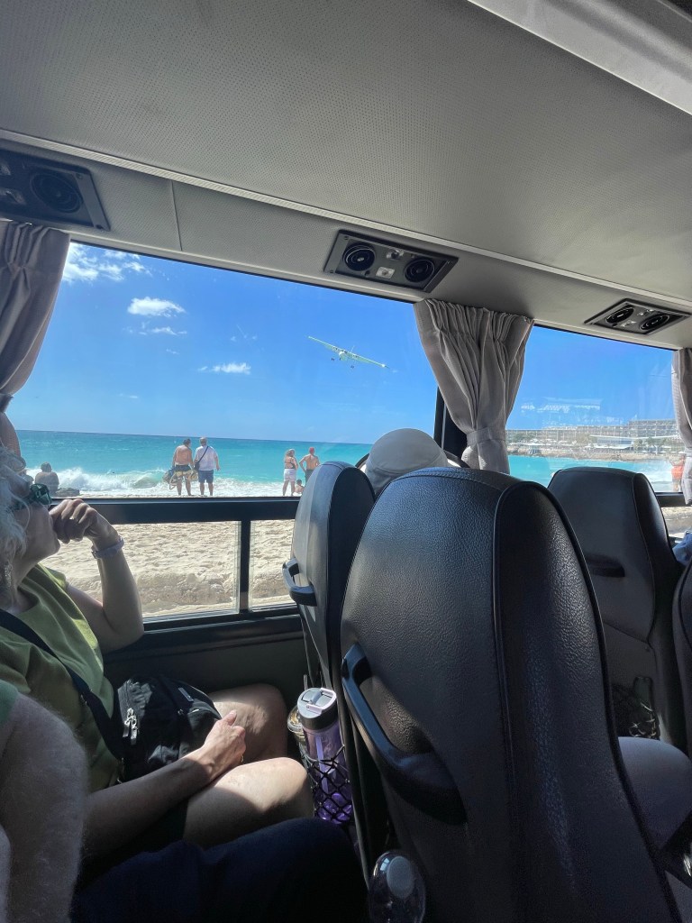
Heading back to the ship on the tender for one last time.
Well, our luck ran out today. After being able to make all our ports for the last 13 days, the wind and currents of the area made it impossible to safely get to our destination for our Beach BBQ today. We were headed for Pickly Pear Island just off the island of Virgin Gorda, BVI, but there is a narrow passage that wasn’t going to work for the captain.
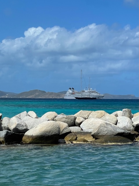
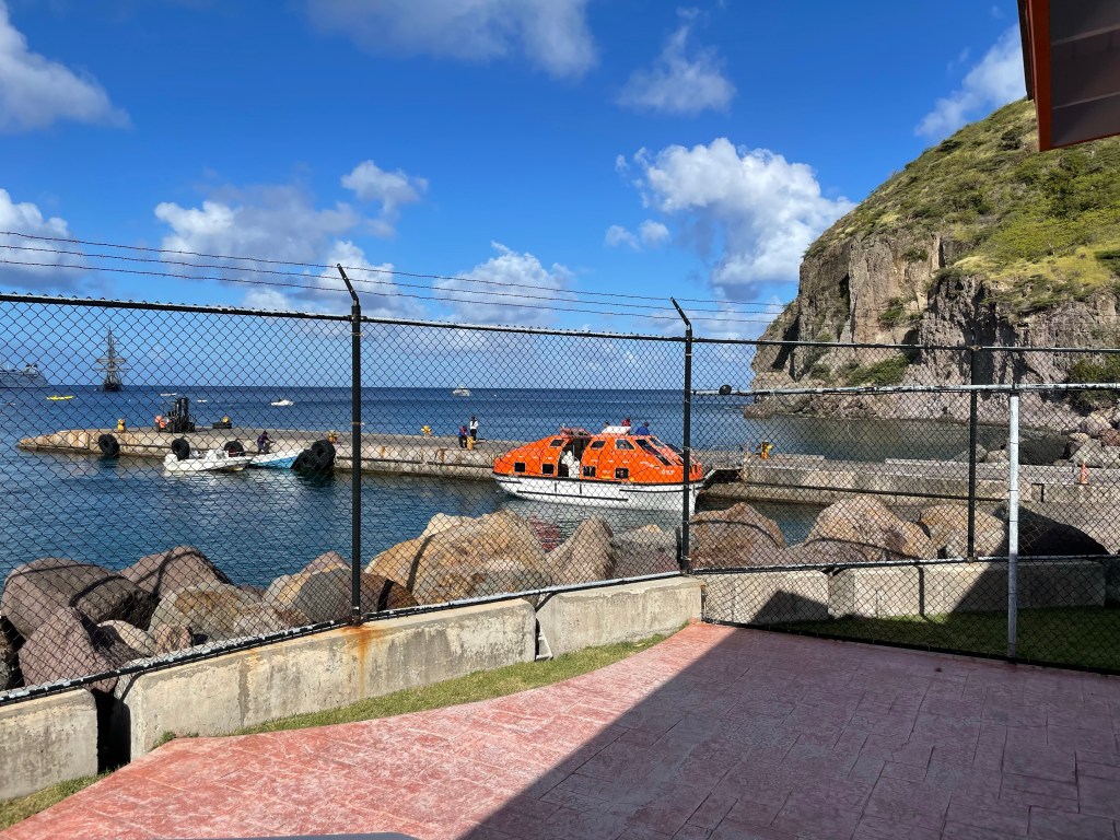
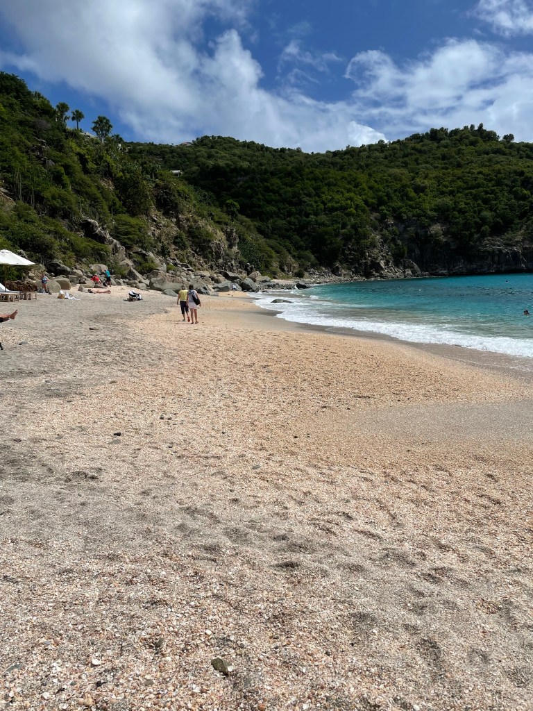
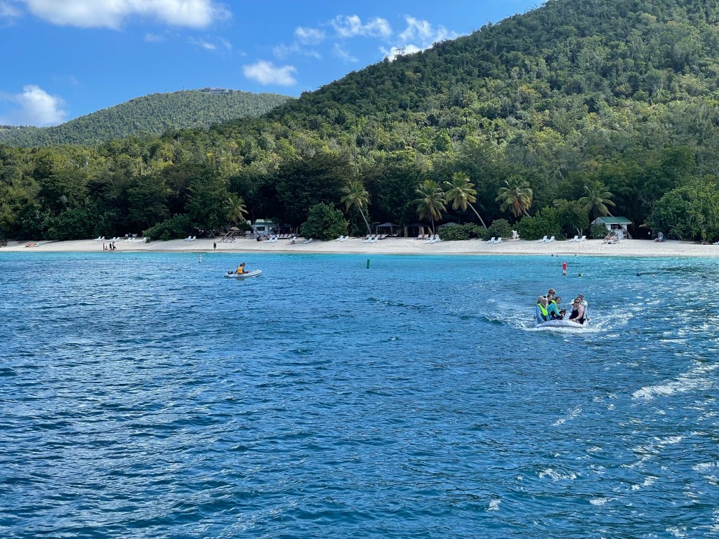
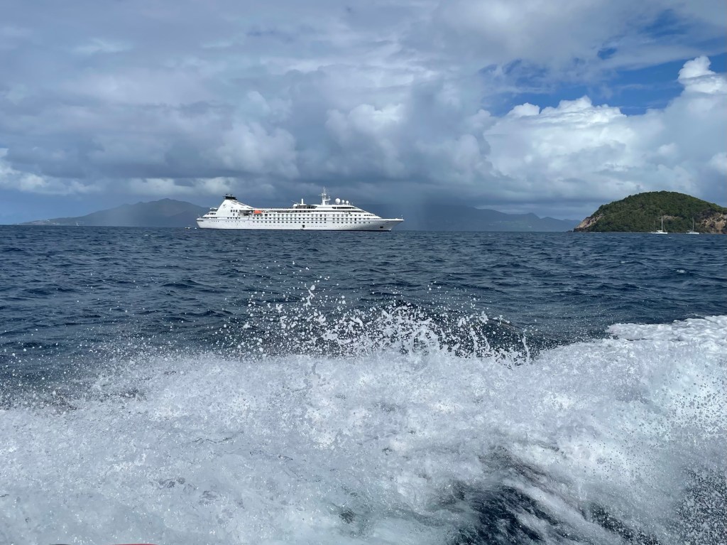
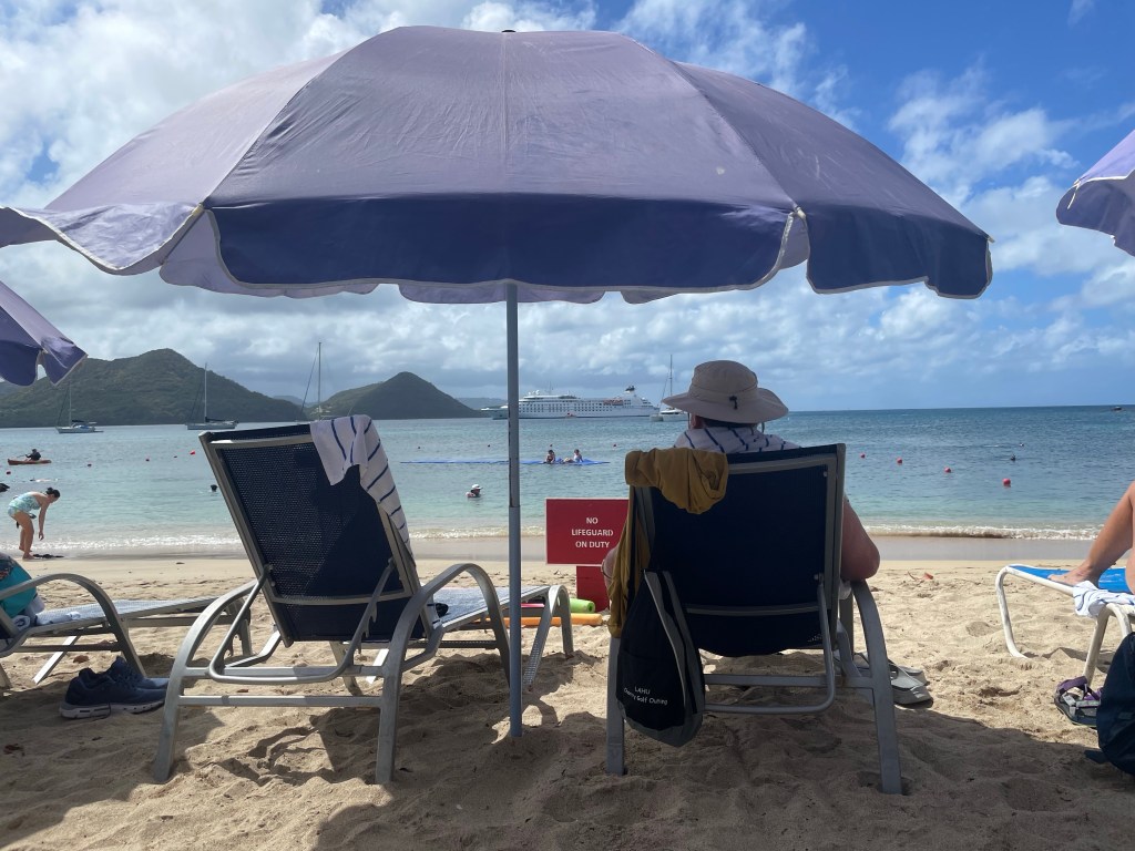
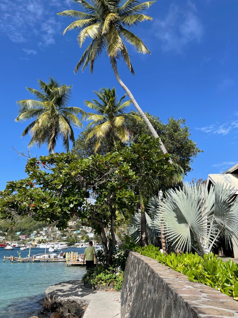
So plan B is that we’re anchored off a small town, named Spanish Town, on Virgin Gorda to allow for the planned excursions to happen. I didn’t have an excursion booked for today but a friend and I tendered off the ship and went for a short walk but there weren’t safe sidewalks to walk on so we came back to the ship. Happy to spend the afternoon by the pool, reading, chatting and likely eating.
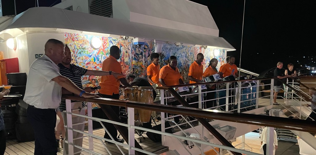
The amazing crew got the planned barbeque up and running on the upper deck instead of the beach for us.
Sadly I’ll have to find some time to pack as well. My fantastic adventure ends tomorrow which will be a travel day. It will be a long one, as our bags have to be out by 6 am and I don’t get home to Ottawa til 10 pm. Fortunately there is only one hour time difference to deal with. Then it will be back to reality.
After 2 attempts cancelled because of COVID I’m so glad this cruise finally happened. It has been fantastic. I’ve met some fantastic people, some who I will continue to be in touch with I’m sure. The crew has been amazing. I can’t say enough good things about Windstar. Another cruise by them will definitely figure into my future.
Now on to figure out what to do for my next adventure!
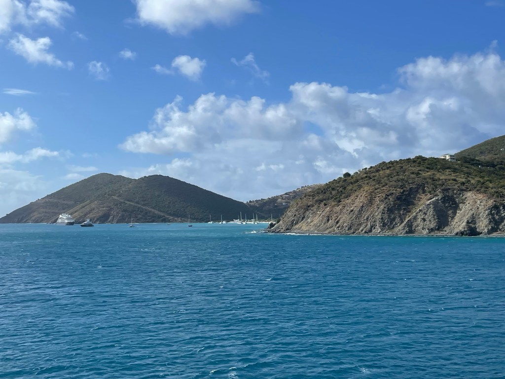
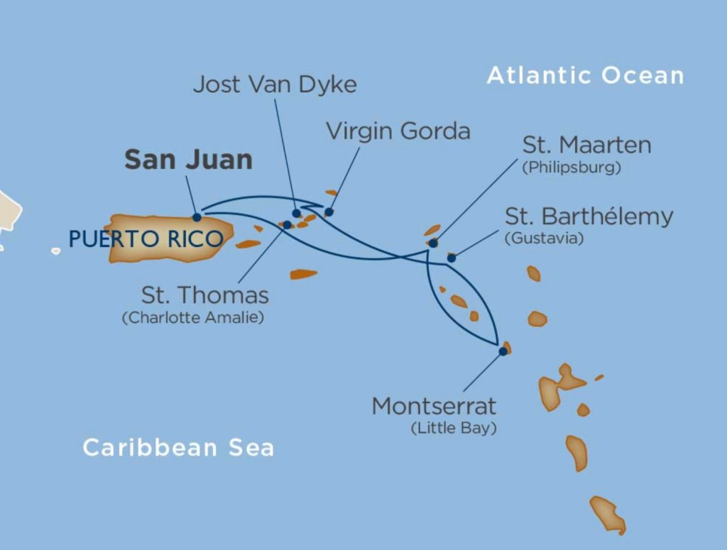
We are down to our two last stops on this fabulous tour of the Leeward islands of the Caribbean, and they are both in the British Virgin Islands (BVI).
There are 4 larger islands in this archipelago and a bunch of small ones. Tortola is the largest and the capital, Road Town, is located there but the other 3 largest ones are Anegada, and two more which we’ll visit in the next two days. Jost Van Dyck today and Virgin Gorda, tomorrow. The population of this British Overseas Territory is about 36,000, with most of the population in Tortola and the rest scattered on 16 of the more than 50 islands.
Unlike other Caribbean islands it’s thought that Joost Van Dyck a Dutch privateer and perhaps sometimes pirate may have been the first one to discover this island; however, it was British Quakers fleeing persecution in England in the 1700s that first settled here. The island citizens were granted British citizenship in 2002. The current population is only approximately 300.
The cove where White Beach is located.
It’s thought that Joost Van Dyck and other pirates used the many bays and inlets as hiding places for their ships. Eventually sugar cane and cotton were grown on the island, which would have employed slaves although they were emancipated in all of BVI in 1838.
This island and many in the BVI were hit hard by Category 5 hurricanes, Irma and Maria, both in 2017. Most buildings were destroyed and the island was stripped of it’s vegetation. The islanders were mainly on their own and they worked together to combine their resources. The one remaining working refrigerator was at a beach bar named Foxy’s Tamarind Bar and Restaurant and all food that could be preserved was brought there. Foxy is a natural leader in the community and for his efforts, he was knighted in 1968 for his humanitarian efforts, and in other projects for improving life in BVI.
The draw to Jost Van Dyke is the many beautiful white sand beaches and coves around the islands that are ideal for boating. The bay at Great Harbour is the most well known and biggest, with White Beach in the next bay as a close second. There are restaurants and bars along both beaches some of which are really well known. After the emancipation, charcoal, a byproduct of the cotton and sugar cane industries became a viable export.
Jost Van Dyke’s population is unusual for the Caribbean because of its population’s young age. Nearly half the residents are under the age of 35 and almost 70% under the age of 50. Perhaps because of this that two of the most famous beach bars in the area are on the beaches of White Bay and Grand Harbour. Foxy’s and the Soggy Dollar Bar are institutions and a frequent stop by the yachting community. The Soggy Dollar Bar has been given credit for being the birthplace of the drink called the Painkiller.
Another bit of trivia we learned is that the architect and designer of the US Capital building in 1793 in Washington DC, William Thornton, is from Jost Van Dyke. He received $500 and a building lot in the city of Washington for his composition. He was trained as a medical doctor in Great Britain and then moved to Washington where he continued to have influence on architecture there.
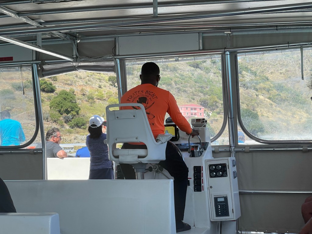
Captain of our catamaran who expertly navigated rough waters.
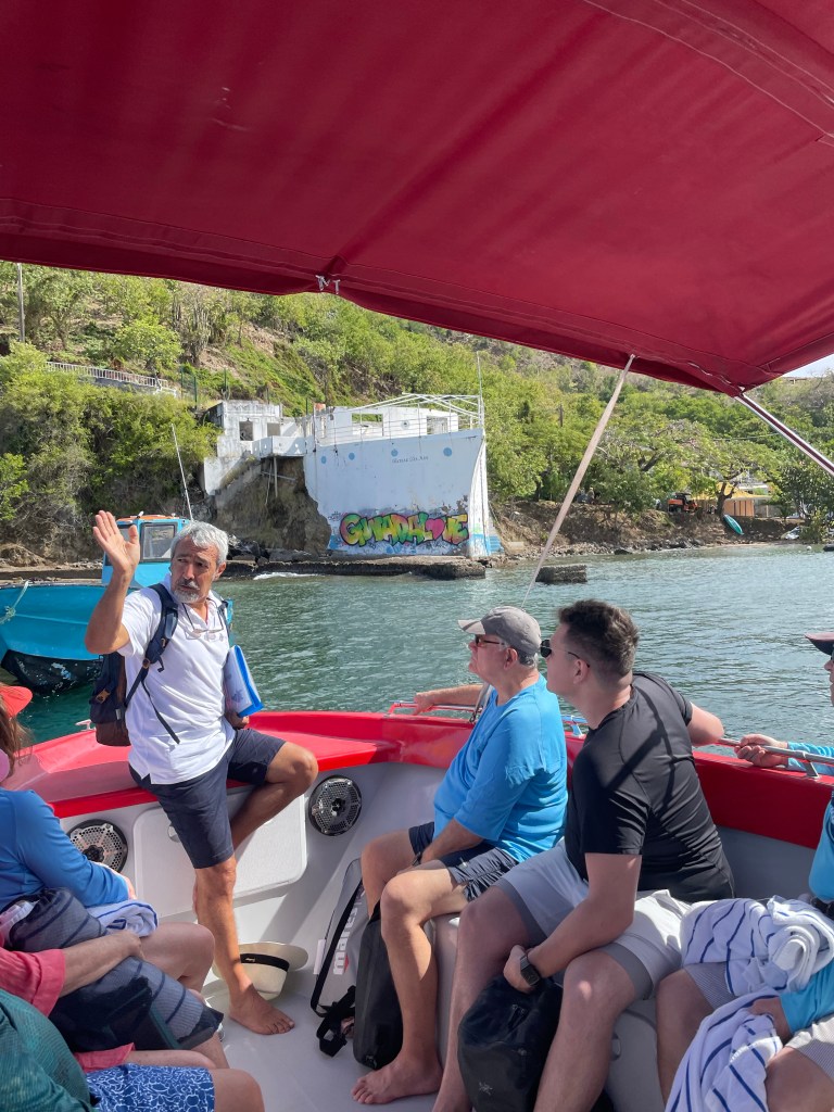
So, to no-one’s surprise, I booked another snorkelling adventure for this morning. This was a recent addition to the itinerary and involved both snorkelling and a beach day. We were transferred to a large, motor driven passenger catamaran at the tender pier, and we traversed practically all the way across the archipelago of the BVI I think. It was a rough ride in the open space between the islands, but the bay we came into on Norman Island was as flat as glass and the water was crystal clear.
Norman Island
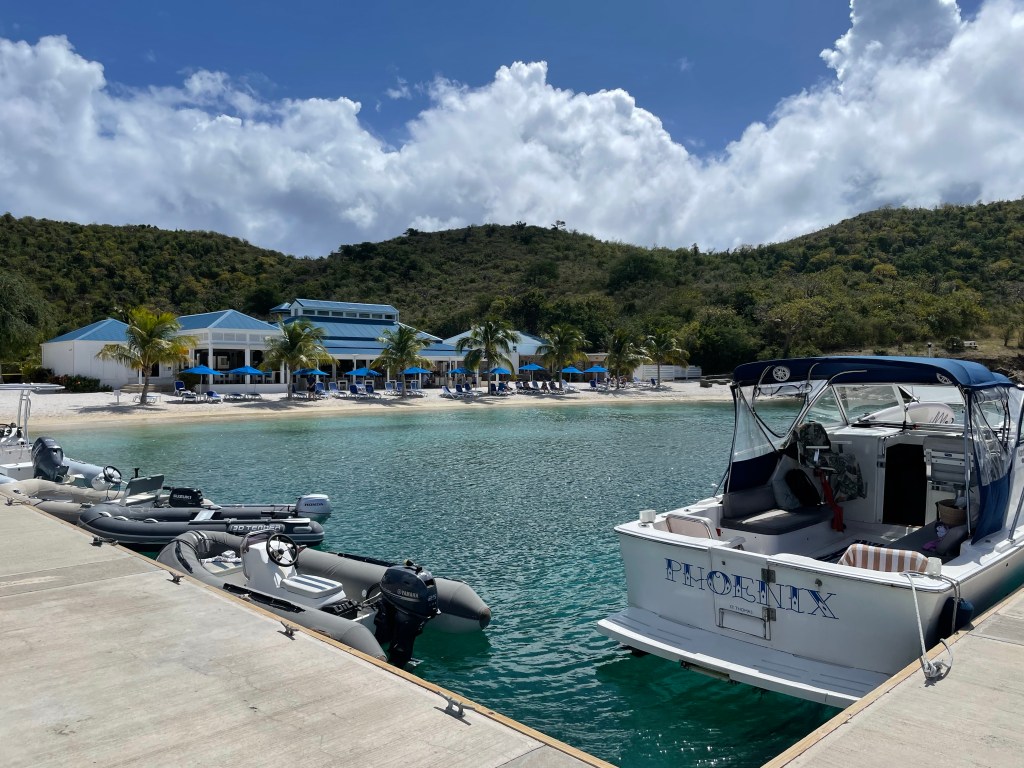
Norman Island is a privately owned small island that used to have only a small shack selling drinks on the beautiful beach but after the hurricanes, a substantial beach restaurant and bar and facilities, called Pirates Bight, was built. Norman Island is apparently one of the islands that inspired Robert Louis Stevenson’s pirate novel Treasure Island.
(I have to admit that I have been hearing and reading about pirates all this past two weeks and I have kind of ignored the subject as not being significant. But then I remembered the Disney ride Pirates of the Caribbean and the movies with Johnny Depp and realized I probably need to do some research!).
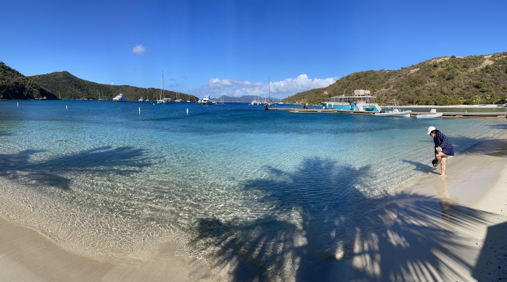
In the bay there are dozens of buoys for anchoring, and a substantial pier where we docked. Newly planted palm trees, providing shade to the beach chairs are still relatively small, but it’s going to be a gold mine for it’s owners as it gets established. We grabbed some beach chairs and headed off to snorkel.
The water was so clear and really calm.
I checked one side of the bay and found a couple of large turtles in the sea grass but not much in the way of fish. The other side however was teaming with fish of every size shape and colour. The coral reef was destroyed in the hurricane, but there are signs that it’s coming back. Not too much colour yet, but lots of new growth of different types. I was in the water for 45 minutes or so, and then soaked up some sun to warm up, until we were ready to head back to the ship. Sadly that will be my last snorkelling adventure of this trip.
The beautiful white sand beach.You can see some of the yachts moored in this sheltered bay
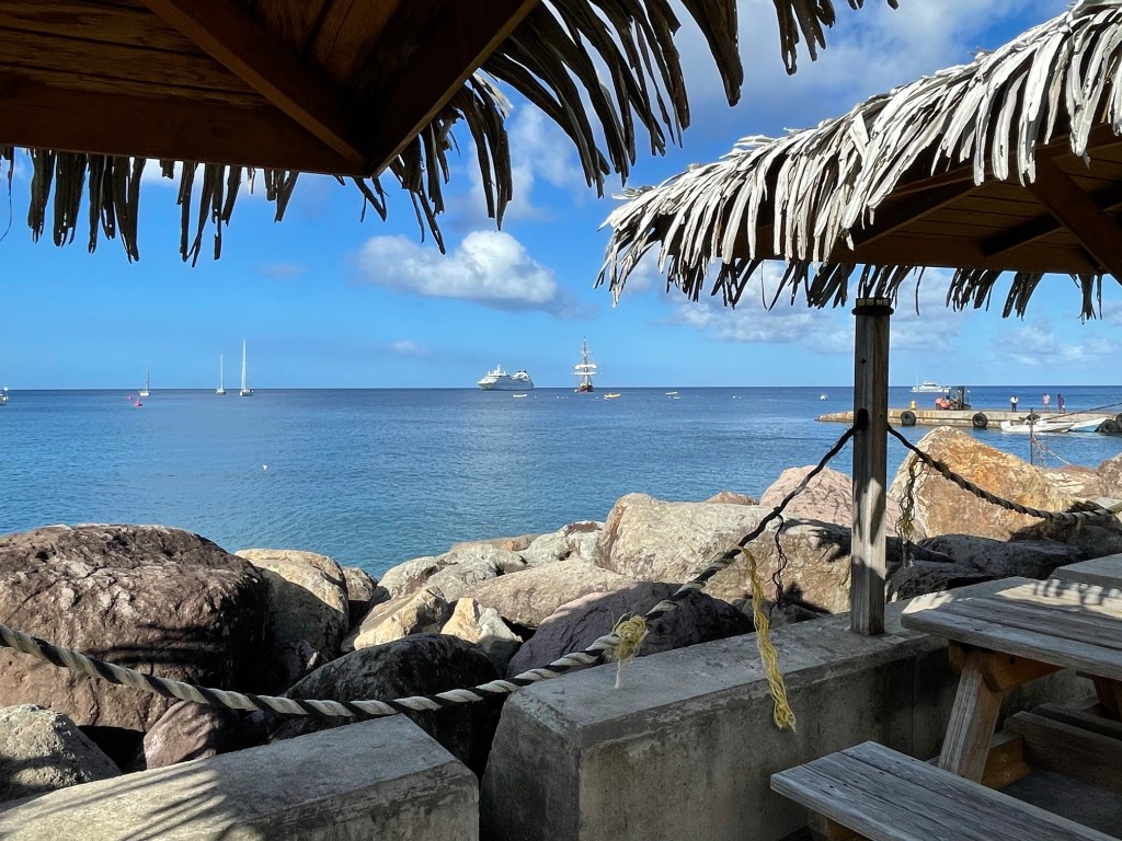
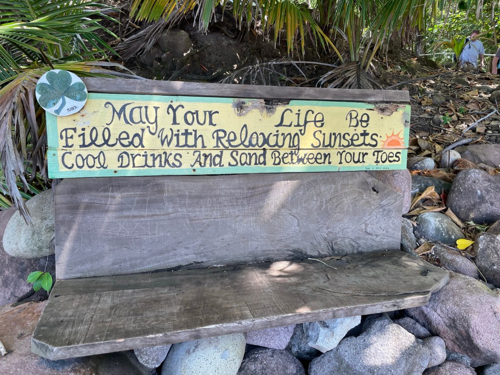
Tomorrow, our beach BBQ is planned, however, the Captain has started to signal that it might not be possible to do it as planned on Prickly Pear Island due to wave and swell conditions. If that’s the case, we’ll have a BBQ on the ship and stop at Spanish Town, on Virgin Gorda.
Today was very different than any of the other of the islands we’ve visited. But let me first start with my template.
The Harbour at Little Bay
Columbus sighted Montserrat in 1493 and named it Santa Maria de Montserrat after a mountain in Catalonia Spain (which I’ve also visited); in 1632 the English got control of the island from the Caribe indigenous people; It changed hands to the French but the English took control again, slaves were brought to the island to work on sugar, rum, arrowroot and cotton plantations but slavery was abolished in 1834; in 1998 the residents were accorded full residency rights and citizenship in 2002.
Something that we haven’t seen in the other islands we’ve been to is a large population of Irish immigrants. They either came to escape the poverty in Ireland on their own or were forced to leave Saint Kitts and Nevis and come here. Called the Emerald Isle of the Caribbean because of their Irish population and also because of the green hills that some say look like Ireland. The only place in the world outside of Ireland to celebrate Saint Patrick’s Day with a national holiday is Montserrat and the people’s local dialect includes some Irish influence. Their national costume includes an Irish Tartan.
The Irish Tartan used in the national dress.
Our guide told us that the national bird is the Montserrat Oriole which is a bigger version than North American one, the national flower is the Haliconia, the national fruit is the hairy mango, and their national dish is called Goat Water, which is a goat stew. And she quizzed us on this on our way back to the ship!
Montserrat is a pear shaped island 11 x 7 miles in size, located in the Lesser Antilles chain, between Antigua and Guadeloupe. It’s hills are lush and very green given their 62 inches of rain annually. (There are apparently 100 different varieties of ferns on the island). There are three hill ranges, and in between are valleys and gorges known as ghauts. They are sometimes dry but are teaming with water after any rainfall. The island is volcanic and there is only one white sand beach, the rest being grey or dark brown sand.
There had been 5 eruptions of the volcano on Monserrat over the past 100 years, but not for some time and it had become a desirable tourist destination with a huge cruise ship pier and lots of small hotels just like many of the islands we’ve already visited. But in 1995 a series of eruptions started in the Soufrière hills, one of the three hill ranges. Then on July 12, 1995 a series of eruptions began as the volcanic domes rose and receded. Because of the constant monitoring of the volcano, the volcanologists were able to sound the alert and all residents were safely evacuated. However 19 farmers who were told not to return to their farms did so to try and recover their animals and perished.
Ash and hot rock, hot gases and hot air, called a pyroclastic flow moved down the south slope of the Soufrière Hills. The volcano has not emitted significant ash for the past 2 years, but since the first eruption, over 16 years of time, enough ash has been emitted by the volcano to cover almost 3 square miles of the south slope of Soufrière Hills. Problem is that in addition to agricultural land, and forests, the capital city of Plymouth along with the only airport was on the south slope of Soufrière Hills. This is were most of the population lived.
Nearly 2/3 of the island’s population of 12,000 at the time had to be evacuated, and went either to the United Kingdom or other parts of the Caribbean. At one point the population was as low as 2000, but some people have returned and others arrived and the current population is approximately 3000- 4000. Continuing small eruptions has made redevelopment uncertain and the southern part of the island is now in what’s called the “exclusion zone”. No one was admitted into the exclusion zone until 2015, but they have now started letting people return with guides only and police permits. No one is allowed to live there due to the threat of renewed volcanic activity.
The north and north west side of the island however, is not threatened by the volcano, and several settlements are sprinkled around.
Today, I took a tour called the Buried City, and that is what we saw indeed. We landed in one of the new communities, called Little Bay. It has a rudimentary pier which allowed us to get off the tender but it’s not capable of receiving large ships. Windstar was the first cruise lines to start bringing passengers back in, for which the islanders are obviously grateful. As you can imagine, with tourism being the main economic driver, the volcano eruption, Hurricane Hugo and then COVID the people here are grateful now to be seeing tourists even in small numbers. They have recently received a grant of $2.5 million to build a breakwater and proper docking facilities which they expect to be built within 18 months.
Taken from the pier where our tender landed.
There was a steel band greeting us after the customs house, and we were made to feel really welcome. We jumped on two separate buses each with a guide and drove through some of the small communities. Our guide was born in Montserrat, left for England and then the United States, but just returned after retirement. She was hilarious but she didn’t know as much as the guide who was on the other bus than I was on, and the bus driver, “Pinky”, needed to help her out with some of the information. She told us lots of stories about the history and daily life of the island on our way to the Exclusion Zone. She and the other guide referred to the eruption as the “volcano crisis.” Turns out the other guide was the administrator of the Airport and responsible for the evacuation of the island’s residents when the call came to do so. He was the last person to fly out of the airport before it closed. He was passionate about his home and its future.
There is the Star Pride in the distance. The pier where our tender landed today.
One community she pointed out was Cudjo Head. It is a startling reminder of another time. A slave who had tried to run away named, Cudjo, was made an example of and hanged from a tree on a prominent cliff to serve as a warning to the other slaves. In later times they named the place after him as a grime reminder.
She pointed out Runaway ghaut, where legend has it that if you drink water from this particular river when it’s flowing that you will return to Montserrat. We were meant to stop but because of a delay in getting in to the Exclusion Zone because the police hadn’t opened the gate there wasn’t time. At another point she said there was a nice hiking trail and that just 5 years ago some ancient petroglyphs had been discovered thought to be somewhere between 1500 and 2000 years old.
The guide at one point indicated a small road leading off the road we were on and told us it was the former location of AIR Monserrat. This was a recording studio set up by George Martin in 1979, who was the Beatles producer, when he discovered Montserrat on a holiday. There is a star studded list of groups who produced records there: Climax Blues Band, Jimmy Buffett, Police, Sting, Duran Duran, Stevie Wonder, Paul McCartney, Dire Straits, Elton John, Eric Clapton, Marvin Gaye and others. Our bus driver talked about walking past a bar one night and hearing piano music and when he stuck his head in the door found it was Stevie Wonder. It’s reported that Elton John arrived with 5 security people and after being on the island for a week, sent them home, not needed. The studio was destroyed, not by the volcano but by Hurricane Hugo which made a direct hit on Montserrat in 1989. Ninety percent of the islanders lost their homes during the storm.
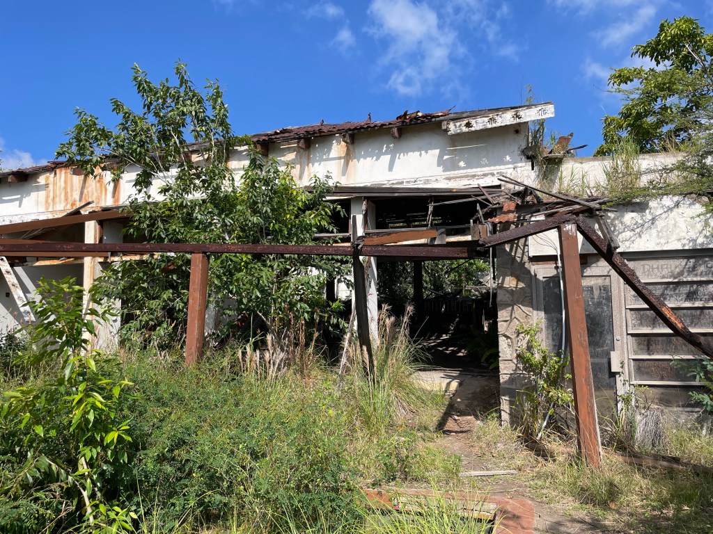
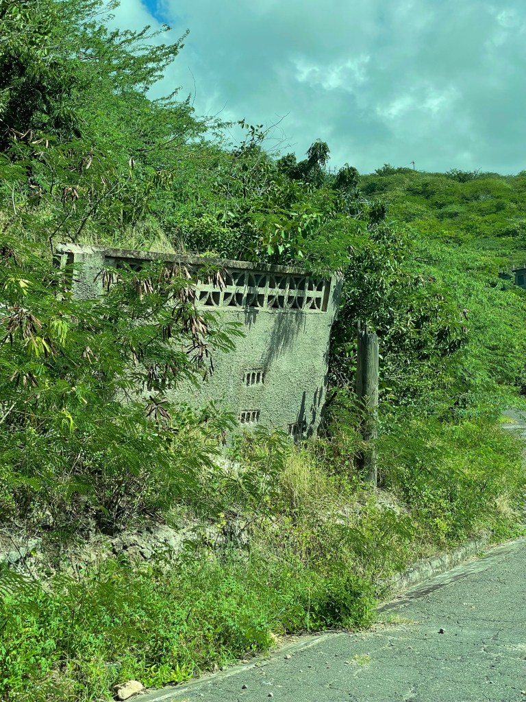
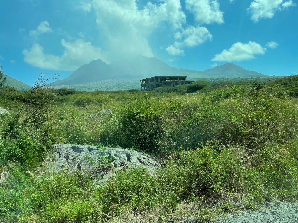
We got to an area where travel was permitted but it was an area that had been abandoned as it was determined it was inhabitable because of the gases escaping from the volcano. Hundreds of houses on the hill sides were abandoned and have been lost to the jungle of vegetation. If the roofs were made from corrugated metal, they have disintegrated due to the acid whereas the tile roofs remain. Some structures using metal for structural beams have collapsed, and all are completely grown over. There are no longer any services to this area of the island, so while people can live there, they have to live off the grid. One fellow had rebuilt, and is doing so, but there is always the threat that the volcano will blow again. It is still considered active by the volcanologists that are monitoring it constantly. Our guide pointed out the house, now decrepit and covered in forest, where she had lived as a child.
Abandoned homes in an area which could be threatened by future volcanos Evidence of formerly lovely neighbourhoods.
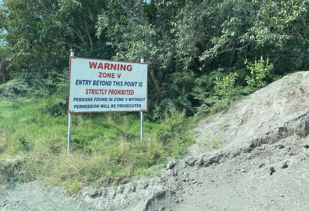
We came to a gate that marks Zone V (5), which is the Exclusion Zone, but it was locked. Our drivers were on the phone to the local constabulary, and we were directed to another gate where we waited for a few minutes for him to arrive to open it up. The police came with us and kept an eye on us until we left.
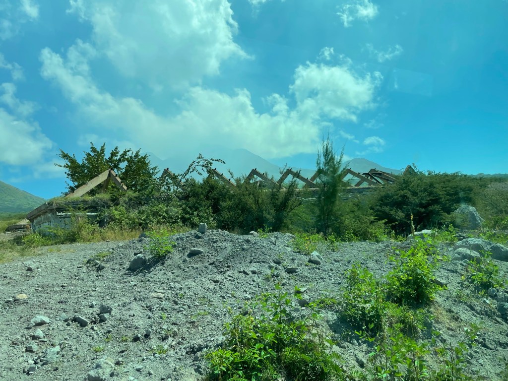
As we drove, our guide and the driver who lived there during the crisis pointed out the tops of roofs that we were seeing. A new government building had just opened the week before, and all you could see were some rusting roof beams. A five story building was covered up to the top of the 3rd story. It depends on the prevailing winds as to how much ash dropped where, as it was only up to 2 -3 feet on some structures but in other places it’s 85 feet deep.
This was a five story building and only 2 stories are visible now. You can see the volcano in the background. A government building that had just opening the week before the eruption.
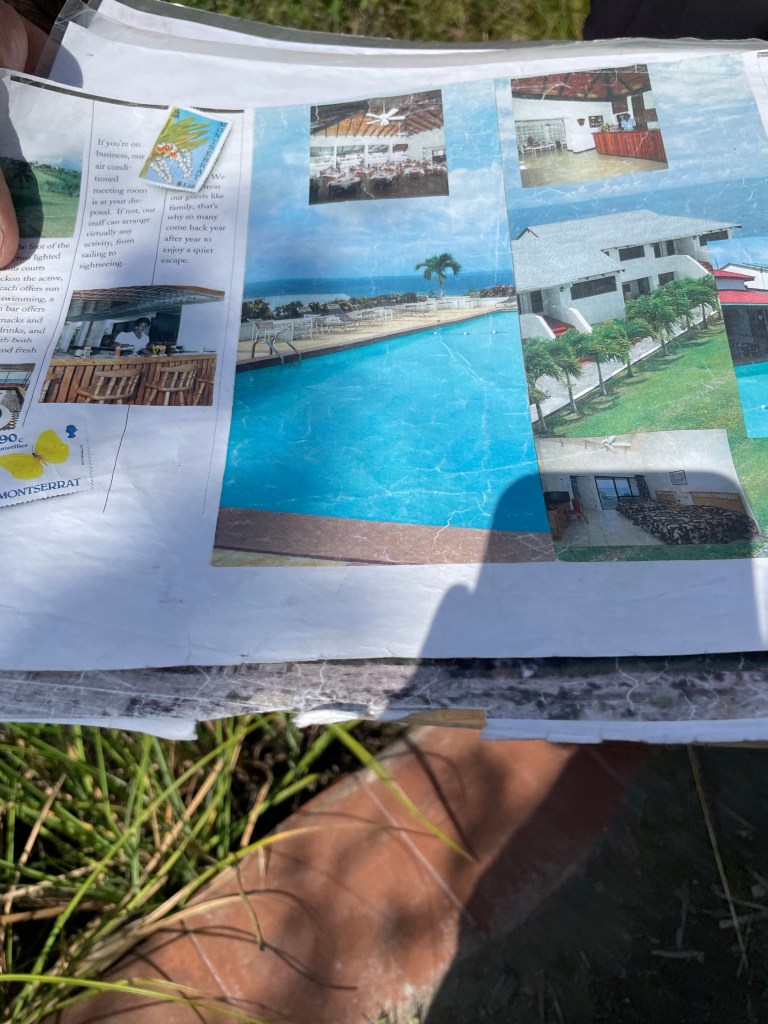
We drove to our first stop which was a very fashionable and well known hotel called the Montserrat Springs Hotel (previously the Emerald Isle) on the hillside over looking the ocean and Plymouth. The guide said it used to have a spectacular view at night with the lights of the city twinkling below. Apparently when it was the Emerald Isle they discovered there were hot springs around them, and they took advantage of that and transitioned into a spa with hot springs. They had the biggest pool on the island and the local kids were taught how to swim there when there were no tourists in residence. It was owned by a Rotarian and the Rotary events were held there. Many islanders learned the hospitality industry there and were able to get jobs at other paces on the island. The guide showed us pictures of its one-time glory days. Now it sits in ruins. The pool is filled in with ash, the jungle has moved in and taken over. The property did provide a great view of the volcano and the area it destroyed. The profile of the hills in the background has changed and the eruption created a new peak as well as several acres of new land at the base of the hillside where it enters the sea.
Brochures from the Montserrat Springs Hotel The swimming pool full of ashThe view from the hotel overlooking the former city of Plymouth
We then carried on to the pier where only the end furthest into the water is left and the guide explained the whole story of the volcano crisis to us. He pointed out a hill in the distance where some grass has grown back which was his home. He now lives in Little Bay. It’s absolutely devastating to hear the stories and see the destruction. He pointed out an area where there was manufacturing: a rice milling plant, a cotton spinner, a coffee processor, and a tire factory.
A view of the Soufrière volcano still emitting gases.
When his story was told, he expressed sincere thanks to Windstar for being the first ship to come back here, and to us for travelling here and coming to hear their story. He was almost in tears, as was I. He then said that they needed us to spread the word that Montserrat is open again, that the north side of the island is safe and green and there is so much to do. We needed to come and stay longer. Hiking to enjoy nature on both the land and along their reefs, eating their traditional foods, enjoying their clear, clear waters, visit the botanical gardens, visit the volcano observation station, and enjoy the warm hospitality of the people. There are not big hotels but there are lovely AirBnBs and VRBOs. It’s an easy ferry or plane ride from Antigua and it really is gorgeous. The Montserrat Festival each year doubles the population. They have a long way to go to be prosperous again, but they’re on that path.
We piled back on the buses and travelled back along the same hilly road to a government picnic and beach site, called Woodlands Beach where local families had prepared a lunch for us of chicken, pumpkin fritters, rice with spinach, and banana bread. And of course rum punch. After lunch we had time to walk down to the beach to see the blackish (more grey) sand. Some of the group went swimming and other enjoyed wading and taking pictures. (That would be me.)
Here is me on the greyish sand beach with the Star Pride way in the backgroundNo explanation necessary. Words to live by
After a 45 minute stop we headed back to pick up the tender back to the ship. There were some ladies selling locally made handicrafts and I bought a small purse made from the Irish tartan that is part of their national costume. Just because.
Being Valentines Day, our on-board cruise consultant (they offer special deals if you book your next cruise while you’re on this one, they’re not stupid), Emmillee who is just a wonderful woman, invited some single women to sit at her table tonight which was very thoughtful. Not that I’m pining after a Valentine! It was a lively conversation mostly, of course, about travel. But also about lost love and family.
Hope you enjoyed Valentine’s Day everyone. It’s one I’ll certainly remember.
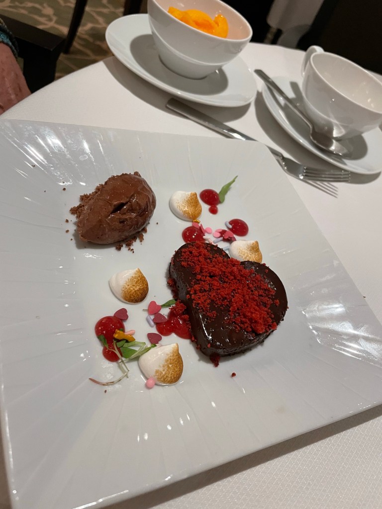
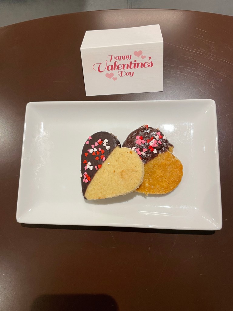
My dessert tonightAnd instead of chocolates on our pillows tonight.
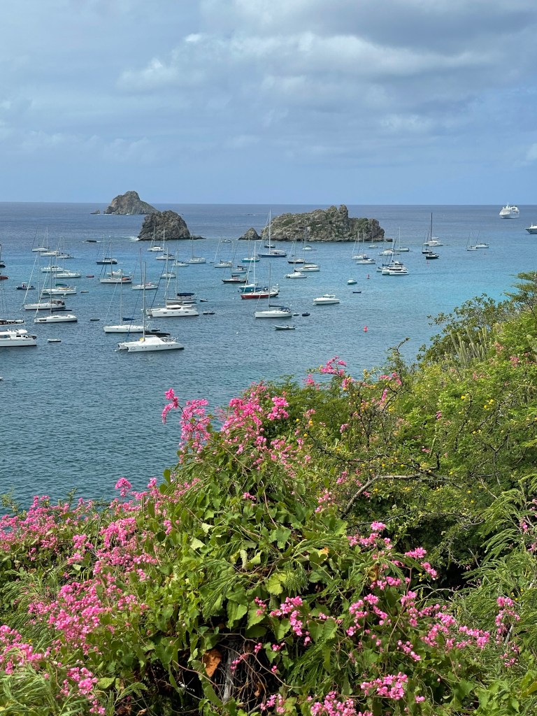
Where the rich and famous (and very briefly I) come to vacation.
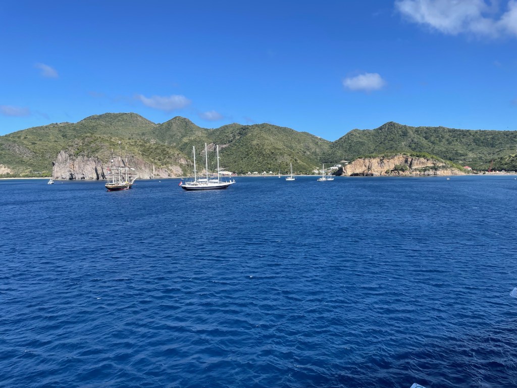
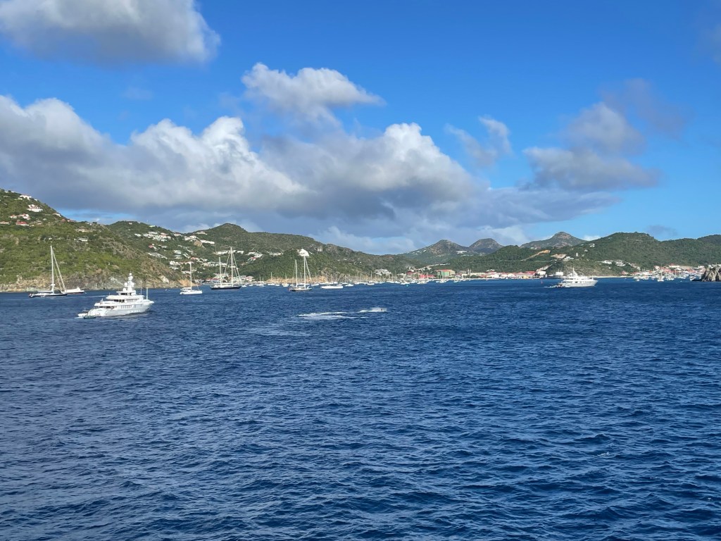
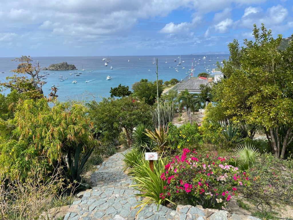
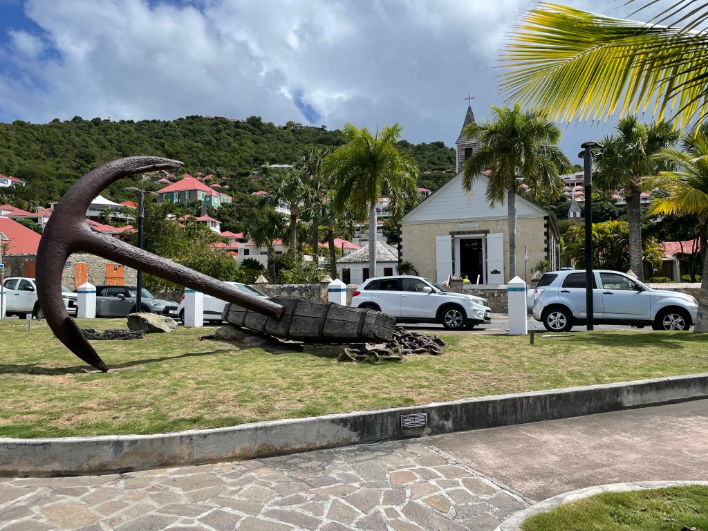
The harbour at Gustavia, St Barts
I feel like instead of writing an island specific history I could have just written a generic template for the islands we’ve visited and just cut and pasted it, editing for minor differences. While there are some differences between their histories, they pretty much follow the same pattern. Columbus first sighted; France, England, Spain, Netherlands or Denmark settled; they were fought over for years; one country won out by war or attrition; slavery was abolished; the island becomes independent or a territory of the country who won.
Let’s try it with St. Barts. Columbus sighted it in 1493 and named it Saint Bartholomew after his brother; in 1648 the French started settling; the British attacked, traded to Sweden (who named Gustavia after their king); slavery was abolished in 1847 during Swedish rule; Sweden sold back to France in 1878; in 1946 the residents became French citizens with no rights. Simple. Of course there is much more, but you get the idea.
Tourism started to grow on this tiny island (9.2 sq miles) in the 60s and 70s spurred on by the building of a landing strip. That landing strip is extremely short and only mid-sized planes are able to land on it, and even then it’s considered one of the top 3 most dangerous airports. The planes need to clear a mountain (well hill) and then make a deep dive to hit the strip to give themselves time to land before dropping into the ocean at the end of the strip.
View from the Lighthouse
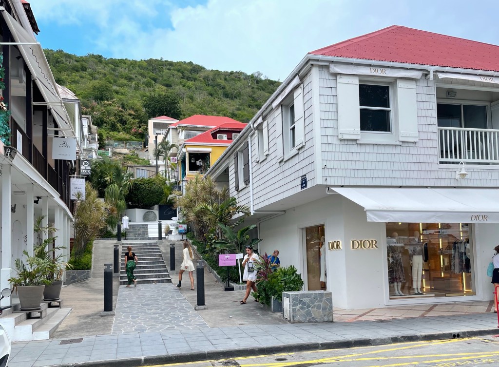
The water colour around St Barts is a unique shade of blue, that seems different than other islands. It is a volcanic island with reefs almost all around the island, which is perhaps the reason for the colour. The French speaking island of approximately 10,000 residents is covered in high end retail, designer shops, boutique hotels (the largest has only 58 rooms), pricey restaurants, and beach clubs. There are strict regulations about not allowing fast food outlets on to the island so you won’t find a Big Mac to save your soul.
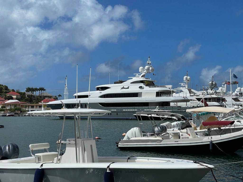
The perfectly sheltered harbour is dotted with the usual sail boats, and yachts, but also super yachts. One shore dingy we saw on our walk today was at least 25 ft long. That was just the shore dingy. Imagine how big the yacht is. One boat we saw in the harbour struck our interest and it appears to be quite the spectacular charter super yacht – world famous according to their website. You can check it out at yachtloon.com – quite the website. (Thanks to Phyl’s sleuthing and locating it for me).
The Superyacht “Loon”
Perhaps because of the challenge in getting to it, St Barts has become a haven for actors, singers, writers and other people who can afford their outrageous prices. Some of the names that are tossed about as those that have vacationed or lived here are: Beyoncé & Jay-Z (St Barts is well known for it’s NYE celebrations and Beyonce performed at one recently), the Kardashians, Mike Tyson, Gwen Stefani, a couple of Victoria’s Secret supermodels, Greta Garbo, Howard Hughes, Nicole Richie and Jeff Bezos.
Oh yes, and to my template I should add which Hurricane played havoc on this particular island. In the case of St Barts, most of it was destroyed by Irma in 2017 however, the local residents used their private money to rebuild infrastructure and rebuilding happened more quickly here than most of the other affected islands.
I got ahead of myself a little, so let me start again. We arrived into the capital of Gustavia this morning at about 8 am under very grey skies and pretty wild waves. I didn’t have an excursion planned for today, so I was able to have a bit of a lazy morning, and enjoyed my 3rd cup of tea before attacking the day.
Under blue and sunny skies, one of my fellow passengers and I headed for the tender to do some exploring on the island and discovered a longer than usual line. We discovered the reason when we got close to the front of the line. The swell and waves were making each passenger boarding difficult because the tender was pitching about. Eventually we were all aboard and off we went.
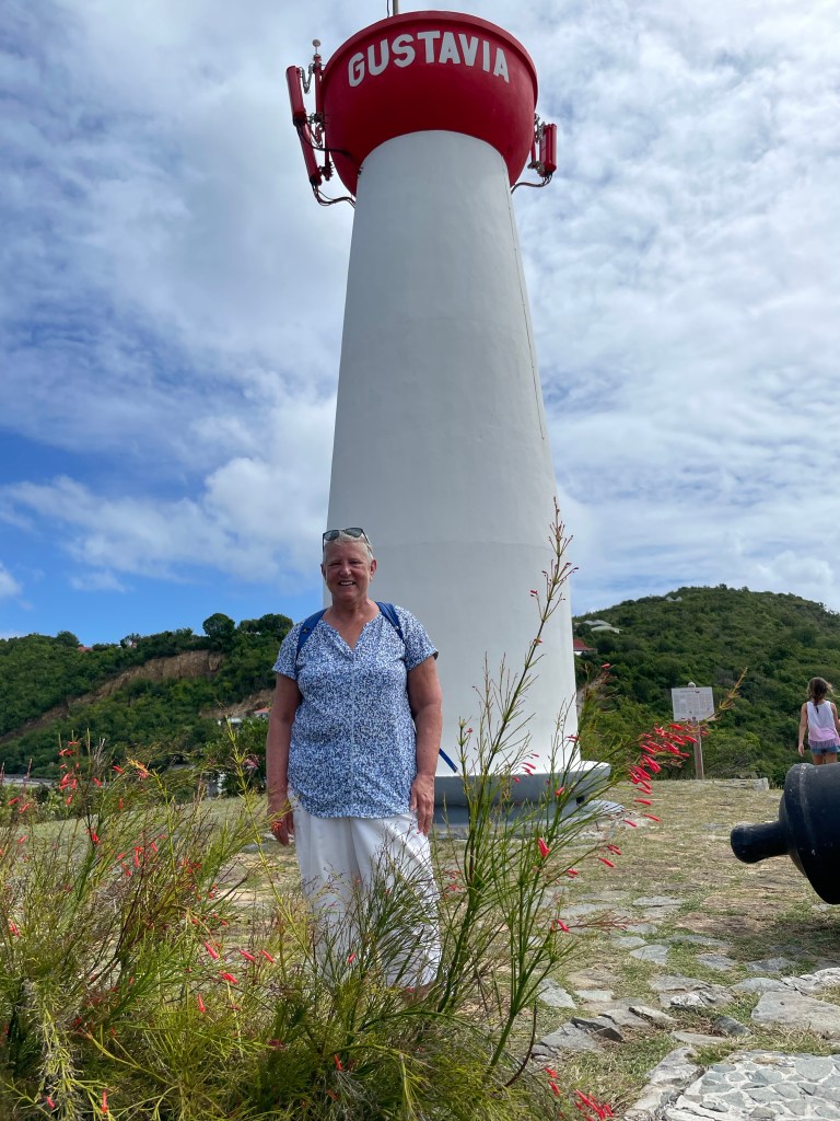
You could tell immediately upon disembarking the tender that this island was upscale. The ferry facilities, the street lights, the board walk, etc were all very nicely done. Our Destination Manager had told us about a lighthouse we could walk to and how to get to an interesting beach so off we went.
One of the many shops along the main front street. Our destination, the lighthouse
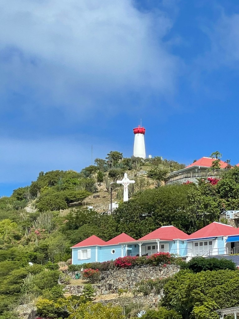
After just a short walk past stores like Cartier, Rolex, Louis Vuitton, Dolce & Gabanna, and Hermes we found the pathway to the lighthouse and also found a lovely botanical garden all around it. There were many species of trees and bushes that were identified by signs all along the pathway. One of the trees that was familiar to me from other trips was the Plumeria or Frangipani tree from which the flowers grow that they make into leis in Hawaii. And the view of the harbour from the base of the still active, 30 foot lighthouse built in 1961 was spectacular.
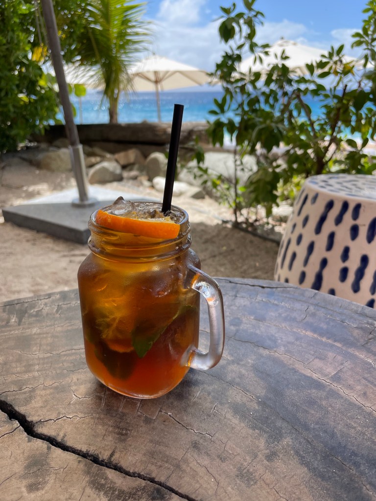
Back down the hill we wondered along the streets, dodging traffic, trying to stay in the shade and making our way in the direction of our second destination. In no time we’d found the famous Shell Beach. Before exploring the beach we stopped in a shaded area for a lovely refreshing drink at the Shellona Restaurant. The prices were pretty outrageous (12 euros for an iced tea), but the view couldn’t be beat and it was a hot and humid day – not complaining!
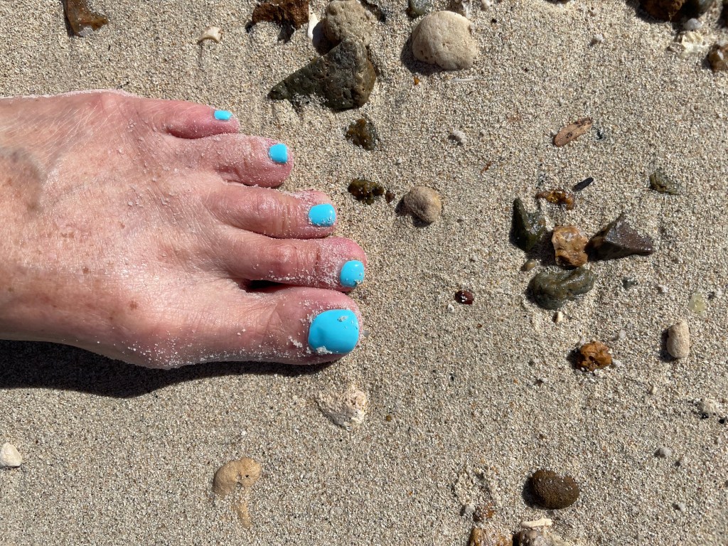
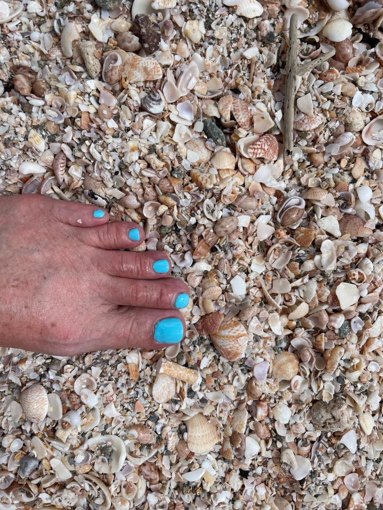
Much needed iced tea in the shade with a spectacular view.There’s those toe nails again. Shell BeachPark along the harbour
We found our way back to the tender dock, mostly along the harbour and after putting in 5.3 km worth of steps we came back to the ship for lunch at the Star Grill on the outdoor upper deck of the ship. The afternoon has been spent napping, reading and writing this blog. Tonight is the “famous” deck BBQ where the sun decks are transformed into a huge outdoor restaurant, with buffet style food service. Afterward, is line dancing with the staff. I’m pretty sure the staff enjoy it as much or more than the passengers.
Tomorrow is going to be something totally different than anything I’ve seen so far on this trip. My blog won’t be focused on long ago history or pretty beaches, but rather an event that took place 18 July 1995. Tune in tomorrow!
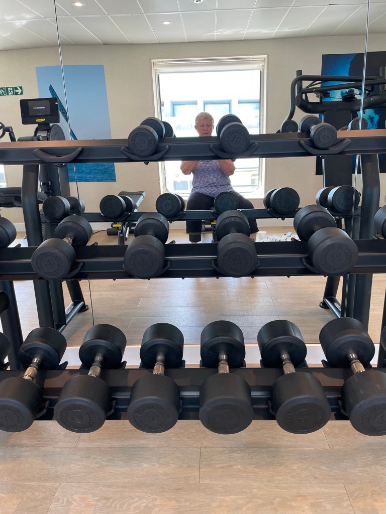
So, here we go with week 2 of this fantastic trip. I can’t wait for some of the neat stops this week. It’s two cruises combined really and so yesterday a whole crop of new people got on the ship. There are 33 of us that were on the cruise last week so approximately 200 newbies. I spent the day on the ship, taking advantage of the space with hardly anyone else on board since the people leaving the tour were gone by 9 am and the new passengers didn’t start to embark until 1 pm. I actually got to the gym for the first time. I am pretty proud of myself for doing a pretty good workout. Hard to do on those days when we’re snorkelling.
Rather empty ship!
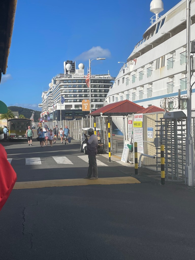
We departed San Juan at 10 pm on Saturday evening with the same flag raising ceremony as last week and headed for our first stop at Haven Sight Cruise Ship Terminal in the capital city of Charlotte Amalie on the island of St Thomas in the US Virgin Islands.
Hard to tell from this angle, but the other ship docked here in St Thomas today is the Rotterdam, significantly larger than the Star Pride
The US Virgin Islands are an “organized” unincorporated territory of the US similar in nature to San Juan. They have no “rep by pop”. They get to elect a representative to Congress, but that person can’t participate in votes in Congress and can only participate in committee. They participate in the presidential nomination process but like other territories, don’t get to vote in the presidential election. Locally, they have an elected legislature, with different number of representatives from each of the islands. As of 1970 they are able to elect their own governors, whereas before then, they were appointed by the President of the United States.
The main islands that make up The US Virgin Islands are Saint Croix, Saint John and Saint Thomas but there are approximately 50 more smaller islands in the group totalling 134 square miles.
Christopher Columbus (who else) is thought to have discovered the islands in 1493, but the Spanish didn’t settle until 1555. English and French settlers also started arriving but interestingly so did the Danes in the late 1600s with the establishment of the Danish West India Company. In 1754 the islands became part of Denmark. Slaves were used on sugar cane and cotton plantations and in the last half of the 1700s, there were significant slave rebellions and eventually in 1848 the slaves were declared emancipated by the Governor. Many of the Danish farmers abandoned their farms because they were no longer profitable and their population gradually dwindled. In 1917 the United States purchased the islands.
The islands have been hit by several hurricanes over the years, most notably in 2017 when within two weeks they were hit with two Category 5 hurricanes, Irma and Maria which caused extensive damage.
At one time, oil refining was large here but it has been shut down and now tourism is approximately 60% of the GDP of the islands, and 2.5 – 3 million people visit the islands in a normal year. Agriculture and small scale manufacturing (rum distillation) make up the rest.
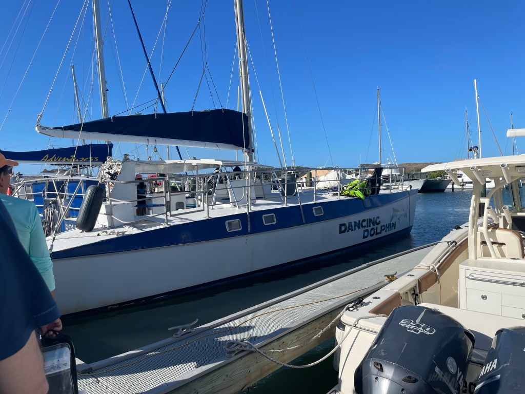
There are several National Park Service sites in the islands, and today, one of them was our destination about 5 km east of Saint Thomas, the island of Saint John. Saint John is only 17 square miles and about 60% national park. Famous Honeymoon Beach is part of it and our specific destination. You can hike 30 minutes from the ferry dock (the only way to get to Saint John is by private boat or ferry) to the beach. We took a charter catamaran today.
Our catamaran, the Dancing Dolphin, was in one of a plethora of yacht clubs on the island, about 20 minutes by bus from the main cruise ship terminal. There were 3 dozen or so people on this excursion called the Saint John Catamaran Champagne Cruise. We motored over under beautiful blue skies and pretty calm water passing several of the smaller islands around Saint Thomas. One of the staff on the catamaran pointed out quite a large island that apparently used to belong to Jeffrey Epstein. Some of the homes on the hills of the islands were pretty spectacular.
There were several boats anchored in the bay at Honeymoon Beach and quite a few snorkelers already in the water. After a safety briefing we got our gear on and headed out. There was quite a large reef to explore with more fish than we’ve seen at other spots. I saw a school of probably 100 bright yellow, fairly good size fish at one point, ebbing and flowing with the current under a coral shelf. There was some bright red coral that I’ve never seen. Then I snorkelled over to the beach and went for a walk on the absolutely beautiful sand. I forgot to take my camera to the beach with me so I don’t have any pictures of my painted toes in the sand there. A good reason to come back.
For those who didn’t snorkel, the dingy took them to the beach and back. That’s Honeymoon Beach in the background.
We weren’t there long before we were called back to the catamaran for the return trip. We were offered the ubiquitous rum punch on the return trip as well as Prosecco and some cheese and crackers to hold us over til lunch. Any day on the water is a fabulous day, and today was no exception.
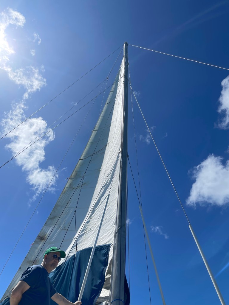
Prosecco was our reward for our hard work today. As promised, the captain put up the sail, but he still powered back.
After we got back I showered and grabbed some lunch and then went browsing through the shops in the cruise ship terminal area. Didn’t buy any jewels I’m afraid. The rest of the day was spent in what has become quite a routine, napping, snacking, chatting, working on blogs, reading, listening to port talks, and dinner. I’ve had some really interesting table companions which makes the chatter really interesting.
Tomorrow we’re in to St Barts, (weather permitting) the island of the rich and famous. Lots of famous people seek out their privacy on St Barts, partly because it’s so hard to get to. Our tour director warned us to check out the menu of any restaurants we might want to try because some of them have outrageous prices for seemingly routine food. I don’t have an excursion booked for tomorrow and am looking forward to sleeping in a little.
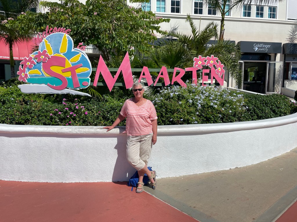
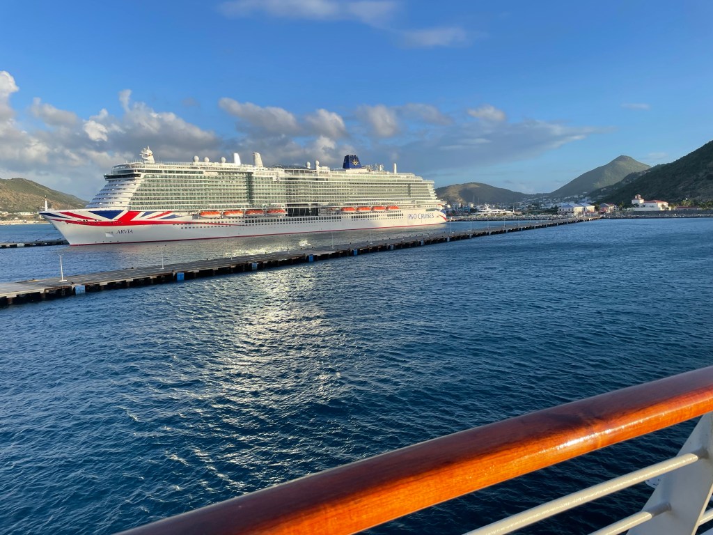
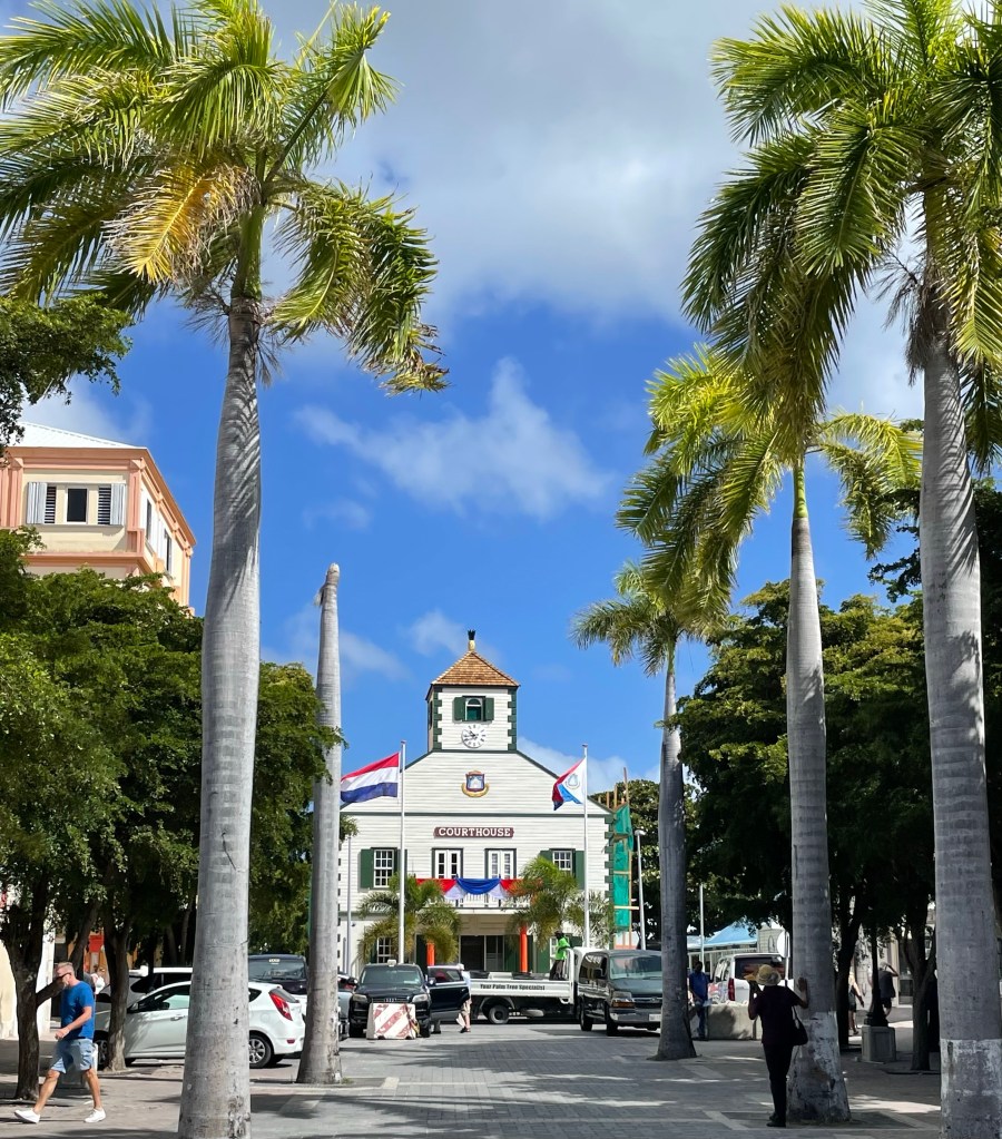
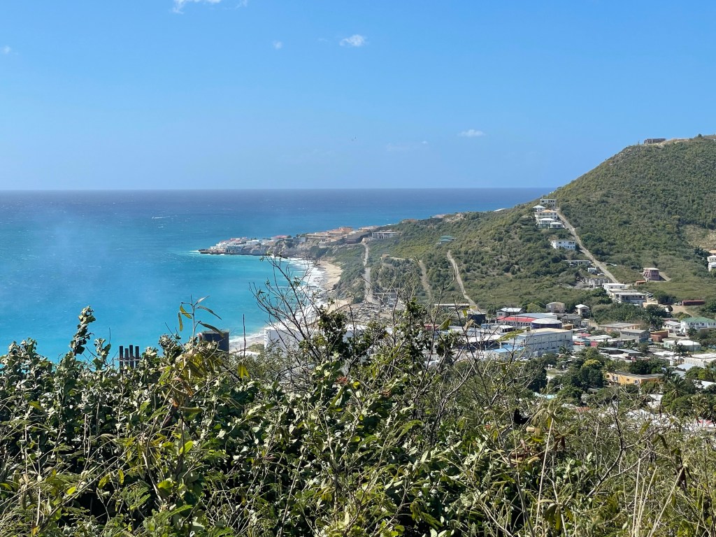
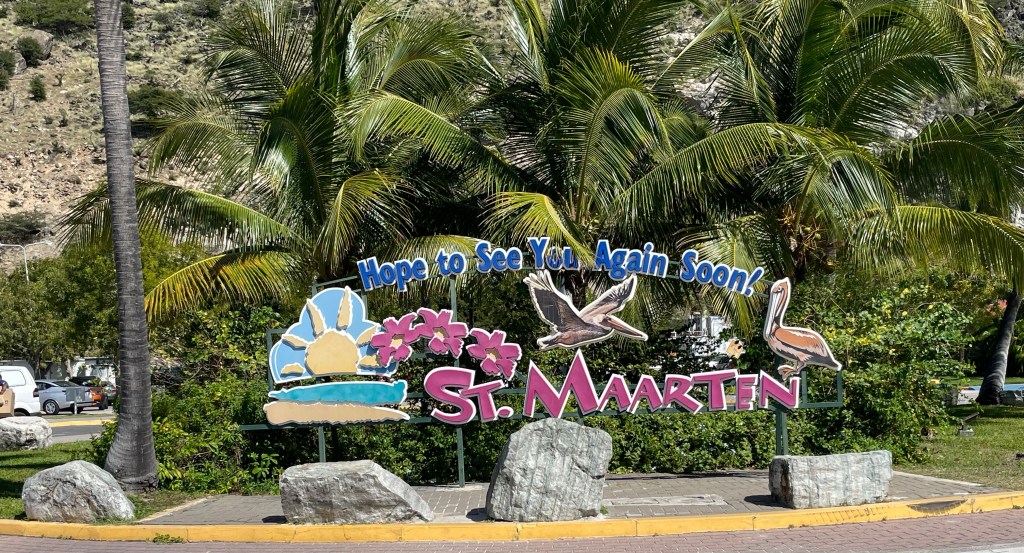
After stopping at less busy ports all week, we arrived at the unique island and into the major port of Philipsburg, St Martin today. The uniqueness comes from the fact that the small island of St Martin comprised of two countries, Dutch Saint (or Sint) Maarten and French Saint Martin. The countries are split geographically fairly evenly with the French side in the north and the Dutch in the south. This arrangement was formed by the Treaty of Concordia in 1648, which our guide said is sometimes called the picnic treaty but I think he was pulling our collective legs. The Treaty is one of the oldest in effect, and is only about one page and 10 points long. It allowed for the ability of the citizens of each side to move freely around the island.
It’s interesting to someone from a country like Canada, which has factions wanting to separate from time to time, that here in St Martin there is bit of a movement among some people from both sides of the island for it to be combined into one. However, it’s unlikely to happen since each of the two territories would probably have to get their independence from the parent country and neither are likely to give up control.
Of course, each side is governed differently, but neither of them is independent.
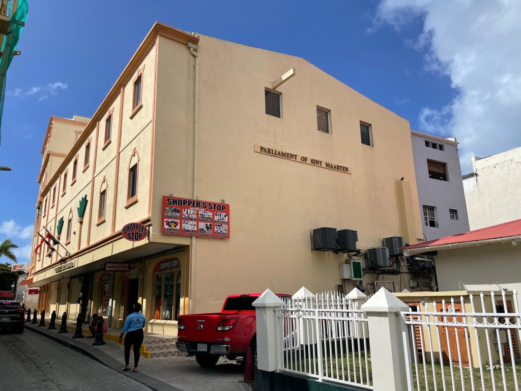
The Dutch Side Parliament Building
The Dutch side has a governor as the representative of the Dutch Monarch and a prime minister as head of government. A representative from St Martin sits on the Netherlands Council of Ministers. The Parliament has 15 members elected by proportional representation. Like many territories, St Maarten has control over internal affairs but the government of the Netherlands maintains control of things like defense, and foreign affairs. Other territories with similar relationship to the Netherlands are the islands of Aruba, Curaçao, Bonaire, Sint Eustatius, and Saba.
The French side of Saint Martin used to be part of the Territory of Guadeloupe, however, in 2003 they voted to separate from Guadeloupe and form their own collective. They are now governed by an elected Territorial Council consisting of 23 members. The head of state is the President of France, whose Minister of the Interior appoints a Prefect to represent the head of state in St Martin. In turn, St Martin elects one member to each of the Senate and National Assembly of France.
Historically, the island was “discovered” by Christopher Columbus in 1493 who did a drive-by claim of the island for Spain without ever stepping foot on the island. The Dutch first settled the island in 1763 as well as the island of Bonaire and Curacau. The historical interest in this island, were the salt deposits, (called white gold) however, tourism is now by far the number one industry at 80% of the economy. They received 2.5 million tourists per year, the largest percentage being from cruise ships.
Both sides of Saint Martin were damaged by hurricanes, Luis (1995), Maria (2017) and Irma (2017). Buildings and infrastructure were destroyed, as were some of the beaches. Work is still being done on the hurricane resistant airport which was severely damaged by Hurricane Irma. Hmmm.
On board the Star Pride we had a bit of a rocky start. We were all set to head off on our various excursions but we were told the ship was bouncing around too much at the dock in Philipsburg, and the usual gangway couldn’t be used. So I think they were on to plan c or d before they found something to work, and that included using a shore gangway on top of a metal platform to reduce the angle of the gangway which would have made it hard to walk down or get goods up. This was a major provisioning stop from the looks of all the cargo sitting on the dock ready to be loaded. We could tell how hard the crew were working to find a solution and I’m sure it was really frustrating for them. The problem was compounded by the fact that we were scheduled to have a really short time in port at this stop. But about an hour late the gangway was ready for us and we headed out on our excursions. The departure time was pushed back an hour to make up for lost time in the morning and to accommodate the excursions.
Today I did not snorkel and I think my knees are really glad that’s the case. They’re feeling the brunt of the action of kicking differently using fins three times this week. So I decided to see St Martin from the land side and signed up for the Two Flags tour, a tour of the major highlights of the island by small bus.
We started the tour on the Dutch side where the cruise ship terminal is located. Our guide was great and he provided so much information that I’m pretty sure not all of it stopped in my memory so bare with me. As we drove from the cruise ship terminal to Philipsburg he noted some examples of peculiarities of the two country island situation. The French side of the island uses 220 volt power and the Dutch side uses 110. The phone carriers are different on each separate country, and it’s an international call to call from one side to the other.
Surprising to me, the Dutch side of the island has legal brothels, and many casinos. The guide said there were 16 casinos on the Dutch side and it’s 16 sq miles so one casino for every square mile of the island. On the French side, there are some nude beaches as one might expect but not on the Dutch side. They use the Euro on the French side, but Guilders on the Dutch side and in fact take $US on both. When students want to go to university on the French side they must go to France for it, whereas there is a university on the Dutch side but many end up in the US or Canada for their studies.
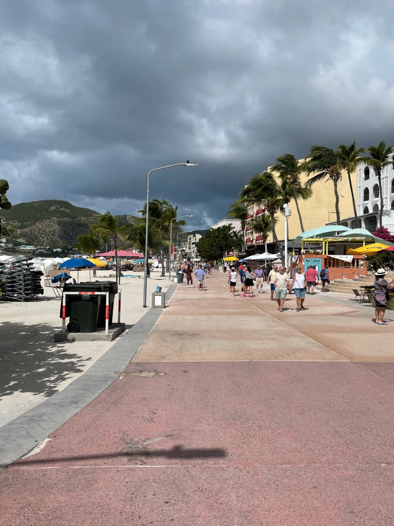
We had a stop at Philipsburg for about 30 minutes to check out the beach and boardwalk along the water of the downtown area, and do any shopping. To get to the boardwalk from the bus, we wandered through a market of souvenir sellers tents and kiosks. It was pretty much the same things we’ve seen all over the Caribbean. I also saw the Parliament Building which is underwhelming and the courthouse, which is adorable. Philipsburg has a beach right in downtown so you have everything you need in one place with the beach on one side of the boardwalk and restaurants, hotels and shops on the other. The boardwalk looks relatively new and there is some (re)building still going on so they seem to still be recovering from Irma. We wandered for our allotted time and I didn’t help the economy I’m afraid.
Then it was back on the bus and over to the French side. The only reason you know you’re changing countries is that there is a sign and some flags and that’s it. There is free movement of people and things between the two. We stopped at a lovely viewpoint and the thing that jumped out at me is the different shades of blue we could see. They don’t stand out too well in pictures.
The traffic from our look out onward was horrendous. We sat for quite a long time, not moving, and our guide did his best to keep us engaged while the driver inched ahead when he could.
Marigot, (named after the marshland that was there before the capital was built) the capital of the French side was the next stop and we were in search of two things there, a bakery and a bathroom. We had only 20 or so minutes there, but I managed to enjoy an absolutely fantastic ham and cheese croissant at the bakery. I’ve resisted all the tempting pastries on the ship so far but could not say no to a French croissant. I was so anxious to eat it that I forgot to take a picture! But I did take a picture of the view we had! The highlight in Marigot was the food whereas the jewelry shops in Philipsburg were the main attraction.
As we headed back to Philipsburg, the traffic on the way to our last two stops was much better and we made better time. You may have seen videos of one of the 10 most dangerous airports in the world where the planes fly really low on their approach to the airfield over top of a beach. Well, the videos are probably of the airport in Philipsburg. That was our next stop. Just as we were approaching the road that runs along the end of the run way and Maho Beach we saw a jet at the very end of the runway getting ready to take off. And lined up at a fence not that far from the end of the runway were dozens of people. Behind the people was a sloped beach. When the jet revved his engines and started his takeoff, the wind from the engines literally sent the people tumbling backwards down the slope of the beach. It was the most bizarre thing. We went a bit further and turned around to see if we could see an incoming flight landing just barely over the heads of people on the beach. We did see two small planes land as we went along the road by the beach and it definitely looks like they’re coming right at you as they’re so low to the ground as they go over the road. I couldn’t get very good pictures of it from the bus but it was an interesting experience.
Somewhere along the drive today we were able to see the chair lift and zip line going to the top of the highest peak we saw on the island. The zip line is called the Flying Dutchman and it is so far the steepest zip line in the world. Someone that had been on it said you went really fast, but that you were harnessed into a seat-like contraption so it’s not like a regular zip line. If I had some time on the island I’m sure I’d give it a try but not when our time is so limited.
There was one more view point stop for Kodak moments and then we were on our way to the cruise ship terminal and our return to the Star Pride. At the cruise ship terminal the shops are just starting to come back since COVID but there is still some huge pieces of retail space available for rent. The jewelry stores are back in full force but there wasn’t much else so I headed back to the ship.
I have to say that St Martin is not my favourite of our stops. The traffic, the retail, and the noise were all a bit much after the quiet, smaller islands we’ve spent time on this week.
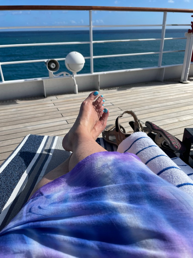
I have been careful all week to be lathered up with sun screen (coral and fish friendly) and covered up while snorkelling to the point where you barely can tell I’ve been in the Caribbean. So once back on board this afternoon I sat on the top deck for quite a while and said some goodbyes and chatted with folks.
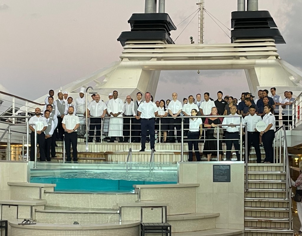
Tonight was the final good bye for most of the passengers with whom I’ve spent the last week. Only 33 of us are staying over to next week. The Captain introduced his officers to the passengers one more time and they and some of their staff stood for a group shot around the hot tub and pool area.
We are into port in San Juan tomorrow for the turnaround, and I plan on staying on the ship to just chill and enjoy the quietness of the ship. Between 9 and 1 there will only be the 33 of us and the crew on board, and even some of the 33 will be off the ship exploring San Juan again. So I will take a break from blogging tomorrow unless some news of great importance comes up!
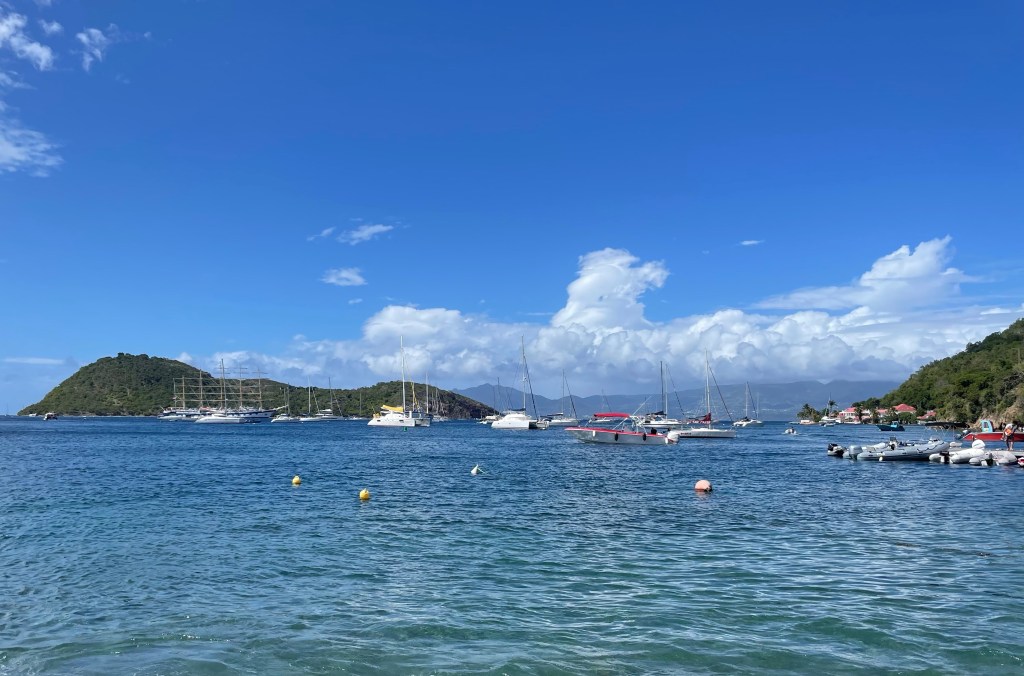
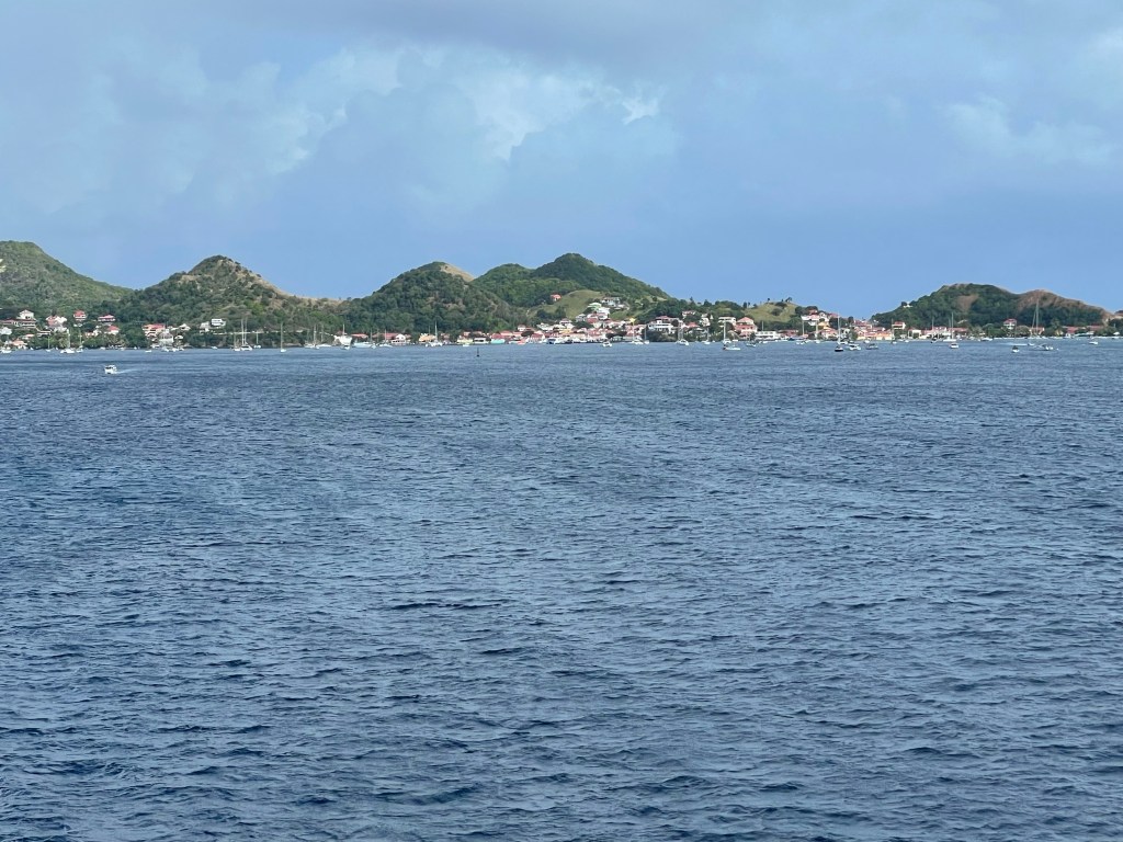
Today we are visiting Les Saintes, which is an archipelago of 5 islands, only two of which are inhabited. This island group got its name from Columbus who discovered them on All Saints Day. Les Saintes are part of Guadeloupe, which is a Territory of France. The main island of Les Saintes, Terre-de-Haut is where we landed. There are only approximately 2000 inhabitants in mostly fishing villages in nooks and crannies of the island. The volcanic islands are surrounding a caldera of an extinct volcano and provide great harbours.
An interesting anomaly of this island is that Iguanas are abundant and we were warned not to approach them as they are seriously protected by the local constabulary.
The islands are historically sustained by fishing by primarily 3 different methods: fish traps, rods or netting. They use a technique of hanging nets between two boats and once enough fish are in the nets, the boats back up toward each other as they both pull up the nets. The younger generation is not really interested in fishing so the government is trying to broaden tourism on the islands. There is some agriculture – sugar cane and bananas, and they distill some local rum.
The history of Les Saintes is significant in the Caribbean as the largest naval battle of the Caribbean happened in Les Saintes and in the strait between Les Saintes and what is now Dominica in 1782. There were 17 British ships up against 35 French combined with the Spanish fleet of 12 in quite a small area. In the end the British defeated the French/Spanish alliance and the French suffered huge loss of life and ships. From what I can gather from what the guide told us today and my brief reading it was a huge and significant battle which may have influenced the outcome of the American Revolution. It reasserted the British dominance at sea and the Americans realized that they could no longer expect the support of the French in their battle with Britain. And the British were more assertive in their demands for the fishing banks of Newfoundland and Canada in the Peace negotiations in Paris. If you are a student of naval battles it sounds like it’s one that would be fascinating to study or perhaps you already have. Of local interest to my friends in Canada, is that one of the ships in the British fleet that was instrumental in their success was named Canada. As always I hope that in my limited research on it, that I have properly characterized the battle and its significance. Bobbing around in the middle of the islands today, it felt a bit like when we visited the battlefields of Hastings or the Plains of Abraham. Travel brings history to life.
Our Destination Manager told us a sad love story about Les Saintes last night at the Destination briefing about a fisherman’s wife who liked to bake and provide surprises to her husband when he went off fishing and one time she made a cocoanut and custard tart for him. He didn’t return when she expected him or on any of the days thereafter. Finally she was so distraught because she thought he was drown at sea that she killed herself. Shortly thereafter he did come back, having been delayed by a storm, and when he returned to find she had died, he killed himself also. So the tarts she made for him became known as “Tourment d’amour” or “Torments of love”. They are a popular treat on the island. The other story was told by our guide. But I’ll leave that to tell til tomorrow when I have more time.
Today I chose to go on….. you guessed it, a snorkel adventure. But today’s was a different experience in many ways.
First of all, we had the first real rain of the trip. It was a little cooler, about 22 and it was really rough on the water. It didn’t stop us from doing anything but it was a little less pleasant on the boat, especially because I was sitting at the back of the boat and got absolutely drenched within the first 30 minutes, including my dry clothes for after snorkelling and towel, so the return trip was a little chilly.
Secondly, we had a tour guide along for this trip and he was fabulous. He taught for 20 years in France and then moved to Les Saintes and taught here for another 20 years. He’s now retired and doing the tour guide duties because he loves people so much and it shows. He stopped at various places to show us points of interest.
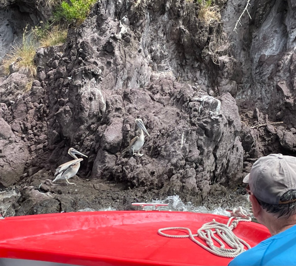
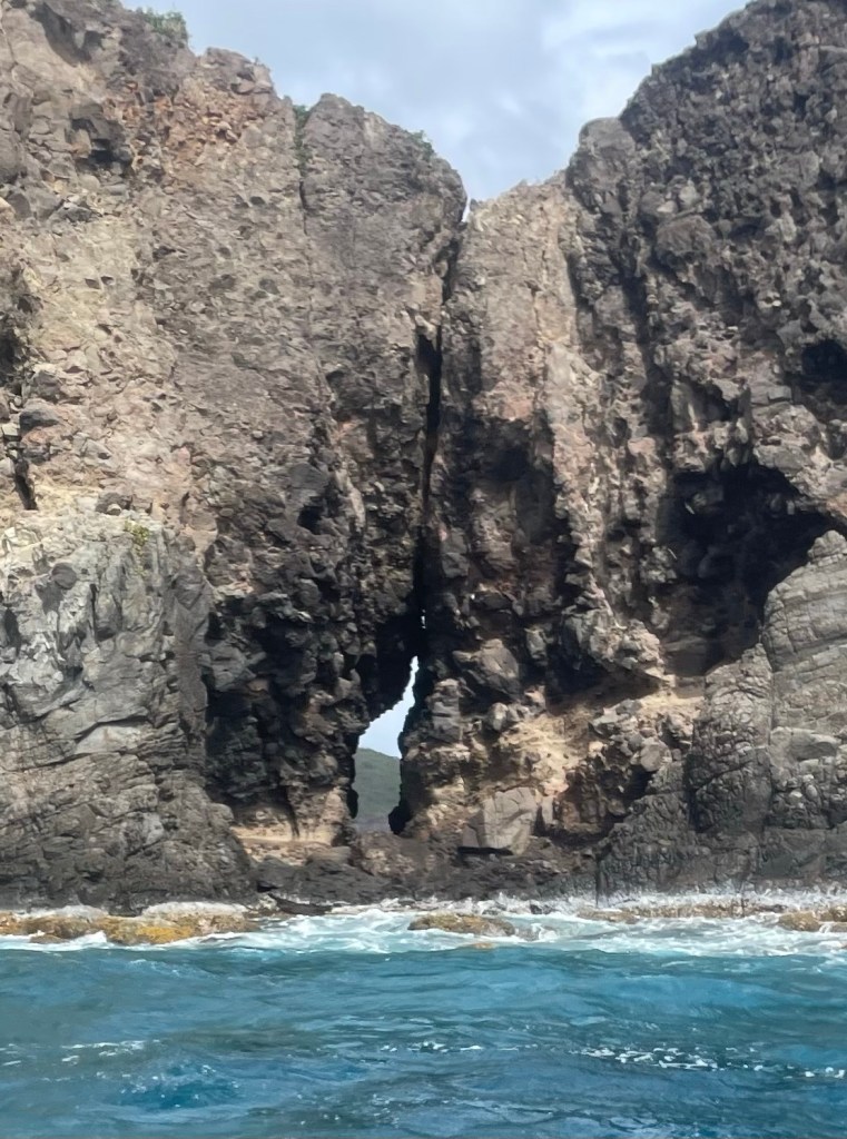
He showed us a pelican colony amongst the trees on the slopes of one of the islands and some down on the rocks by the water. Dozens of them were watching us go by. And a family of iguanas in trees but I unfortunately wasn’t able to get a picture. There were some rock formations that he showed us, and I was amazed at the ability of our boat captain. There was a bit of a cave and even with substantial waves and swells, he took the power boat inside the opening so the guide could show it to us.
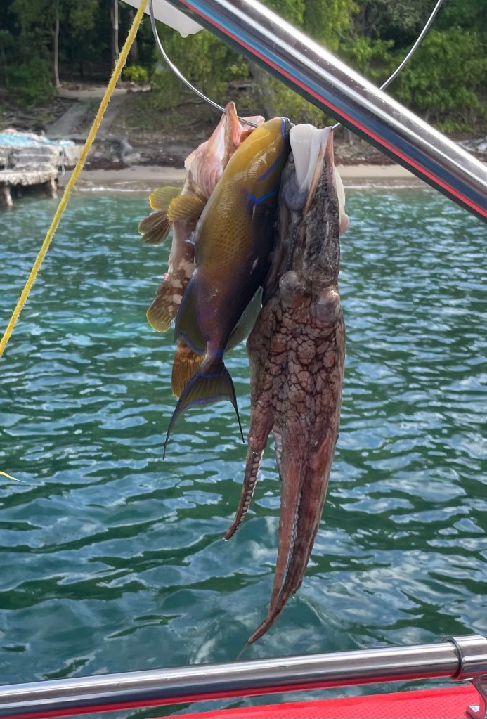
He told us about the importance of fishing for the island and when we came upon a fisherman spear fishing in the water, the captain asked him where his catch was and he pulled it up and showed it to us. Two fish and an octopus!
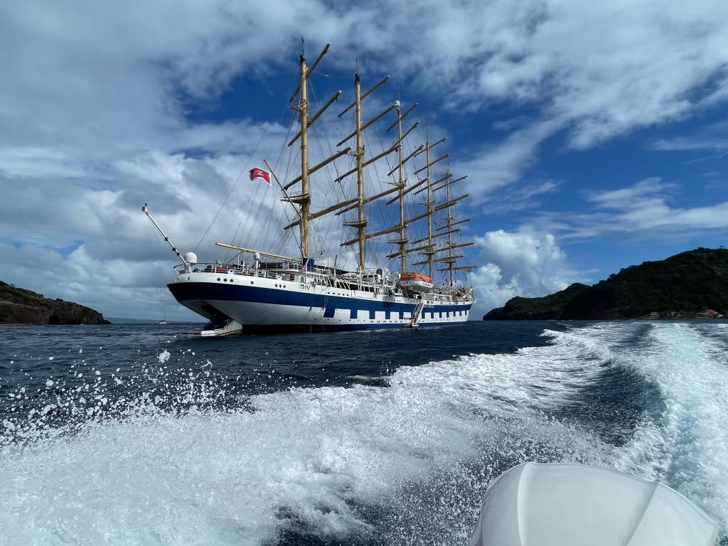
We passed by the Star Clipper who was in port today as well. It’s a beautiful wooden, 5 masted sailing ship. Absolutely beautiful vessel.
We had two snorkel sites, the first of which was to see if we could find any turtles. There are three species found here, Leatherbacks, Green and one other whose name I missed as the wind blew away the guide’s words. It was a grassy bottom and we were lucky to find one fairly large size one munching its way across the bay.
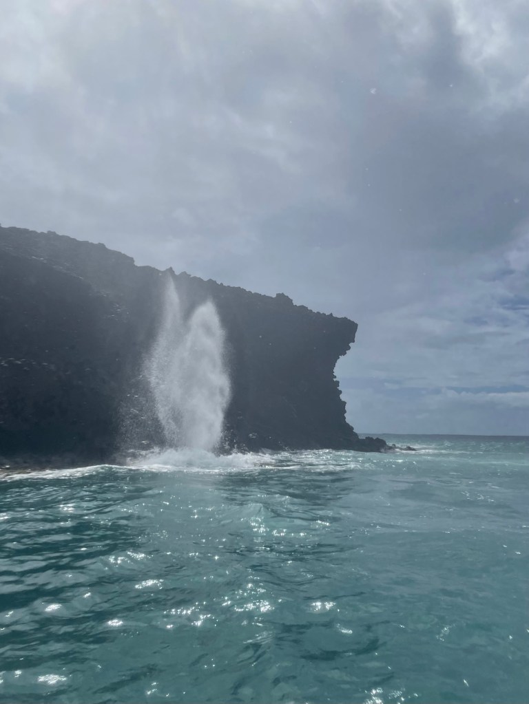
Then we were off to see a blow hole in the rocks, and it was in good form today given the waves out there. I wasn’t able to get a picture from where I was so one of the other passengers got a few shots away for me. We went passed what was supposed to be a nude beach, but from our distance it looked like everyone was clothed to us.
The second snorkelling spot was in a bay with a rock and coral outcropping that was great. There was lots of fish life, and corals. Lots of big fan, staghorn, split brain, and others for which I didn’t know the name. Many of the fish that I saw I haven’t seen elsewhere. One had a red belly and on the sides it had spots of different colours set out in rows and columns. It was spectacular. After about 30 minutes we headed back to town, and once again got soaked! But this time at least we were already wet.
It was almost 1 pm when we got back into town, so unfortunately most of the shops were closed and so there wasn’t much to be seen, so we headed back to the ship to grab some lunch. It rained off and on the rest of the afternoon, so I spent some time in the “Yacht Club”, a space on the top deck to the aft of the ship that serves tea, specialty coffees, and has snacks and desserts from 6 am to 6 pm. It’s got a library atmosphere and in fact has some books, but also jigsaw puzzles, board games, cribbage boards etc. A lovely space where I’ve done some of my reading and writing. And then the luxury of all luxuries, nap time.
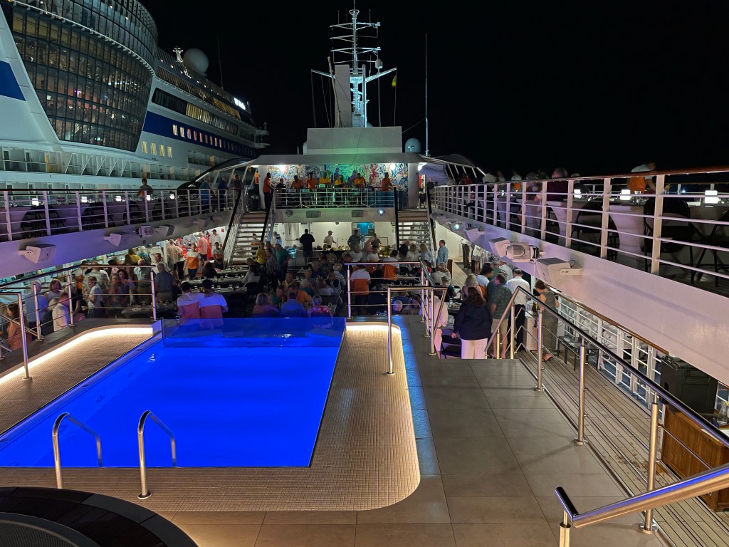
After dinner this evening was the amazing staff talent show. There was everything from a demonstration of martial arts, to Indonesian flute players in traditional costume to a comedic act by the Entertainment Manager and a hilarious story telling about riding a donkey up to the top of Santorini by the Hotel Manager. The Maitre’D (he’s more than that but I’ve forgotten his title) has an amazing voice and did a couple of Rat Pack era songs including a couple of imitations. The deputy chef who does much of the planning of provisioning, figuring out how many potatoes they’re going to need, etc. did this amazing thing with numbers on paper on an easel where every column and row and diagonal and inner squares of a 4 x 4 box table added up to a number that one of the audience members had given him. It was unbelievable. He ended by saying that there were 119 staff members on board from x (I missed the number) countries, speaking 50 languages and they all lived harmoniously together on this little ship. He challenged the rest of the world to do the same. The final act was similar to one I saw on the South Pacific cruise I took before the pandemic, the Star Pride Men’s Synchronized Swim team. It is absolutely hilarious, and I can’t begin to describe how they do it, but it involved a blue waist high curtain, deck chairs, and mattresses. It appeared that they were in the water doing an synchro routine.A fun way to end the day.
Tomorrow is St Martin/St Maarten, and a rare, for me, land tour excursion. We are only in port until 2 pm so our tour starts early in the morning, so I’ll sign off now and get some sleep. I had trouble writing my blog today because every time I tried to work on it in the public areas, I got talking to someone. Not a bad thing. Such interesting conversations.
P.S. One last thing, part of the Entertainment Manager’s comedic sketch was about many passengers going home on Saturday. (I’m staying on for another week, but many are only on for one week or are finishing their two weeks). He said it much funnier than I can, but that we have some adjusting to do when we go home. He said at home we’re going to sit at our dining room table and wait and wait for someone to come along to provide us with a Chef James Beard quality meal. And after our shower we’re going to dry off with a towel and throw it on the floor, and when we come back several hours later the towel is still going to be there. And we’re going to hear the flushing sound of our toilet instead of the sucking sound we’ve come to expect. Yes it will be an adjustment.
Home for today is the Island of Saint Lucia, part of the Windward Islands of the Lesser Antilles north of yesterday’s stop in Bequia. To contrast with Bequia which was 7 square miles, St. Lucia is 238. Castries located on the west coast is the capital and major port town, and is where most of the cruise ships anchor.
However, our stop today is more specifically, Pigeon Island, a small island (44 acre national reserve) on the north end of St. Lucia that has been joined to the main island by a causeway built in 1972 by Sandals Resorts to allow for the development of their property. A previous notorious visitor to Pigeon Island, pirate, Francois le Clerc, (known as Jambe de Bois (Peg leg) by the French and Pata de Palo by the Spanish, due to his wooden leg), camped here in the 1500s to strike out at passing Spanish ships.
Saint Lucia literally stands out for its two tall and narrow mountains on the south west coast called the Pitons designated as a World Heritage Site. One of the excursions is a catamaran trip down to see them but it was a 4 hour tour and I figured I’d be fried by the time I got back! So sorry, no pictures of them. The topography of Saint Lucia is again hilly, with green interior rainforests and beaches dotted around, some volcanic. English and St. Lucian Creole are spoken among the approximately 185,000 inhabitants. Interestingly, Saint Lucia (or Saint Lucie) is the only country nation to be named after a woman. They have a similar government structure to Canada, put in place in 1924. They are part of the Commonwealth, with a Governor General and a Parliament consisting of a elected House of Assembly of 17 members and a Senate of 11 appointed members.
The first inhabitants, like many of the islands, were the Arawaks, likely settled here around 200-400 AD. The French first settled the island in 1660, and then, also like many of the islands, the French and the British proceeded to fight over it for 150 years. Eventually the British won out in 1663. Remnants of those days is Fort Rodney at the peak of the highest point on Pigeon Island. Some of my fellow passengers hiked up to the fort this morning, but I declined to join as I don’t have appropriate hiking shoes with me. (Great excuse, eh).
One of my favourite hang outs on the ship.
St Lucia’s main economic drivers are tourism (65%) and offshore banking. Agriculture and specifically banana exports were more significant previously. St. Lucia seems to have avoided most of the most damaging hurricanes although Hurricane Tomas in 2010 caused some damage. The economy had recovered before the pandemic, and they had been able to attract foreign investment. They actually have a manufacturing sector in chemicals, clothing, and plastics among other things.
Today I chose not to do any excursions. I decided to have a break from the action and just chill. After breakfast I sat in the shade on the top deck of the ship, reading, writing this blog and enjoying the view. And watching the two Windstar tenders going back and forth to the beach pier. The fabulous crew on the Windstar worked feverishly as soon as we moored early this morning to prepare the site for our Beach BBQ. Hundreds of beach lounges, towels umbrellas, the food, tents, stuff to set up the food and bar, the water toys (kayaks, SUP, floating mats, trampoline, etc.
My view for the afternoonDining Tent
I went over around 11 am, chose my chair and parked myself with my book, and a crossword puzzle book. Drinks were delivered, the steel band played and I was a happy camper. In due course lunch was served under a big tent on a hill where the breeze kept us lovely and cool. I went in for a swim multiple times and the water was cool enough to be refreshing but one got used to it very quickly. I spent another two hours on the beach and then came back to the boat to get the salt water rinsed off.
The bar tentRuins left from Fort Rodney were sprinkled throughout the site.
In no time at all, the beach looked like we’d never even been there. Everything was stowed back on the ship and we’ll soon be off on our next island adventure. Not before the water toys were towed back to the swimming platform to be stowed til next time.
Hard to tell but that’s 4 SUPs, 3 kayaks, and the trampoline being towed back to the ship from the beach.
I’m invited to another reception tonight for passengers continuing on to next week’s cruise and think I’ll have dinner at the outdoor grill. In any case, I’ll sign off now, earlier than usual because there’s not much left on which to report. Other than to say, it was an amazing day in St. Lucia.
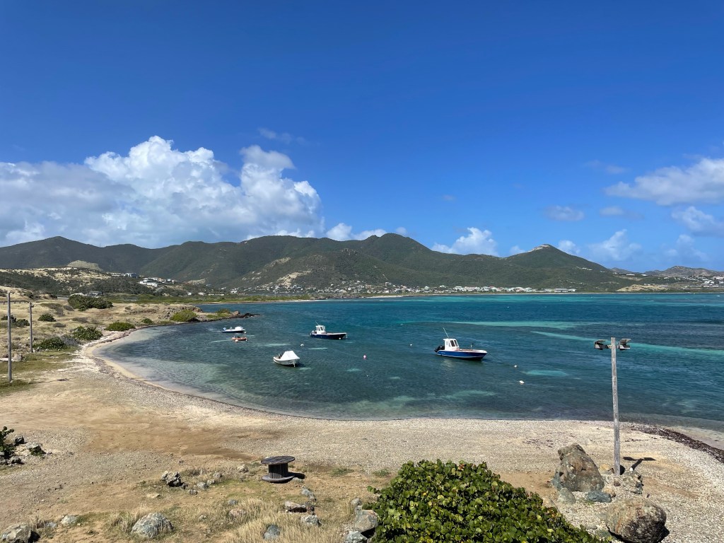
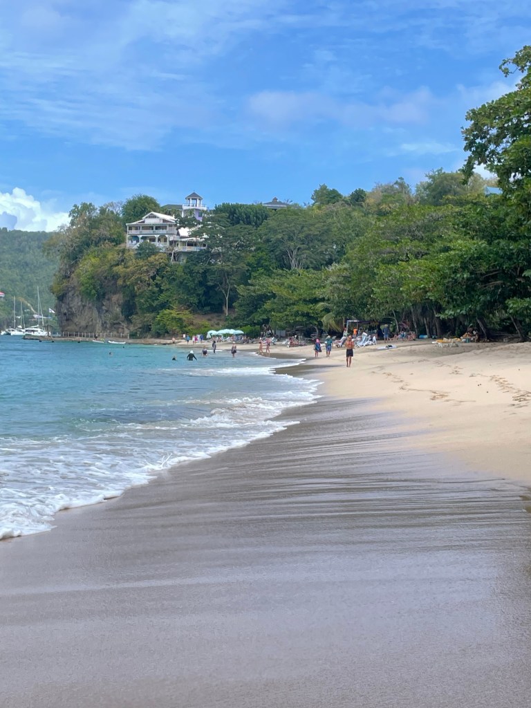
One of the great things about sailing on a small cruise ship is that you are able to get in to ports that the larger ships are not able to both physically and because the infrastructure isn’t there to support the larger number of passengers. Today was one of those stops on the Island of Bequia, the second largest island in the country of St. Vincent and the Grenadines. It is a tiny island of only 7 square miles although it is the largest of the Grenadines and with a population of approximately 5300, the most populated.
From just a mini-exposure to the island it seems like it has a laid back lifestyle. The people are of African, Scottish, Irish and Carib descent and in the 1860s there was an influx of white Barbadians. I’ve only recently discovered that I have DNA that places my ancestors in Scotland for the most part so I figure it’s natural that I would feel comfortable here.
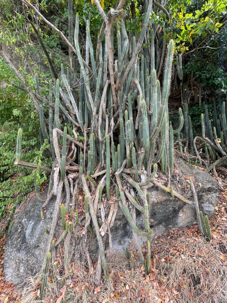
The island’s name means Island of the Clouds in ancient Arawak, but its mountains are lower than that of it’s parent island of St Vincent, 10 miles away, and so it gets much less rain than St Vincent. There are even cacti on the island.
Some famous people are connected to the island including Blackbeard who came here with his ship “Queen Anne’s Revenge” for repairs and Princess Margaret, for whom a beautiful beach is named. She had a home on nearby Mustique Island and she visited Bequia in the 1950s.
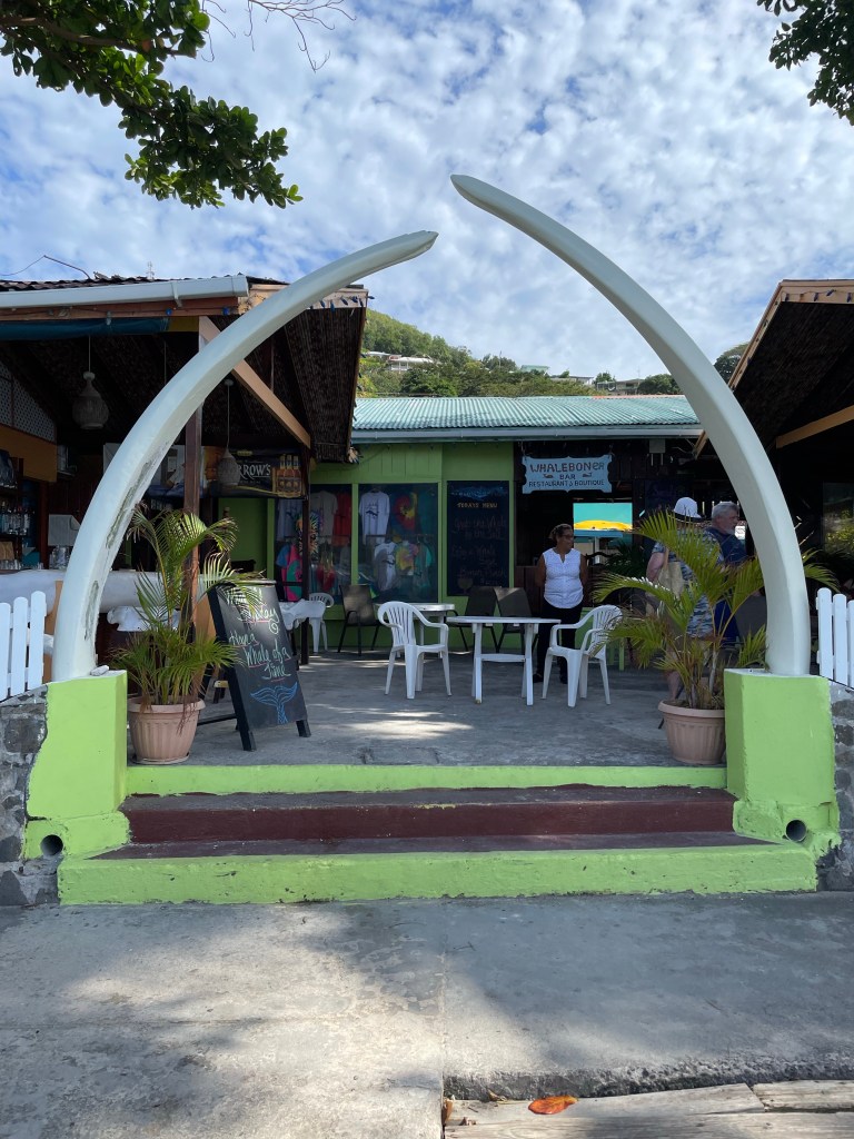
There is a long tradition of whaling on the island, and Bequia is one of only 4 places in the world where it is still legal to do whaling. However, they are only allowed to use traditional methods including a row boat and hand thrown spear and the limit is 3 per year per citizen. There are rarely any whales caught now and the government is helping to move the people away from whaling and into another of its traditions, ship/boat building. There is a Whaling Museum on the island as well as a famous restaurant, called the Whaleboner, whose entrance is festooned with the jaw bones of a whale, and the bar stools are vertebrae from a 75 ft. humpback caught in 1995
There is some agriculture, primarily Arrowroot powder, but also coconuts, sweet potatoes and ornamental flowers and there is also an effort to re-establish banana exports. Tourism and fishing are the other industries.
As with many of the islands, their governance is a parliamentary democracy in the Westminster style. The only difference between their government and ours is that they have only one house, which consists of 15 elected representatives and 6 appointed senators.
One of Bequia’s neighbouring islands is Mustique which is a private island that creates a buzz for it’s current and past inhabitants. In two seasons of The Crown, Princess Margaret is shown to travel to her home on Mustique when she needed to get away. She does in fact own property there and vacationed on the island starting in the 1960s. Mick Jagger and David Bowie have properties there and Prince William and Princess Katherine have also been know to vacation there. Some of the passengers from the Star Pride went on an excursion that circumnavigated the island and then stopped for lunch on the only public restaurant on the island. I haven’t yet talked to anyone that went, but I’ll be interested to hear about it.
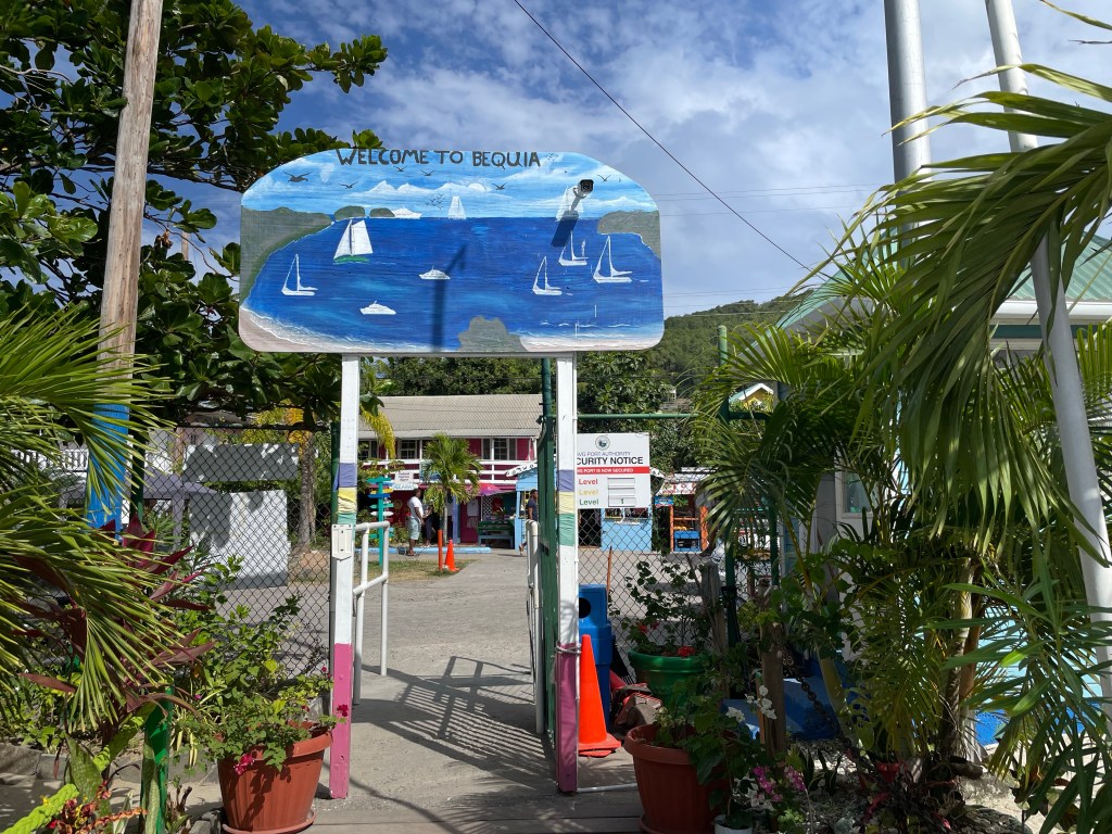
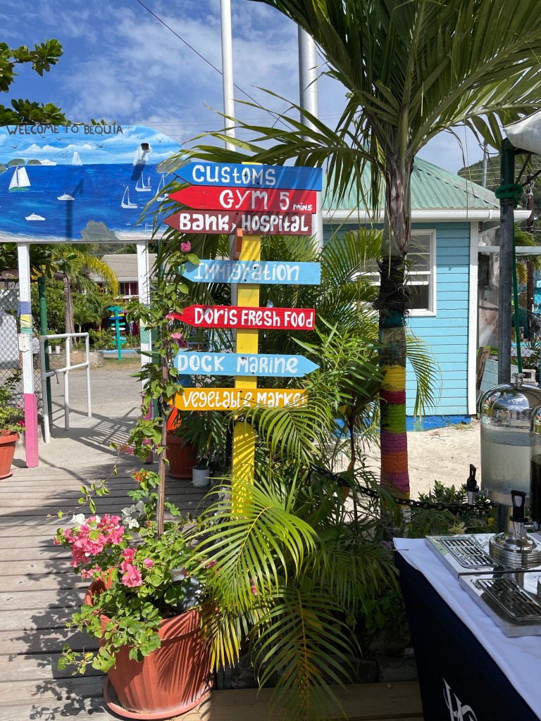
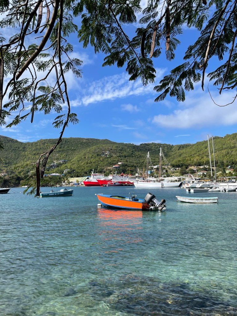
Today we are anchored in Admiralty Bay, near the village of Port Elizabeth which acts as Bequia’s unofficial capital. Some of our groups went to see Fort Hamilton built in the 1700s to protect the harbour from pirates and French Raiders. Star Pride’s tenders dock in Port Elizabeth and will go back and forth to the ship every 15 minutes all day. It’s about a 10 minute trip each way.
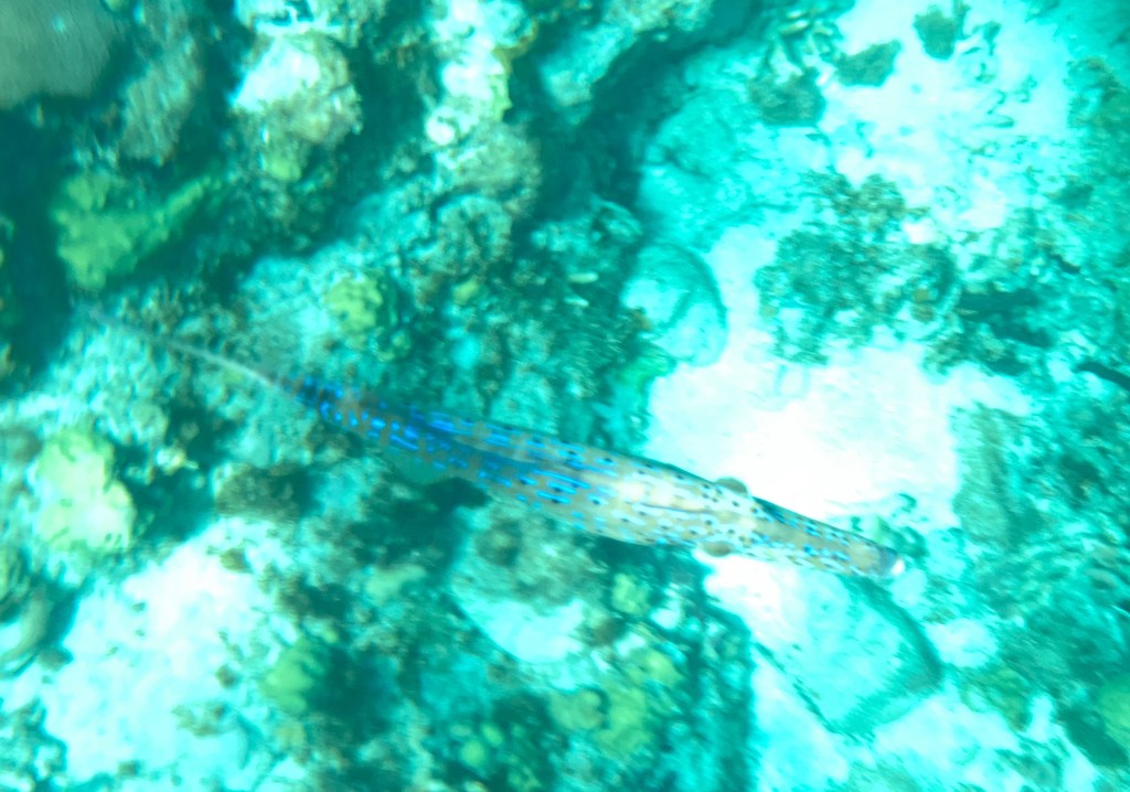
I started my day with a snorkel trip on a fast power boat that took us 20 minutes or so from the tender dock to a bay on another of the smaller islands. It was a little wavy but no serious currents today in this spot that sported a reef sticking out into the bay. It provided some great fish spotting. I saw one fish I’ve never seen before which was almost translucent with purple highlights. I tried using my iPhone in a waterproof pouch to take underwater pictures with not much success. I had trouble seeing if it was taking the pictures and I kept accidentally switching it to video mode. But it was worth a try and I did get a couple of pics that give a sense of what it looked like and one not so good one of the purple fish.
Sorry, not very good.
On our way back we were dropped off for an hour at Princess Margaret Beach for an hour to swim, suntan or have something to eat at the waterfront restaurant there. It is a beautiful clean beach which I walked along from one end to the other. Then it was back on the tender and for a quick shower and lunch and then back onto the island to explore Port Elizabeth.
Princess Margaret BeachPrincess Margaret Beach Haha, you didn’t think I’d miss posting toe pictures this trip did you?
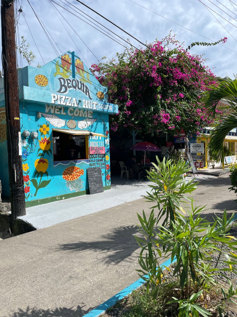
Port Elizabeth has one Main Street, Front Street that is two lanes, one for vehicles and one for pedestrians. There are some lovely shops and restaurants along the way. Artisans have colourful displays of their work under the trees in a park near the pier, with no hassle at all from the artists expecting a purchase. One that struck my interest was a wood worker who made miniature, brightly coloured boats.
Along the lanes for cars and pedestrians there are perhaps a dozen small stores and restaurants, all of which are just so cute. There is a famous shop selling pizza that claims to be the prettiest pizza shop in the Caribbean or perhaps the world. And it might just be, given it’s artfully painted walls situated next to a huge bougainvillea. At the end of front street there is a lovely surprise.
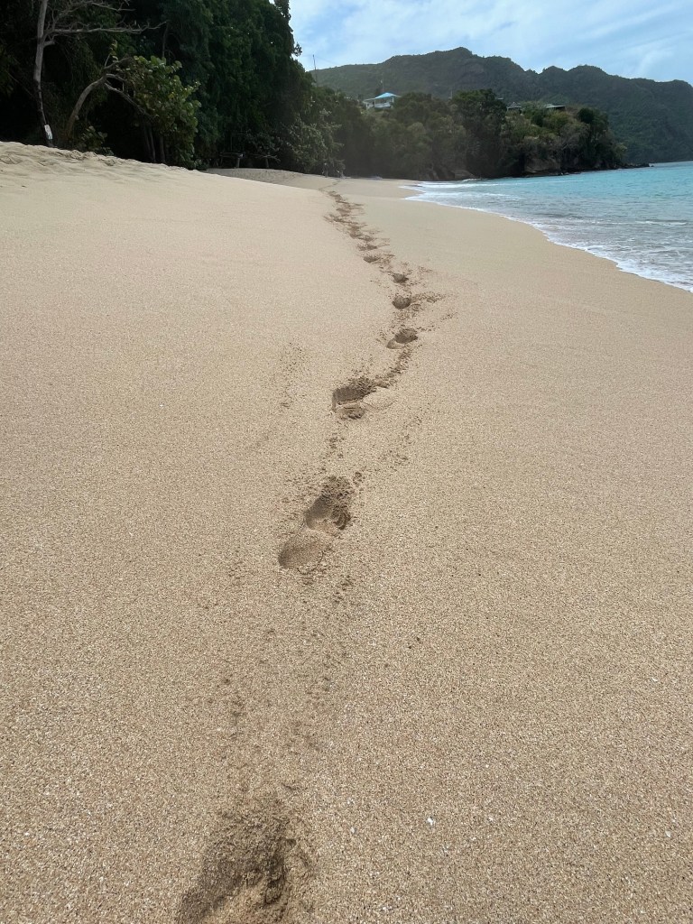
All beaches on Bequia are public and from the end of Front Street there is a path, called the Belmont Walkway, with what has to be one of the most beautiful views for a path in the Caribbean. It takes you to 3 beaches, the second of which is the famous Princess Margaret Beach. The path is narrow and in places needs repair, but it runs along in front of some private properties, restaurants, small resorts and shops. The views of the bay with boats galore bobbing in the harbour, and colourful houses lining the hillsides is pretty spectacular. I walked along the pathway, dodging waves and other walkers almost to Princess Margaret Beach, stopping along the way to sample a delightful lime homemade ice cream. Such a lovely spot I was sorry to have to grab the tender back to the ship.
This evening was a cocktail reception for passengers who have been on more than one cruise with Windstar. Held on the open deck with free flowing champagne, and wine, with some nibblies that I didn’t get over to, it was quite lovely and civilized. And for dinner this evening I was invited to attend the table of the Chief Engineer for the ship, and spent an enjoyable evening with the company of he and 5 other guests one of whom was a former Governor of Vermont. This is done frequently throughout the cruises with various different ships officers.
Quite the day. Tomorrow we’re on to Pigeon Island which is part of St. Lucia for our second iconic Windstar event, the beach BBQ.
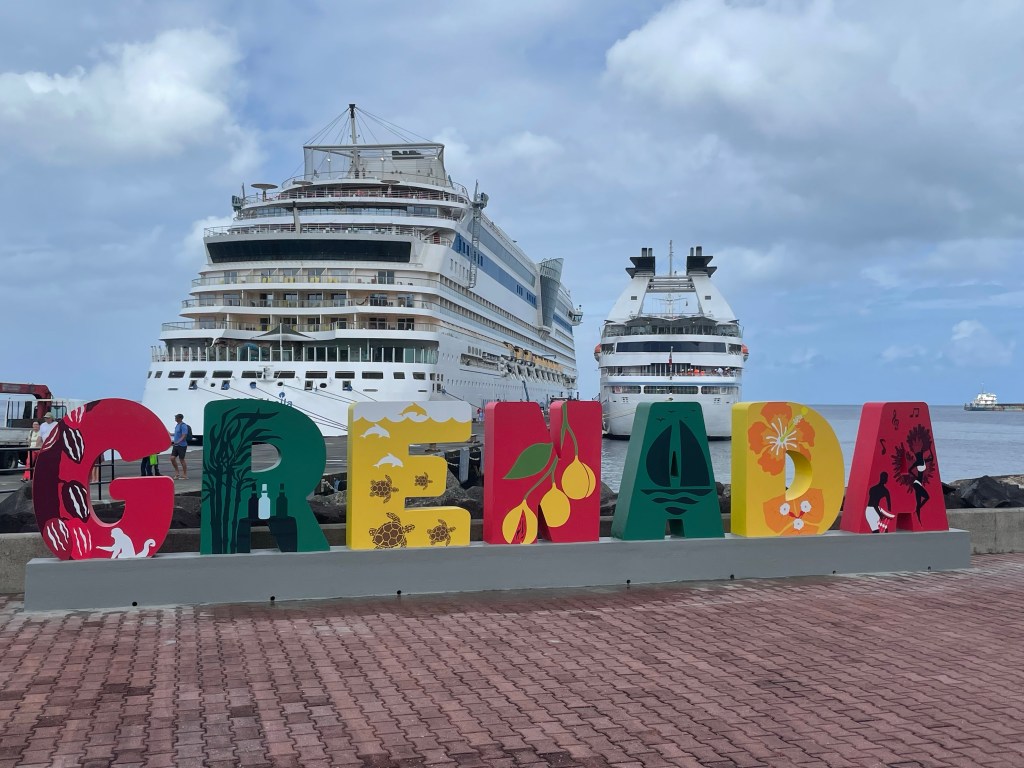
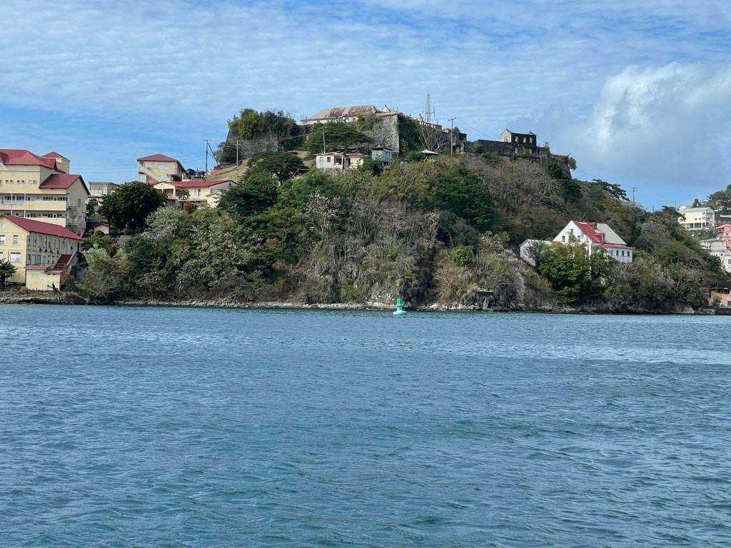
Part way through the night, I realized that the rock and rolling had stopped just as the Captain had promised. I easily went back to sleep being gently rocked. And when I woke up again this morning, we were approaching St George’s, the capital of Grenada. Unfortunately it was grey and raining. From 8 am to 10 am while I was having breakfast and getting ready to explore it had drizzled, poured rain and been sunny. It is close to 100% humidity I’m sure. There is a reason that Grenada is green and lush. Fear not, the sun came out and the day was gorgeous.
Grenada is in the West Indies in the eastern Caribbean at the southernmost tip of the group of islands called the Lesser Antilles. We’re only 100 miles north of the coast of Venezuela. Grenada is the name of the country as well as the largest island which is surrounded by smaller islands.
Christopher Columbus sighted the island on his voyage in 1498 but it stayed in the hands of the aboriginal peoples, who were waring among themselves. Columbus first named the island Concepcion.
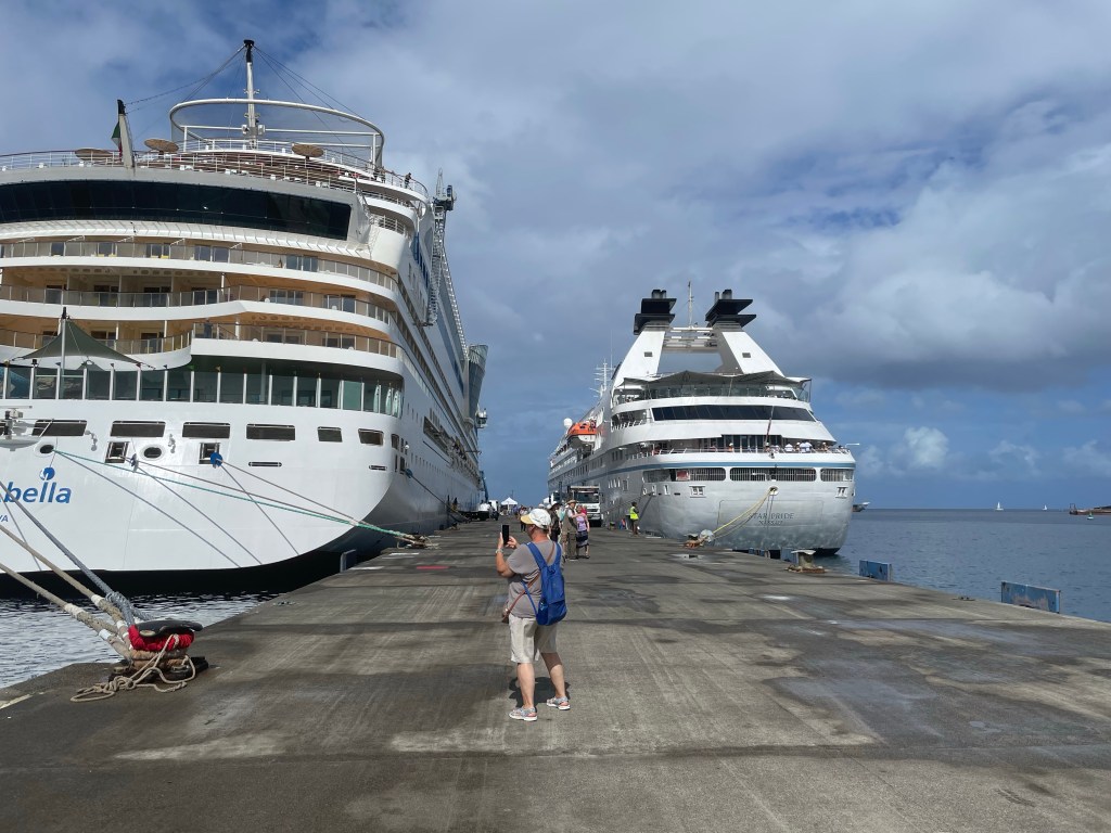
That’s us on the right, sharing the moorage with this German based ship.
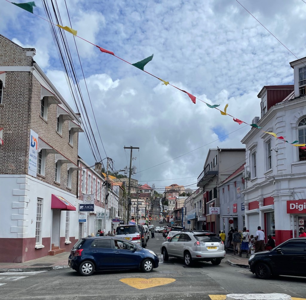
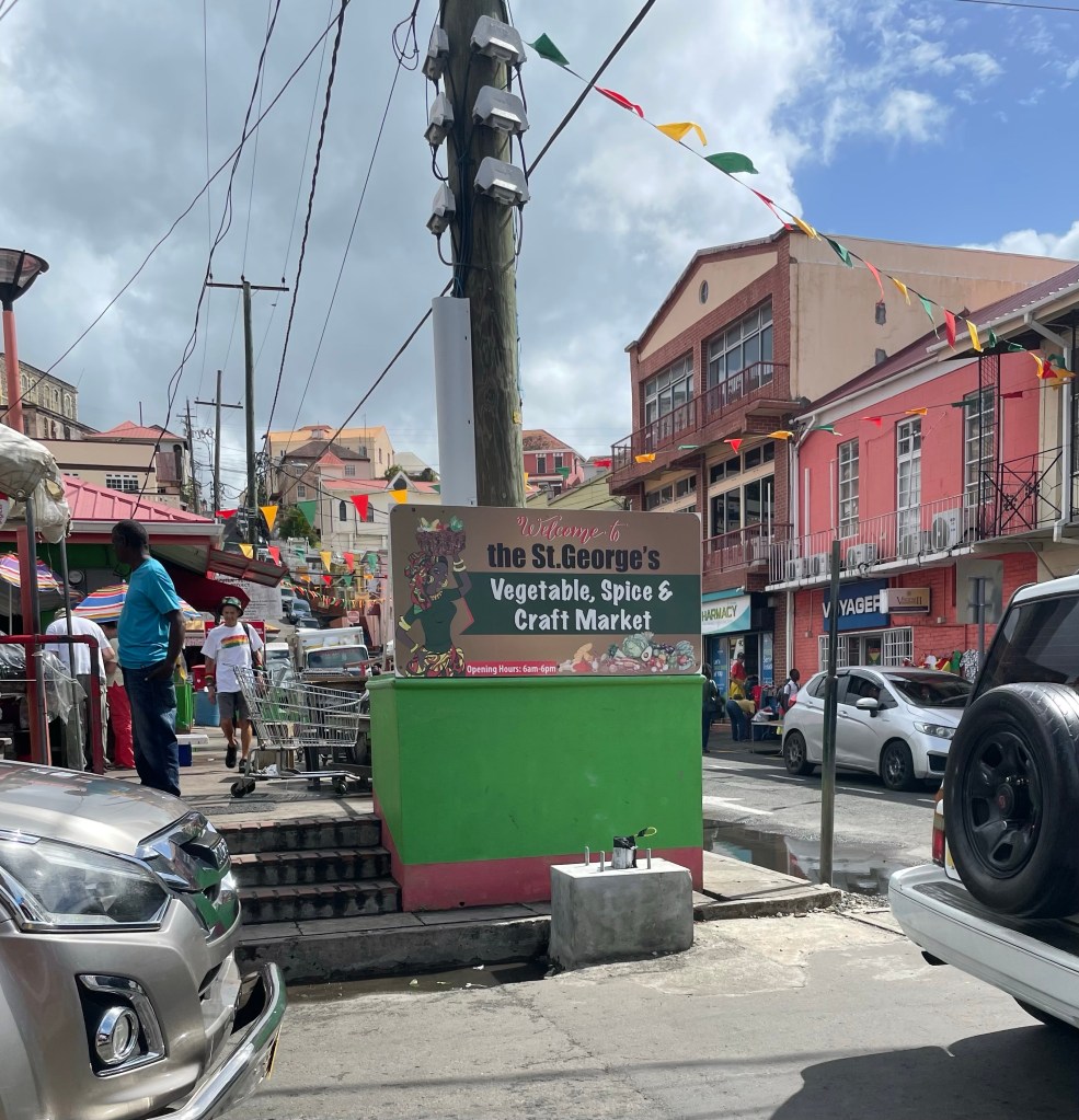
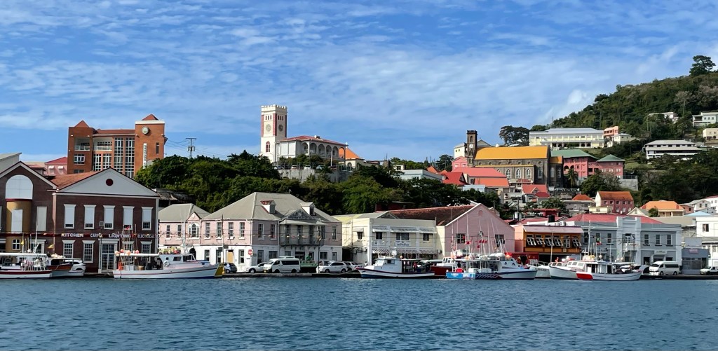
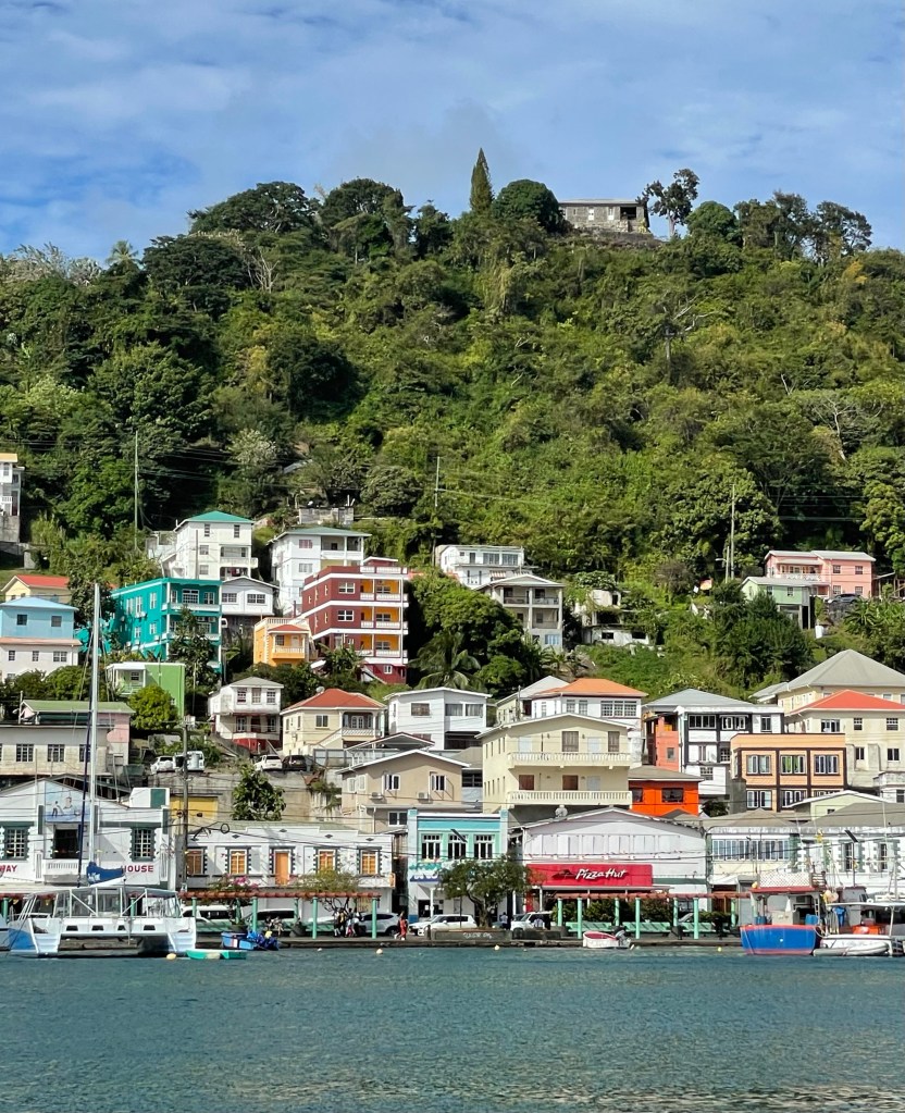
Grenada is nicknamed the Spice Island because of all the spices found and grown commercially here. The spice market is a treat for the senses with the colourful dress and aromas of spices hanging in the air. It’s also somewhat chaotic in the “downtown” St. George’s area. Lots of traffic, no where to park, and poor traffic police trying to make sense of it all. St George’s is on the south west coast of the island at the entrance to a great natural harbour.
Downtown St George’s
The topography of the island is stunning, with lots of steep hills covered in tropical growth and from the ship we can see lots of structures built into the hillsides.
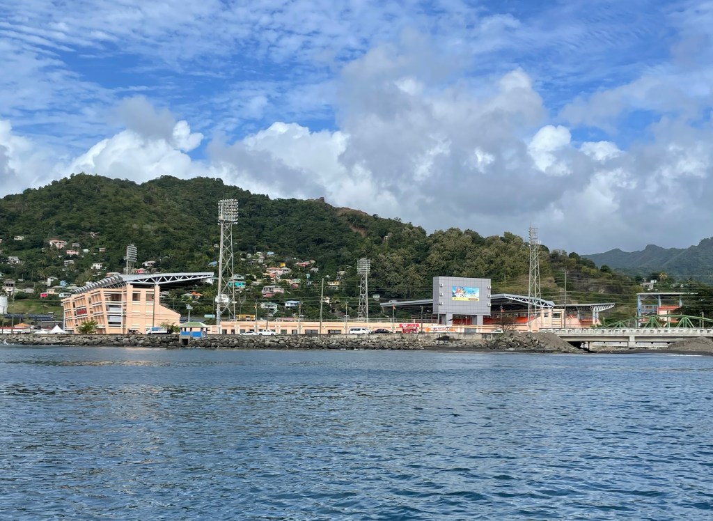
Apparently they are cricket crazy here and it’s considered by them to be a cultural event! Who knew? The National Cricket Stadium prominent on the St. George’s waterfront was built in the 1880s but has been rebuilt and replaced through various hurricanes. It was one of the locations for the 2007 Cricket World Cup. The latest iteration was built in 2004 and was paid for by the People’s Republic of China. I wish I understood Cricket. I’ll have to figure it out one day. That and rugby.
The National Cricket Stadium
Historically, the French and the English fought over the islands and according to our tour guide. Indigo was highly sought after as dye for the blue uniforms and other clothing. The French finally bought the island from the first peoples for 2 hatchets, 2 bottles of run and some glass beads. I haven’t found that during any of the small amount of research I’ve done so far. But I’ll keep looking for a source. There are pictures indicating the first peoples jumping off a cliff to their death rather than be taken over by the French, but I’ll keep searching for a reference to that too.
Slaves were brought to the island from Africa by the British to work the land and grow spices and indigo until they were emancipated in 1833. Now the majority of spices are grown in small independently owned plots on substantially sloped hills throughout the island.
Cuba got quite involved in the island during one particular socialist government and they even built a huge General Hospital for the people of Grenada. Our guide pointed out several hotels that were built and/or owned by Egyptians.
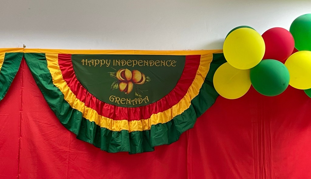
The islands eventually became part of the British commonwealth gaining their independence in 1974 and in fact tomorrow they will be celebrating Independence Day. Their government is very similar to ours, with two houses, and the PM who is the head of the majority party in the elected lower house, the House of Representatives. The Governor General as the nominal head of State, appoints people to a Senate on the advice of the Prime Minister, however they also consult with the opposition leader on the appointments. (I’m doing a pretty good job of being non-partisan, aren’t I?)
Now is possibly time for a reminder that my information is sourced in various ways, and can not at all be considered totally accurate. I try and find legitimate sources but some of the stories told by guides are so much more fun and interesting that I can’t help but include them. There is no question some are exaggerated.
The building on the top of the ridge with the best view of the harbour is the prison!
The spice Grenada is most famous for is nutmeg, but others found here include turmeric, cinnamon, all spice, ginger, cloves, and bay leaves. There is a national dish called “Oil Down” which is a meat and vegetable stew which uses many of their spices. Our snorkel boat captain told us that many people will be making this dish tomorrow to celebrate Independence Day. It’s made in a big pot and he said his Mom’s gets so thick it can’t even be stirred. He said they use salted fish, beef, shrimp, and all sorts of vegetables.
Its primary industries are agriculture and tourism, and fishing is become more significant. A friend of our snorkel boat captain’s went by in a small boat and indicated that he had caught a tuna fish today, and was on the way to the fish plant with it to sell it. There are many larger fishing boats tied up along side the sidewalk along the Main Street on the harbour side in St George’s.
Fishing boats line the Main Street in the Harbour
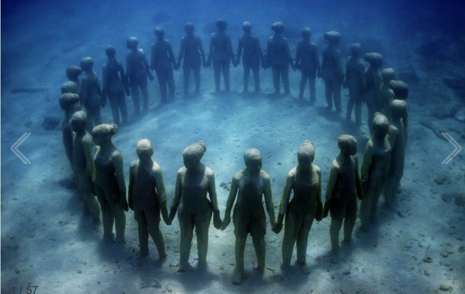
I have already alluded to my excursion activity for today. It won’t surprise you to hear that I went snorkelling this afternoon. But what we went to see might. In 2006, 75 pieces of concrete and steel sculpture by sculptor Jason deCaires Taylor were placed on the sea bed. They were originally put in to protect the sea bed from further erosion and apparently they accomplished their mission as it is coming back. The area is called the Grenada Underwater Sculpture Park and it is protected from any activity which might damage the sea bed or the sculptures. The sea bed is between 5 and 30 feet in the area that we visited, and some of the sculptures were quite far down. Our excursion leader took us on a tour of 13 of the 75 in approximately 45 minutes. I am getting better at diving while snorkelling and I was glad that snorkelling vests were not required as it allowed me to get some more practise while diving to see more detail on the statues. I only came to the surface sputtering once or twice.
The Newspaper Man
Some of the sculptures were religious in context such as Christ of the Deep. The Vicissitudes is the one used for most promotion of the area, and it’s quite remarkable. It is a group of 26 children holding hands in a circle facing outward. Some say it represents the circle of life but others have claimed it represents slaves thrown off the slave ships. One, called the “Newspaper Man” is of a fellow sitting at a desk using a typewriter. It was a somewhat weird adventure, and I think I’d really rather just see fish and other sea life, but at least I was bobbing around in the warm Caribbean water.
The Vicissitudes (photo credit to the Sculpture Park Website)
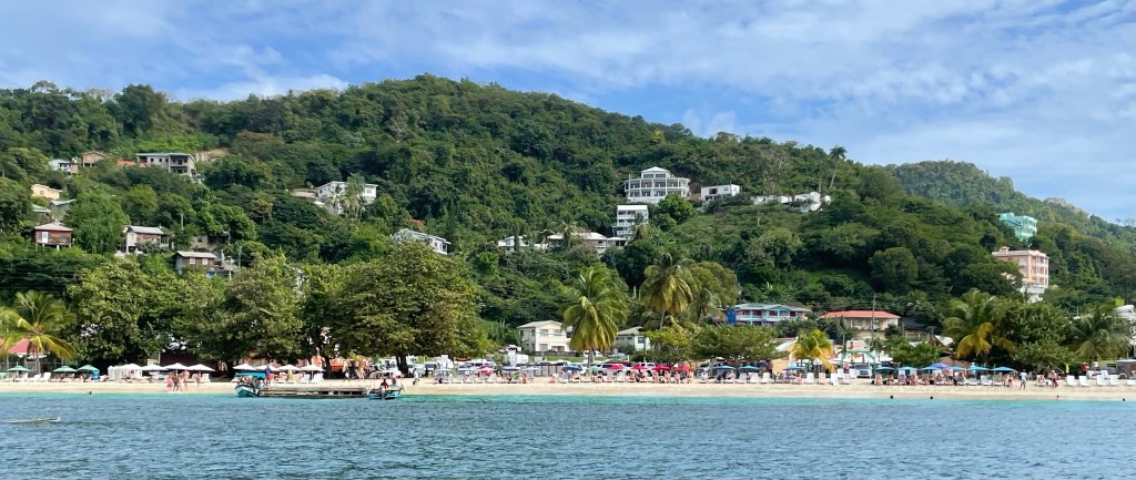
After our snorkelling adventure our guide took us at high speed (our boat had 2, 250 hp engines and could go like stink) on a tour of some of the nearby sites. He started at Grand Anse Beach where many of our fellow passengers took water taxis and spent the day on the beach in rented lounge chairs and attendants bringing food and drink. One hotel, the Silversands, apparently owned by Egyptians, costs $1100 a night! But there are many others that are reasonably priced and the beach is pretty spectacular. It’s 2.5 km of beautiful white sand and warm water.
Grand Anse Beach
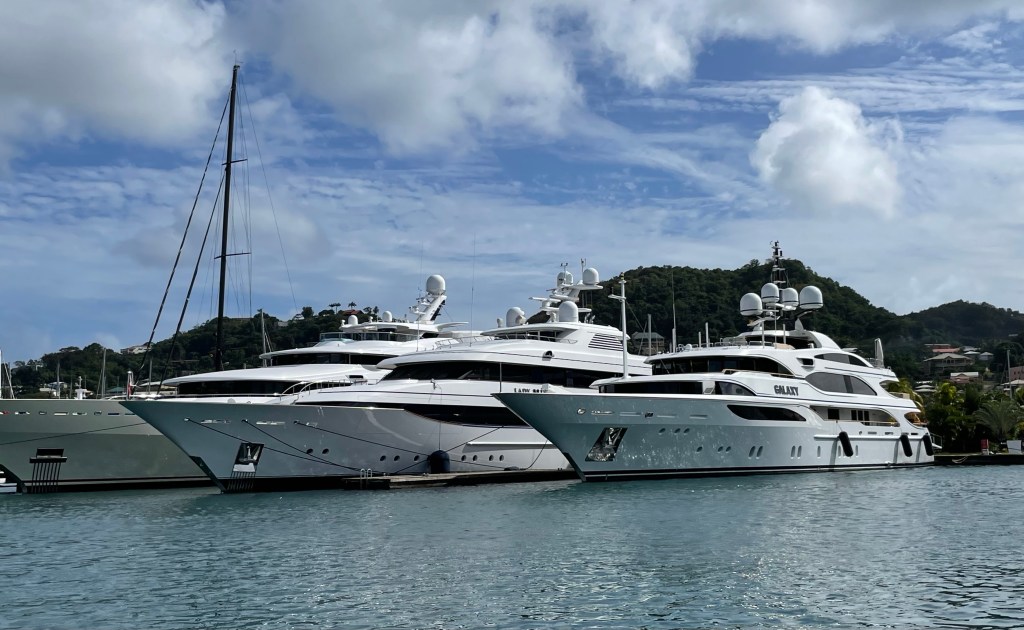
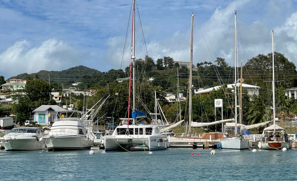
Then we went on a tour of St. George’s natural harbour, which is one of the best protected in the southern Caribbean. Apparently when there is a storm coming boats from many other islands come hide out here to ride out the storm. The views from the water of the coloured houses going away from the harbour and the billion dollar yachts tied up was worth the price of admission.
Unfortunately not mine. Safe harbour for allIt’s built up like this all around the harbour
Tonight was one of the ship’s marquee events, the Deck BBQ and line dancing with the staff. The food was amazing. And our next door neighbour left part way through the evening. Tonight we’re underway for Bequia. I’ve very excited for this stop. It’s one that only small cruise ships can get in to. Going snorkelling again tomorrow. No statues.
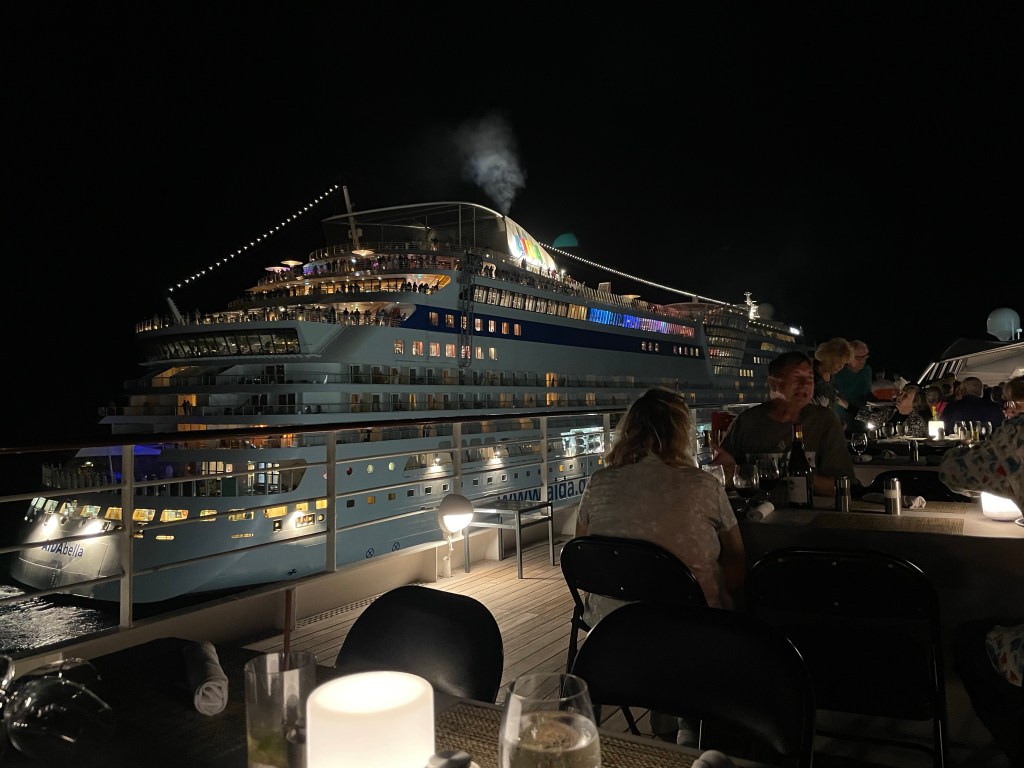
The Steel drum band was amazing! Our neighbour departs for parts unknown.