Wednesday, July 10th – Kirkwall, Orkney Islands
Today the rainy and cooler weather caught up with us. We feel very lucky to have had such great weather up until now so we’re not going to grumble about a little rain, cold and wind. Well, maybe a little. The wind was really piercing and we were both chilled to the bone by the end of our excursion today. A warm shower felt great at the end of the day. It was a long but really enjoyable day and in a place that quite frankly I never imagined I’d get.
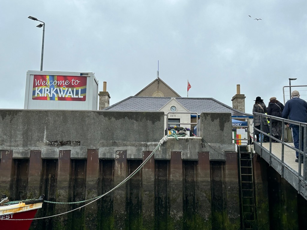
We docked early this morning in Kirkwall, the capital of the Orkney Islands. The Orkney islands are almost as far north as you can get in Scotland, and walking through Kirkwall, and learning about the history, it almost felt like we’d hit Norway by mistake. The Orkney Islands were part of the Norse empire after they conquered the Pict people, the original people of this whole area. The Vikings called them Pict people because they had many tattoos all over their bodies and Pict is the word for pictures in their language. In the 15th century (1468) the Orkney Islands became part of Scotland (as well as the Shetland Islands) after an unpaid dowery situation between the two countries.
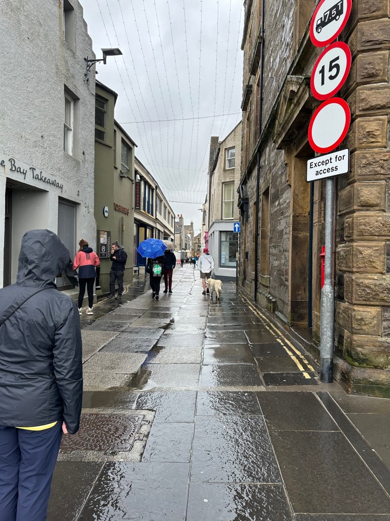
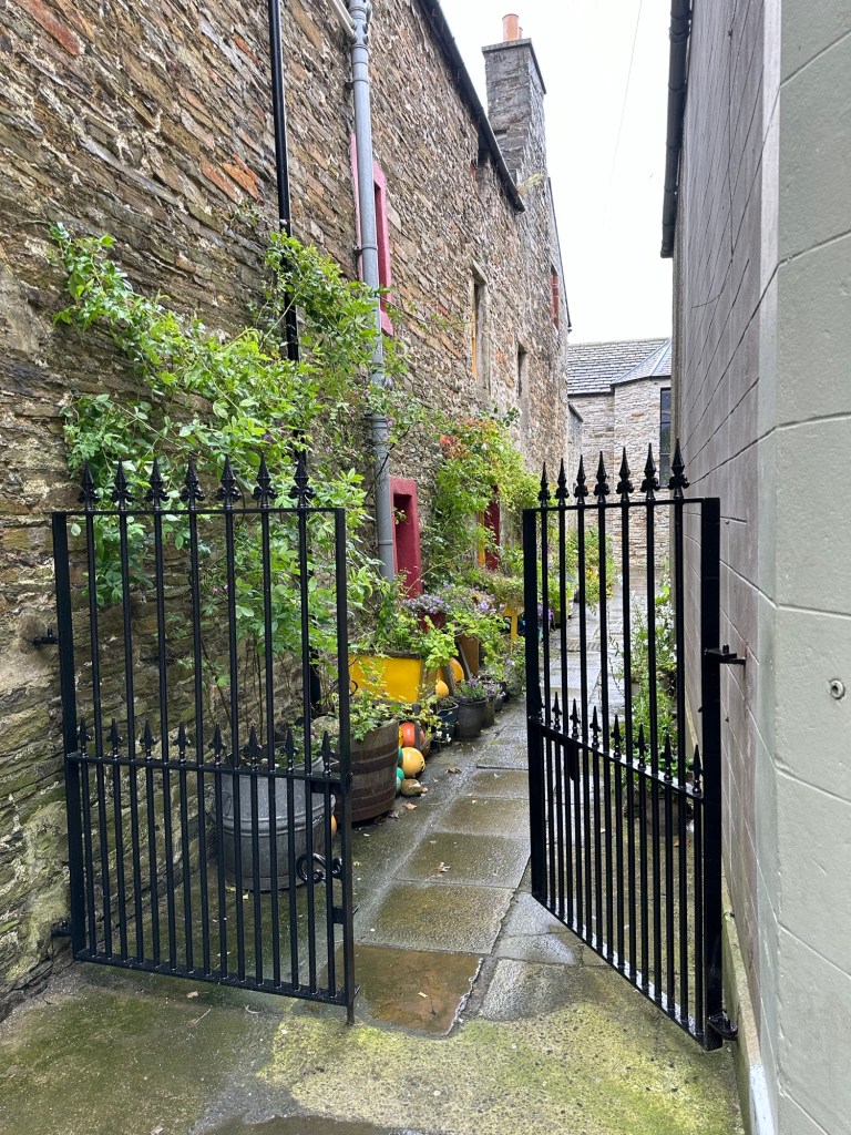
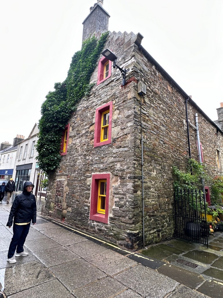
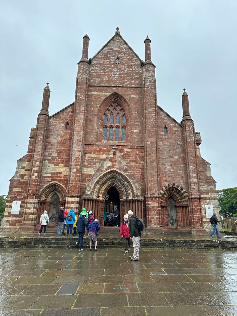
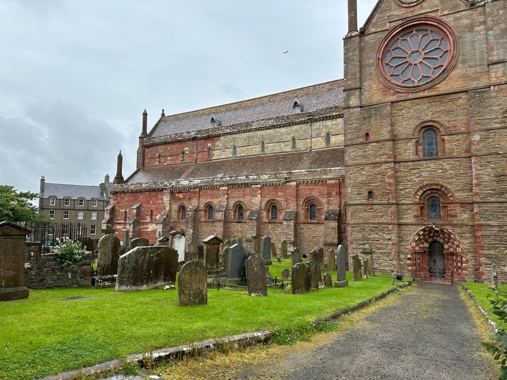
The Star Legend was anchored just off shore at the Kirkwall harbour which was a busy place most days, with the fishing fleet and a ferry depot. Our excursion today was not until 12:45 so we decided to tender in and explore Kirkwall in the morning, grab something to eat and then go on our excursion. It was a challenging exit from the ship to the tender due to the waves and swell, but the crew does an amazing job of making sure everyone is safe and feels that way. It was drizzling as we made our way from the tender dock up the main connecting street to High Street, where we found a lovely selection of shops, bakeries and restaurants. It was relatively quiet through the wet stone streets, with a solo bag piper playing in the mist making it quite magical. A lovely mood. Our destination was St Magnus Cathedral whose unique building could easily be seen from the whole town however it took some time to get there with stops in shops along the way. No one ought to get excited, I didn’t actually buy anything in said shops. But it was fun looking.
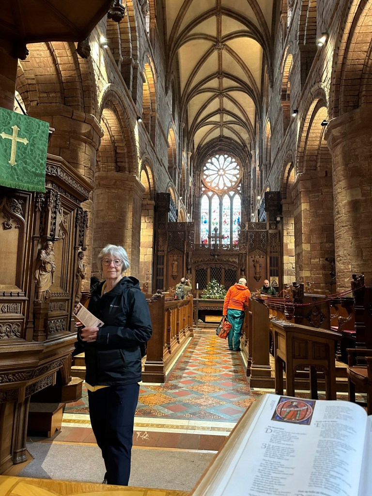
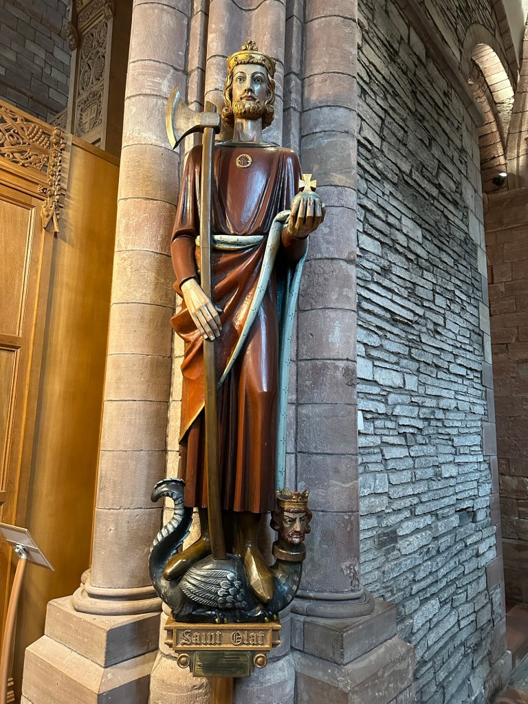
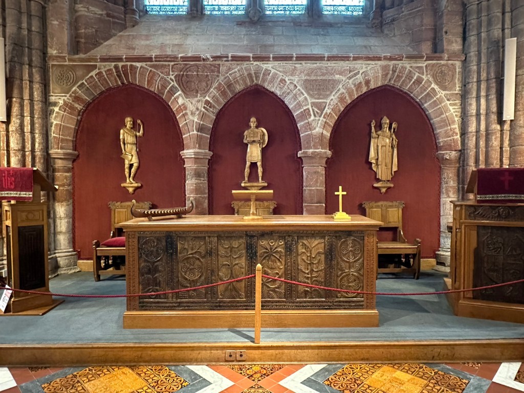
St Magnus Cathedral is primarily used by the congregation of the Church of Scotland, but is owned by the people of Kirkwall and is used by whichever Christian religion wishes to hold services or masses in it. The exterior of the church is unique because of the two-tone (red and yellow) sandstone from which it’s made. It was founded in 1137 but was added on to and restored in the 1850s and again in 1913. The cathedral’s beautiful stained glass windows were designed and installed in the 1920s.
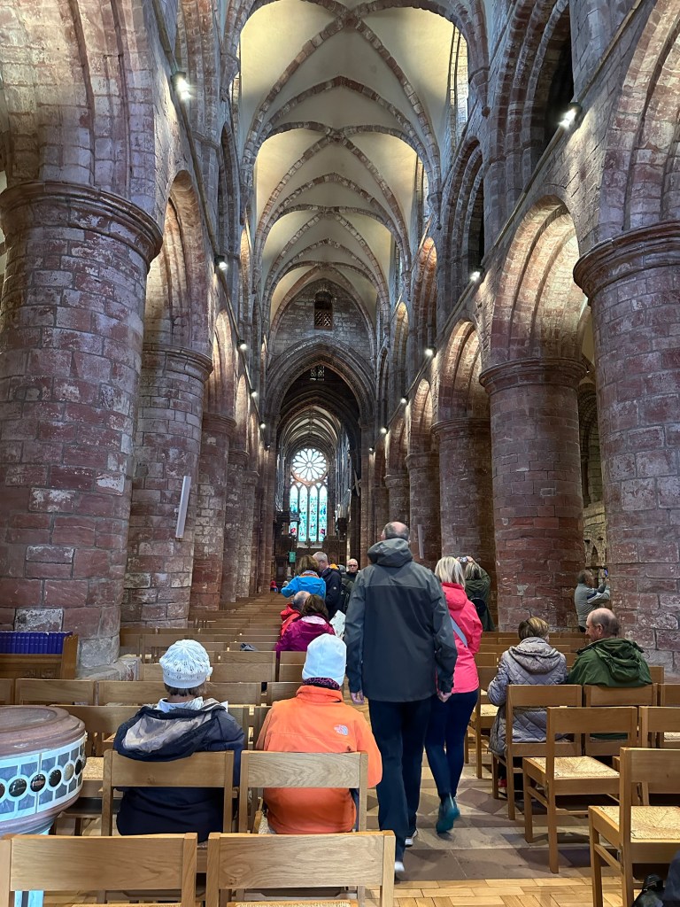
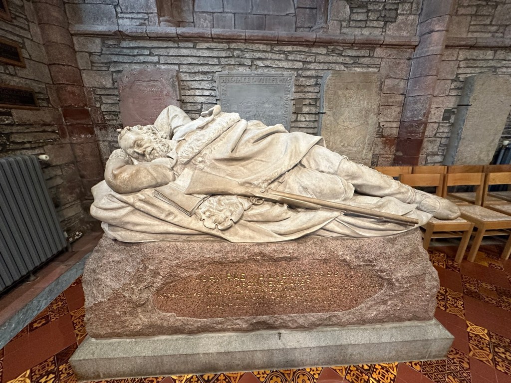
It was at St Magnus that we learned there is an interesting connection between the Orkney Islands and Canada. Many Orcadians were recruited to work for the Hudson’s Bay company in their outposts through Canada. In the church we came across a reposed statue of Dr John Rae, an Orcadian, who was an employee of HBC, and explorer of the Canadian Arctic and discoverer of an important part of the Northwest Passage. He is buried in their cemetery.
As we were leaving the church, tourists from one of the mid-sized cruise ships that docked just after we did today were streaming into the church and the streets of Kirkwall were teeming with people. We were really glad we got a relatively early start. Also, because of all the activity, we decided to grab a bite early and stopped in a cafe to get some tea and oat cakes. They were served with butter and shredded cheese, which seemed a very strange way to present them.
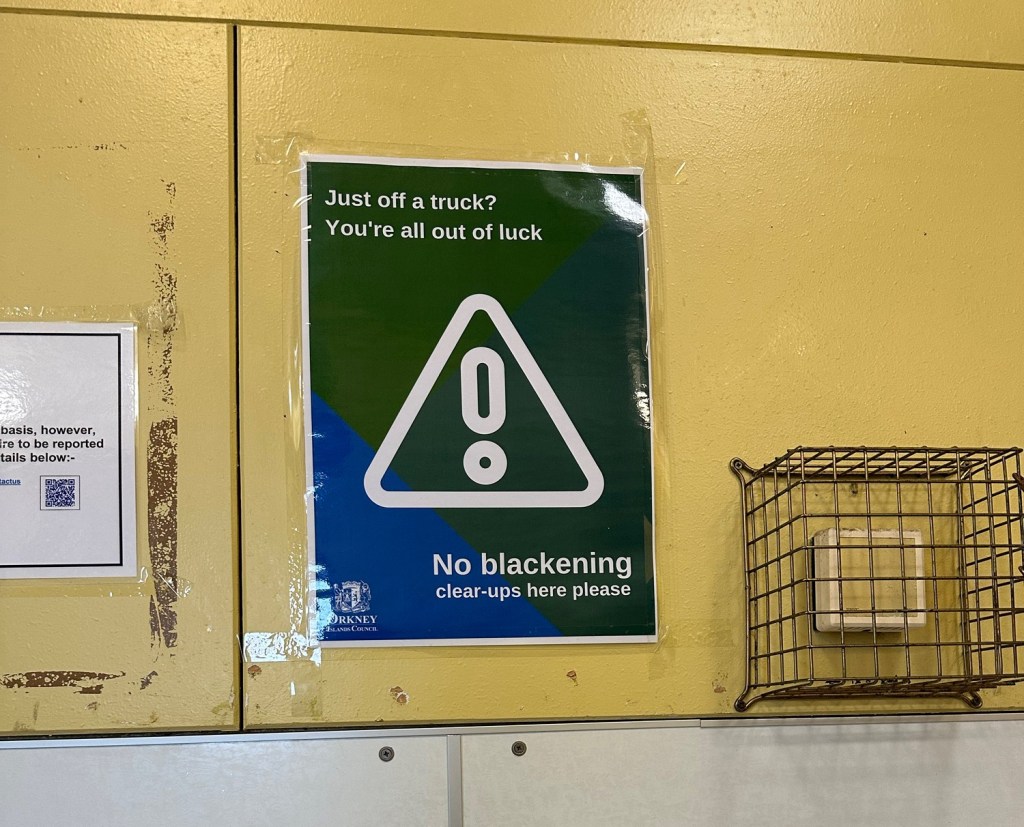
I couldn’t resist taking a picture of this sign and asking someone at the information tent what it was all about. One of the wonderful volunteers who greeted us as we came off the ship explained to us that as part of the pre-wedding rituals in the Orkney Islands, the grooms men and brides maids cover the groom and bride with molasses, soot, eggs, fish guts, manure and various other disgusting substances and take them for a ride in the back of a pick up truck. A BBC article I read on the subject noted that “a Blackening, is known for taking disgusting behaviour to another level.” Apparently there have been complaints that the bride and grooms sometimes use the public toilets (which is where I took this picture) to clean up after the Blackening and the Council has put up these signs to try and put a stop to it.
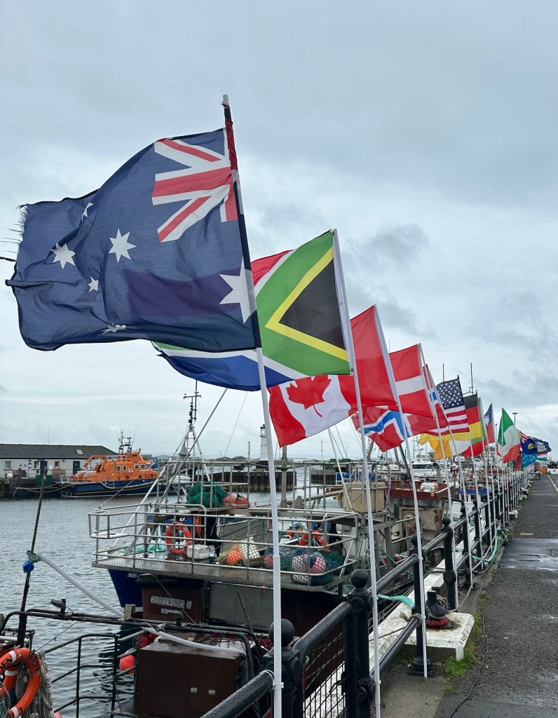
Our tour for the afternoon started at the dock so we headed back there to join up with our group. We were able to get on the bus that we’d be using a few minutes early and got out of the rain for a bit. Our guide for the day was Andie and he was an excellent guide. Char noticed that he spoke off the top of his head whereas many of our guides have used notes. I was wondering out loud where one of the flags was from among the group that were lining the dock, and the bus driver overheard, got off the bus and went and pulled the flag out of it holder to look at the base of it and then put it back in. He got back on the bus and said, Panama. I asked how he knew the name would be there, and he said because he also works on the docks and one of his jobs is to help the guy that changes the flags each day! They have the country roster of each of the cruise ships crew and passengers and they put up a flag to represent each of those countries on the dock. Every day! Sorry, I digress.
As we drove through the lovely green but windswept and pretty much treeless countryside with various small fields separated by dry stone dykes our guide told us about the Orkney Islands and Kirkwall. There are 60 islands in the group of Orkney Islands, 20 of which are populated with 23,000 inhabitants all together and 8,000 of which reside in Kirkwall.
The main industries on the Orkney islands is farming and its supporting industries, (beef, dairy, sheep), and Tourism. Eighty percent of the land is cultivated and used for farming, lots of which is sheep grazing. They don’t use the wool commercially, but rather sell the young animals for meat. Two hundred and forty cruise ships will stop in Kirkwall this year, mostly smaller ships (average size being only 500 passengers). They also have fish farms in various spots throughout the islands.
The islands are far north, (around 59 degrees north), but they have relatively mild winters due to the warm Gulf Stream waters. In the summer it is light from 5 am to 11 pm but in the winter, the days are dramatically short. Peat was the main source of fuel traditionally but they are gradually changing over to renewable resources. We saw quite a few wind turbines in our travels.
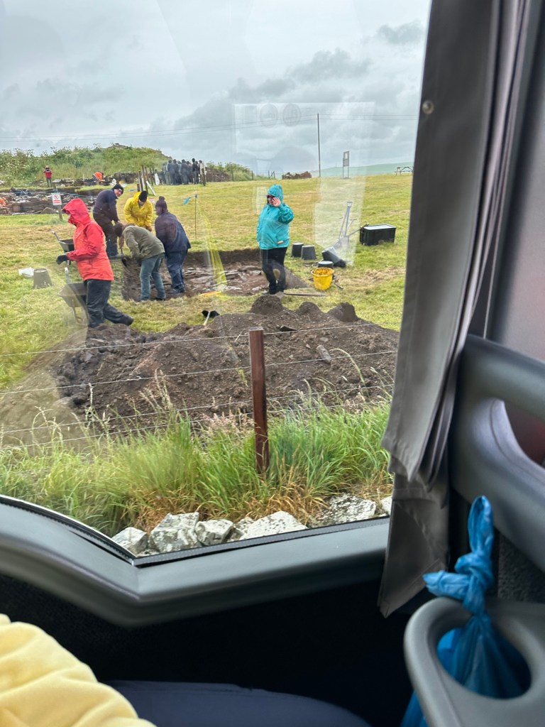
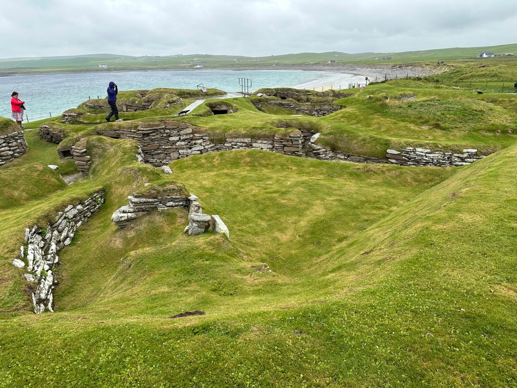
We were traveling across the rugged beauty of the island today to see a UNESCO World Heritage Site, including a stone circle from 3100 bc (800 years before Stonehenge) and a village which was from roughly the same period which was found quite by accident. Both were fascinating. We passed an active excavation site that our guide worked on which has been so rich in discoveries that after this season of digging they’re going to shut down the site, and re-bury it to preserve the site while they spend years cataloging and preserving the artifacts.
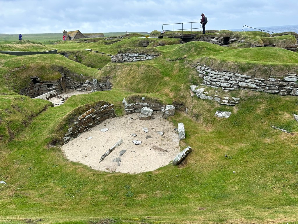
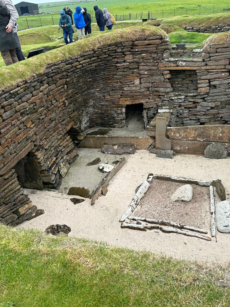
In 1850 a huge storm with wild winds removed a whole lot of sand from an area which revealed what is now called Shara Brae (meaning village under hills). It is a village which has been dated to be from 3100 BC, 4000 years before the Vikings arrived or the pyramids were built!. It is believed that a maximum of 125 people lived at this site at any one time but that it was abandoned after 600-800 years probably because it was close to the shoreline and they may have lost even more of the site to the sea than the 10 homes we visited today. It was a bit like a rabbit warren, built into the ground, with tunnels connecting the individual living spaces. The space has been really well presented with a visitor centre and great information posted throughout the site, and we would have probably stayed longer if it weren’t for the cold wind off the water and rain.
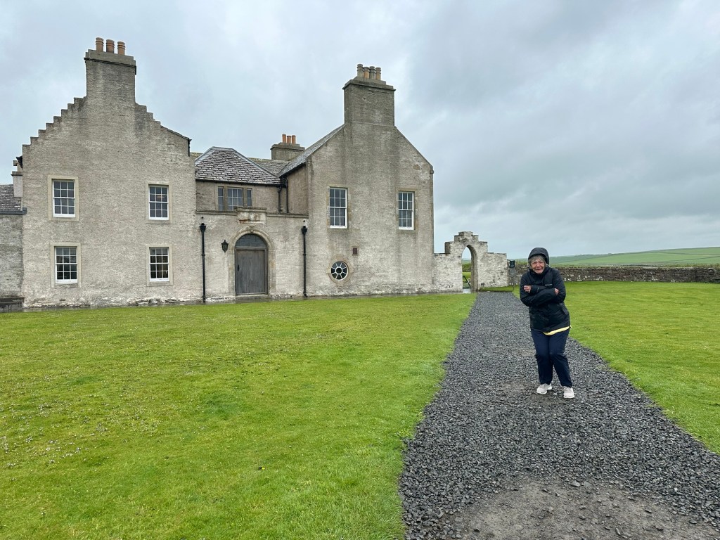
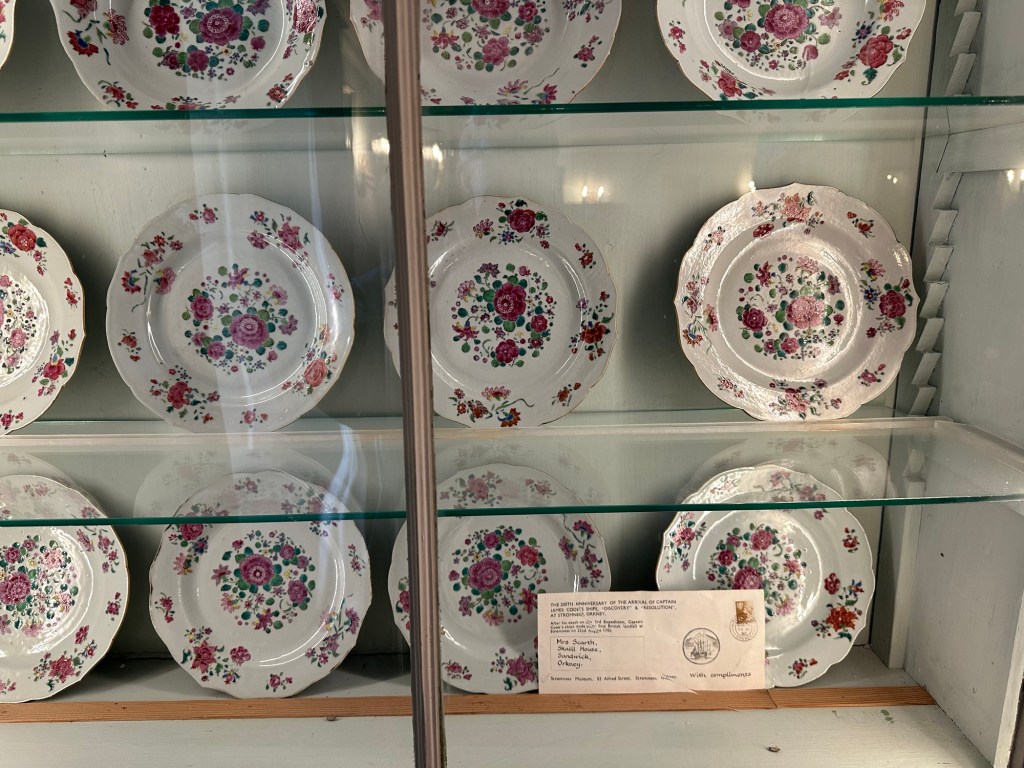
Also on the site of Shara Brae we visited Skaill House, the 17th Century mansion of the 12th Laird Major Malcolm MacRae, It has been restored and opened to the public
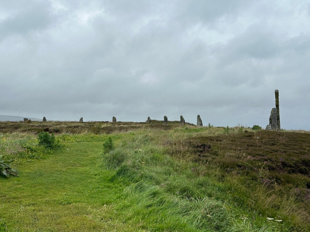
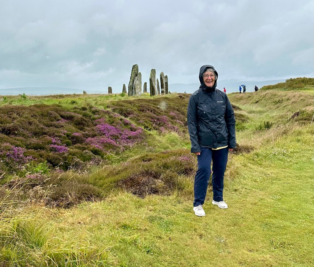
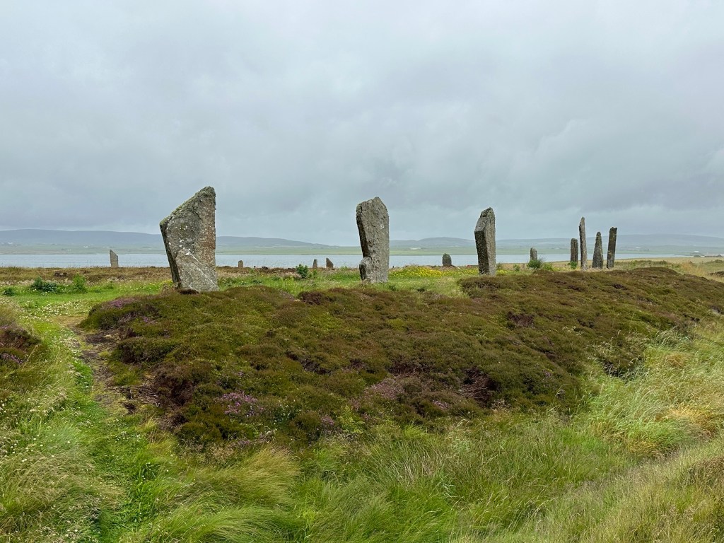
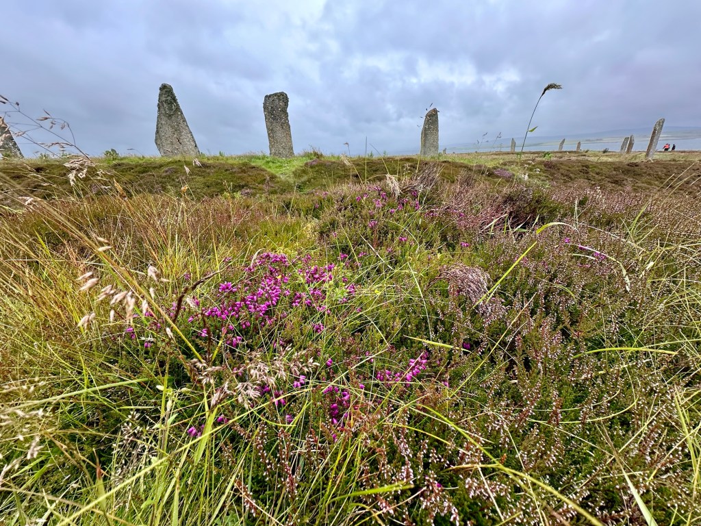
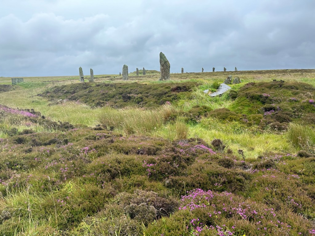
Then we travelled back the way we had come to a stone circle called Ring of Brodger. It has been dated to be just a little younger than the village at Shara Brae, around 2600 BC. Twenty seven huge stones remain and are arranged in a circle and it’s imagined that there were likely originally 60 but the others have been either vandalized or struck by lightning. It has a ditch around the circle, so it is called a “Henge” monument, like Stone Henge. It’s been calculated that it would have taken 80,000 man hours to dig the ditch. One of the other nearby smaller stone circles does have an astrological orientation, but it doesn’t seem this one does. The stones have been brought from different parts of the island which they can determine by the different types of rock. It’s theorized that this might have been a meeting place with the people from the region that the stone was from standing with their stone around in the circle. One of the “fairy stories” of the area is that the stones were formerly giants that lived on the islands who got together to have a party and the gods gave their permission to do so but said they must finish partying by sunrise. And when they were still partying at sunrise they were turned to stone.
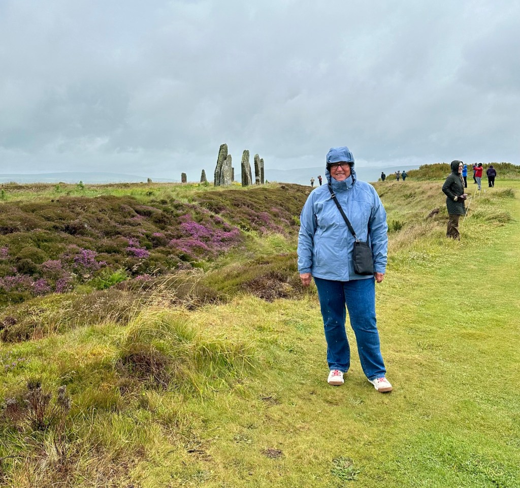
It would have been great to have a longer look and contemplate what it all meant but the wind, cold and rain had us practically running around the circle of stones and back to the bus.
Our guide told us the significance of the area to both World Wars on the way back to the ship. A plane attacked this area of the Orkneys on March 16, 1940 at the beginning of WW II and it killed the first civilian killed in the war in the British Isles.
The Orkney Islands were used as a navy base in both world wars, in an area called the Scapa Flow, where the surrounding islands provide protection and the fleet could be protected on all sides. In WW I 120 ships were harboured there. It was important to keep the navy fleet up in the north of Scotland to keep the German navy bottled up and keep them from getting into the Atlantic.
At the end of the war, as part of the Nov 1918 Treaty of Versailles negotiation, Germany had to hand over their 74 navy ships by sailing them into the Scapa Flow area. They did so, but the German commander had no intention of handing over the ships and communicated with each of the ships captains and in unison on one day in June 1919 they sank their own ships. The British sailers figured out what was going on and managed to save some of the ships, but 52 were sunk. The fleeing German sailers rowed to saved themselves, but the British sailers killed 9 Germans. They were the last military men to be killed in WW I.
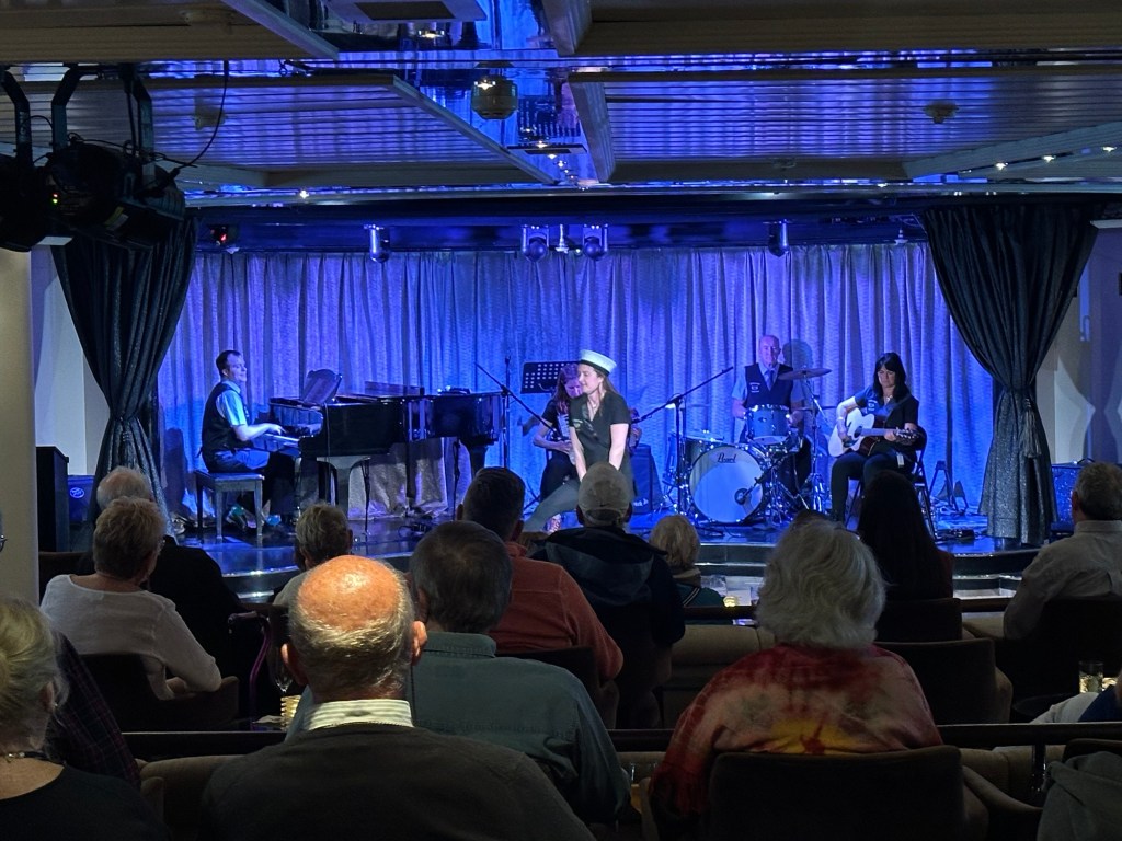
Once safely on the Star Legend we hurried to the lounge because the entertainment crew had organized a ceilidh with a local Orkney family group. I loved the music and if there was any question before about whether the east coast of Canada has been influenced by the immigration of people from Ireland and Scotland, that question was dispelled in my mind when I heard their music. I could have been sitting in a concert in any of the Atlantic Provinces rather than in the Orkney Islands the music was so familiar. If I shut my eyes I was back at the Women’s Institute Hall in Stanley Bridge, PEI.
This has been one of my favourite days despite the weather.

I’d not be getting married in the Orkneys for fear of the blackening! Some fascinating and vivid history here, and great pictures. Charlene looked very cold, but you not as much Lois!
LikeLike